Tropical Depression 2 was upgraded to Tropical Storm Arlene yesterday afternoon, and as I am writing this, Arlene is on its way out. Here now, a quick recap of 2023’s first named storm.

No, but seriously, Arlene is on the way to dissipation later today or tomorrow. Looking at a satellite image today, Arlene is more curious looking than menacing.
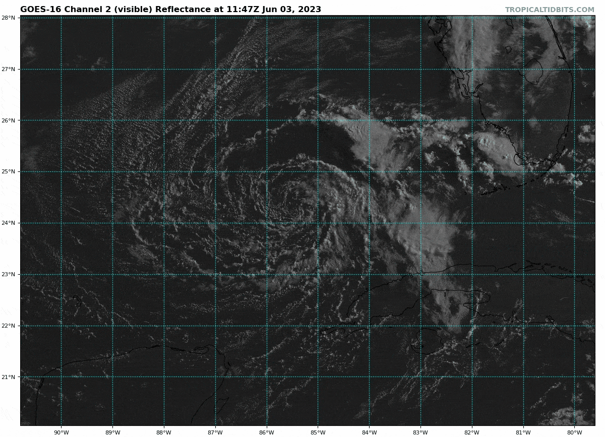
There are some thunderstorms still on the far northeast side of Arlene, but that’s about all right now. The center is clearly visible, but without thunderstorms around that center, it’s clearly evident that shear and dry air are doing work. A forecast map from the GFS model that shows wind speed and direction (indicated by the little barbs on the map) and relative humidity in the upper atmosphere (brown = drier air and green = more moisture) shows that Arlene is in a very dry, very hostile (windy) environment aloft. This is a good recipe for disorganization, and as such, Arlene’s end game is clear.
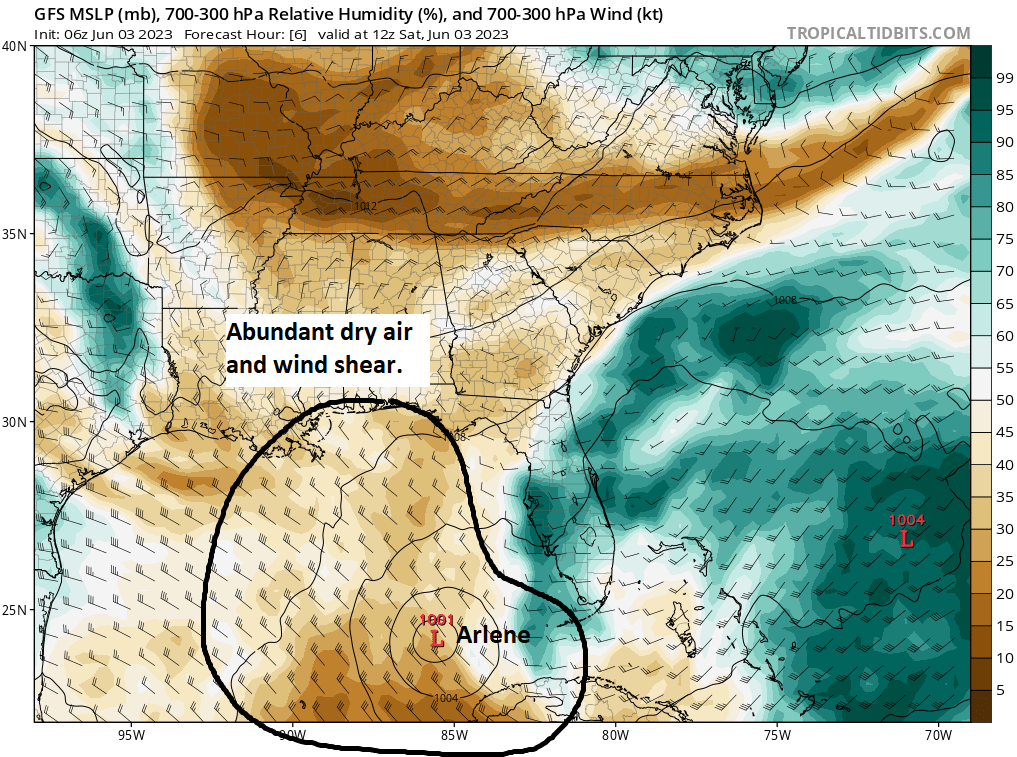
So we’ll call that a wrap on Arlene for all intents and purposes.
Florida rainfall chances
For Florida, which on the map above is covered in higher moisture, there will continue to be rounds of thunderstorms today, and the National Weather Service in Miami continues the flood watch from Miami-Dade through Palm Beach Counties and around Lake Okeechobee. The heaviest rains on Friday fell north and west of the lake and between Tampa and Orlando.
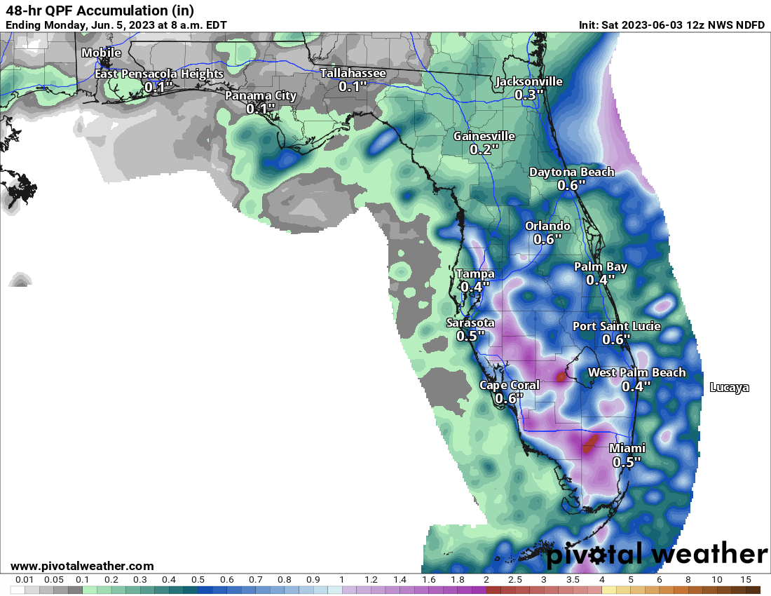
Rain totals as forecast above will be quite variable (and may be placed a bit differently than shown in the forecast). Some areas may see a quarter to half-inch or less, while others could easily see 2-4 inches of rain between now and Monday, so watch for ponding and areas of localized flash flooding, especially in spots that have seen a good bit of rainfall this week. Also, as is occasionally the case with tropical thunderstorms, we could see reports of waterspouts or even some isolated strong to severe storms today or tomorrow in South Florida.
Otherwise, that’s all to discuss. We’ll be back on Monday with our daily tropical update and a look at some seasonal forecasts for this year. Enjoy the weekend!
Matt…very clever…”a quick recap of 2023’s first named storm.” Cartoon clearly says it all!!! Thanks for the humor.
Milt
Congratulations on the site!!! Added to my homescreen.
Jean. League City 🌀⛈🌩