Headlines
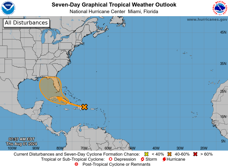
- Tropical Depression Four is crossing Cuba and will enter the Gulf of Mexico later today
- This storm will menace the west coast of Florida with winds and surge this weekend, with heavy rainfall also likely
- The system may reach tropical storm status, or possibly even become a hurricane before landfall along Florida’s coastal bend
- Downstream there is a significant threat of flooding in Georgia and the Carolinas
Tropical Depression status
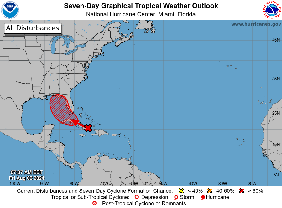
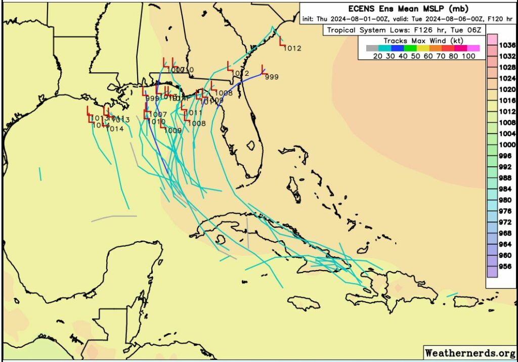
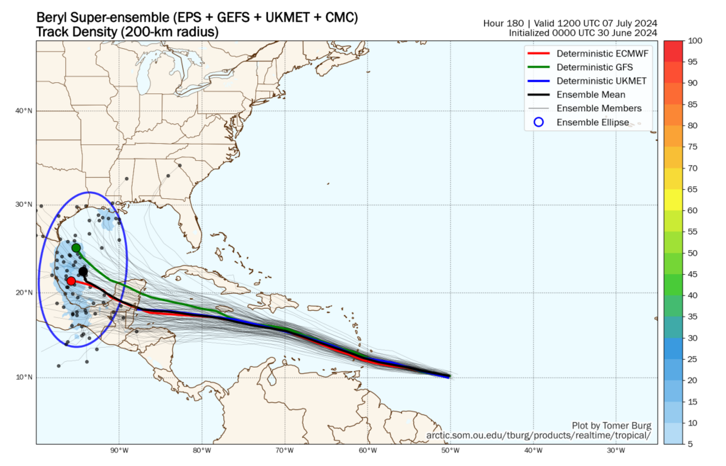
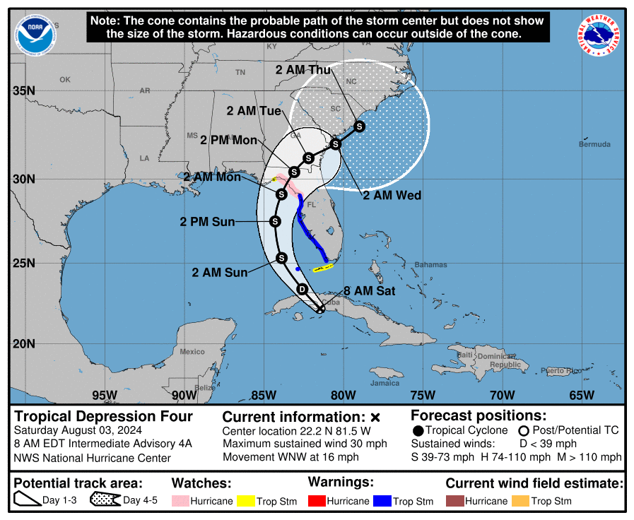
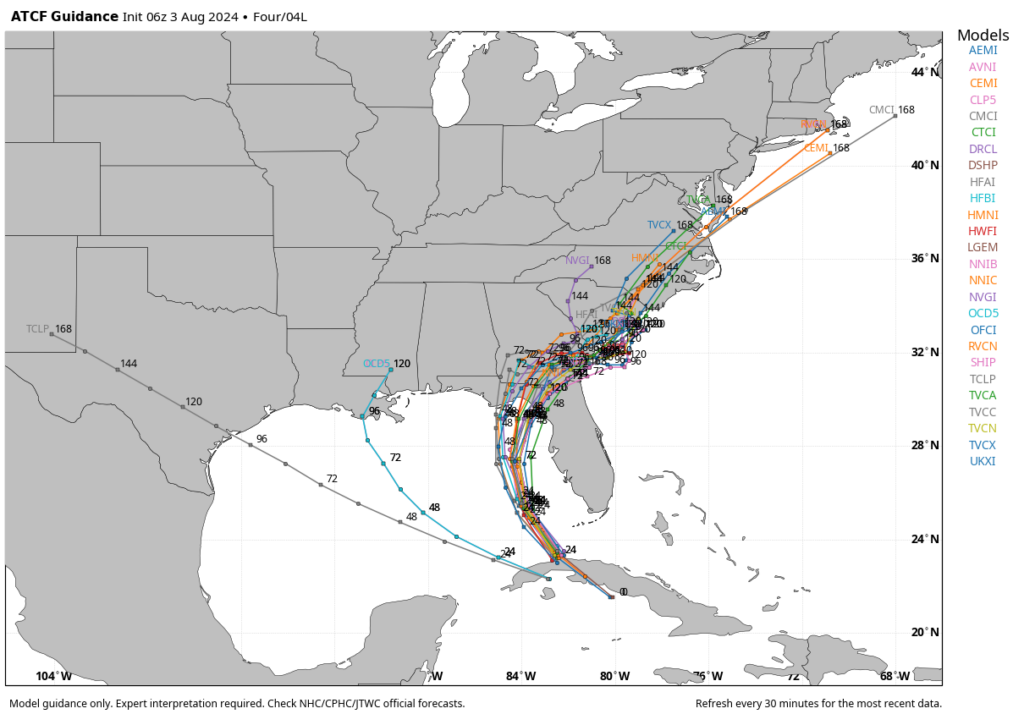
The tropical disturbance we’ve been tracking for much of this week has become Tropical Depression Four, with sustained winds of 30 mph. The center of the storm is in the vicinity of western Cuba as of Saturday morning, and moving to the west-northwest. As it moves into the southeastern Gulf of Mexico later today the depression should find favorable conditions for some strengthening, and forecasters believe it will become a strong tropical storm or possibly a hurricane before landfall somewhere along the coastal Bend of Florida on Sunday night or Monday.
This will basically be a tale of two storms. There is the first part, the storm’s path across the Gulf of Mexico and impacts on Florida. Then, it now appears more likely than not the storm will cross the Florida peninsula and move into the Atlantic Ocean off the coast of Georgia and the Carolinas. There, the storm’s track is far less uncertain. So this post will discuss the first half impacts to Florida, and the second-half impacts to the southeastern United States.
Florida impacts
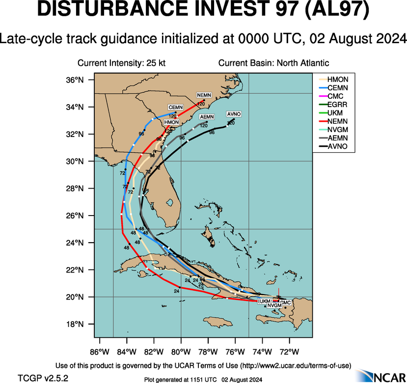
Tropical Storm Warnings are in effect for most of the western coast of Florida, with Hurricane Watch in effect for the coastal bend portion of the state. Because the models are increasingly confident in a track between now and a landfall in about 48 hours, or less, the larger question is how strong the storm will get. The majority of model guidance this morning still indicates the storm will remain at tropical storm strength prior to landfall. However, the eastern Gulf of Mexico is rather warm, and could support further strengthening. The bottom line is that some areas of Florida north of Tampa Bay and to the east of Indian Pass, may see hurricane-force wind gusts. Surge impacts look fairly modest, 3 to 5 feet in areas near and to the right of the storm’s landfall.
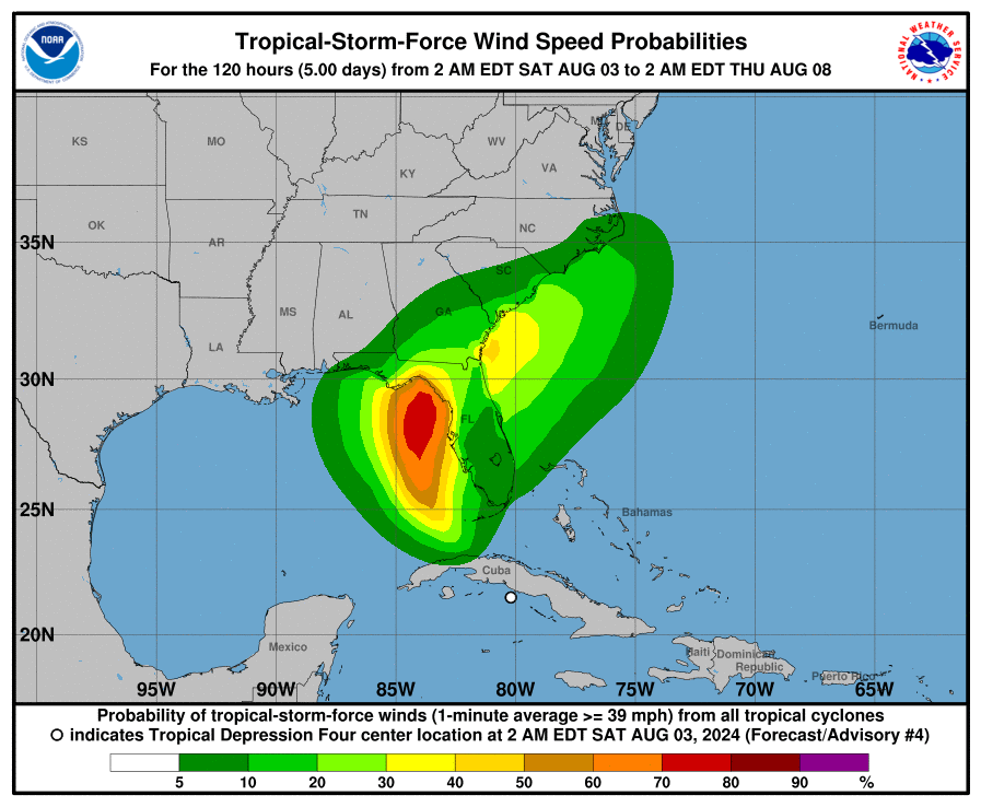
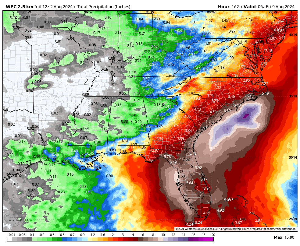
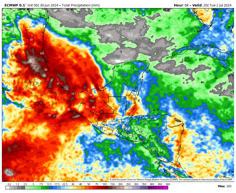
Probably the largest impact to Florida will be rainfall totals, as the entire west coast of the state, from Key West north to Tallahassee, could see between 4 to 10 inches of rainfall over the next two days as the storm’s center moves north in the Gulf of Mexico, remaining just offshore the state. This puts Florida to the right of the center, where heavy rains are most likely.
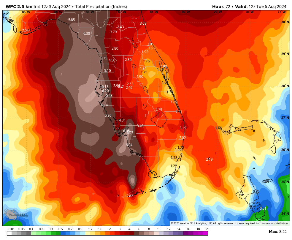
For much of Florida, as the storm moves away by Monday afternoon or evening, these impacts will lessen. The bottom line is that state residents need to be vigilant for heavy rainfall beginning as soon as this morning.
Southeastern US impacts
The storm should cross over northern Florida and perhaps southern Georgia on Monday before reemerging into the Atlantic Ocean late on Monday night or some time on Tuesday. At this point our uncertainty ratchets up. This is because, increasingly, it looks like the storm may stall offshore, near the Georgia or South Carolina coast. If it does, it could re-strengthen some, battering the coast with winds and waves. Given the model uncertainty, I don’t feel confident in making a forecast for wind strength yet, but the southeastern United States, including Georgia and the Carolinas, should be prepared for impacts from this storm from Monday night through at least Wednesday. Again, the timing and intensity of the storm will depend on the extent to which its center moves offshore, and how long it lingers in the absence of steering currents.
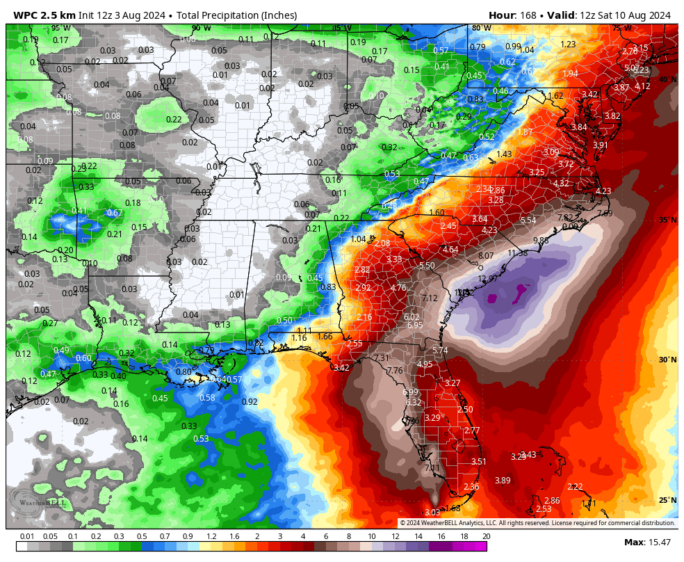
The other significant impact of a stalling storm, of course, would be the potential for heavy rainfall over a longer period of time. Forecast models are indicating some pretty high rainfall totals for coastal areas of Georgia and South Carolina, especially. There is the threat that these areas may see 10 inches or more, with significant flooding possible should the storm linger offshore, or just inland for a couple of days.
We will have an additional post on this tropical cyclone later today.