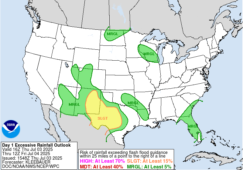
In brief: Tropical Storm Chantal’s remnants brought record flooding to parts of North Carolina overnight. It will exit off to the north and east later today. More heavy rain is causing flooding issues in Texas again. And Saharan dust is choking the Atlantic for now. For those that rely on email subscriptions to the site, please see the bottom for changes taking shape today.
Note: Most of the data in these posts originates from NOAA and NWS. Many of the taxpayer-funded forecasting tools described below come from NOAA-led research from research institutes that will have their funding eliminated in the current proposed 2026 budget. Access to these tools to inform and protect lives and property would not be possible without NOAA’s work and continuous research efforts.
North Carolina Chantal flooding
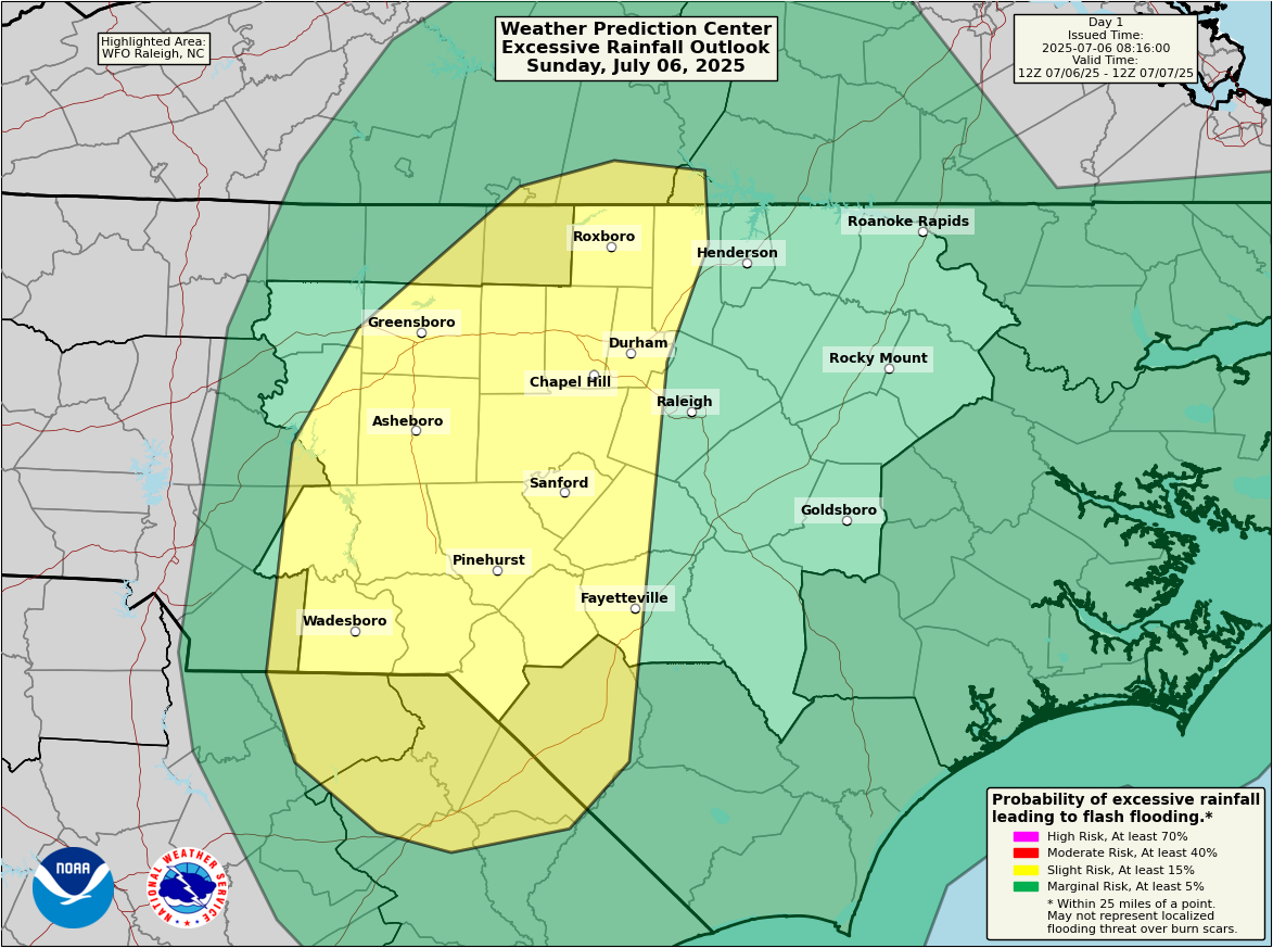
Overnight, rains pounded portions of North Carolina and southern Virginia.
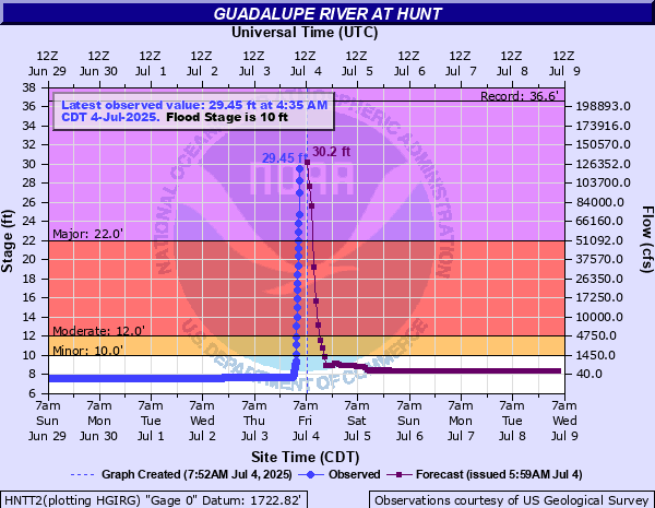
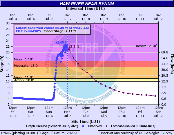
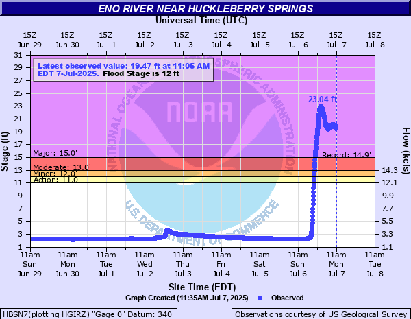
The Eno and Haw Rivers in North Carolina are in record flooding territory as a result of the rains. The Haw River’s records go back to the 1970s and the record level of about 22.5 feet was set earlier this morning southwest of Durham near Bynum, NC.
The Eno River just northwest of Durham absolutely obliterated the previous record by nearly 10 feet. Records appear to only go back to the 1980s, but there’s no questioning that this was a very impressive new record.
This was another instance where people were left scrambling in the middle of the night to get to higher ground. And it’s another instance where warnings may have been meteorologically adequate but receiving them was tougher. This topic is going to justifiably take up a lot of oxygen in the coming days.
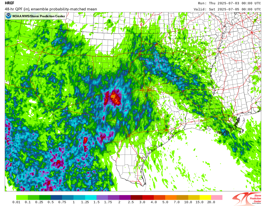
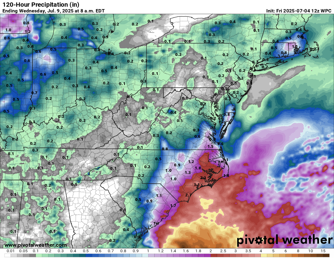
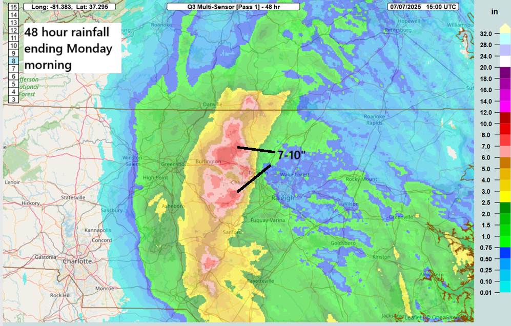
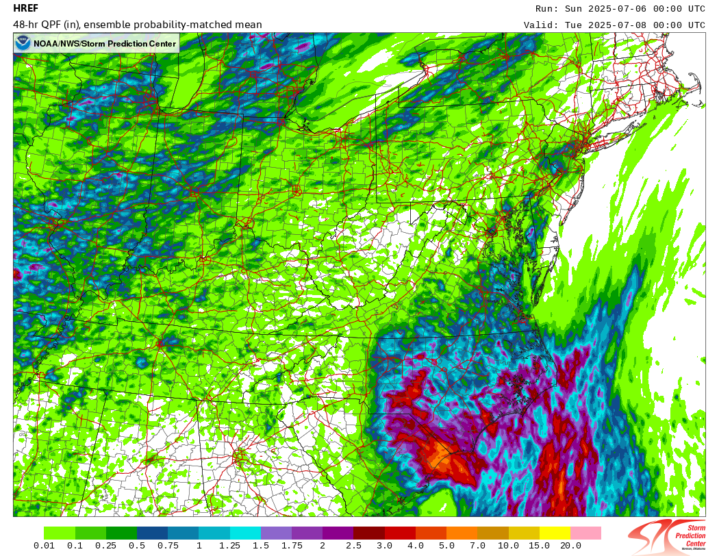
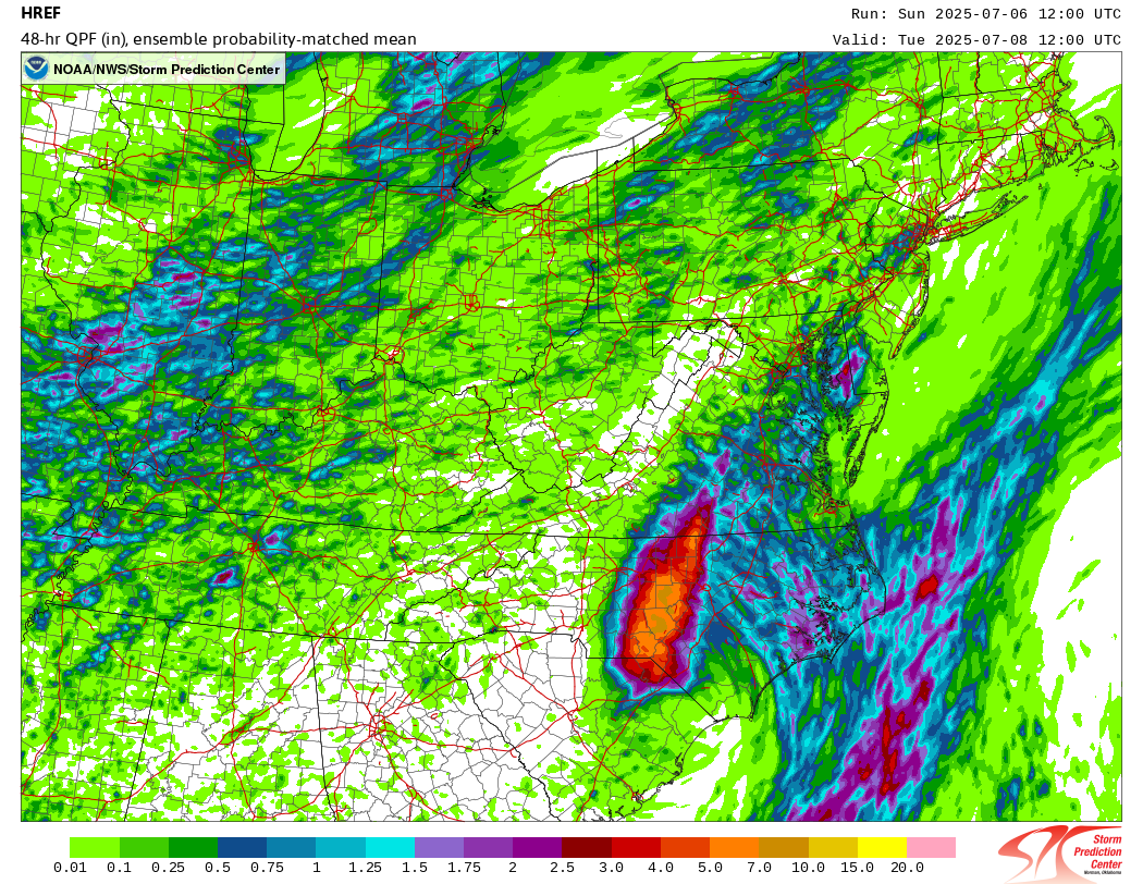
Much like the flooding in Texas, this flooding in North Carolina while somewhat predictable escalated very late in the game forecast-wise. Compare the 48 hour rainfall forecasts using the probability matched mean product from NOAA’s HREF model below. The 00z run, what I was looking at yesterday while writing my post showed minimal risk of significant flooding rains. The 12z run, which was available a couple hours later? Much more adequate.
The HRRR model also caught on late in the game too, though its performance actually worsened somewhat as the day progressed.
I think that the takeaway here is we had another event that showed us how model guidance in flash flood situations needs to be monitored religiously leading up to the event. If you are an end user of weather forecast information in Texas or North Carolina and you assumed the forecast was settled by 9 AM on the day of the nighttime event that caused historic flooding, you missed out on a ton of critically valuable information. Weather forecasting is so much better in 2025 than it ever has been. Our tools rarely miss something major at the end of the day. But they don’t always catch on 2 or 3 days ahead of time. But if you happen to use weather information to conduct your work or business or for public safety, it is absolutely critical that you monitor things closely leading up to any weather event. We can’t just assume anymore that it will be all’s well that ends well. And we can’t just check out on any given day.
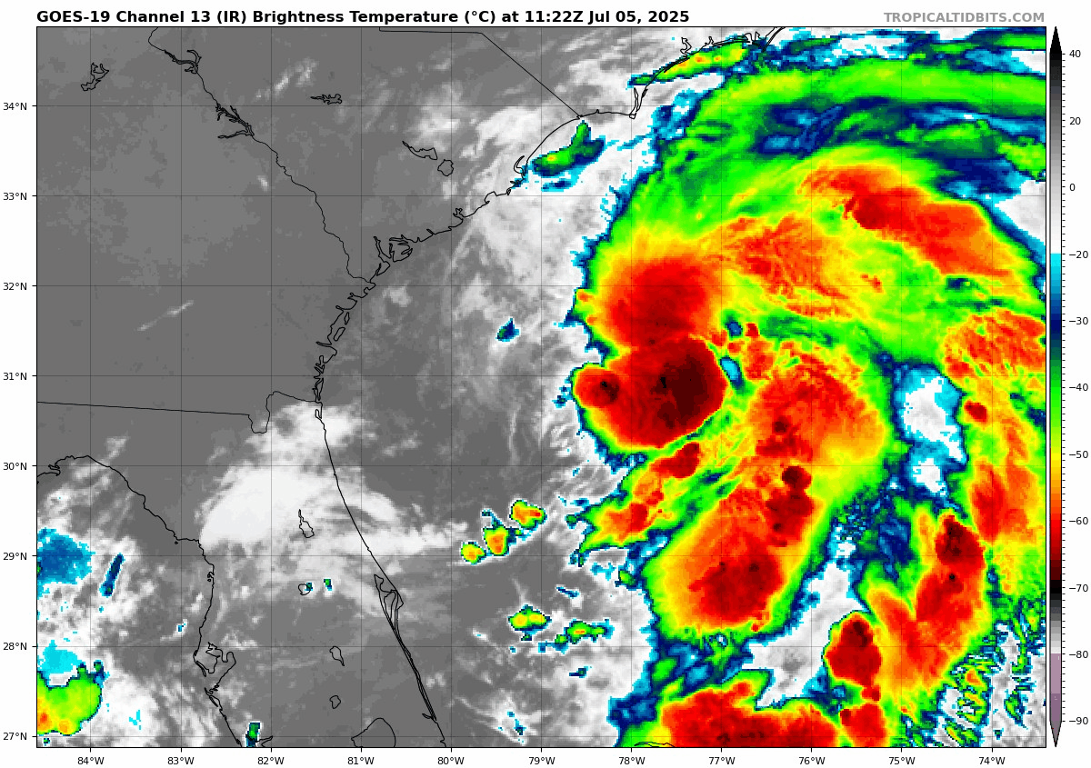
Texas flooding continues
Another round of heavy rain impacted portions of Texas overnight, with upwards of 4 to 8 inches of rain falling in some small areas west of Killeen, farther north than the weekend’s rainfall.
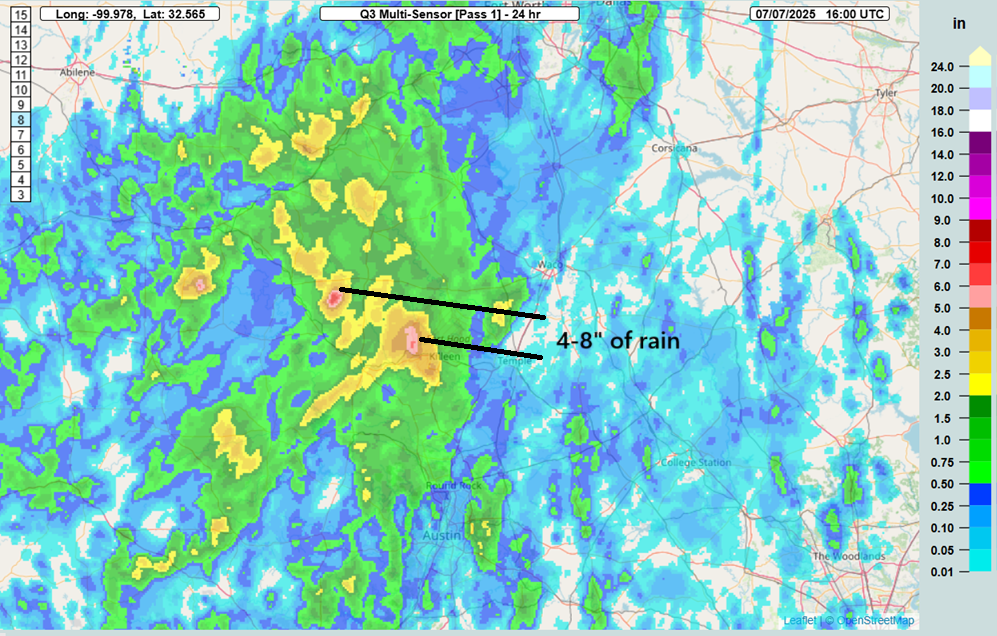
No major incidents have been reported yet, but flooding did occur in the Killeen area.
Rains are expected to continue through the day in spots. The overall weather pattern responsible for a lot of the rain and flooding is beginning to slowly unwind though, so as the week progresses, storminess should begin to ease up some.
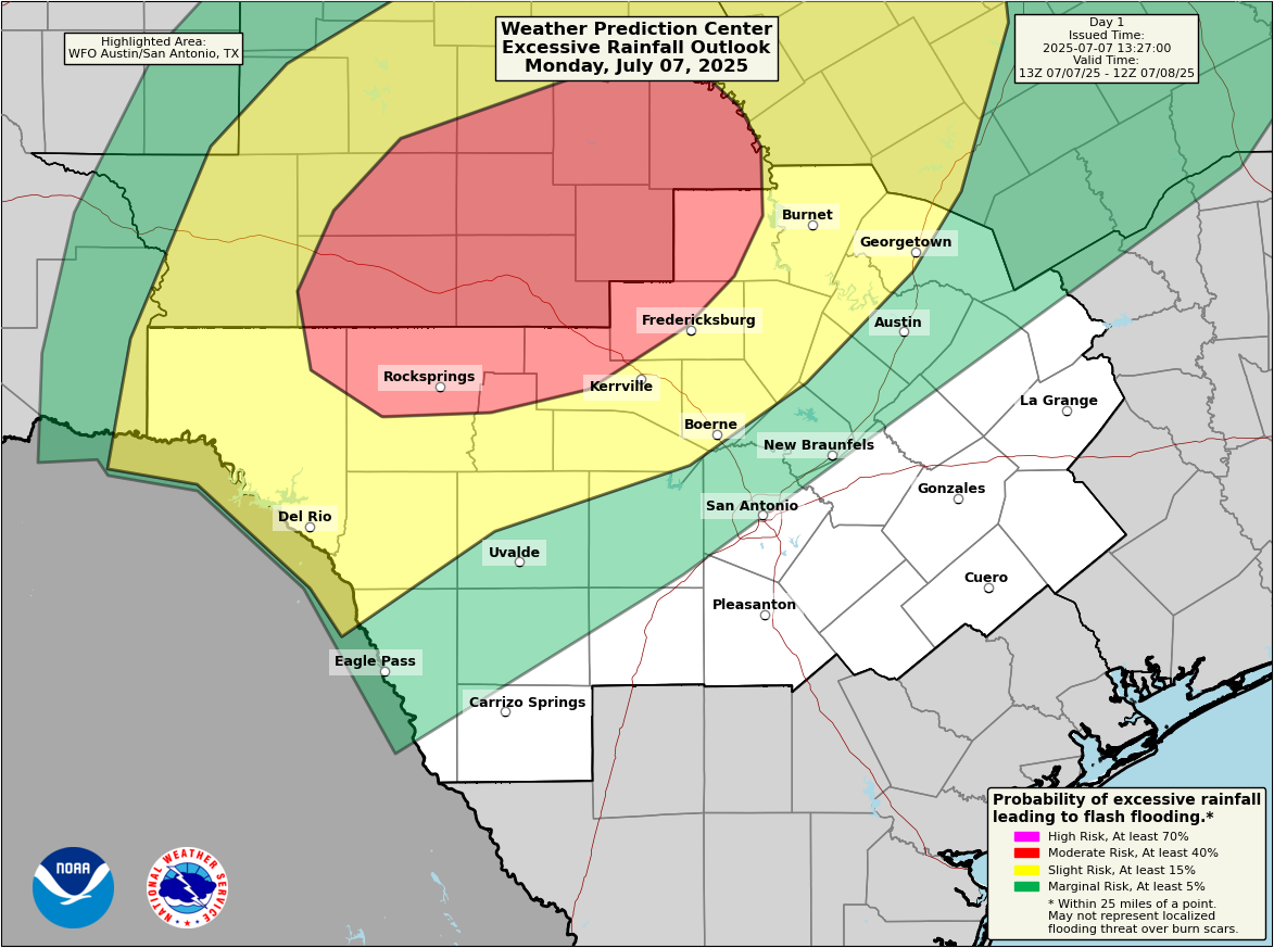
Still the moderate risk for excessive rainfall is in place, as we still have some ingredients available for hefty rainfall. It is possible that heavy rains will disrupt recovery efforts, and all people in the region responding to Thursday night’s disaster should remain on guard for heavy rainfall and quickly changing conditions today.
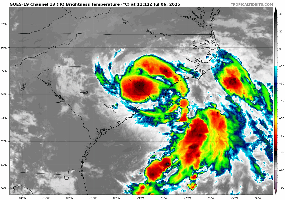
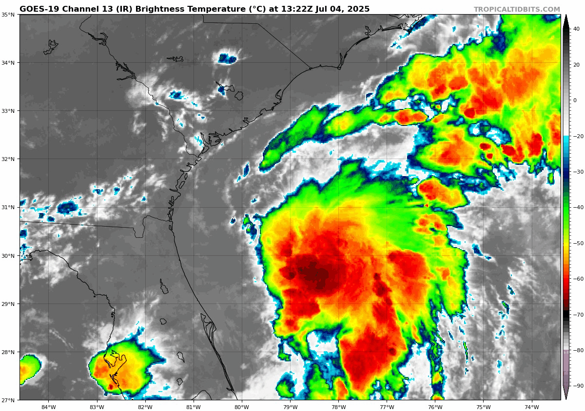
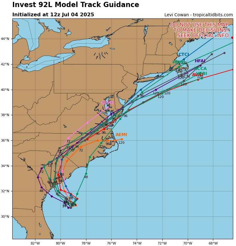
Tropical Atlantic
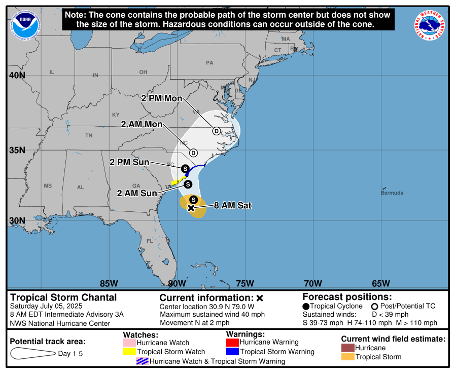
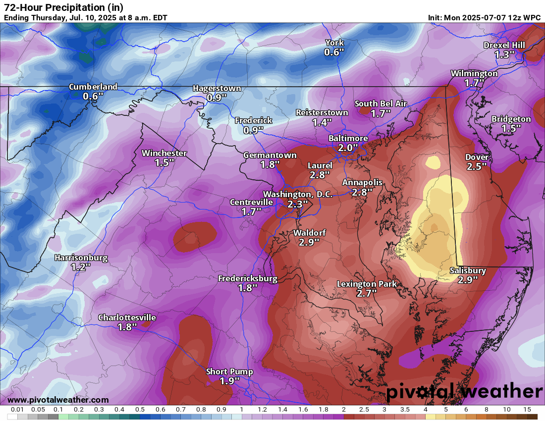
Quiet in the Atlantic, with Chantal’s remnants continuing to lift northward up the Eastern Seaboard. Those will exit off the coast of New Jersey today and out to sea. Locally heavy downpours could occur in spots from the Chesapeake Bay into the Philadelphia and Trenton areas. A slight risk (2/4) for heavy rainfall exists there.
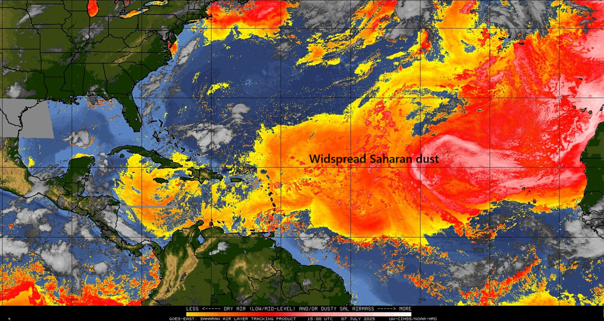
Beyond Chantal I think the Atlantic looks quiet this week. We have a lot of Saharan dust in place, and that should help suppress any development. After this week, the next area to watch may be in the northeastern Gulf of Mexico next week. A handful of ensemble members and AI ensemble members from various model suites indicate some potential there in about 10 days or so. Nothing to worry about at this time.
Last note, our housekeeping update:
We will be migrating our email newsletter over to the Substack platform today. If you currently subscribe to The Eyewall via email, your email should roll over to our Substack without you having to do anything. We understand a few people have various concerns about the Substack platform, and some of the content posted there by other writers. If you decide to unsubscribe from emails, we understand. But the benefits of this route outweigh the potential costs. The primary issue is that WordPress caps our email subscribers, and the process to manage an account is not user-friendly. For a site with a limited budget such as ours, this is the best way to ensure the continued delivery of an email newsletter with our content. We will still continue to post here at The Eyewall.com, but updates will not be sent via email from here.
Also: Nothing at all is changing with Space City Weather. So for our Houston readers, our site, email, and annual fundraiser is not changing! This only applies to The Eyewall.
We hope that this will offer us the flexibility to do more things, offer more options, more content, and a better overall user experience as time goes on. Thanks for your support!