Headlines
- The southern half of Mississippi River will experience moderate to major flooding in the days ahead, albeit well under levels seen in other flood events in recent years.
- But the addition of potentially significant rainfall in portions of the Mid-South this weekend (Oklahoma, Missouri, Arkansas) could add to Lower Mississippi flooding risks.
Flood situation on the Mississippi
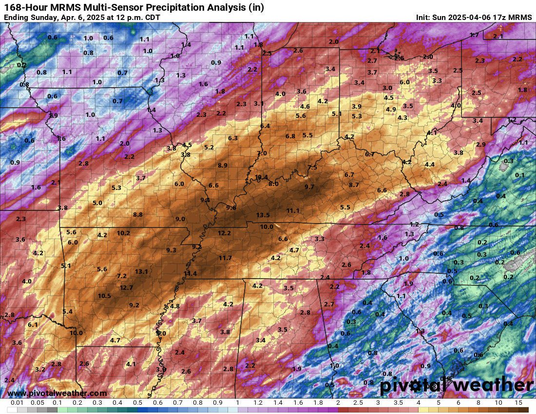
About a year and a half ago, dire concerns were raised about salt water intrusion into the water supply of the Mississippi River because water levels had gotten so low. Thankfully that threat passed, and for the most part, things have been rather ho-hum in the Mississippi. We’re beginning to see signs of change now, however, as all the water from the multi-day rainstorm earlier this month dumps into the Mississippi River.
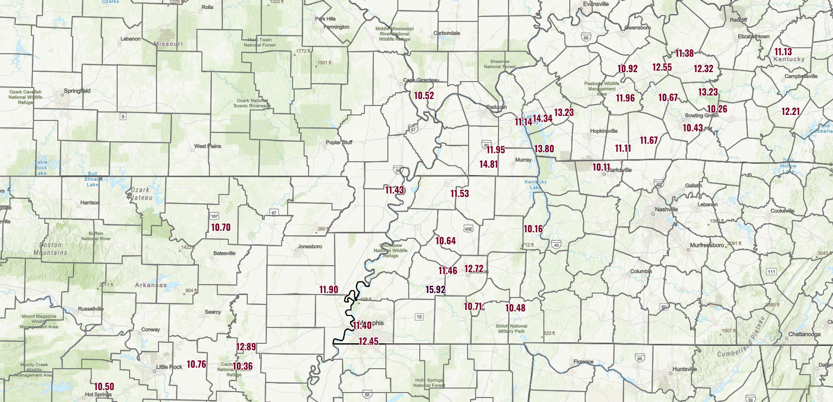
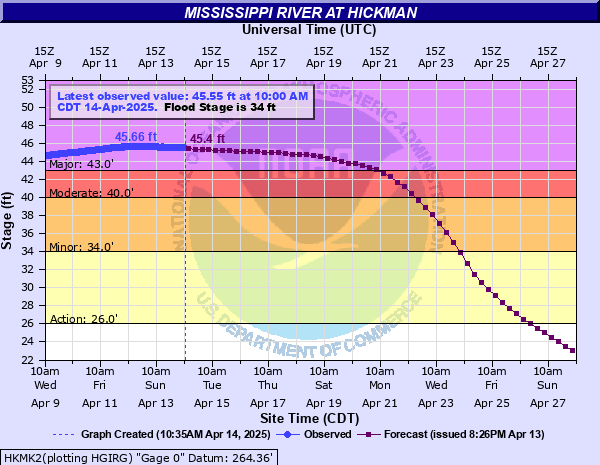
None of the rises on the Mississippi look to be anything outlandish. For example, at Hickman, Kentucky, just downstream of where the Ohio empties into the Mississippi, there is major flooding expected, but still about 9 feet shy of the record from 2011.
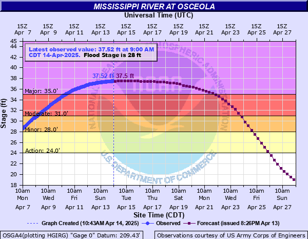
Farther downstream at Osceola, Arkansas (just north of Memphis), the river is slated to be at a level of about 37.5 feet, which multiple floods have topped in the last 15 years.
The story repeats down past Memphis into Mississippi, where the river will rise to moderate or major levels but nothing too absurd.
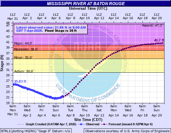
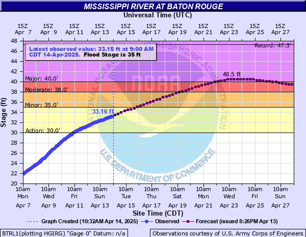
Down in Baton Rouge, the river will continue rising this week, eventually projected to crest around next Wednesday at levels similar to what had been seen in May of 2017 (and lower than levels reached in 2011, 2016, 2018, 2019, and 2020).
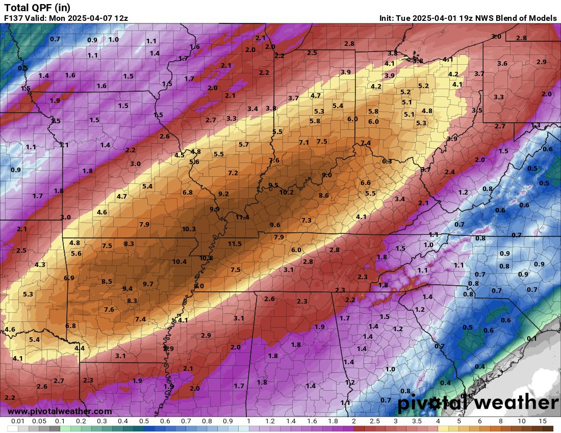
Back to the rains in the Mid-South
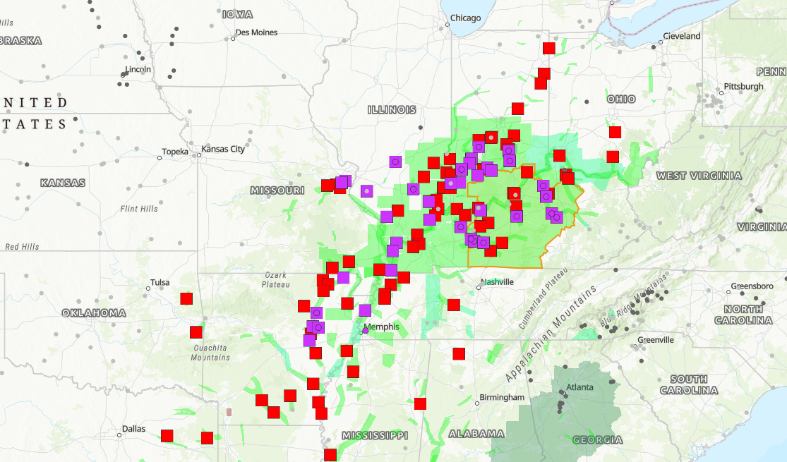
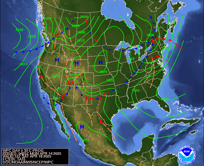
One interesting element about the river forecasts is that they only contain rainfall forecasts in the next 24 to 36 hours or so. So, we assume 0 rain falls after, say this Wednesday. Which brings me to an interesting possible storyline that could develop in the Mississippi. Over the upcoming holiday weekend, a cold front is going to push into the Ohio Valley and Mid-South again. There will likely be some degree of severe weather with this, though exactly how widespread or significant remains to be seen.
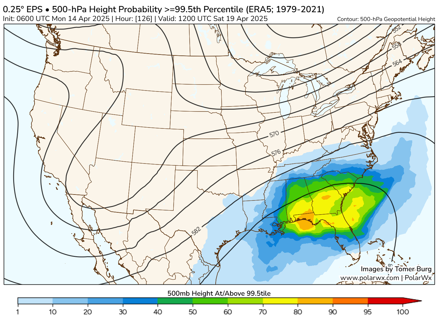
One thing I did notice this morning while going over my forecasting is that the ridge of high pressure setting up over the Southeast is expected to flex again this weekend. In fact, on Saturday morning, the European ensemble has about an 80 percent probability of the upper-level high pressure being in 99.5th percentile for this time of year. In simple language: It will be strong. Similar (but far less alarming at this point) than what we saw a couple weeks ago.
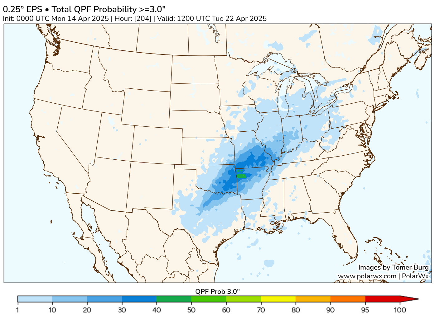
So the combination of a cold front slowing or stalling as it runs into a southeast ridge would likely lead to an increasing risk of heavy rainfall. Unlike last time, where the bullseye was extremely widespread but focused on Kentucky, at least the initial odds this time favor Missouri and Arkansas. About 40 to 50 percent of the 51 European ensemble members show 3 inches or more of rainfall over northwest Arkansas through early next week, with 20 to 30 percent showing 4 inches or more.
What does this all mean? For one, it means that the upcoming weather story will perhaps focus once more on the Mid-South or southern Plains. Secondly, it could mean that the forecasts for the Mississippi River, particularly those down into Louisiana have some risk of increasing in the days ahead. Or, perhaps the river will just stay high for longer, an entirely feasible outcome. Whatever the case, after a quiet week last week, the weather is beginning to look interesting again.