In brief: A system moving toward the Bay of Campeche has about a 30 percent chance of developing before it moves ashore in Mexico later Sunday or Monday. Another system in the northeast Gulf may emerge by late next week with low odds of developing a little. Plus, we answer questions surrounding the expected loss of a major satellite tool used in hurricane forecasting.
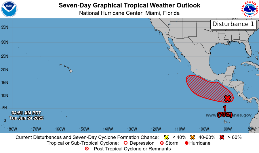
Bay of Campeche
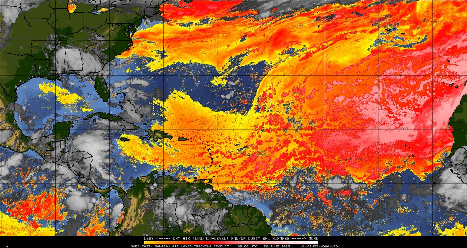
There is a disturbance sitting off the Yucatan as of Friday morning. This is expected to cross the Yucatan and emerge into the Bay of Campeche this weekend. From there it should continue to press west or west northwest into Mexico. Does it have a chance to develop? Certainly; the National Hurricane Center currently assigns about 20 percent odds of it doing so.
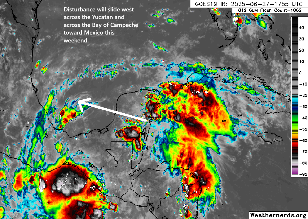
However, realistically, this has such a limited time over water with minimal organization that even if something began organizing, it would run into the wall that is mainland Mexico by Sunday or Monday. Thus, any development is both low and with a low ceiling for intensity. That said, this disturbance will bring some heavy rain to Mexico this weekend and early next week.
But in terms of concern priorities, it’s low.
Northeast Gulf late next week
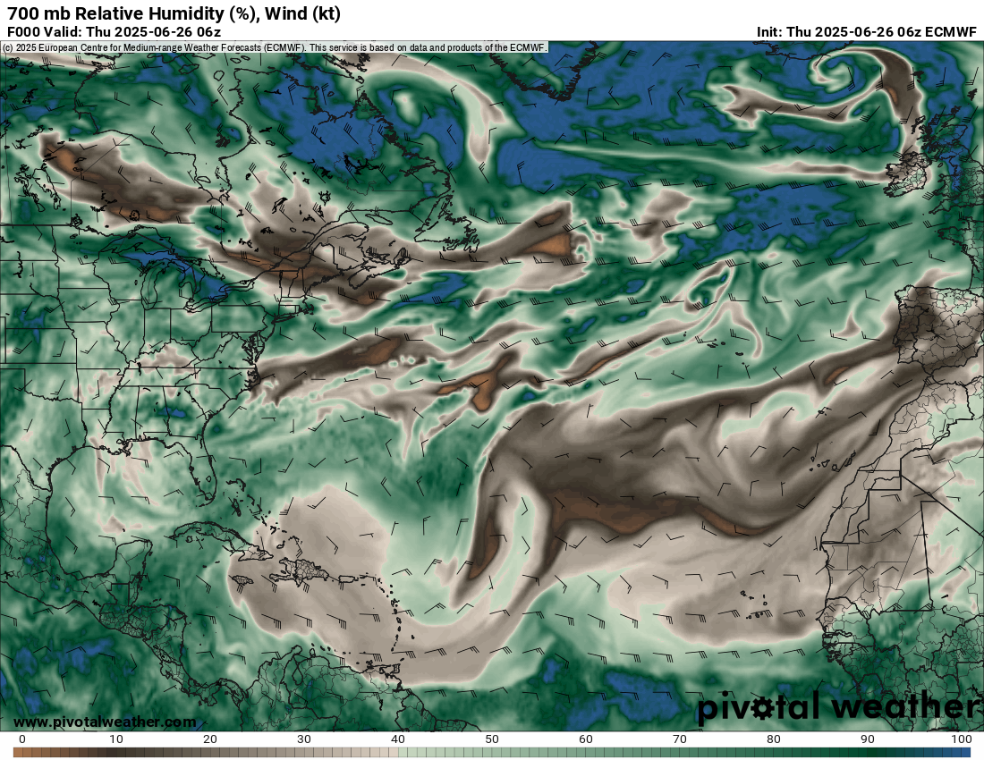
We continue to see signs in modeling that another disturbance will emerge in the northeastern Gulf by later next week.
The system will pinch off of a dying cold front that stalls out in the northeast Gulf and off the Southeast coast. Look for unsettled weather to setup in the northeast Gulf by late next week, likely bringing some continued heavy rain risk to parts of Florida and the Gulf Coast. But will it develop beyond just periodic thunderstorms? It’s too soon to say, but there is a subset of weather modeling that points to this.

This is not what I’d call “strong agreement,” but it’s something I suppose. I think the most likely outcome here is that we get a disturbance that festers for a few days off the west coast of Florida or even over Florida itself and then gradually exits out to sea. Development odds seem fairly low overall, and I would presume that overall conditions would be hostile for significant organization.
The heavy rain risk later next week is noteworthy with several inches of rain possible in Florida, especially along the coast between Pensacola and Tampa. This could lead to some eventual flash flooding issues there.
No laughing matter
We have an update on this story here: https://theeyewall.com/tropical-storm-barry-will-soon-move-inland-in-mexico-while-the-northeast-gulf-gets-an-area-to-watch-next-week/
“I laugh about the weatherman’s satellite eyes,” is the final refrain from the popular Dave Matthews Band song from the days of yore. Well, the meteorologist’s “satellite eyes” lost some significant peripheral vision yesterday when word came down that the Department of Defense was pulling data from a critical satellite used for hurricane observation and forecasting. We’ve gotten a lot of questions about this. I’d encourage you to start by reading this piece from Michael Lowry to understand more.
Meanwhile, let me tell you what I know and what I think this means. I’ll caveat this by saying that this administration has a well-documented habit of making rash decisions, triggering outrage, and then either pulling back the decision or changing it in some way to make it more palatable overall. So what I write here may be outdated literally 5 minutes from now. If they’re trying to build massive frustration, chaos, and increase unpredictability, they’re being quite successful. That said, since this situation seems to start at DoD, I don’t believe we’re going to have a positive resolution.
What is this satellite data?
The Department of Defense has 3 satellites in space that provide a bunch of weather monitoring and space weather data. One of the most important is the Special Sensor Microwave Imager Sounder (SSMIS). The SSMIS data is a key component in hurricane forecasting, as it allows forecasters to observe the features of a tropical system that cannot be adequately viewed on regular weather satellites. Take for example the below image I am borrowing from the University of Wisconsin.
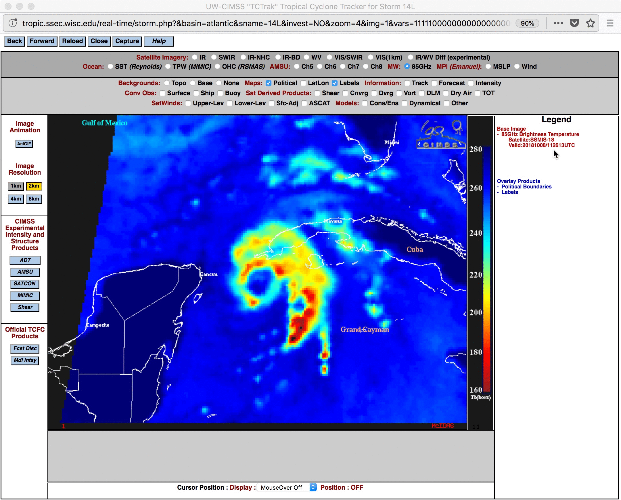
Notice how on traditional weather satellite, Michael looks like a very active storm with numerous thunderstorms. But in the “bluer” image, you can actually see an eye forming underneath the thunderstorms. Michael eventually hit the Florida Panhandle as a category 5 hurricane. This is a nice precursor for a meteorologist to get a view on to help inform forecasting or intensity estimates of a storm. In fact, it’s arguably critical information to have to help predict or identify that a storm is rapidly intensifying. It also helps us peg down the center of a storm when you don’t have aircraft out observing it. We sometimes take hurricane hunters for granted, as they’re not in every single storm. It’s tools like this that have been developed that fill the gap.
What is happening?
The DoD has announced that as of Monday this data will no longer be available to anyone.
But, surely the National Hurricane Center will retain access, right?
As far as I am aware and what is being reported in the media, the NHC does not have an exemption from this order. And this data will no longer be available for anyone outside of DoD. That may or may not be the case, but no one has said anything to this point to assume so one way or another.
What will losing this mean for forecasts?
Right out of the gate, if we have this data missing, you can expect a few things.
First, particularly for storms that are early in their development cycle, you will have a less accurate position of the center of the storm. Why does this matter? Because that’s what gets fed into every single model we use to forecast.
Second, when a storm is rapidly intensifying, we may get a delayed reaction. In other words, it may be 3 or 4 more hours after it begins that we’re able to identify that it has begun. Why does this matter? First off, situational awareness of what’s happening. Delaying that is poor. But of more importance, again, you are feeding models this data. Garbage in, garbage out. If you input a less accurate picture of intensity, you’re more likely to get an inaccurate intensity *and* track forecast. Intensity impacts track.
Third, the ripple effect of all this means less accurate forecasts at scale: Poorer NHC forecasts, poorer model forecasts (including from the European, ICON, Canadian, etc. models), potentially less warning that a storm is coming at a level that requires evacuation decisions. That’s not an exaggeration either.
Can we replace it with other data?
There are other microwave sensors on other satellites outside of DoD that we can use to fill some gaps. However, as Lowry reported in the link above, the DoD sensors comprise half of all microwave sounding data. So basically, while there is still a lot of data available, you are taking one critical data set and slicing it in half. Basically, you’re setting hurricane forecasting backwards.
So why is the DoD doing this?
The official reasoning is security. No specifics have been given. There was no head’s up. They just pushed out the memo above, and here we are today. In Matt’s opinion, it would have been nice for them to include disseminating the data to NOAA still. But perhaps whatever security issue is occurring affects that too. Who knows, but it would be nice to know from a public awareness and safety standpoint why we’re willfully degrading hurricane forecasting.
Bottom line: The government has decided that a key tool utilized by government and private sector meteorologists and researchers to track the intensity and position of tropical systems is going away on Monday with no actual reasoning and no replacement identified. While the public affairs folks will say they still have robust and significant data available to NOAA and the public, the reality is that one of the most important tools in the arsenal will no longer be there every time we need it to be.