Headlines
- Sluggish tropical development is a low possibility in the northwest Gulf of Mexico as low pressure forms off the Texas and Louisiana coasts.
- Though a serious system is not expected to develop, locally heavy rain and flash flooding are a good bet along the coasts of Texas and Louisiana into next week.
- The Atlantic tropical wave continues to have mixed chances to develop, but the ceiling is high enough to continue watching closely.
- An additional wave behind that one will probably stay out at sea, but conditions may continue to get more and more conducive to development as September progresses.
Gulf of Mexico
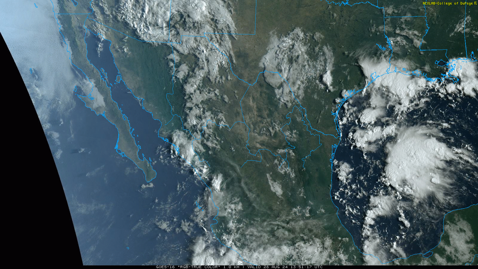
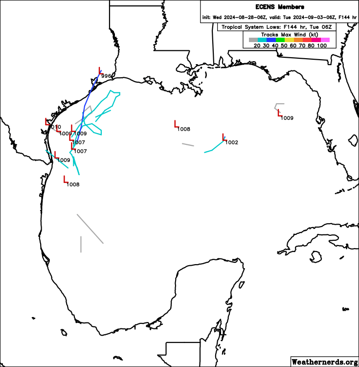
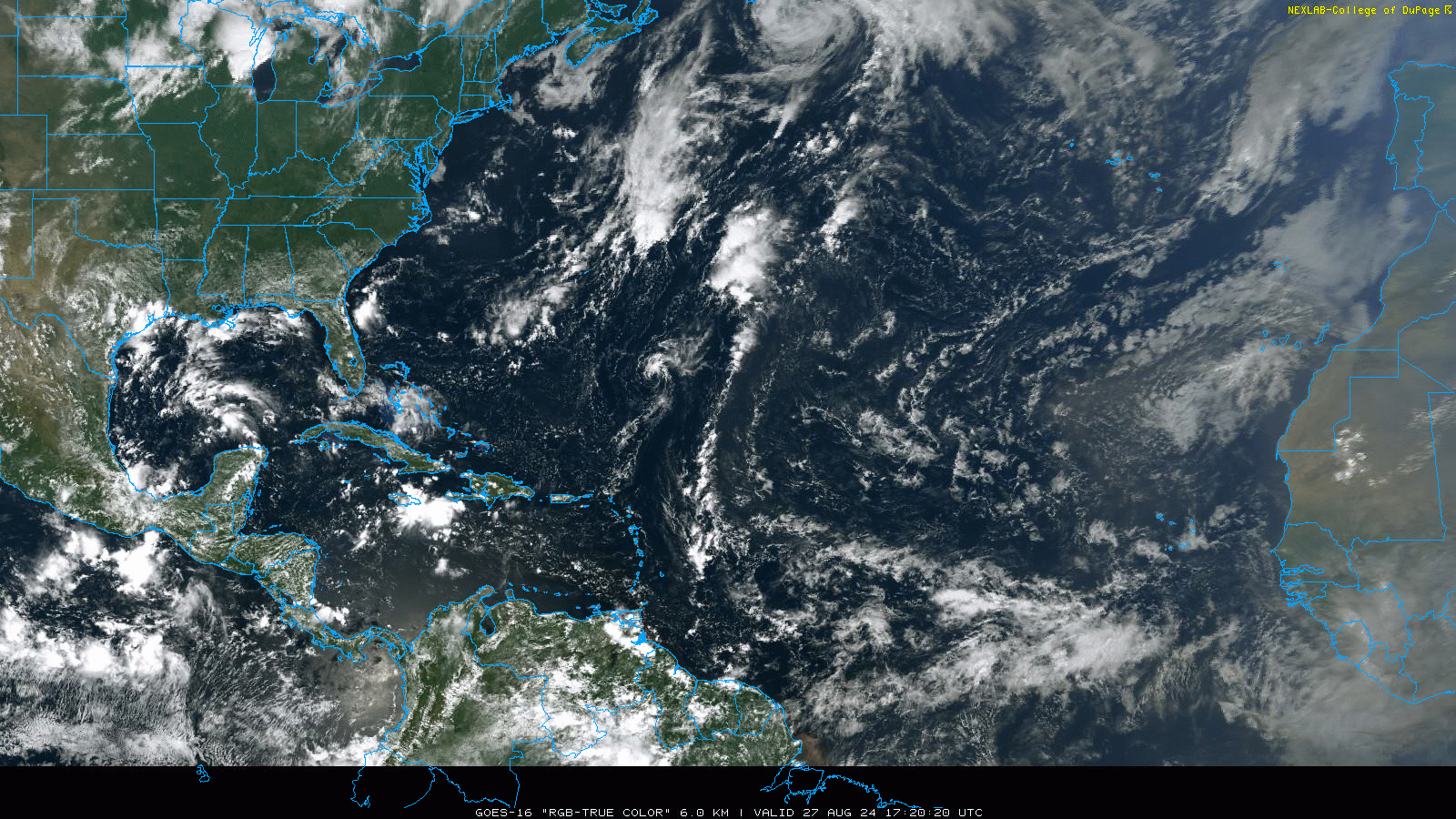
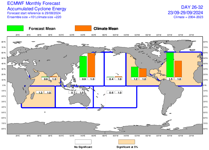
Let’s start closer to home first. We’ve been discussing it all week, but low pressure has now officially formed in the Gulf, with a surface low analyzed offshore of Galveston and Sabine Pass. The National Hurricane Center now highlights this area with a 20 percent chance of development.
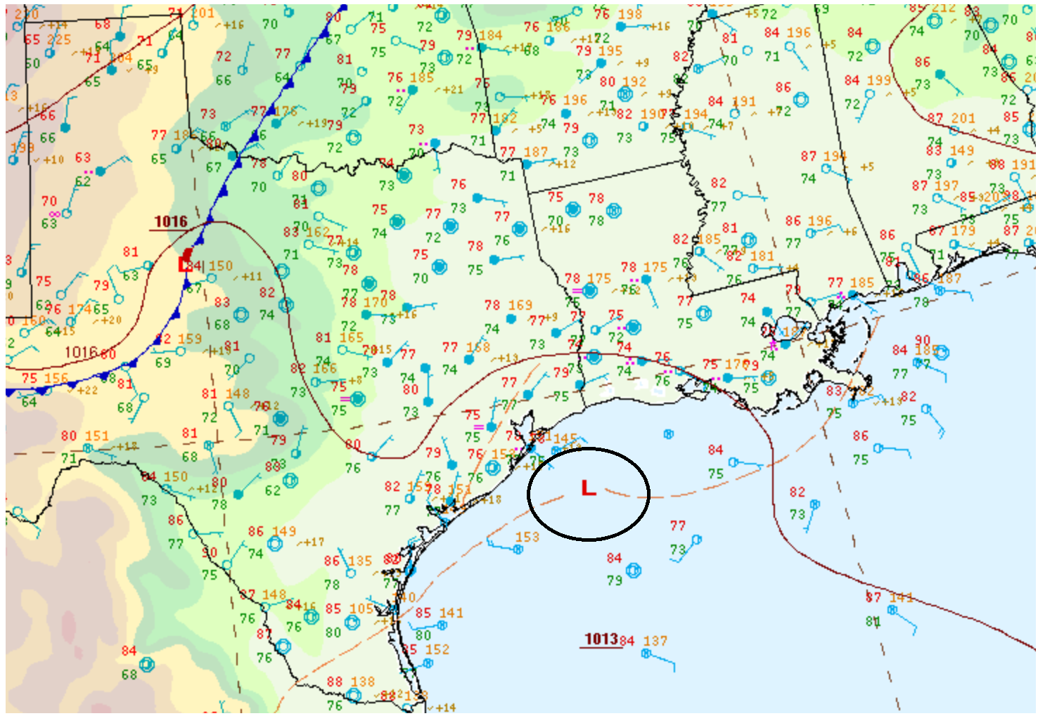
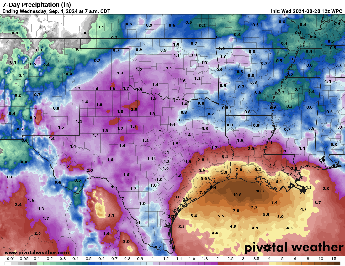
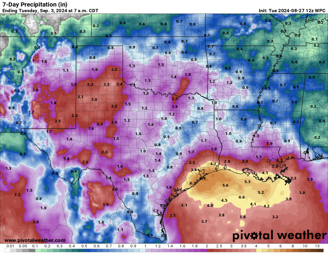
The surface low is rather broad, so it’s not as if we have a rapidly intensifying tropical system off the coast. But we have low pressure in the Gulf, which is always something of note. Any development risk from this is very low-end in terms of winds and waves. But in terms of rain, this will be a source for some serious coastal rainfall in the coming days, development or no development. Rain totals through next week may tally up an additional 5 to 10 inches between Galveston and Vermilion Bay in Louisiana.
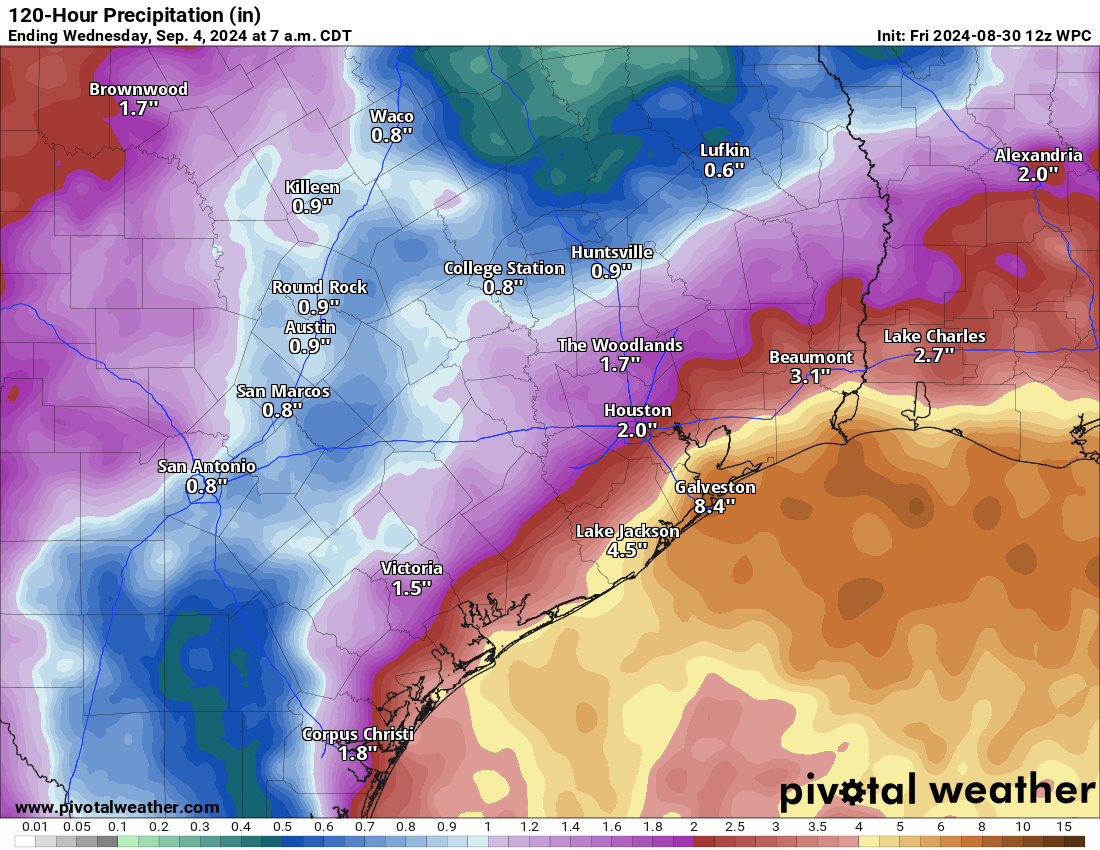
While there are no flood watches posted currently (except in the New Orleans and Baton Rouge areas), there is some potential for flooding to occur in coastal counties and parishes. Places like Galveston, Port Arthur, and Cameron through Morgan City and New Orleans could definitely see at least localized street flooding crop up. With a surface low now offshore, most of the rain will likely consolidate around that feature, meaning that inland places like Houston and perhaps Lake Charles see less rain, less often.
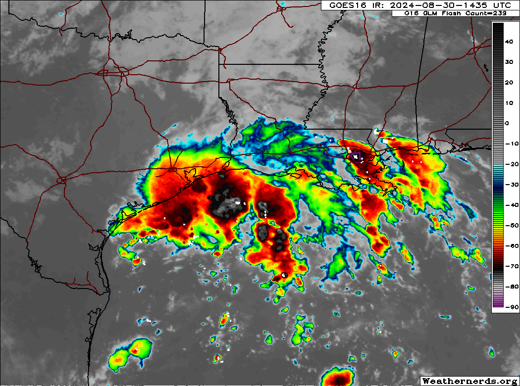
This will be a very coastal-focused feature. The low should meander in the days ahead offshore. Thankfully, upper level conditions aren’t super conducive for development, so again any organization or strengthening would probably be very sluggish and the ceiling from this is rather low it seems. As the low meanders, it could end up onshore in Louisiana or back toward the middle Texas coast, so proximity to land will also act against its development.
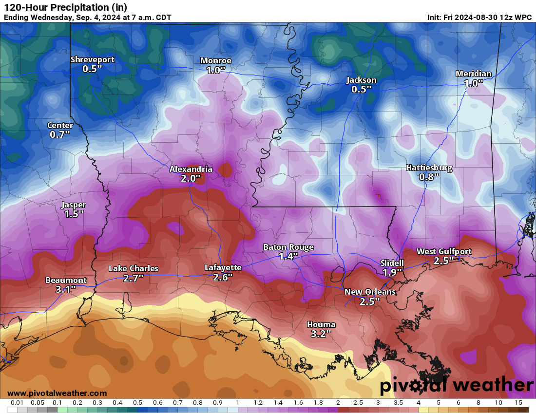
Bottom line: This is not a major concern, but it bears some watching and it will, at the least, deliver locally heavy rain and flash flooding potential on the Texas and Louisiana coasts.
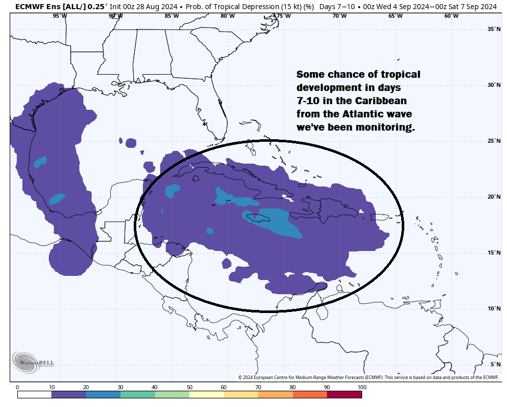
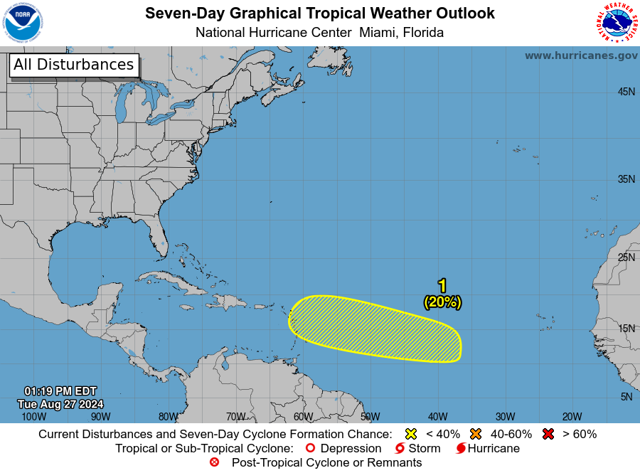
Caribbean development chances
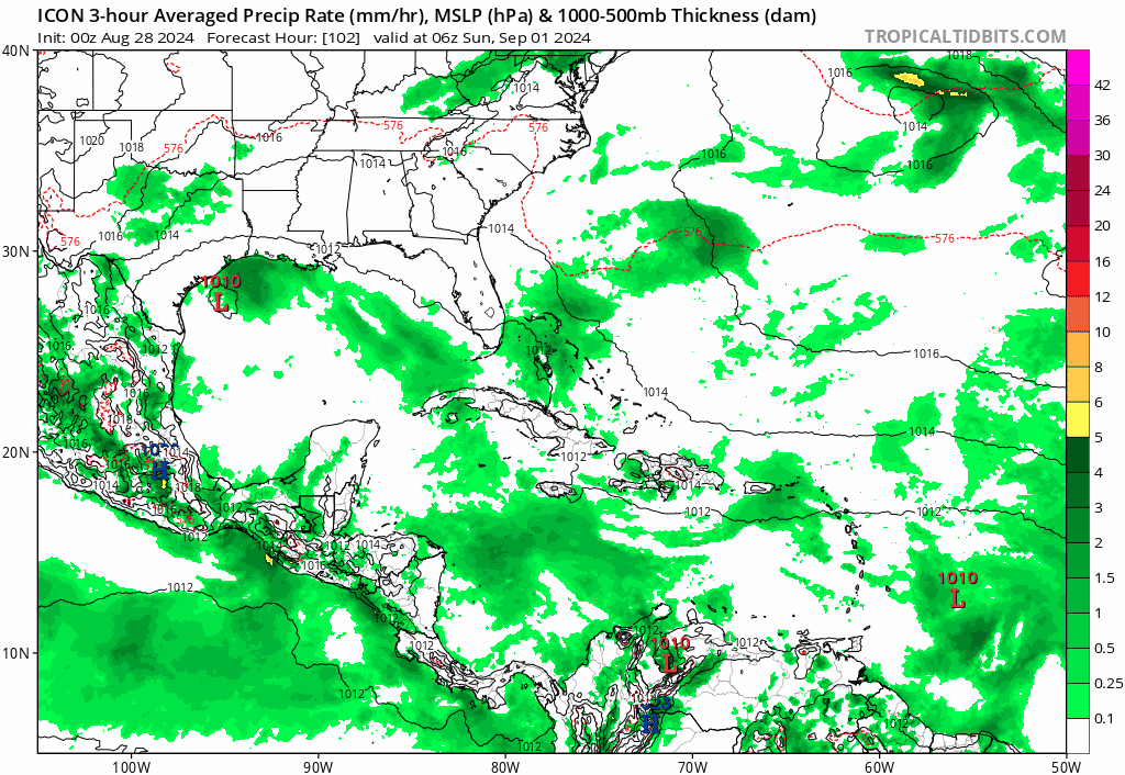
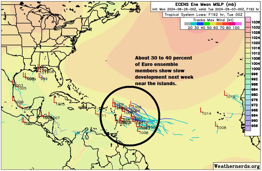
We continue to monitor a tropical wave in the Atlantic that has about a 40 percent chance of development as it moves into the Caribbean next week.
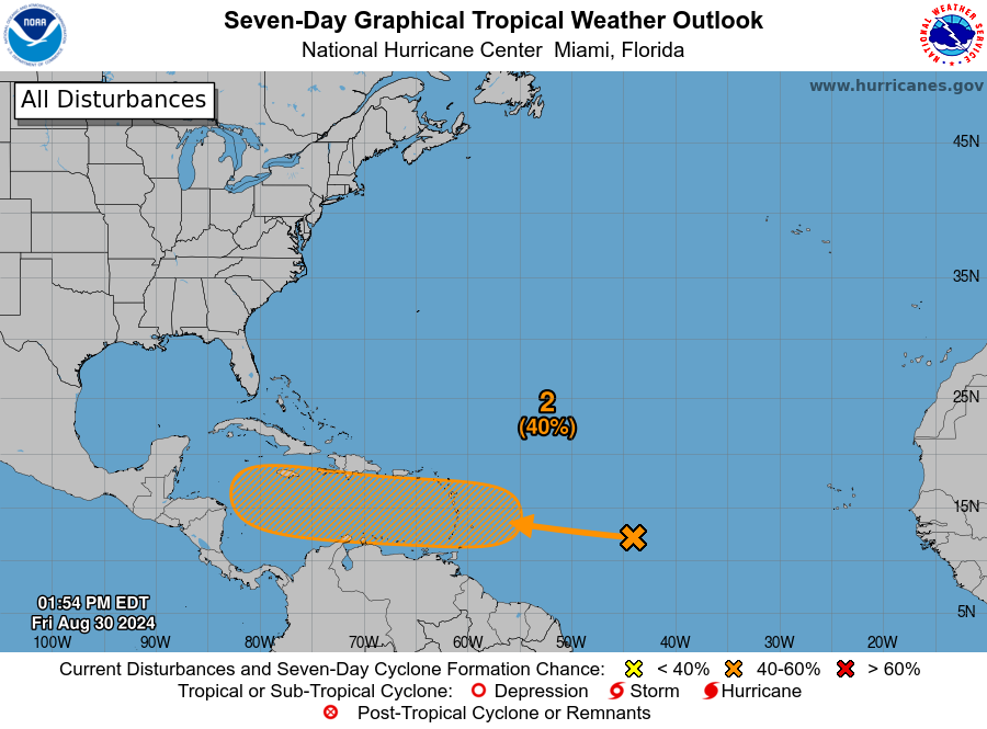
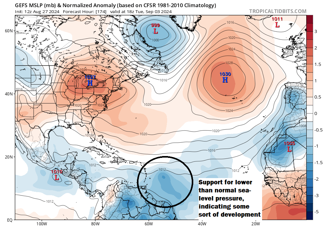
To be clear out of the gate: We have no real good feel about the future of this system. It may not develop, or it could become a serious system to watch. We see legitimate arguments for both outcomes right now. We do know that there are a couple features to watch that will influence the outcome of this system. First, high pressure off Bermuda will help dictate steering flow for this, which is why we’ve seen the NHC outlooks gradually shift more and more to the south and west with time. Second, a cold front dropping into the northern Gulf of Mexico next weekend affiliated with an unusually deep trough of low pressure in the Eastern U.S. may also play a big role in this. Third, the intensity of the system itself will be important, as a stronger storm is more apt to turn north faster, whereas a weaker one will get farther west before turning.
What does it mean? It means we just need to continue watching.
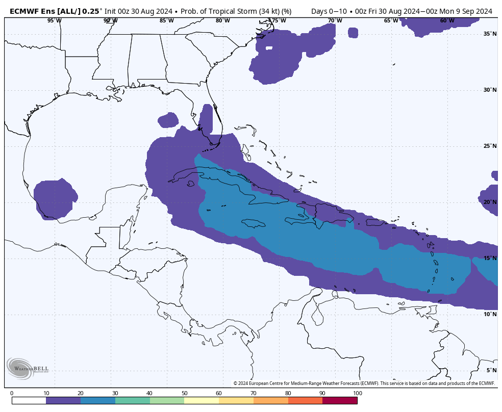
The European ensemble and ICON model are generally the most bullish on development from this system. But even the ensemble can only muster about a 20 to 30 percent chance of development. There are a couple ensemble members that are very bullish on intensity with this. While they remain in the minority, that’s enough reason to keep watching. As we work through the holiday weekend, I am sure we will glean more information on this. For now, while frustrating, it’s prudent to acknowledge there is a great deal of uncertainty with this.
Beyond the Caribbean
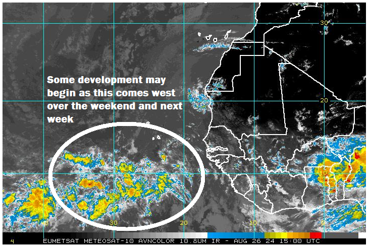
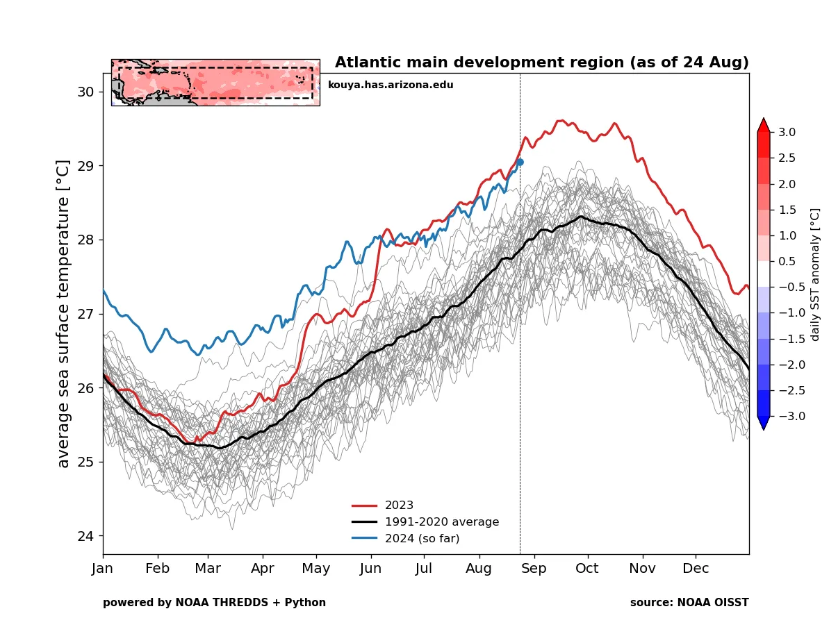
Another system moving off Africa will have a chance to organize in the deep tropics but even that seems less than super exciting right now. It should hopefully end up out at sea as high pressure builds more to the west in the Atlantic, opening the exit door a bit in the east. We continue to see signs of an uptick in activity overall, and in fact, yesterday’s Euro weekly forecast for final full week of September is the first I’ve seen to show above normal storm intensity in some time.
Based on this and some other data I’ve been looking at, I think September may play out interestingly. The first few systems we’ll probably see struggle to organize or struggle to get a handle on. The next batch will probably struggle to organize less, and then the final third of the month may be when the door barges open on an active period. A lot to watch in the weeks ahead, but fortunately still some time to keep tabs on things.