One-sentence summary
The main land impacts this week from the tropics will come via two eastern Pacific systems that will hit Mexico, eventually spreading precip across the Gulf Coast region of the U.S.
Tropical weather: Pacific moisture and a late season Cabo Verde system
In terms of land impacts, the main story will be Tropical Storm Lidia in the Pacific. Lidia will likely become a hurricane before making landfall between Puerto Vallarta and Mazatlán. To the south, Tropical Storm Max will come ashore later today in Guerrero just west of Acapulco.
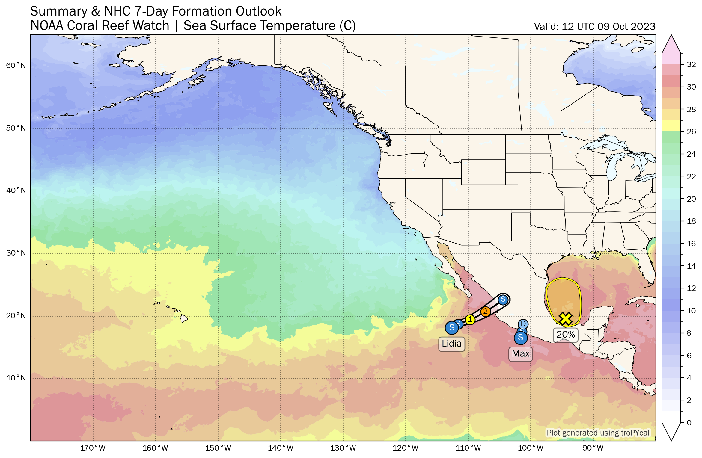
Lidia will be capable of producing flash flooding and mudslides in portions of Jalisco, Sinaloa, and Nayarit in Mexico, as well as a substantial storm surge in the Islas Marias and on the Mexico coast near and south of where it makes landfall.
As Lidia and Max track across Mexico, moisture will arrive in South Texas and eventually spread east across the Gulf toward Louisiana, Mississippi, Alabama, and Florida. In addition, a developing low pressure system in the Bay of Campeche may act to focus some of this rain with a low-end chance of tropical development before it rockets east. Heavy rain is possible in that corridor, with as much as 2 to 4 inches from Corpus Christi to New Orleans to south Georgia and much of Florida.
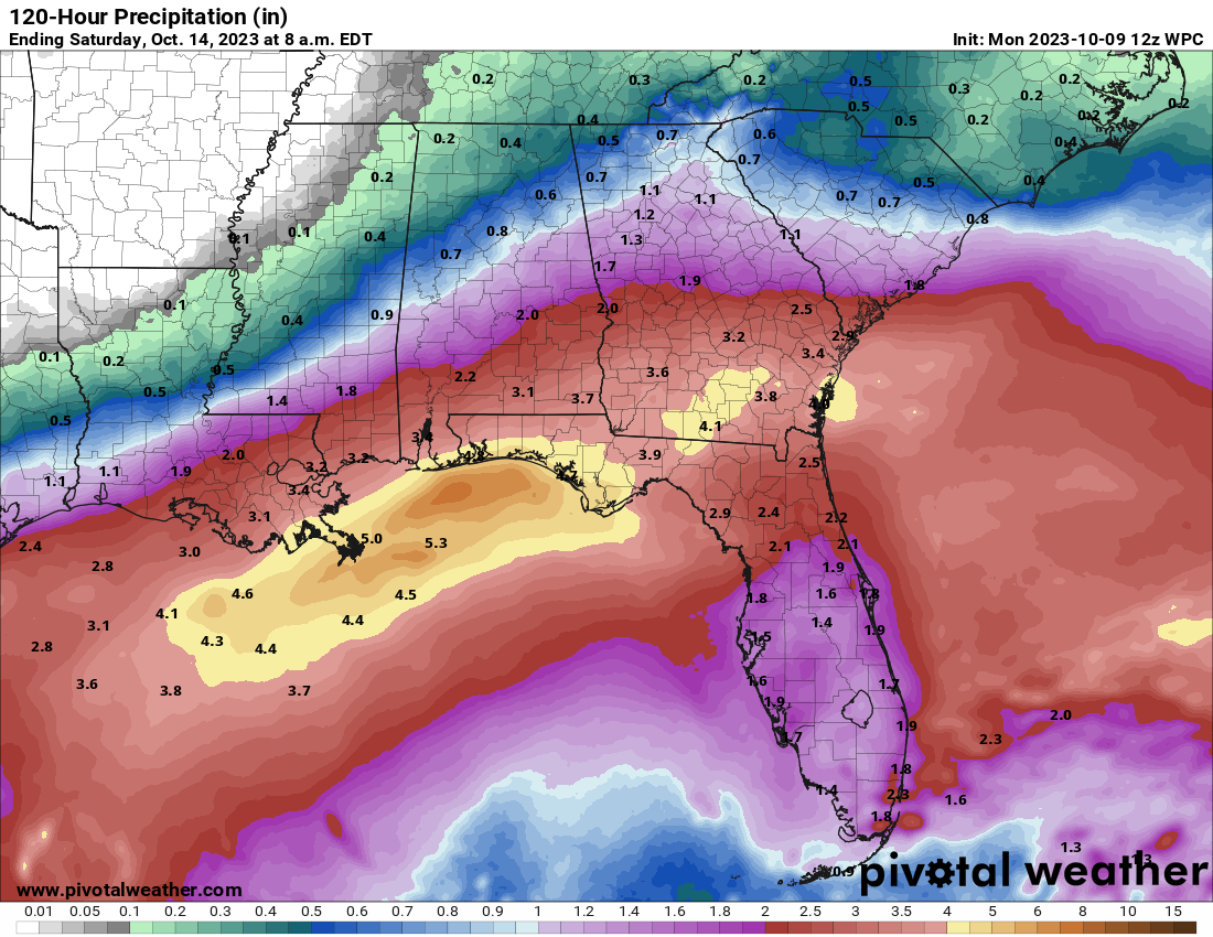
Localized flash flooding will be possible from this, but in general, this will be mostly welcome rainfall. We’ll watch the track of all this over the next day or two to see how this evolves (whether it’s further south, more consolidated, etc.) but a decent soaking is expected in these areas.
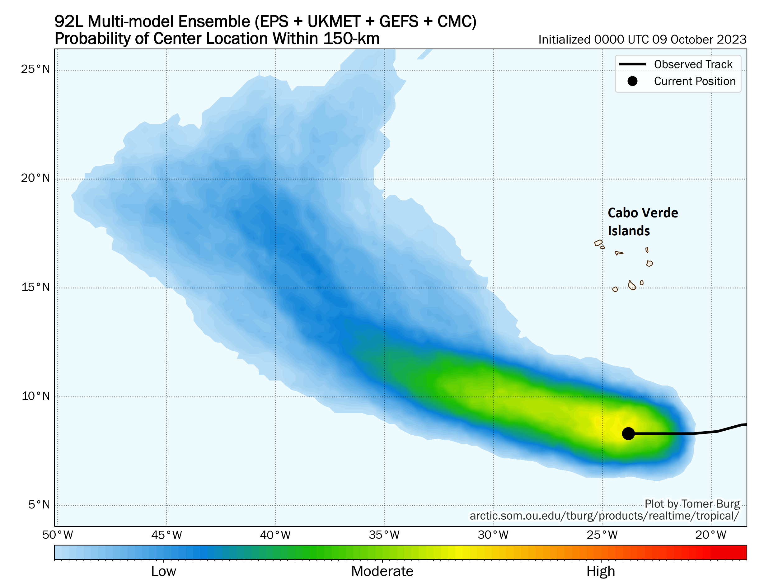
Elsewhere in the Atlantic, things look quiet for now, but Invest 92L in the deep Atlantic near the Cabo Verde Islands is likely to develop this week. This is not an area where you’d historically be looking for tropical systems in mid-October. Every so often one can form, and that may be the case here. The good news is that it’s expected to turn out to sea rather quickly and be of no impact to land.
Elsewhere, the Atlantic looks fairly quiet for now, with the Caribbean and Gulf under control for the next 7 to 10 days or so.
Annular eclipse outlook
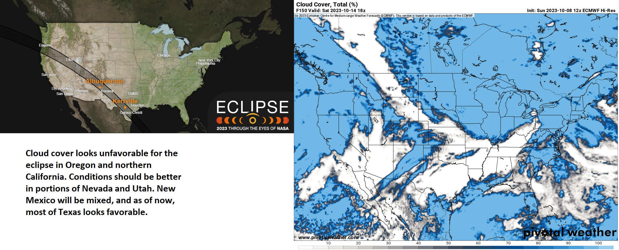
The first of two major solar eclipses over the next 6 months occurs this weekend, as an annular eclipse tracks across much of the southwestern United States. In April, there will be a total solar eclipse that tracks over most of the eastern half of the country into Canada.
An annular eclipse occurs when the Moon passes in front of the Sun, but does not block it entirety, leaving a ‘ring of fire’ in the sky. It is crucial to use solar eclipse glasses when viewing the Sun during the eclipse!
In terms of the best spots to view the eclipse, our money is currently on Texas and Utah. We’ll fine tune things as we get closer. But it appears that a storm system will spread clouds over much of Oregon, which is where the eclipse will first be seen. Conditions may improve once you get into Nevada, and they look solid right now in Utah and the Four Corners (I assume nearby Monument Valley will be a popular spot for this). New Mexico is a bit of a crapshoot right now, as some models indicate high clouds. Once in Texas, things should be clear, although high clouds may spoil things in the Rio Grande Valley or Corpus Christi areas. We’ll provide an update on this for you again later in the week!
Thank you for your work,great as always. We moved to the hill country in Tx, around the first of the year, but our boat is mourned in Kemah,so we follow y’all everyday. Where we live we are on the green line for the eclipse,have all cameras set up, was wondering what you think of overcast on Saturday. If everything works out will send photos. Y’all have a great day.