We continue to watch the East Coast for potential tropical development, although the odds of a formal tropical entity seem to be fading. Regardless of the technicalities involved, it’s an absolute flood mess in Florida, and stormy weather will spread up the coast this weekend. Meanwhile, the West is getting a breather before the next atmospheric river arrives next week.
Soggy Florida
Excessive rain has soaked almost the entirety of the Florida coast over the last few days, with over 15 inches on the Space Coast up into near Daytona Beach.
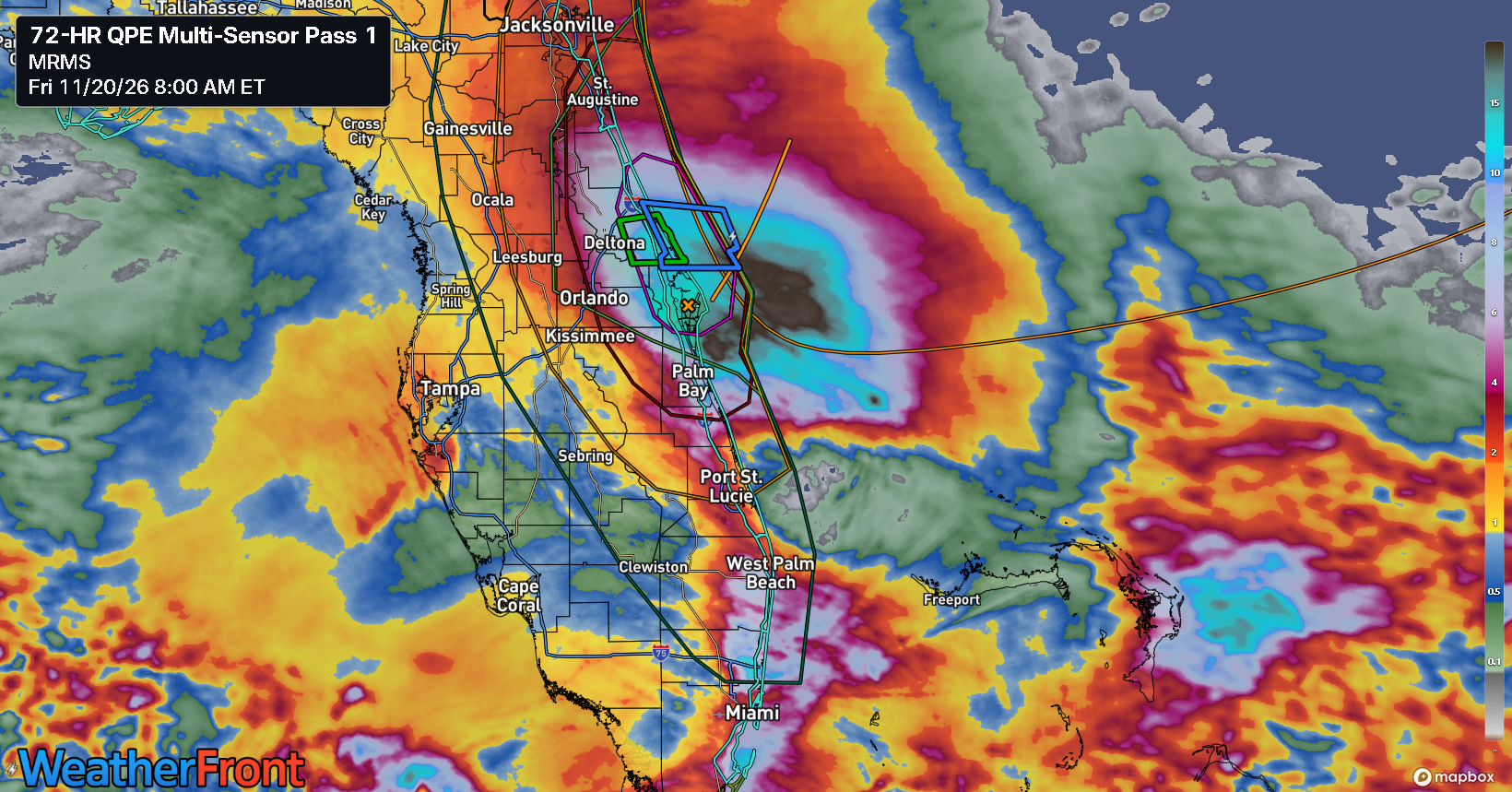
So far this month, Melbourne, FL has had their wettest day on record (November 2) and their 14th wettest day on record (yesterday). November 2026 is their wettest November on record by a mile, with 1/3 of the month to go. Same goes for Daytona Beach and Vero Beach and West Palm Beach and Fort Lauderdale. So any way you slice it, this has been a record busting November in Florida.
What’s next?
Heavy rain continues on the coast today and as low pressure slowly drifts north along the coast, we’re going to see the axis of heaviest rain possibly shift farther north toward the First Coast and Jacksonville. But there is still likely to be plentiful rain on the Space Coast. Again.
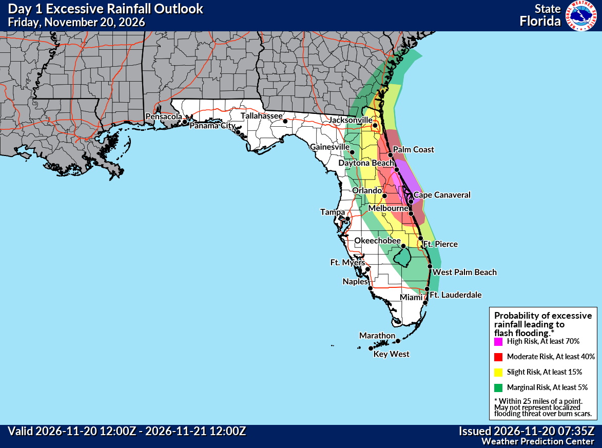
The Weather Prediction Center has issued a high risk today (level 4/4) for significant flooding on the Space Coast, with a moderate risk surrounding that up to about Ponte Vedra Beach outside Jacksonville. High risk days are historically extremely well-correlated with flood damage, and these are only handed out when confidence is high and risk is high. Basically, it’s going to get worse before it gets better.
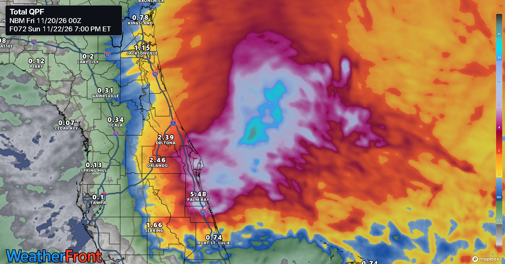
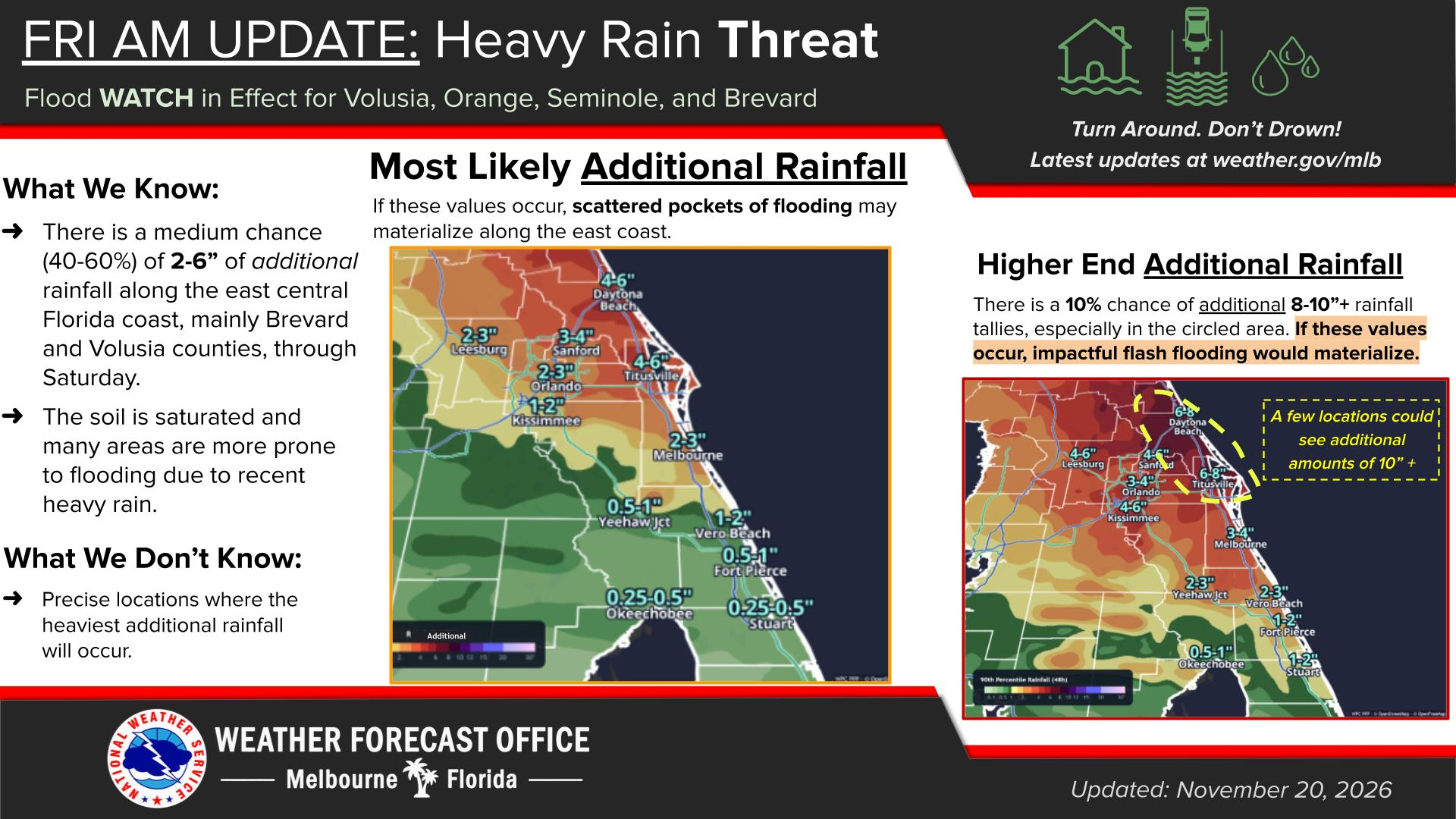
Flood Watches remain in effect, and folks north of Port St. Lucie should remain on alert for significant flooding risks.
The other story in all this will be flooding along the St. Johns River. For those that are unfamiliar, the St. Johns flows south to north in Florida and has its mouth in Jacksonville. All this rain is running off into the St. Johns river system and onshore flow is basically blocking any of the water from draining into the Atlantic in Jacksonville. Also, the St. Johns isn’t exactly flowing downhill with any speed. Florida is relatively flat terrain, so the water naturally drains slowly. So the water levels are dealing with antecedent rain that lifted them, current rain raising them further, and a slow draining process. The end result is long duration record flooding. This isn’t “flashy” like we saw out in the Southwest earlier this autumn. This is high and slow.
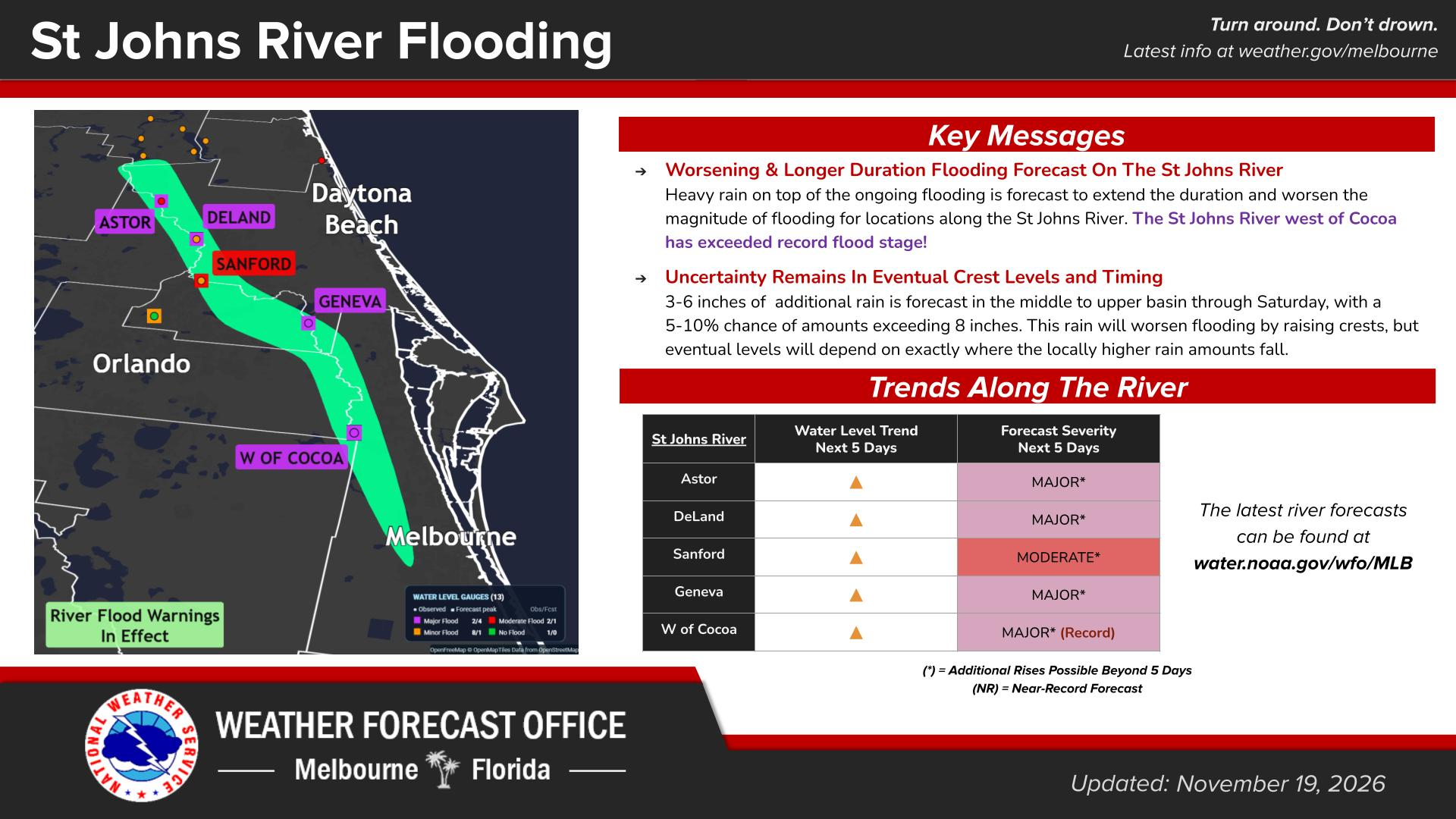
For the area near Cocoa, this means multiple consecutive days of the river sitting over a foot above the previous record. That is just crazy.
Tropical development?
The NHC is keeping a requisite 50% chance of tropical development with this system as it comes north just off the East Coast toward the Carolinas, but it seems as though the odds of that happening are being trimmed back. Still, we’re going to get basically a potent little nor’easter out of this as mess comes northward.
Farther up the coast
The initial system on the Florida coast may bend back toward the Gulf and weaken while new low pressure forms offshore. This will zip up the coast this weekend, arriving in New England by Sunday afternoon. The Jaguars/Giants game might be something to watch with at least the potential for torrential rain. Things could shift a bit depending on exact track and timing of course. But for now, expect a burst of heavy rainfall and gusty winds on the Mid-Atlantic coast and into New England this Sunday and Monday morning.
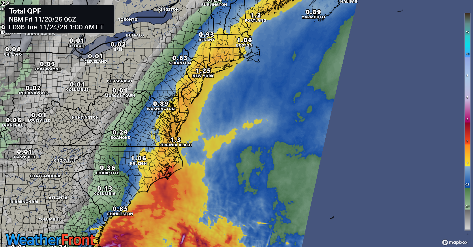
Expect about 1 to 3 inches with some isolated higher amounts on the coast from Wilmington, NC into southern New England. This could also come with 40 mph wind gusts as well. Welcome to a Super El Niño winter.
West Coast
This week has been busy. The San Francisco Chronicle’s coverage has been excellent this autumn with their focus on these atmospheric river storms. Also, Daniel Swain remains an essential West Coast follow on all social platforms. He pointed out that San Francisco and Burbank both shattered their all time records this week for hourly rainfall. This is indicative of the super El Niño and an exceptionally warm Pacific Ocean, amplified some by climate change. An atmosphere that can hold more moisture can disperse it on the land with greater force and efficiency. Thus, you can get these more extreme rates of rain, and that’s what we saw this week.
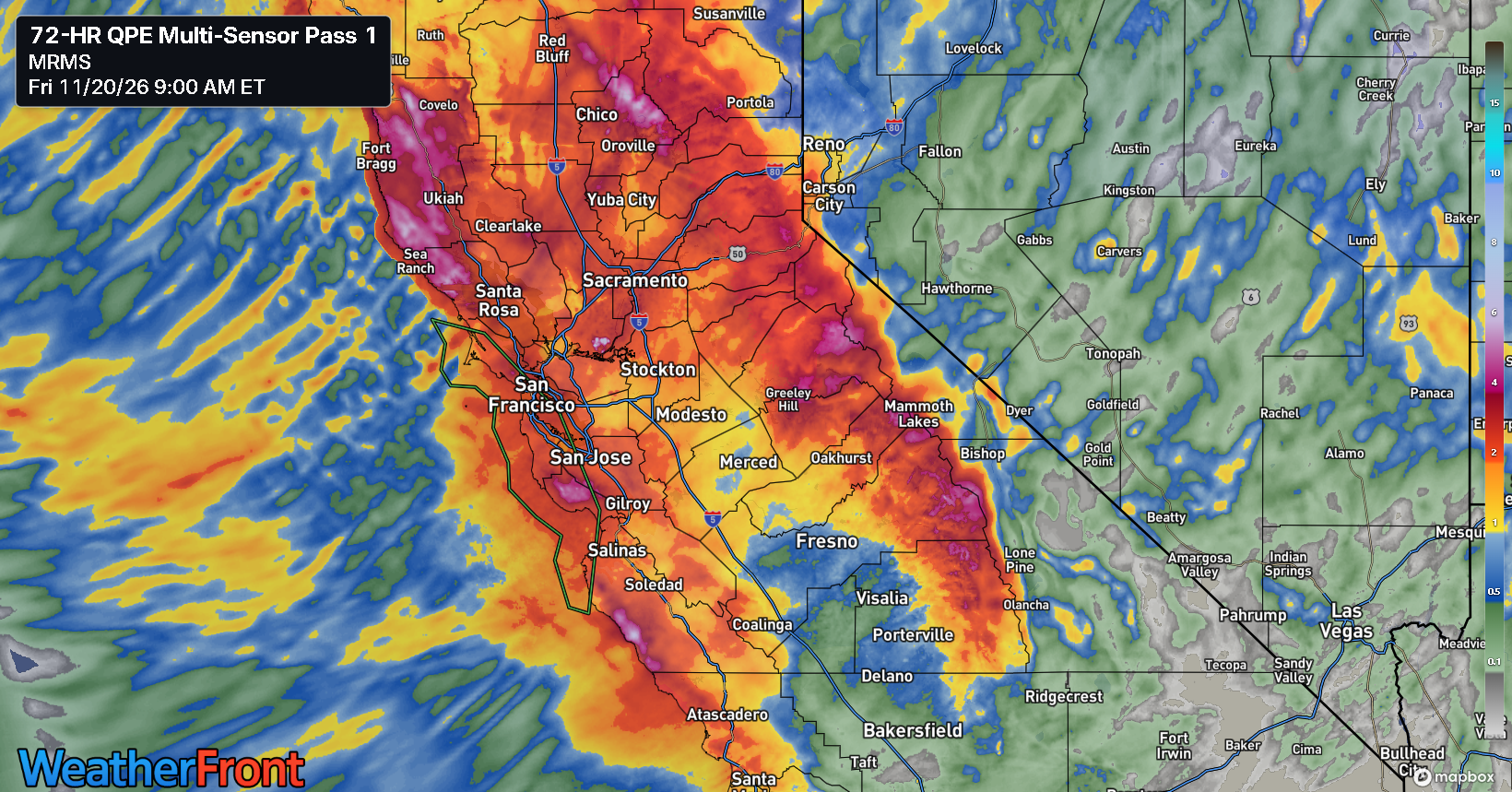
This storm is winding down, but there are signs of another significant atmospheric river storm next week in California and Oregon. This one could be fairly potent as well.
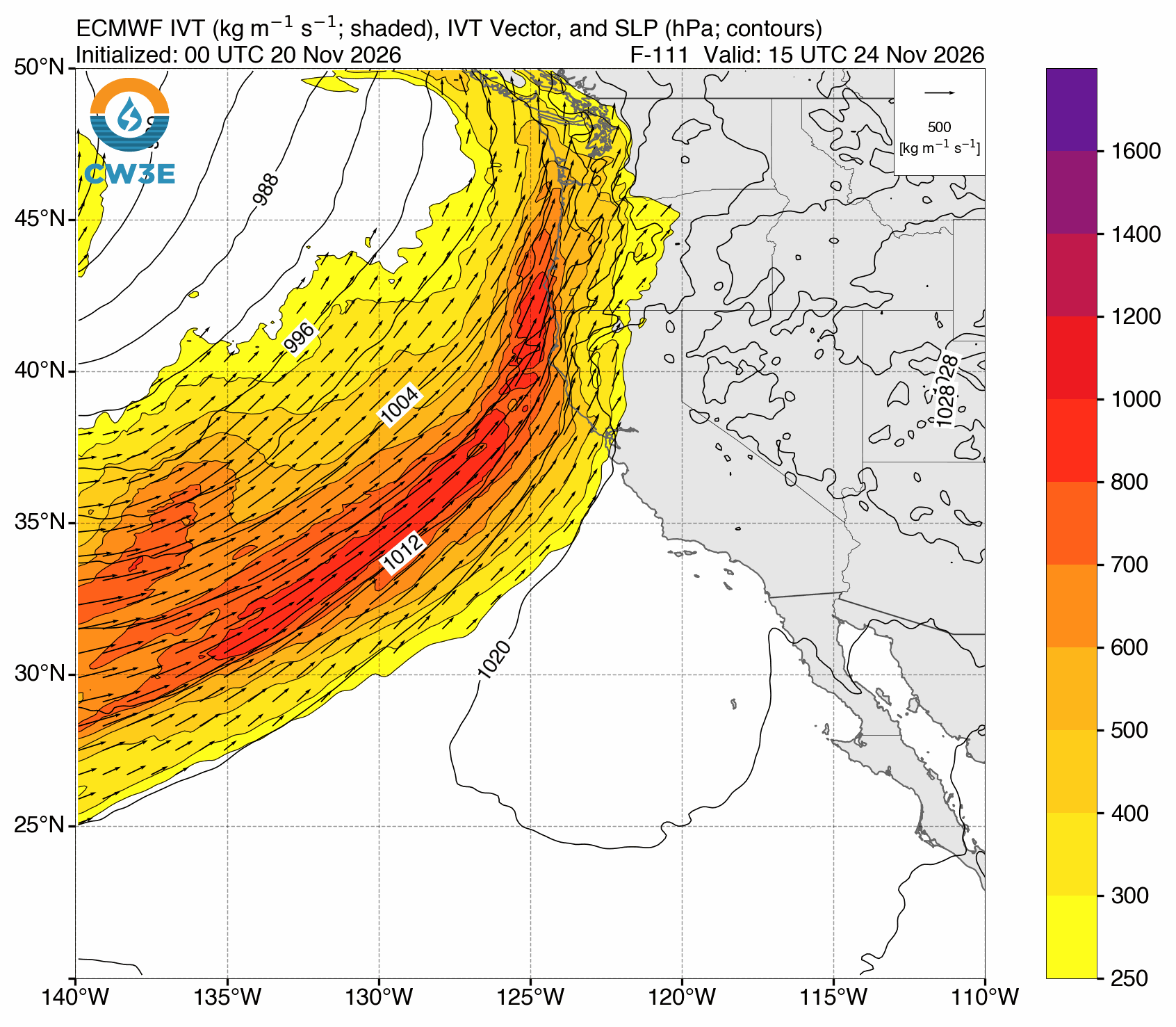
It’s still a bit too soon to get specific on impacts, except to say it may be worse a little farther north this go around. Regardless, if you have travel plans to or from the West Coast ahead of the Thanksgiving holiday, this is something you should keep in mind.