One-sentence summary
Idalia is now a tropical storm, racing off to the northeast and should emerge offshore tonight, where it will head east for several days before possibly impacting Bermuda.
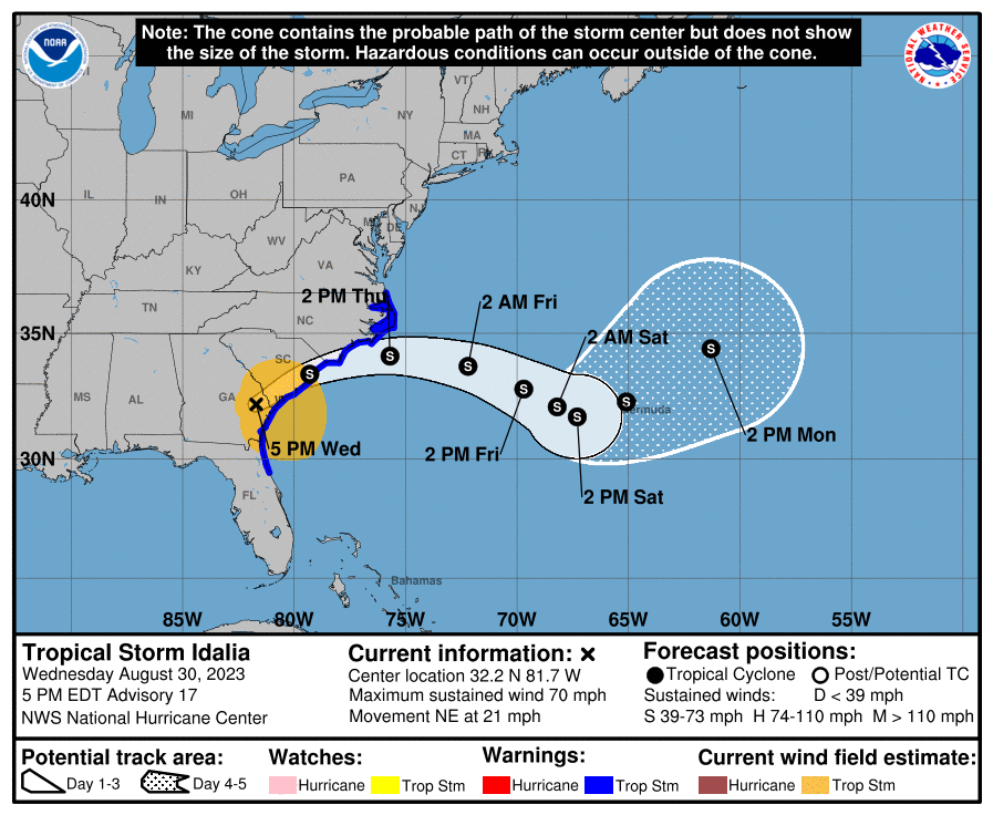
Tropical Storm Idalia: 70 mph, moving NE at 21 mph
Idalia is no longer a hurricane, now a tropical storm, but still causing plenty of headaches as it comes northeast across Georgia and just about into South Carolina.
What’s changed since late morning
Idalia is now a tropical storm.
All warnings for Florida’s Gulf Coast have been discontinued.
Idalia’s wind
Wind gusts up near 70 mph were recently reported near Savannah, GA, so Idalia still has some punch left. Power outage numbers are now up to around 500,000 in Florida and Georgia per poweroutage.us. Idalia will weaken a bit further as it moves northeast before getting back out over the Atlantic, but it will still be capable of 50 to 70 mph wind gusts over a wide area of Georgia, South Carolina, and parts of North Carolina.
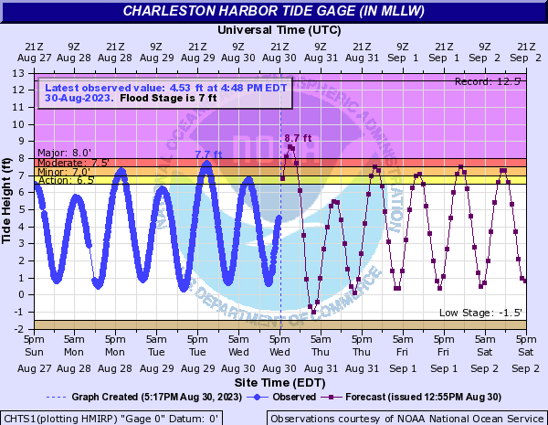
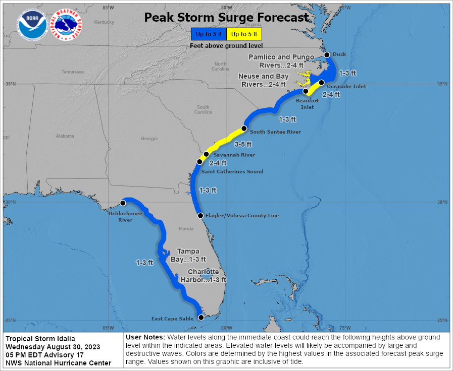
Idalia’s surge
Major coastal flooding is expected in parts of South Carolina, with Charleston forecast to see their highest tidal level since November 2018 this evening, peaking near 8.7 feet. If that is achieved, it would be the seventh highest level recorded in Charleston since records have been kept.
Farther up the coast, Myrtle Beach is expecting moderate coastal flooding, while Wilmington, NC is expecting minor coastal flooding. Additional moderate flooding may occur on the mainland side of Pamlico Sound in North Carolina.
Idalia’s rainfall
Heavy rains continue along the path of Idalia.
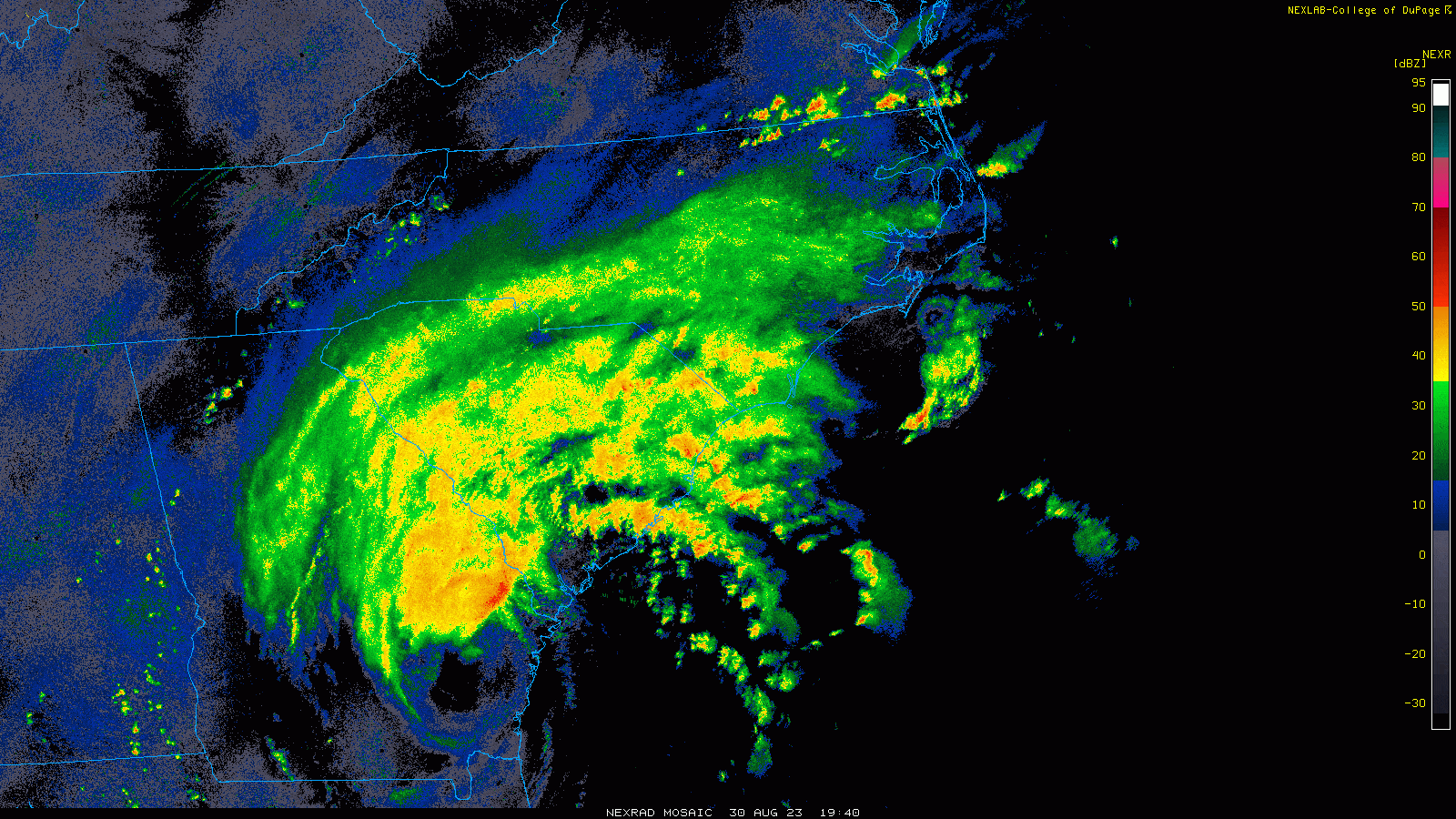
Pockets of flash flooding should occur in spots across the Carolinas this evening, with 6 to 8 inches possible in North Carolina and another 2 to 6 inches in South Carolina. River flood warnings will be needed for some of the hardest hit basins. A moderate (level 3 of 4) risk of excessive rainfall remains in effect for the Carolinas.

Idalia’s tornadoes
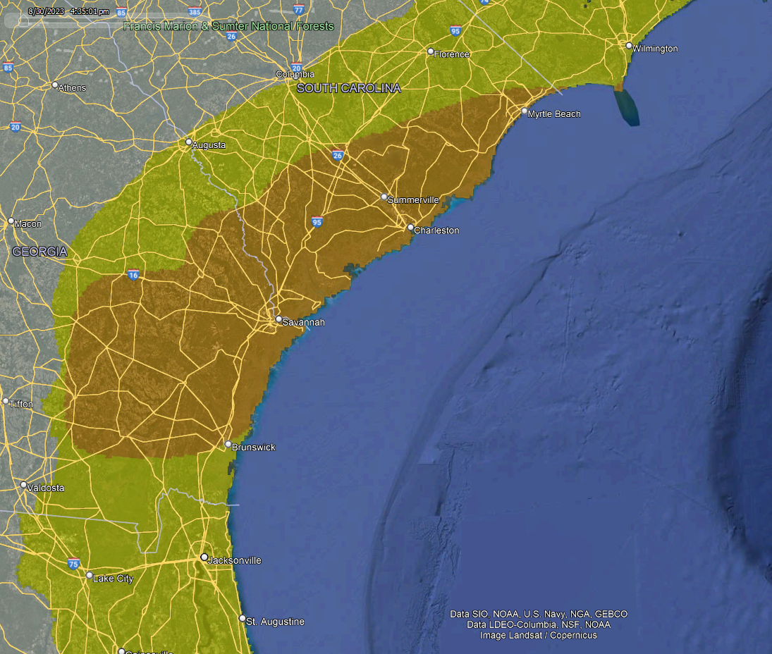
Isolated tornadoes remain possible, particularly south and east of where Idalia ventures, hence a tornado watch is in effect tonight for coastal South Carolina and a portion of North Carolina.
Idalia’s future track: Loop looks less likely
The forecast track for Idalia is coming into better focus now, and we can stop talking about the possible loop de loop back to Florida. Models are unanimous in taking Idalia out to sea for now, slowly but steadily.
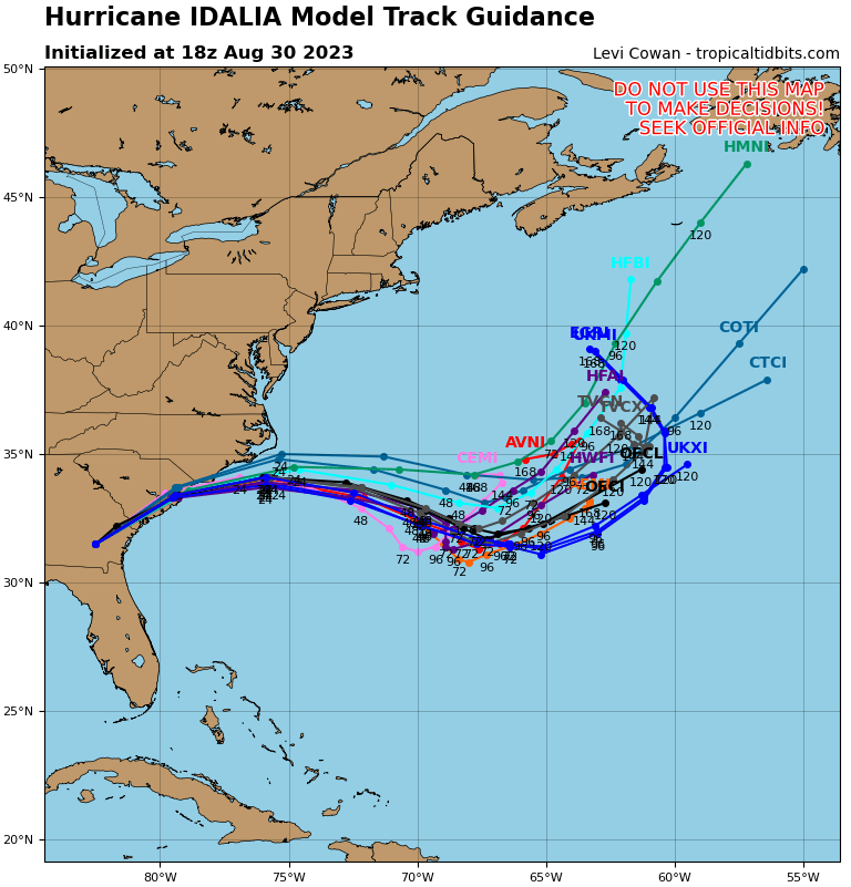
If there is a risk with Idalia, it would be to Bermuda or for the very, very, very outside chance that it were to get pushed back toward the Northeast U.S. at some point. The latter seems highly unlikely right now, and the former (risk to Bermuda) is a low risk right now. Modeling agrees that Idalia should remain below hurricane intensity for now while it meanders offshore. We’ll keep eyes on this over the coming days however.
Regardless, Idalia will help keep surf rough and probably enhance the risk of rip currents up and down the U.S. East Coast, in concert with what’s left from Franklin.
Our next update will be a brief one after the 11 PM ET advisory package.
You guys are troupers, staying with these storms from beginning to end. Thanks so much; I have recommended you to other relatives along the coast.
Thanks, Elaine!
So appreciate The Eyewall, just like SCW. You guys are the best! Been sharing The Eyewall with lots of southeast friends. Look forward to particularly seeing your Idalia updates in a few days re Bermuda. Sincere thanks for all you do.
Thank you!
The reporting was awesome. Helped family and friends to take action based what you provided. Hopefully they will start following this report themselves.
Thank you!