One-sentence summary
Hurricane Lee is expected to reach the Bay of Fundy or western Nova Scotia by midday Saturday, bringing widespread wind, power outages, coastal flooding, and battering waves to the western half of Nova Scotia in particular.
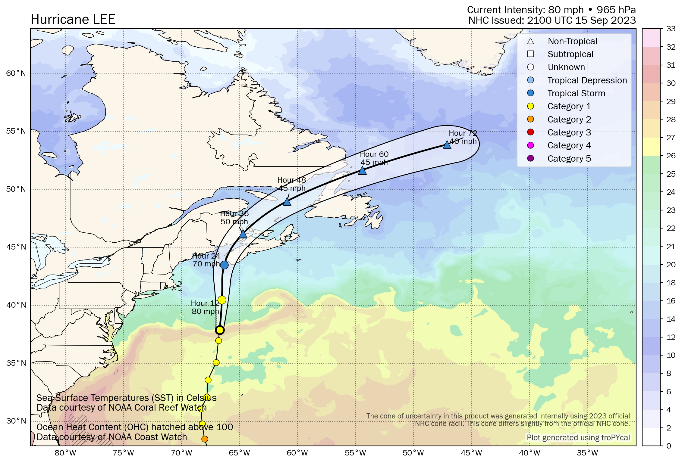
Hurricane Lee: 80 mph, moving NNE 20 mph
What’s changed since this morning?
Not much. The forecast appears mostly on track. Lee’s potential surge has been upgraded for the Atlantic coast of mainland Nova Scotia to 1.5m (3 to 5 feet).
Nantucket is currently seeing wind gusts as high as 47 mph. Mt. Washington, NH is now sustained at 45 mph, gusting to 55 mph.
Update on Lee
I honestly don’t have a lot to add this evening. This is more of a “hey, Lee is arriving, and we’re just checking in” post. The forecast impacts should be pretty baked in. Reading over some of the latest from Environment Canada, it appears that the surge values have been increased some on the Nova Scotia coast between Shelburne County to Guysborough County where a Storm Surge Warning is posted. This is essentially the entire Atlantic facing coast of Mainland Nova Scotia.
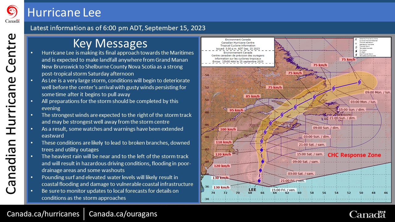
We’ll see about the Bay of Fundy and how the water levels behave toward the Isthmus of Chignecto. The current track probably alleviates some of the risk for extreme conditions in those areas, focusing the worst on coastal mainland Nova Scotia.
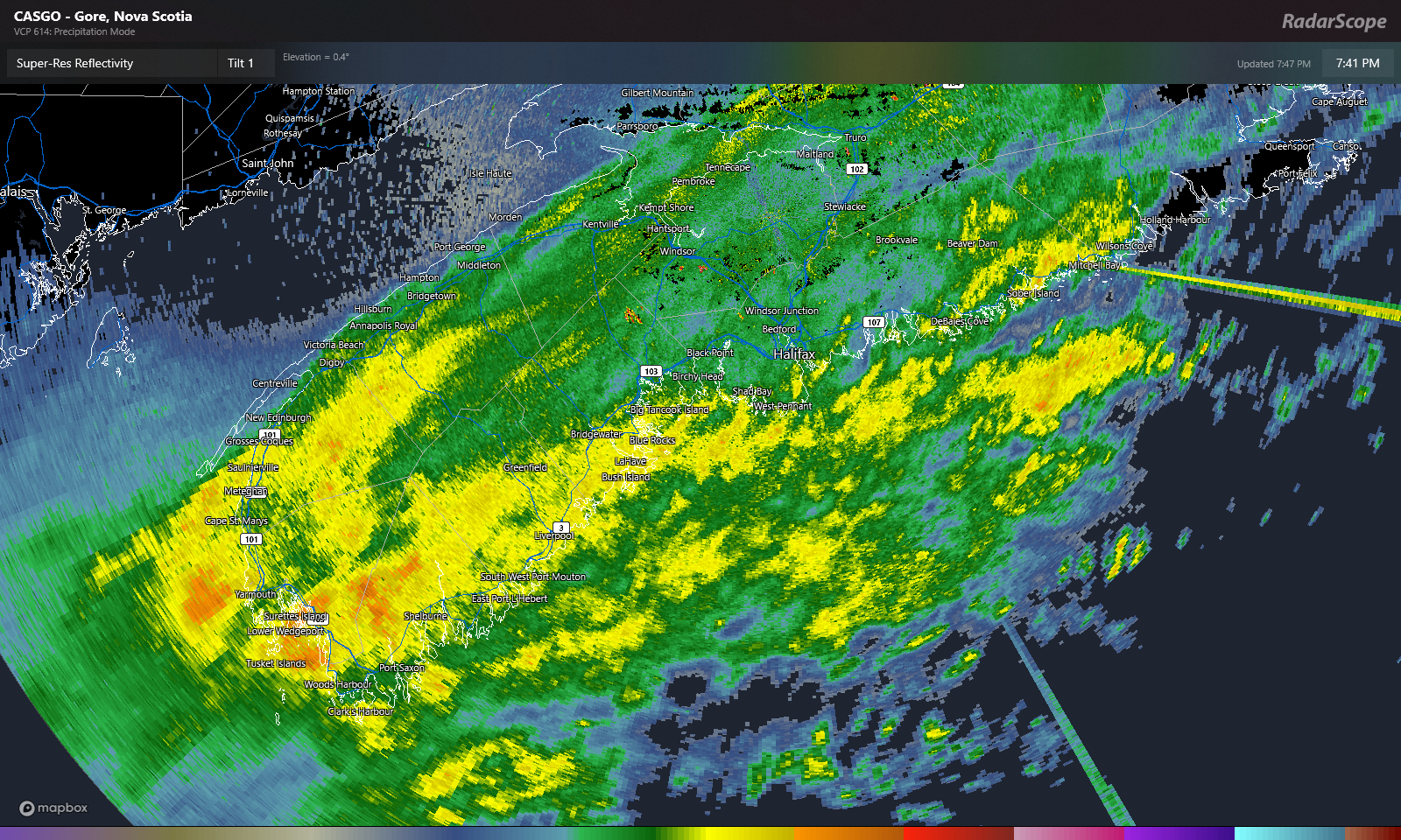
In addition to surge concerns, winds are likely to cause widespread power outages on the Maine coast, as well as much of mainland Nova Scotia. Trees may be more susceptible to being knocked down from the wind given the antecedent wet soils in place. Heavy rain may cause additional flooding, with the highest risk probably being in eastern portions of Downeast Maine, central and northeastern New Brunswick and into the Gaspe region and Quebec Lower North Shore through Blanc-Sablon.
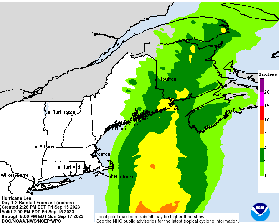
Soil moisture in Maine is running in the 98th to 99th percentile, per the NWS in Caribou, which means that flash flooding will not be difficult to do with these rain totals. Portions of Nova Scotia have already seen a good deal of rain recently, so they too are vulnerable, particularly in the Annapolis Valley.
So we’ll see how it goes. We’ll have a full update for you in the morning. Be safe!
From Cape Cod, Ma. No hurricane here. A touch of wind overnight, hardly worth mentioning and a thimble full of rain.
All predictions were off by miles. Hopefully Maine nd Canada will have the same.