One-sentence summary
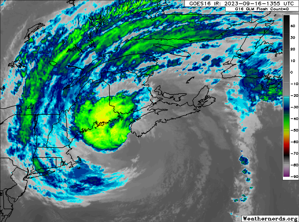
Lee is on track to deliver mostly expected impacts to Atlantic Canada and Maine today, with heavy rain ongoing in Maine, a 2 foot surge so far in Canada, and wind gusts as high as hurricane-force so far in portions of New Brunswick and Nova Scotia.
Hurricane Lee (now-post-tropical): 80 mph, moving N 25 mph
Lee was determined to be post-tropical, which means it’s now essentially a gigantic nor’easter instead of a tropically-derived hurricane. It means absolutely nothing other than a classification change. Impacts are identical to forecast.
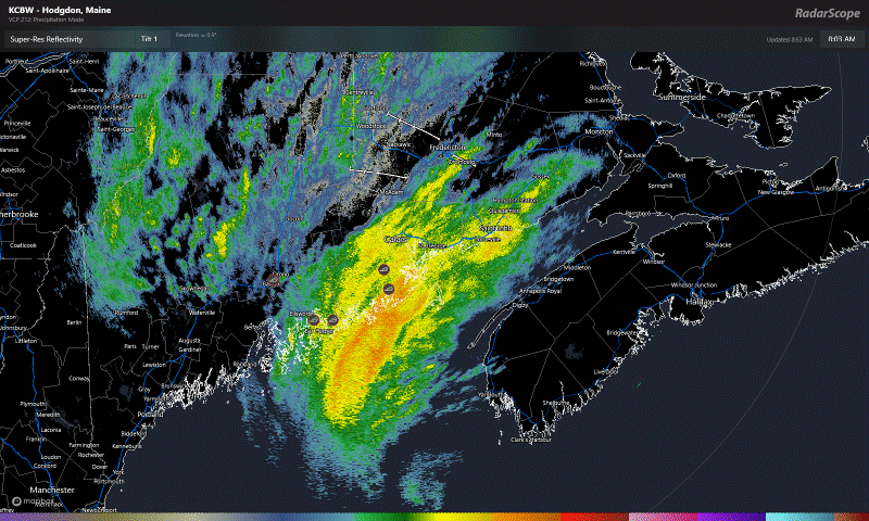
Lee is flinging very heavy rain onshore in Maine right now, with a band of torrential rain between Fredericton, NB and Acadia National Park.
Meanwhile, wind gusts have been ticking up around the region, with Grand Manan as high as 123 km/hr (77 mph), Halifax as high as 117 km/hr (73 mph), Mt. Washington, NH to 74 mph, St. John, NB to 85 km/hr (53 mph), Nantucket to 55 mph, and Eastport, ME to 62 mph.
The high tide cycle ongoing right now, as well as the next one this evening will be the highest for these areas. Yarmouth, NS is seeing about a 0.6m (2 ft) surge, Halifax 0.7m, and St. John about 0.5m. These are generally in line with expectations, maybe a smidge under. Surge of up to 1.5m (5 ft) is possible in Nova Scotia. With Lee’s center still technically south of Nova Scotia, the highest surge is yet to come. In addition, some potent waves will be coming ashore in Nova Scotia as well, with a buoy near Lee’s center at 8 AM AST reporting 30 foot waves.
So I think the takeaway here right now: Worst is over for southern New England, and it was handled pretty well as expected. Maine, particularly Downeast are in the height of the storm now, and it will wind down this afternoon. Nova Scotia, New Brunswick, and PEI will be in the height of the storm shortly if not already, and it will wind down tonight.
Elsewhere
Tropical Storm Margot may turn toward the Azores next week, while weakening and becoming a post-tropical cyclone.
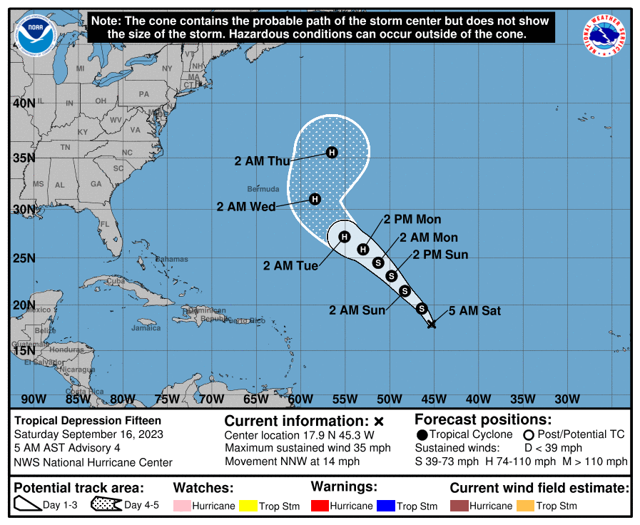
Tropical Depression 15 should become Nigel today, if not by the next advisory. It is expected to become a hurricane out at sea, while re-curving east of Bermuda.
Another potential Cabo Verde system may try to slowly develop later next week, but that is not a guarantee. The Gulf looks quiet, as does the Caribbean. Otherwise, things look generally quiet elsewhere too. We’ll let you know if that changes.
I was seeing a model in the lower Caribbean that trends into 240 I have seen this in the last 18z 00 and 06. I wish I knew more to accurately trend these things.
GFS
something seems to want to pop up down there – enough consistency in the inconsistency to make me wonder…
None of what the GFS is showing in the Caribbean matched it’s ensemble model. The operational has been awful this season.
On next week’s Cabo Verde system…will it be one where a weaker system heads toward the Gulf, while a stronger system heads north into Atlantic?