One-sentence summary
The majority of the Atlantic will remain fairly quiet, but the far north may see a weak system develop by the weekend that could gradually drift toward the Azores.
Happening Now: No worries for most
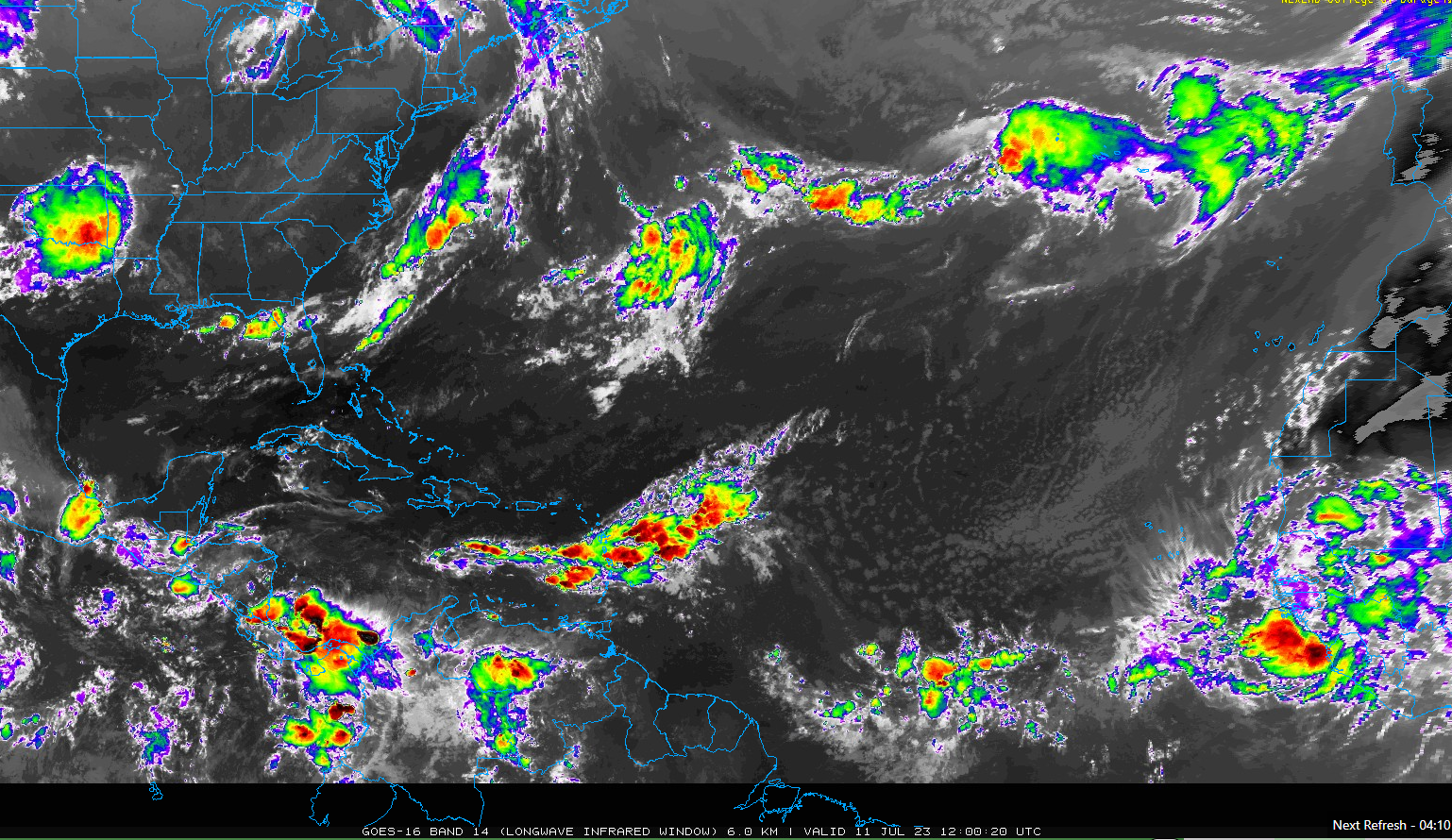
The Atlantic has some action out there today, but none of the systems at this point looks like a serious threat, and certainly nothing that would threaten any land. There’s a tropical wave in the islands today, bringing some showers and storms. A rather robust wave just emerged off Africa, but it’s already losing some steam.
But the main system we’re watching will come to fruition in the medium range, so we’ll get into that below.
All in all, things are currently quiet from an impacts standpoint.
The medium range (days 6 to 10): Can the North Atlantic do it?
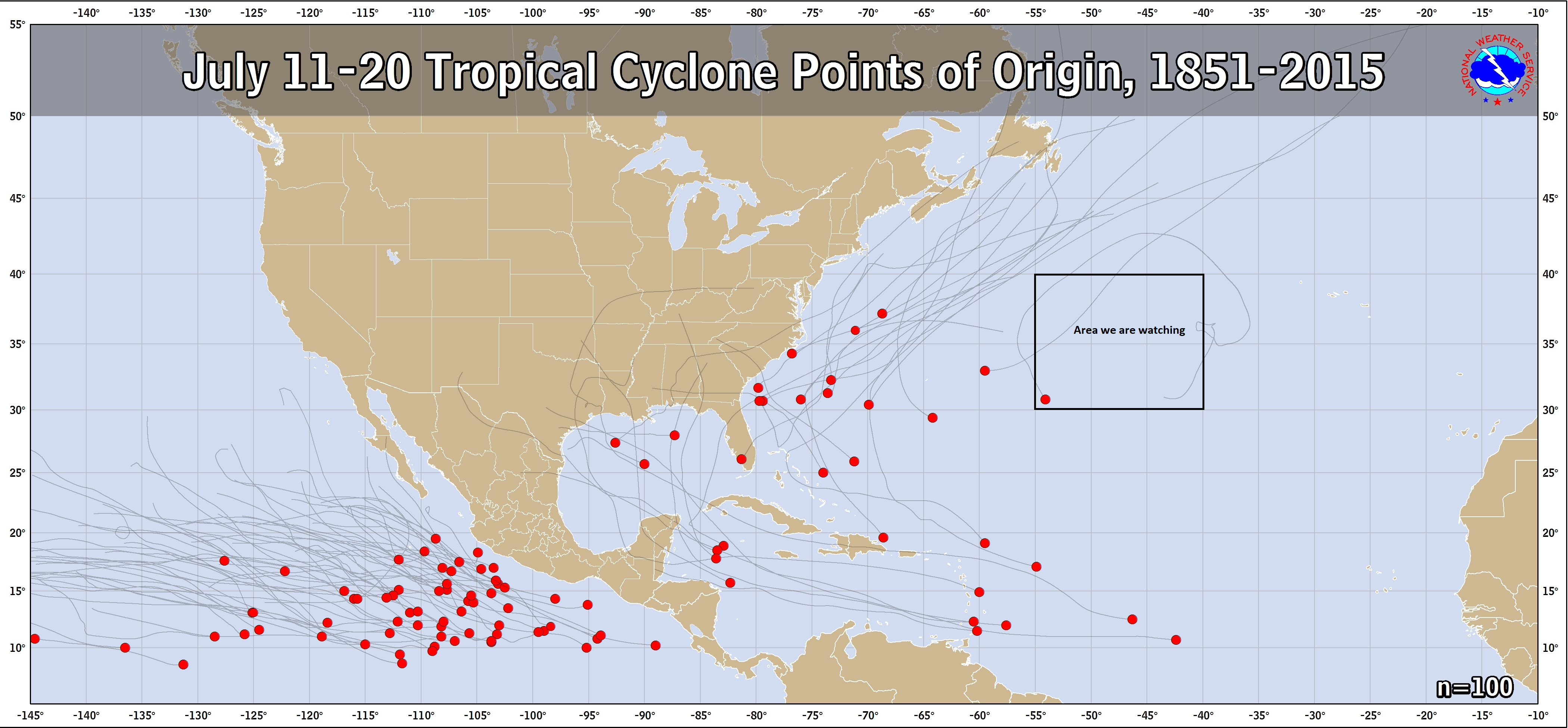
When we look at formation points of northern Atlantic storms throughout history between July 11th and July 20th, one area we generally can usually rule out for storm origin is east of about 55°W longitude. We’re going to be watching exactly that area this week and weekend for potential development.
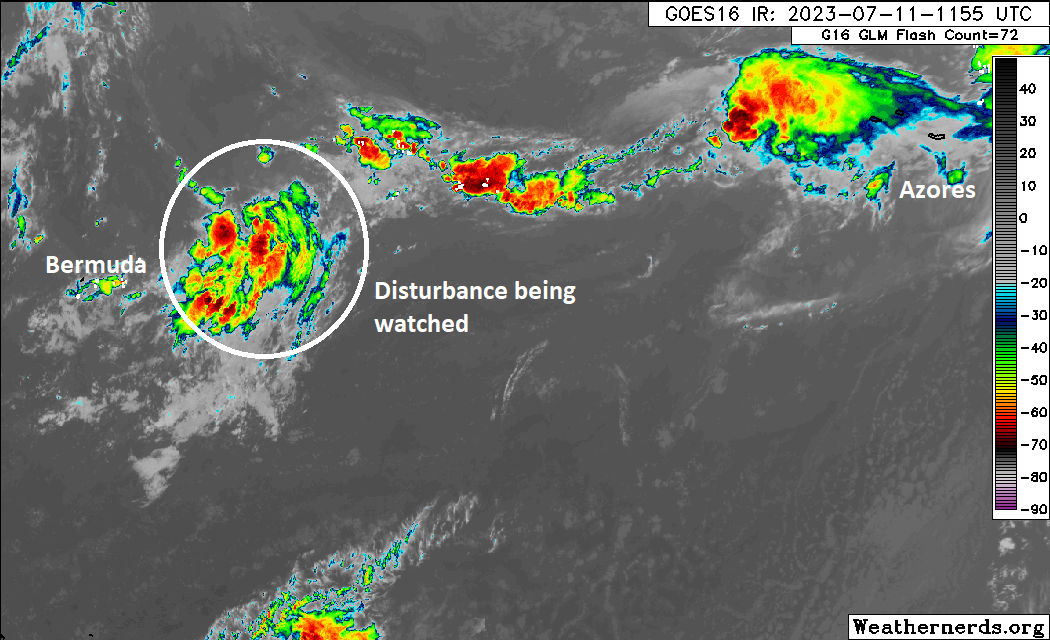
The National Hurricane Center has a 50 percent chance of development over the next week as of this writing. Curious and puzzling are words that come to mind, but when the Atlantic is as warm as it is, I guess this should not come as a shock. Whatever the case, we are watching this disturbance east of Bermuda in particular that will slide eastward over the next few days.
We can say a couple things about this system, should it develop. First, from the spaghetti plot below, which shows all the European ensemble members, 51 of them run with different tweaks in their starting points (to generate a more realistic spread of potential outcomes), we get a broadly north then east-moving system for several days. The map stops at day 7, and that’s a pretty wide dispersion of outcomes. In time, there’s also some chance the system meanders as far as the Azores, which could lead to eventual impacts there, though I’m not ruling that in just yet. But a fairly broad spectrum of potential track outcomes leads to above average uncertainty over the next 5 to 7 days.
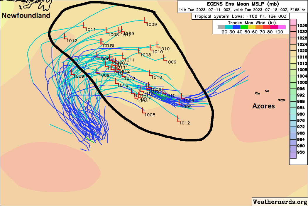
The other thing you can say is that most modeling does keep this system on the lower end of the intensity spectrum. Wind shear and relatively “cooler” water should eventually take a toll on whatever this is and cap it at a reasonably manageable intensity. Again, if it develops.
A lot of ifs here, but it’s something. Certainly unusual and a curiosity. Thankfully it remains relatively away from land impacts. We’ll see how this goes in the days ahead.
Fantasyland (beyond day 10): Quiet
No sign of anything menacing us in the extended range right now. Modeling continues to non-specifically hint at some more activity in this timeframe, but there’s nothing we can hang our hats on and focus on showing up out there.
The most worrisome storms, in the past few years, have been the ones that spring up off the coast with little warning. How do you track those and is there anyway to give more warning?
There’s not a lot we can do about those, but the good news (I guess) is that we can usually see the idea that *something* is coming. We may not know what it ends up being or doing, but it at least pegs down something to watch. We’ve had notice that Harvey, Irma, Maria, Dorian, Michael, Laura, Ida, and Ian were going to happen….though we were short on specifics. We’ll always struggle a bit with that, part out of necessity and part because the science only allows for so much predictability. But at least we have some ideas we can start with.
The various news organizations are reporting Atlantic water temperatures up to 96 degrees. Are the wind sheers keeping the storms at bay? Are the temperatures reaching the Arctic’s with consequences?
Wind shear and dust are helping for sure. As is the calendar…it’s still a bit early in the season. Arctic warming is occurring, but we can’t say whether or not it has any real connection with this particular season. We know that in general, the oceans are expected to continue warming, so this all fits the script, as it were.