One-sentence summary
A disturbance in the north-central Atlantic presently remains the only area of note over the next 7 to 10 days, and it will not threaten any land.
Happening now: Mid-ocean madness!
That subheading is a bit dramatic, but it’s been quiet enough of late, so we’ll let that go. Anyway, as we gaze upon the open Atlantic between Bermuda and the Azores this morning, we can see an area of cloudiness and storminess sitting over that part of the world. Yesterday, it received the invest designation, meaning meteorologists have enough evidence to run some additional modeling on this area.
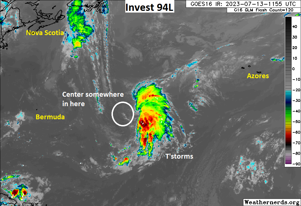
Invest 94L has about a 60 percent chance of developing over the next few days before it runs out of support in the open Atlantic. It will not threaten any land, and at worst, it should become a minimal tropical storm. Chaotic steering currents and a weak system will make 94L, whatever it becomes, susceptible to being bullied around, and as such, the potential track looks a bit like a horseshoe.
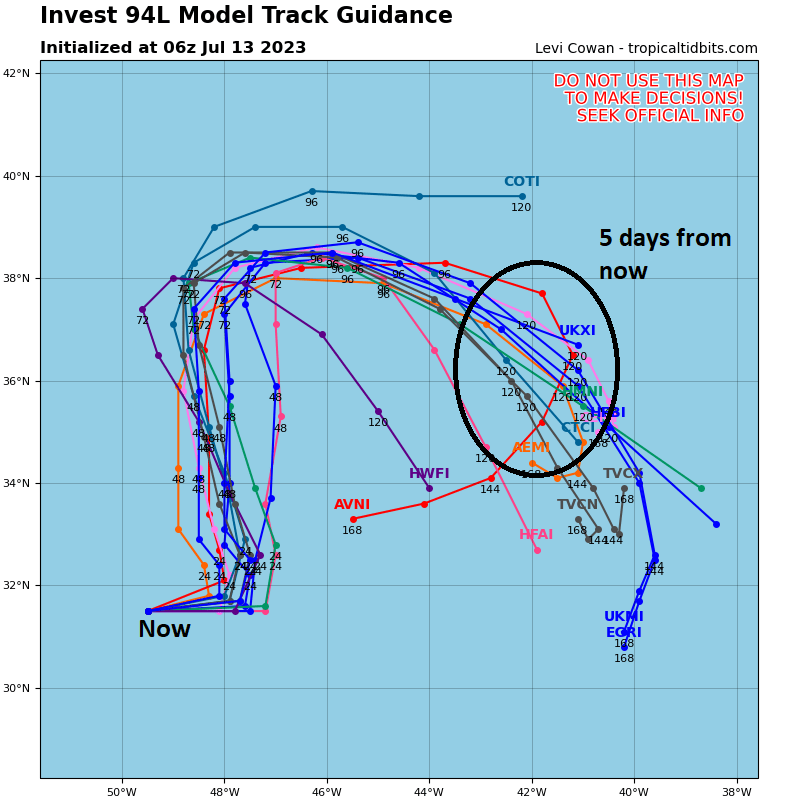
This type of track, odd as it seems, is not that uncommon in this part of the world. When storms develop out in the hinterlands of the basin, they can do weird things, because they are often and weak and just going to get pushed around by whatever influences exist at the time in those areas. We’ve seen storms do loop-de-loops, curly-Qs, stutter steps, somersaults (ok not really), and more. So, yes, it looks difficult to wrap your head around perhaps, but it’s not uncommon. That it is happening in mid-July does make it a bit uncommon, as we’ve discussed this week.
Anyway, over the next few days, 94L will possibly rev up, rev down, and eventually falter as it has to manage shear and cooler waters.
The medium-range (days 6 to 10): Nothing for now
There is nothing of note in the medium-range that we can see at this time. I will note, however, that one way to get a homebrew-type storm (a system that forms somewhat unexpectedly close to the coast) is to pile complexes of thunderstorms into the Gulf of Mexico. Over the next week or so, that’s sort of what we may see happen, as areas of thunderstorms meander around the eastern periphery of high pressure anchored over Texas and the Southwest.
As of today, I see no reason to think that any of this would form. But with enough “oomph” it becomes something to watch. For now, that’s not expected, but I at least want to point it out to you so you can see a little more of what we look at and why we don’t just rip and read models verbatum.
Fantasyland (beyond day 10): Let’s look way out beyond day 10
As of today, nothing is showing up out there in the distant future. Things look quiet into most of days 10 to 15 or so.
The ECMWF model recently completed a major upgrade that allows a 100 member ensemble to run once a day to produce a forecast 3 to 6 weeks out in time. In other words, it runs the model 100 times with various tweaks to produce various outcomes. One product it does produce out 3 to 4 weeks is a tropical cyclone frequency and accumulated cyclone energy (ACE) forecast. I try not to read too much into these, as they can be somewhat noisy. Just this week, they suggested more activity in weeks 3 and 4. But as of yesterday’s run, that had backed off.
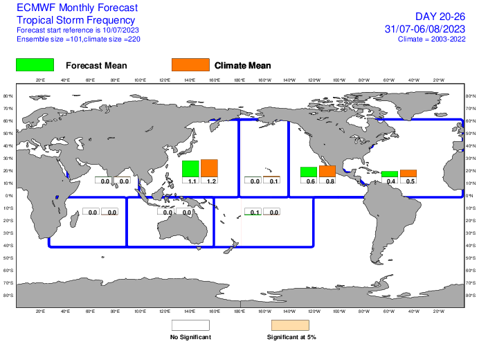
Still, it’s a nice tool to have. It currently shows near average activity for weeks 3 and 4, sort of what I would have expected when looking at the bigger picture right now. That is not to say that things cannot get active in that timeframe, just that sitting here today, we don’t necessarily expect it to happen. There are some hints that later in week 4 or week 5 (mid-August), we may see the Atlantic develop a more favorable “background state,” which could lead to a more hospitable environment for tropical systems. We will see how that progresses forward in time. For now, rest easy and enjoy the quiet!
I wish this was the forecast for the entire hurricane season!
The information in these posts is invaluable to me as a homeowner living on the coast. However, I find I read them as much for their entertainment value as for current weather news. Even gaining a bit of weather/climate knowledge while being entertained. Thanks!