One-sentence summary
Subtropical Storm Don formed overnight, the 4th named and 5th overall storm of the 2023 season, but it is thankfully no threat to any land.
Happening now: Don!
Invest 94L was upgraded to Subtropical Storm Don early this morning. The “subtropical” designation is technicality. Storms that are tropical in nature form within and feed off of warm, tropical water and air. Being subtropical doesn’t make it any less of a storm, but the process by which it forms and strengthens is more hybrid in nature…like a nor’easter or a tropical storm mashed together. Usually, subtropical storms are a bit lopsided and larger in size. Over time, a subtropical storm can transition to fully tropical, but it’s not clear if Don will do that or if it will even stick around long enough to have a chance.
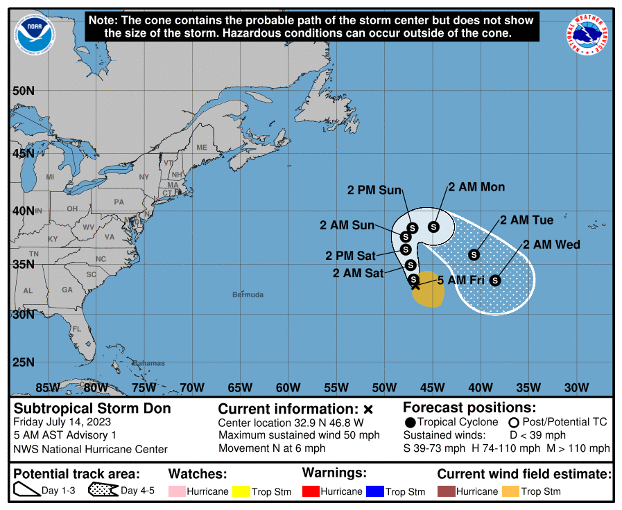
As noted yesterday, Don’s forecast track resembles a horseshoe, going north, then east, then southeast. This is because it will be pushed around by various moving parts in the atmosphere over the open ocean.
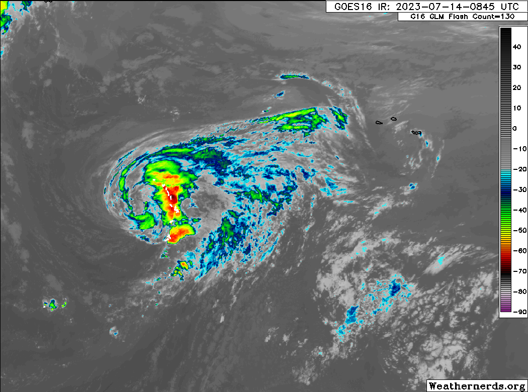
Don has 50 mph winds this morning. It’s a respectable looking system, but clearly not terribly menacing looking. The wind field is fairly large, with tropical storm force winds extending out over 200 miles east of the center. Don’s future intensity will be influenced in part by cooler waters, so we should see a slow weakening. It may or may not survive through the weekend, but if it does, it has some chance to get some of its bluster back as it moves south next week, back over warmer water. Eventually it should be picked up and sent away, however.
The medium range (days 6 to 10): Wave emerging off Africa may have a low chance to organize
Some models are picking up on a tropical wave in the Atlantic, which appears to be this big one emerging off Africa this morning. This is certainly one of the most robust waves we’ve seen this season.
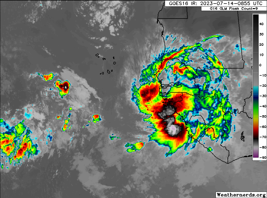
This wave’s future is a bit sketchy. Some modeling is warming to the idea of slow development next week, but the vast majority is cool to that chance. I would say that it’s an item to watch but unlikely to be an item of serious concern. We’ll see where we are on Monday with this one.
Fantasyland (beyond day 10): Nothing else of note
Really, things look pretty quiet outside of this wave off Africa and Don’s meanderings in the open Atlantic. Modeling is fairly calm for days 11 through 15. The European model’s extended output ticked back up activity odds a bit in weeks 3 and especially 4 yesterday. I think sometime around August 10th, give or take, it will be time to watch the big picture a bit closer. We shall see.
Waves off Saharan Africa: during a past wetter Sahara (which we know about due to both fossil river beds and early human rock paintings) would there have been fewer or less intense waves entering the Atlantic from North Africa? Fewer or weaker long run Atlantic hurricanes?