One-sentence summary
The Atlantic remains quiet, with no action expected over the next 7 to 10 days, while the Pacific should see a bit of activity ahead.
Happening now: Remaining quiet
Things remain quiet across the tropics this morning.
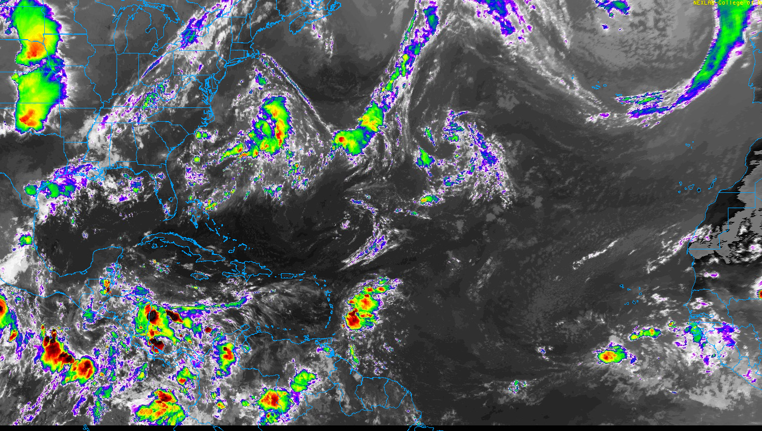
We still have disorganized disturbed weather in the western Gulf, but it is basically ashore at this point. The only other feature that stands out is a wave approaching the Lesser Antilles. This should bring showers and storms there, but there is no real risk of development. Another disturbance about halfway across the Atlantic may have a narrow window to develop next week. Short of that, there’s not much doing.
The medium-range (days 6 to 10): Still calm!
All remains quiet, though we expect a system or two to form in the near and medium term in the Pacific. Nothing that is expected to impact land, however.
Fantasyland (beyond day 10): Likely quiet a bit longer
We still do not see any items of note on any of the modeling we use looking out farther in time. The Atlantic may begin to get a bit less hostile toward tropical systems by late month, but as of now, there are no consequences of that potential showing up out there.
Housekeeping!
A kinder, gentler version of housekeeping than the scene in “Tommy Boy” to close out today. Let’s hop through some things.
Seasonal outlook
The fine folks at Colorado State University released their second to last seasonal update for the 2023 Atlantic season yesterday. Somewhat surprisingly, it increased the seasonal totals, by 3 storms, 2 hurricanes, 1 major hurricane, and most impressively 35 Accumulated cyclone energy units (a very consequential increase).
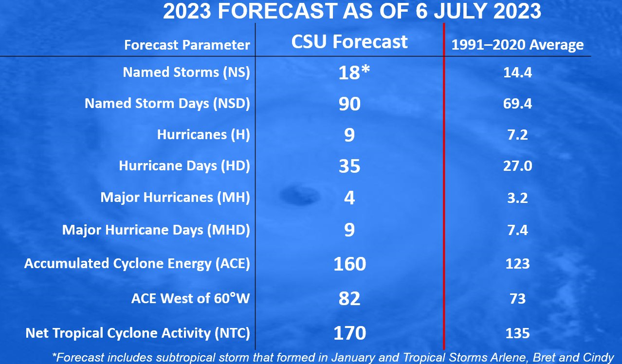
Not that we expected them to cut their numbers or anything, but this was a bit of an aggressive increase. If you read between the lines, the battle between warm sea-surface temperatures and El Niño makes their outlook almost a damned if you do, damned if you don’t situation. While we feel that this is a bit of a bold forecast, there is a conceivable path there — but we would need El Niño to do something unprecedented in our history, which is to substantially reduce its impacts on the Atlantic. Another possible route to an active season? More activity in the open Atlantic, where the water is way warmer than normal and El Niño’s influence is a little less.
Whatever the case, we are statistically only about 3 percent of the way through hurricane season, when using ACE as a metric. So it is far too soon to write any seasonal outcome off.
July hurricane nuggets
When was the last July hurricane in the Atlantic? You have to go all the way back to 2021 to find one. Elsa, if you may remember due to its memorable name, was the last July hurricane in the Atlantic.
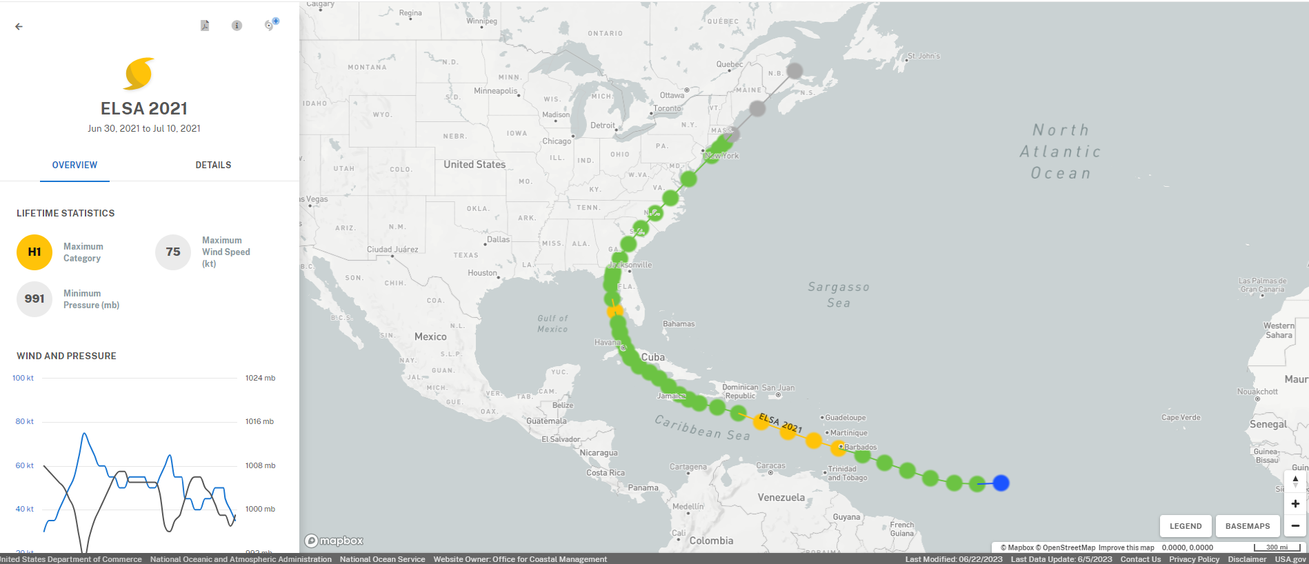
It never made landfall as a hurricane but still caused about $1 billion in damage. The last landfalling hurricane in July was Hurricane Isaias, which came ashore in Brunswick County, NC and managed to cause over $5 billion in damage across the Caribbean, Bahamas, up the U.S. east coast, and in Canada.
The strongest observed July hurricane was Emily in the frenetic season of 2005. Emily became a category 5 hurricane southwest of Jamaica. It made one landfall in the Yucatan near Tulum as a category 4 storm and another in Tamaulipas as a category 3 storm.
Some other memorable July hurricanes?
Hurricane Dolly in 2008
Hurricane Dennis, also in 2005
Hurricane Danny in 1997, which dumped almost 40″ of rain on South Alabama.
Hurricane Bertha in 1996 (which the author fondly remembers going out in when it came through New Jersey as a tropical storm)
The “Surprise” Hurricane of 1943 in Texas
The 1926 Nassau Hurricane
The 1916 Gulf Coast Hurricane
The 1916 Charleston Hurricane
The 1909 Velasco Hurricane
So, yes, storms do happen in July and they can be memorable!
Social media
Without getting into the weeds on all this, we recognize that the social media landscape is ever-changing and seems to be undergoing some considerable upheaval right now. We encourage you to sign up for our email updates to the right (desktop) or by scrolling alllllll the way down (on mobile), so you never miss a post. But, if you do prefer using social media, we currently have numerous accounts established, and we’ll reassess our strategies as the landscape further evolves.
Facebook
Instagram
TikTok
Twitter
Threads (the new Meta Twitter competitor)
Bluesky
Mastodon
On almost all of these, we should be “theeyewallwx” if that makes your life easier.
Please keep in mind…this is a *lot* for us to keep up with, so we will likely be making some cuts once the dust settles, hopefully within the next 6 months. But for now, we’ll do our best to keep up with all these platforms to reach you where you are.
as always, really enjoying the “no-hype” discussions on this site. It is not surprising all the click bait sites out there hyping the new numbers. I hope I’m right that I believe a lot of this could be early forming Atlantic storms that recurve. However, always be diligent and ready for anything.
thanks again
Thanks for your tropical outlook and information. You keep it easy to understand for us non-meteorologists. (By the way, why are you all “meteor-ologists” since I didn’t think meteors affected the weather, at least normally?
HA…the story of that is that precipitation is technically referred to scientifically as “hydrometeors.” The term “meteorologist” is sort of a derivative of that. It originates in Greek and was technically started by Aristotle, who wrote a book about what was known about weather during his time. It was called “Meteorologica.”
Yesterday I read CSU reported something called the Pacific Decadal Oscillation (PDO) having a negative phase and that this contributed to lessening of the effect of el Niño. (Plus the extreme heat in the waters in the Atlantic & I’m guessing the Gulf). How does that fit in?
The PDO is pretty strong, which is an important feature. Usually that correlates to stronger tradewinds in the Central Pacific…that would sort of take the edge off El Niño. So far, I’m not sure that’s really having an impact but it certainly could at some point.