We hope everyone had a good weekend. This week at The Eyewall, we’ll keep tabs on next week, when the pattern is expected to get at least a little more favorable for some type of noise. Maybe. We will also check in on Saharan dust tomorrow. This Wednesday, look for the first significant piece from us on the spate of high-end hurricanes in recent years in the Gulf of Mexico. We talked to experts, read research, and broke down what we think is important for you to know if you live anywhere along the Gulf Coast. We hope you’ll check it out.
One-sentence summary
The Atlantic looks quiet for another week, with minimal development chances and a whole lot of wind shear dominating the picture.
Happening now: Very little!
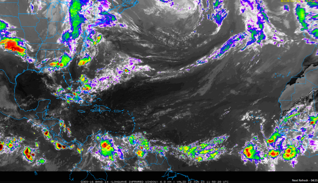
Let’s take a look at the satellite image of the Atlantic this morning.

This week is starting off quiet. The Gulf and Caribbean are void of much in the way of thunderstorm activity, and there’s nothing in the Atlantic of note. Saharan dust and dry air are mostly in control right now, with a dollop of wind shear. You can expect this sort of satellite image with those conditions.
The medium range (days 6-10): Nothing expected
As of right now, we don’t expect any development in the medium range period. Certainly not through the weekend. I will say that there are a couple reasons to think that perhaps early next week we could start seeing more thunderstorm activity in either the southwest Caribbean or on the Pacific side of Central America. None of those areas would feature a candidate for development at this point, however. Just a little more to talk about.
Fantasyland (beyond day 10): The GFS won’t give it up
The GFS continues to advertise a spurious tropical system in the Caribbean and/or Gulf. I sort of debuted our TikTok account this weekend with an explanation on that. We’ll work on a way to cross-post videos like this elsewhere for those that prefer to avoid TikTok. Whatever the case, I also wrote about this Friday and quite frankly not much has changed. I would argue that the overall pattern looks a little more interesting next week, but exactly what we can generate from it, if anything at all, remains uncertain. I would say that if I had to bet, the eastern Pacific basin would be much more likely to see something before the Caribbean does beyond day 10. But we’ll see. More tomorrow!
Thanks Matt and Eric for the Weather and Tropical Updates. Have been following y’all for a couple of years. Really appreciate the no hype information. Regarding the tropical system that’s being posted on YouTube as forming in the Caribbean or Bay of Campeche near Yucatan. They’re referencing the GFS Global Model for next week of the 19-21. I look to y’all for accuracy and no hype. Thanks Again
Yep. We’ve been trying to tackle that head on to at least discredit those trying to hype it up. Hopefully it works!