One-sentence summary
Tropical Storm Cindy degenerated into an open wave yesterday, but there is at least a little chance the storm tries to give it another go near Bermuda on its way out to sea.
Happening now: Cindy slumps
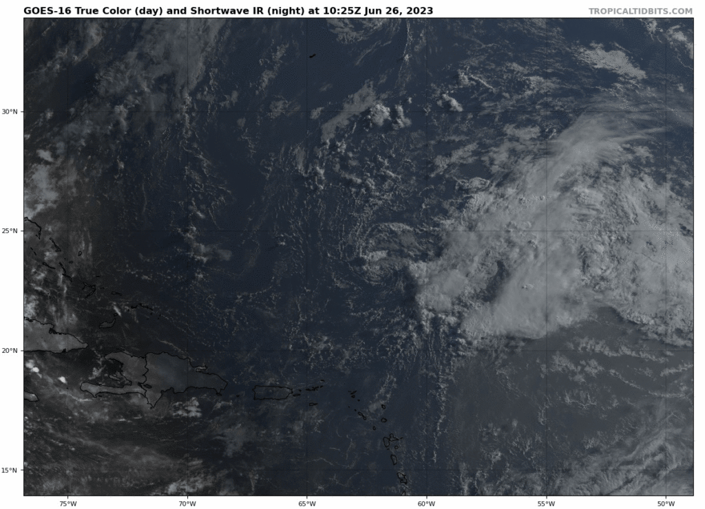
Cindy was downgraded to an open wave last night, ending the current chapter of the storm. You can still see the remnant circulation this morning, virtually achieving “naked swirl” status.
That said, there is some chance we are not done with Cindy just yet. The remnants are in a very high shear environment right now, so that’s what has helped shred it up. But as it tracks northwest, that shear may relax some, allowing for the system to regenerate thunderstorms and possibly reorganize. Why does this even matter over the open Atlantic, you ask? Because this would happen not very far from Bermuda. Not that we’re expecting a major storm for Bermuda. But it at least keeps Cindy alive and worth discussing over the next few days. The National Hurricane Center is assigning a 30 percent chance that this occurs.
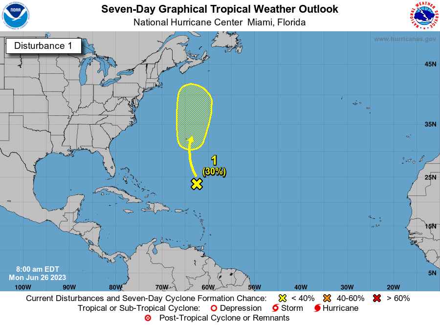
Whatever the case, seeing a storm in this part of the Atlantic in June remains odd and speaks to just how warm the waters are. We will keep an eye on this as it meanders north, but again for Bermuda, while it’s good to keep tabs on things, it’s not too serious a threat.
The medium-range (days 6-10): Caribbean incoherence
I would expect to see some more storms (Editor’s note: Disorganized showers & thunderstorms, not organized storms!) developing in the Caribbean as we head toward next week. Right now, it does not appear anything meaningful is going to come of it, but we will see showers and storms likely recharging in parts of the Caribbean. There will likely be dust and wind shear around to keep a lid on any sort of development. But that won’t stop some models from showing spuriously strong systems in the Gulf or Caribbean at times. For now, nothing to worry about.
Fantasyland (beyond day 10): The GFS doing it again
As noted above, the GFS continues to fire off systems with a lack of any real consistency in terms of time or place, much as it did earlier the month. With the Caribbean likely to see some moisture around this time, you always have to at least watch. But a lack of any real meaningful ensemble support from models (meaning when we run the models 30 to 50 different times we get no real consistent outcomes) leads me to believe we won’t see anything too big here. More tomorrow!
Morning 🌞 I read that in addition to impeding the formation of tropical disturbances, the Saharan Air Layer helps keep Atlantic waters cooler through blocking sunlight. Also, that there wasn’t so much of it this year, and that may contribute to the storms we’ve seen so far.
During what months is the SAL typically most active? Does anyone know how/if El Niño affects it?
Tysm 🌻
Hi Cat: SAL is usually most active now into the early part of August. There has been near record low dust over the Atlantic (at least back thru the satellite era) this year. That’s certainly helping heat the basin…not the only reason it’s at record highs but definitely a big part.
That might make July a little more interesting.
Ty ☺️
Hey, Matt.
Storms over the open oceans matter to sailors! In a big way…
Steve
No doubt…hopefully in this case it won’t be a big issue!
Sorry, what is the GFS?
Generating Fantasy Storms lol. But really, it stands for Global Forecast System.
It’s a forecast model run by the US government, one of a handful we use to look out 2 weeks in time. It’s a “deterministic” model, meaning one solution. Ensembles are where you tweak the start of the run a bit and run it 30 to 50 different times to generate a more robust spread of possible outcomes.
Does the GFS consider both the European and American forecast model info? Were the 30-50 model runs based on both?
The European and American models are two different things. The GFS is the American one. In the ensemble, the GFS is run over 30 times to generate a spread of possible outcomes, whereas the European model is run 50+ different times. So they’re two completely separate models. Often the GFS/American is the one that produces random, inconsistent storms.
NOAA will issue a percentage chance of a new storm developing, usually low. Then it increases the next day and then the percentage is for a full blown storm. Why can’t they get it right the first time?
You can’t just go with an 80-100% chance of a storm developing. With tropical system’s it’s not a binary no chance/100% chance. There are so many external factors and possible outcomes at play that it’s best to take things cautiously at first. I’ve seen plenty of 30-50% areas outlined by NHC never make it. I’d much rather be at a 30% chance and have to build to 100% than be at a 90% chance and drop it to 0. Just the nature of the business!
Been a SCW follower since Harvey 2017. As a Texas transplant in NC, y’all were my lifeline staying abreast of Harvey with so many family & friends all over Houston. I’m so happy you’ve extended your services to the southeast/Atlantic! No one does weather/storms/hurricanes like you two. As commuters to Bermuda you are now my go-to. Spreading word about The Eyewall service. Thank you for all you do!!
Many thanks for the kind words and support!