One-sentence summary
Potential Tropical Cyclone 22 has a narrow window to develop before tomorrow when it slams shut in the Atlantic, and today’s post covers Wednesday travel weather which looks good with a couple big exceptions.
Potential Tropical Cyclone 22
We were expecting that Potential Tropical Cyclone 22 would become Vince later today as it races northeast across Jamaica, Cuba, and the Bahamas.
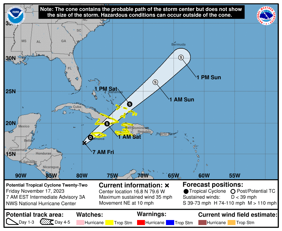
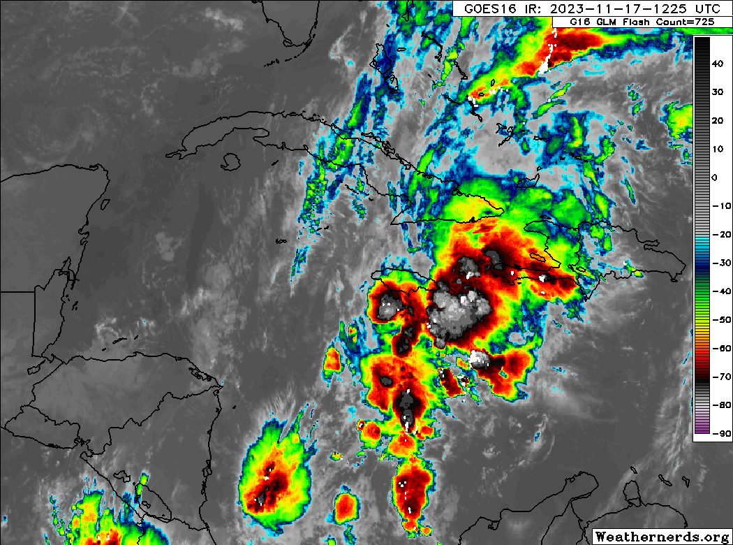
But a look at satellite this morning suggests that 22 is still far from organized. The window for organization will remain open a bit longer before it slams shut, and 22 or Vince or whatever merges in with a non-tropical system in the open Atlantic, as it passes Bermuda.
So if PTC 22 were to become a tropical storm as it passes Jamaica, Cuba, and/or the Bahamas and Turks & Caicos Islands, how strong could it get? Not very. The ceiling on 22 is limited, probably to a minimal tropical storm. That said, it is going to bring a good deal of rainfall to the islands as it passes by, and as much as 8 additional inches could fall for portions of Jamaica or a bit more in southeast Cuba. As much as 4 to 8 inches or so will be possible in southern Haiti.
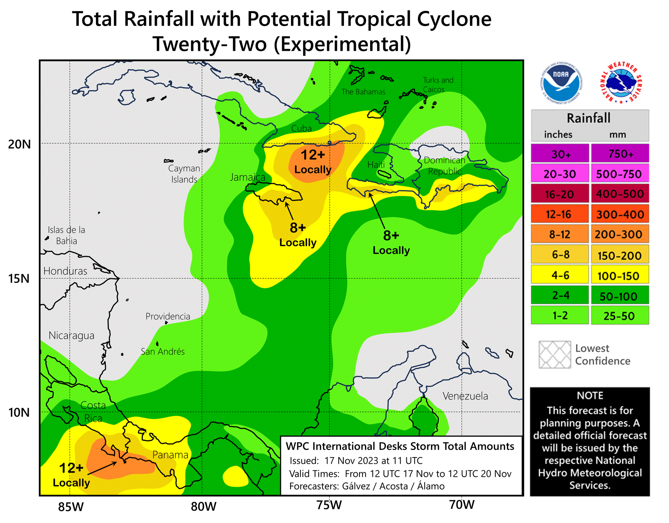
So flooding is the primary concern with 22 as it trucks through the Caribbean and into the Atlantic today and tomorrow. With that, we suspect that the 2023 Atlantic hurricane season will come to an unofficial close.
Thanksgiving Wednesday travel outlook
With a lot of people hitting the road next week for the Thanksgiving holiday here in the U.S., we thought it might be helpful to give you an initial read on what travel conditions may look like for Wednesday.
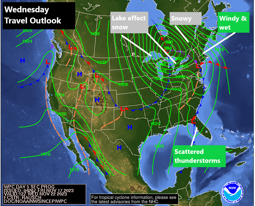
So, right off the bat, travel in the West looks fine right now. No issues are expected Wednesday. The Central U.S. looks quiet as well. A cold front will deliver scattered thunderstorms to Florida, this after some potential severe weather on Tuesday in the South. But overall, other than some minor issues, the expectation is that any travel to or from Florida will be fine.
The trouble spot on Wednesday looks to be the Northeast, Great Lakes, and Canada, where a potent storm will bring a bunch of issues for Wednesday. Chief among those issues will be wind, which is likely to cause delays at Northeast hubs like Boston, the NYC metro airports, and perhaps Philly and DC. Conditions should gradually improve later in the day Wednesday it appears, but there may be cascading delays due to airline issues there. I would also watch Chicago for potential issues with wind, which can always impact the air travel system. Aside from wind, some heavy snow is likely in parts of Quebec and interior Ontario, and some lake effect snow is likely in the snow belts of Michigan and perhaps off Lakes Erie & Ontario as well.
So if your travel plans take you north and east of about Indiana, you’ll likely want to have a little extra patience this year.
It’ll just blow over
☺️