One-sentence summary
Invest 94L is slightly better organized this morning in the Atlantic but still has a long way to go to develop, while Invest 90E is likely to develop today or tomorrow and will eventually be a concern for Mexico.
Tropics: Invest 94L
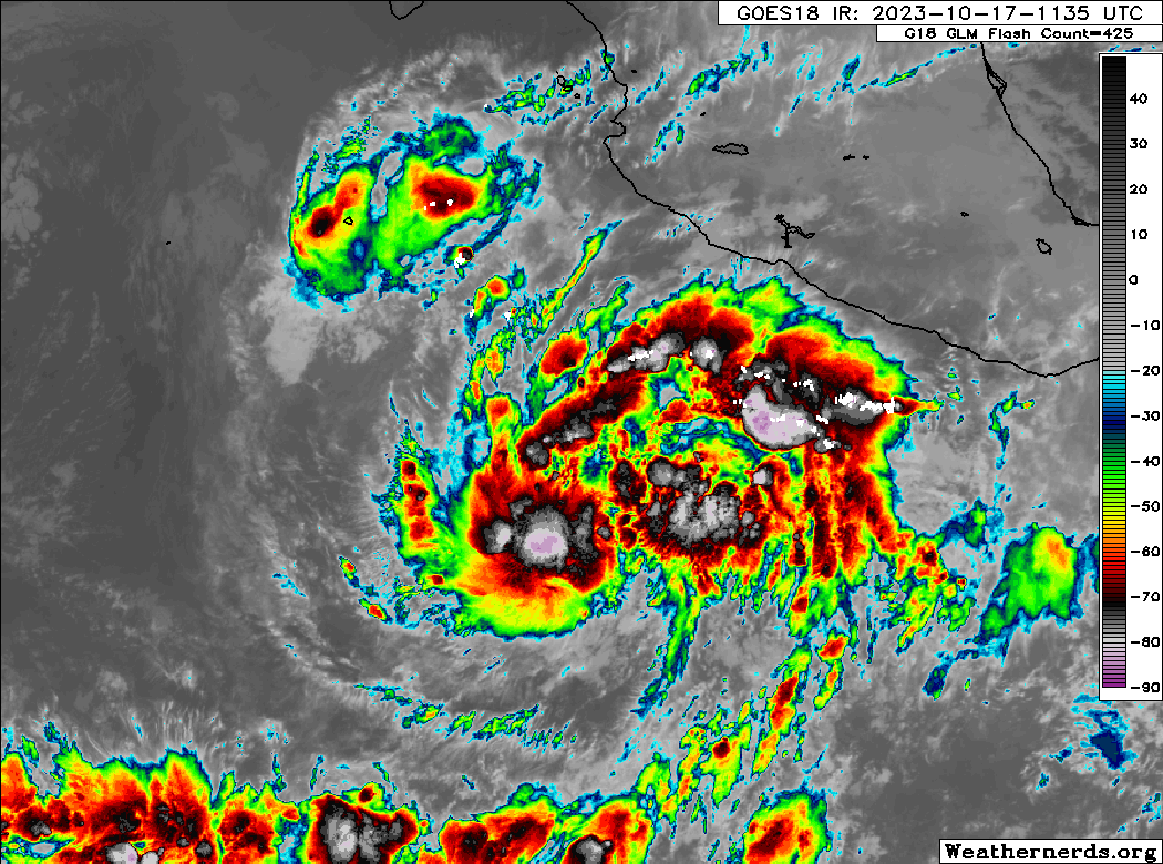
Thunderstorm activity improved around Invest 94L yesterday evening, and this morning, while it’s clearly heavily sheared, it actually has a bit of a nascent organizational “shape” to it.

There’s clearly still a long way to go here, but 94L is at least taking baby steps toward organization today. Whether or not it maintains those baby steps or throttles back in reverse remains to be seen.
The track forecast has not changed much for 94L’s future. In general, if it can get its act together over the next day or two, there’s a good chance it will start to shift northwest faster. If it remains a discombobulated mess, it will probably track toward the islands with some impacts, albeit most likely on the lower-end of the intensity spectrum.
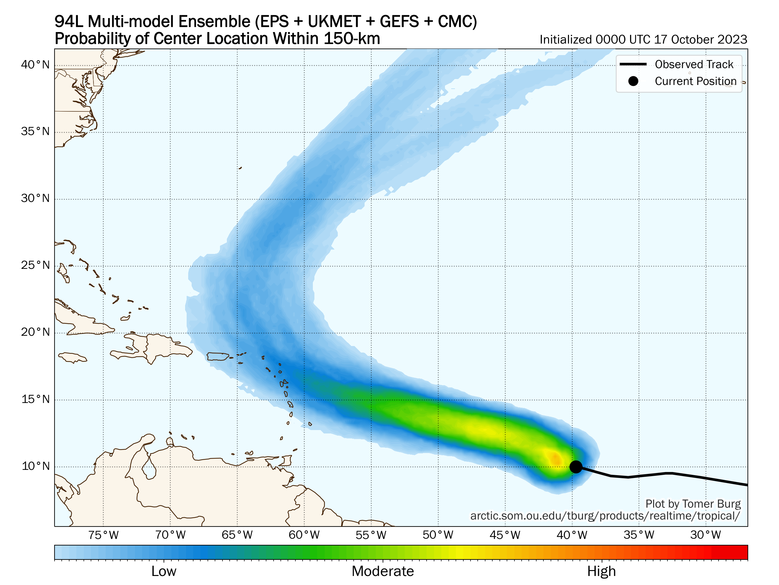
This remains a system to keep an eye on in the Caribbean islands, but probably nothing to worry a ton over still at this point. We’ll continue to watch it closely through the week.
Pacific Invest 90E
Meanwhile, in the other ocean, Invest 90E is on the cusp of developing into a tropical depression or storm.
Invest 90E is a little more intriguing from a potential impact standpoint, as this is expected to organize rather considerably and track toward Mexico. This bears watching from southern Baja to northern Jalisco and Puerto Vallarta in Mexico.
Next significant U.S. weather event? Not for a bit
With a quiet stretch ongoing across the country much of this week, the question is: When will we experience our next significant weather event? Well, we may be looking at another 1 to 3 inches of rain this weekend in parts of the Northeast, an area that has seen below normal rain in portions of New Hampshire and Vermont and almost 200 percent of normal rain in portions of Southern New England and near New York City.
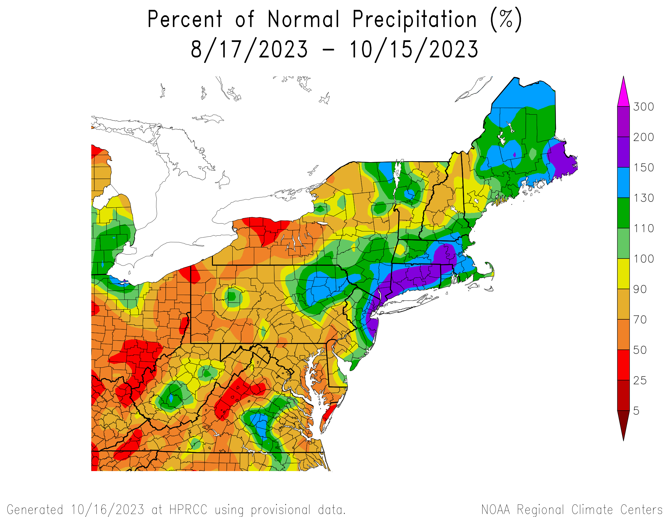
So how wet your soils are depends a bit on where you live in the Northeast or parts of the Mid-Atlantic. I would suspect 1 to 3 inches of rain wouldn’t cause any serious flooding issues, but it’s something to watch.
Record warmth
California is set to experience a couple days of near record and record warmth for mid to late week. Thursday’s forecast highs show records in a few spots in interior California from east of San Diego all the way north to Medford, Oregon.
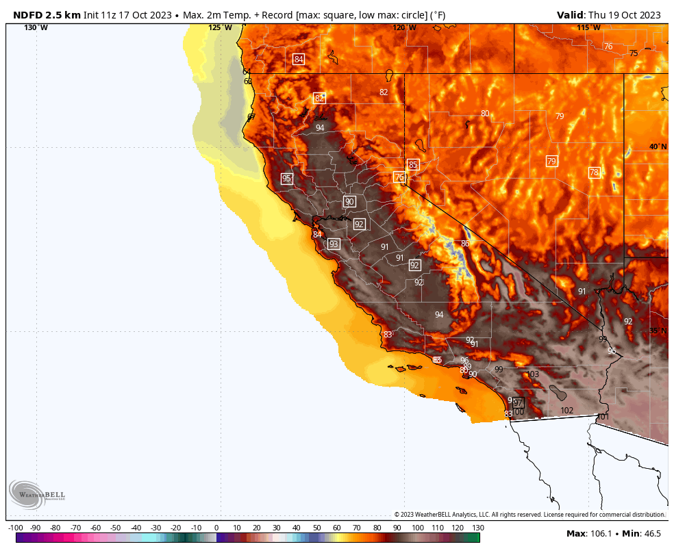
Weak to moderate offshore winds will also help keep temps up overnight, allowing many locations to set or tie record warm minimum temperature levels on Wednesday night and Thursday night. Some of that record warmth will expand into the Desert Southwest and Texas heading toward the weekend.
But truthfully, aside from these items, it’s a quiet stretch for autumn here in the States. I suspect we will want to watch the Pacific tropical system and a potential cold front later next week for some more significant weather chances, but that’s a long way off. For now, enjoy the quiet.
The west had MONTHS of cooler than average weather, better hope this heat is brief.
Going to Cabo on Friday. Bummed to see the forecast!