One-sentence summary
Hurricane Tammy will take an unconventional track over the next few days, but it is expected to peak in intensity before weakening by the time it could maybe threaten land again.
Atlantic tropics: Tammy, Tammy, Tammy
Tammy has shifted north of the islands now, and it is unlikely to directly impact any land significantly for the foreseeable future. That said, there are still a lot of questions with Tammy’s future track. For one, how far north will it get before it turns west? This will have implications for Bermuda. And for how long will it maintain tropical characteristics?
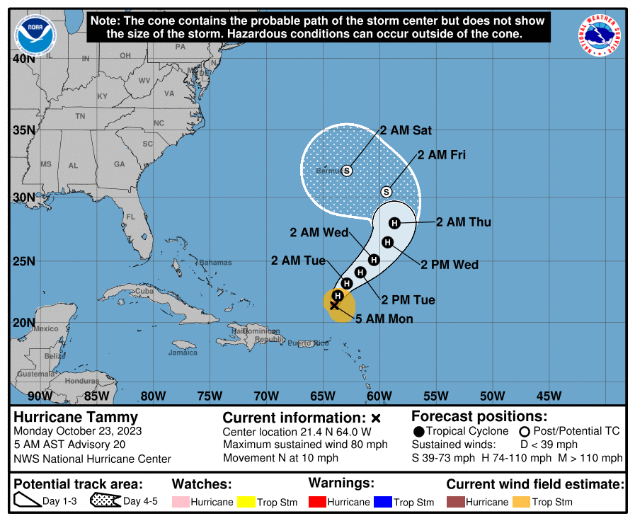
For now, the general thought is that Tammy will move north and northeast over the next couple days and strengthen some before slowing down and cutting back west while losing tropical characteristics. Some models do continue to push Tammy north and northeast out of the picture entirely, so there is a pretty healthy degree of uncertainty still. If this were September, I might be more intrigued and concerned by this, but given how late in the season it is, the stakes are probably not as high. Modeling is in good agreement that Tammy will peak in intensity early this week before weakening. Ultimately, we can probably just observe Tammy from afar without much more than bemusement at this point. That said, interests in Bermuda, the Bahamas, and Florida probably want to check back in on this through the week to make sure all is going to plan.
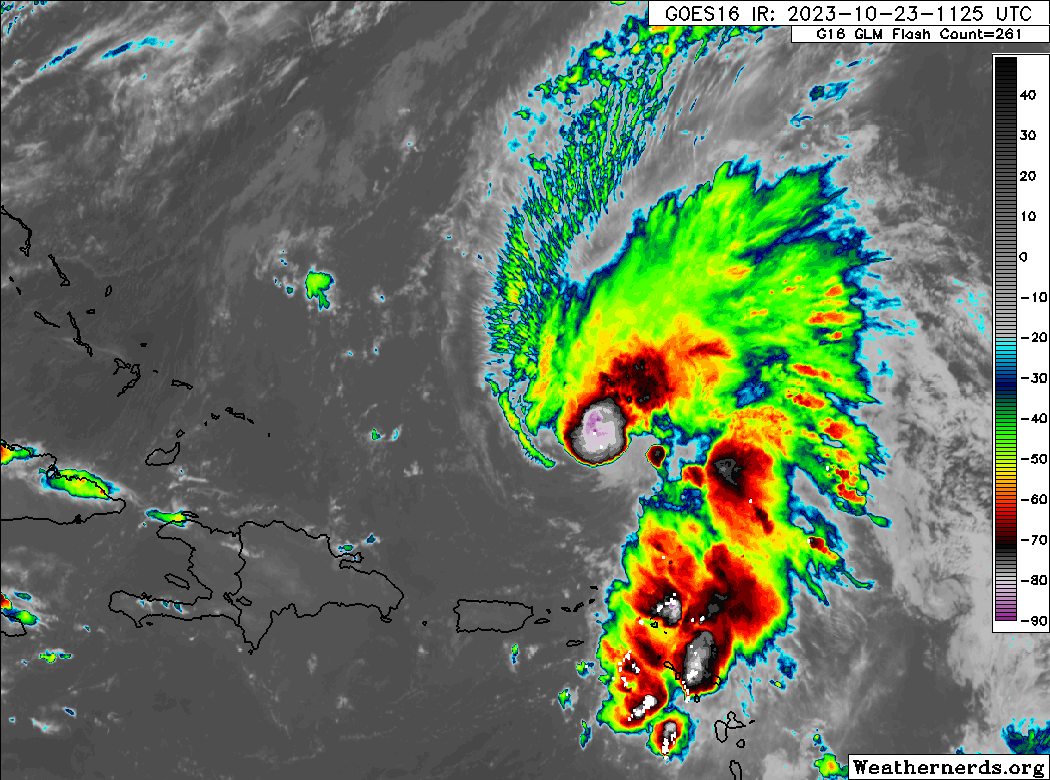
In the meantime, you can see some heavy thunderstorm activity remaining over the northeast Leeward Islands this morning. That should subside this afternoon as Tammy puts more distance between itself and the islands.
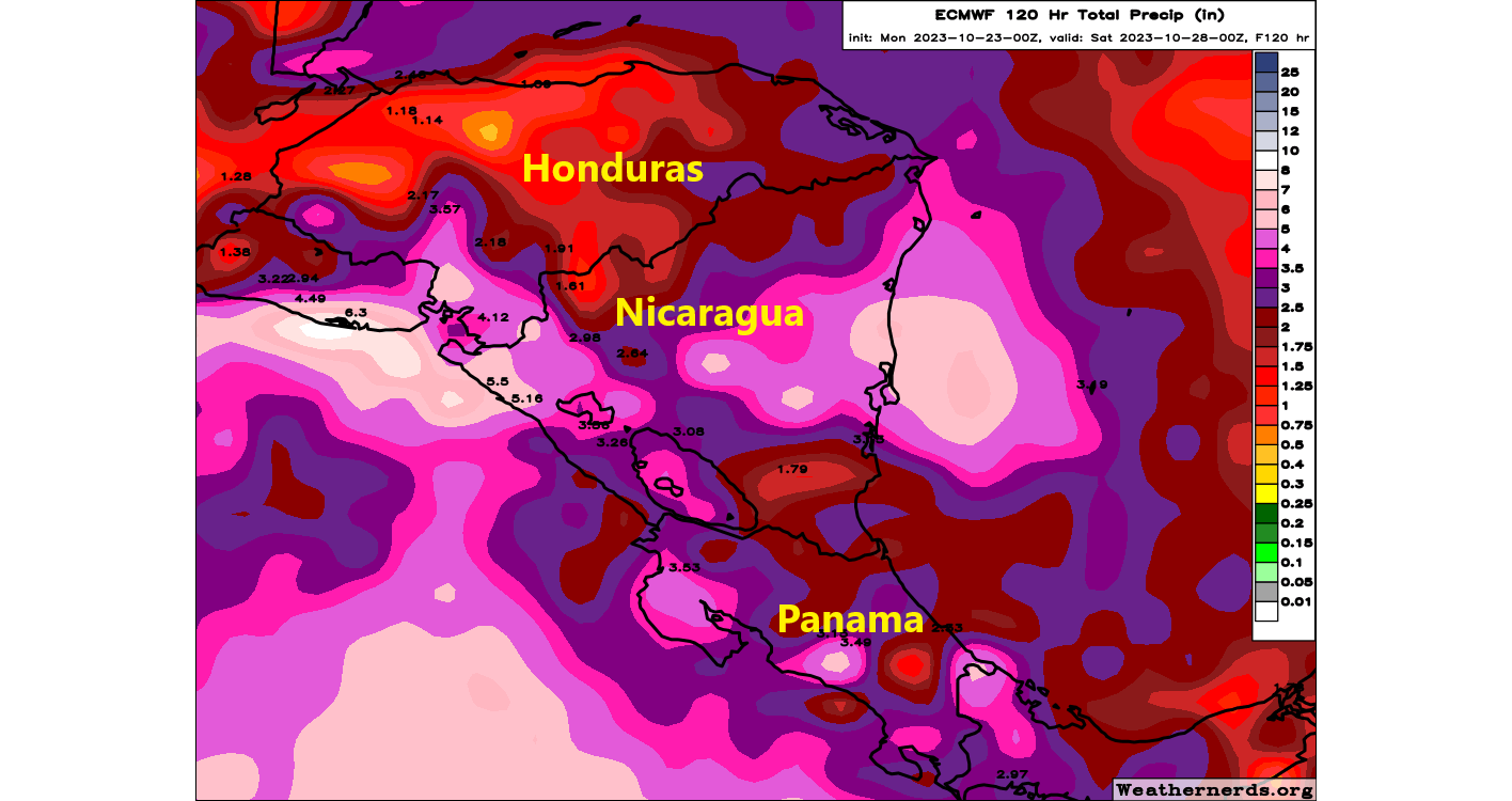
Elsewhere in the Atlantic, Invest 95L is right off the coast of Central America and it has the potential to become a short-lived depression or storm before it moves inland tomorrow. In the interim, 3 to 6 inches of rain could fall in Nicaragua over the next day or two leading to some flash flooding.
Beyond Tammy and 95L, we don’t expect any other development in the Atlantic this week.
Pacific tropics: Mexico may notice Otis
Meanwhile, the Pacific is calming down a bit, but not before we deal with Tropical Storm Otis. That one is not currently expected to grow beyond tropical storm intensity as it tracks north and northwest toward the coast of Mexico this week.
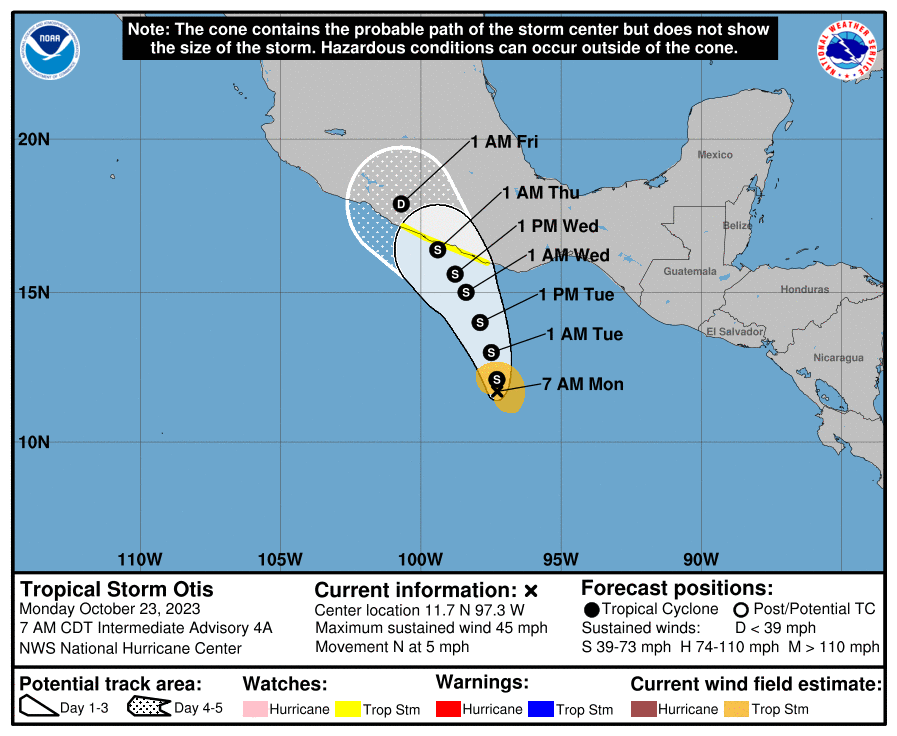
It’s expected to come in probably in Guerrero, not far from Acapulco. We’ll keep an eye on this through the week, but as of now, tropical storm watches are posted for a chunk of the Mexico coast.
Texas and Southern Plains rain
Just a quick closer today on the rainfall expected this week in the Southern Plains. Portions of west Texas up into Oklahoma are in the “slight” risk for excessive rainfall today and tomorrow (level 2 of 4). Locally heavy rain will occur in central and west Texas up into southern Oklahoma the next couple days.
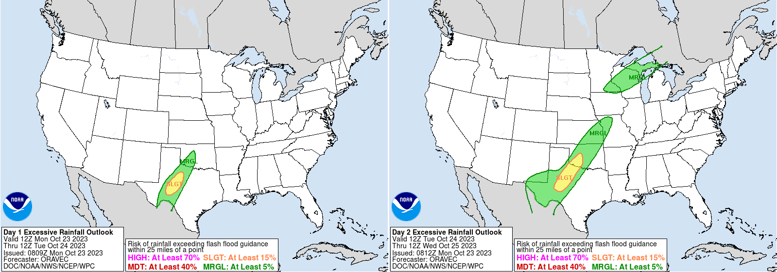
Total rainfall over the next 3 days could exceed 4 inches portions of this area.
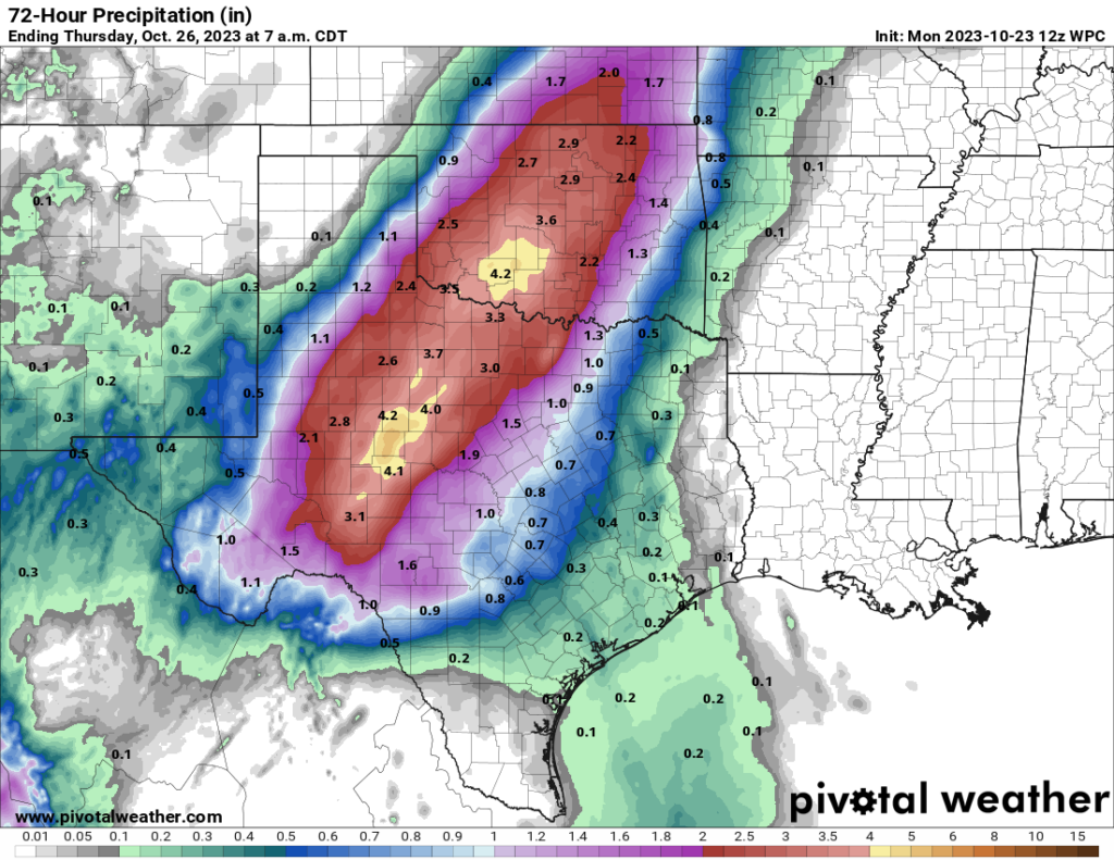
For the most part this will be welcome rainfall in these areas.
Tomorrow, we’ll talk more about snow from Washington into Montana, as well as the potential for some chilly air to invade later this week and next week.
great info 🍂🎃🍂
fun rhyme time 👻
Love your in depth coverage of the tropics. Always concise and explained clearly.
If I may, I noticed in your above map of Central America, I believe Costa Rica is where the “Panama” label is located.
Thank you! I added a note there…bad mistake on my part! But appreciate the correction & kind words!
“Mexico may notice Otis….”
Just FYI, Matt: In the above story about Invest 95L, the map has Costa Rica labeled as Panama.
I love all the weather and storm details in The Eyewall and learn something new in every new edition. Will it continue over the winter months when tropical storms mostly disappear?
Thank you! And yes, that’s been noted. Alas…a bad mistake on my part! Yes, we do plan to continue the site through the quiet season. My initial goal is to continue write ups on significant weather in the forecast, but we’re being flexible based on traffic and input from readers.