One-sentence summary
Invest 97L in the Caribbean is likely to deliver impacts to portions of Central America in several days, but the exact issues beyond heavy rain and flooding potential remain unclear at this time.
Invest 97L: A troublemaker for the southwest Caribbean
We finally got the Caribbean disturbance a classification yesterday. It is Invest 97L. As we noted yesterday, this one will bear close watching for folks in Central America in particular.

Thunderstorms really popped with 97L overnight, but in the last few hours those storms have begun to steadily weaken. In order for 97L to develop, it will need to be able to sustain thunderstorm activity.
In general, 97L is going to be steered west or just south of west around the periphery of high pressure over the open Atlantic. This will take it on a beeline toward Central America. Unfortunately once it gets there, it looks like it may slow down. This could lead to a considerable rainfall event for portions of the region. In fact both the GFS and European operational models, despite vastly different intensity outcomes each produce nearly double digit rainfall totals through early next week in portions of Central America, particularly near the coasts of Honduras, Guatemala, and Belize.
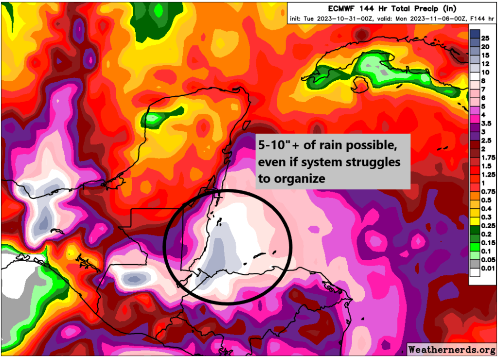
So we have two aspects of this system that will give us heartburn in the coming days. The rainfall is one, but the intensity of the storm is another. As I noted above, the GFS and European models have been on different planets in terms of what they do with 97L. The GFS continues to be very aggressive, while the European model is far slower to develop the system.
We often get asked “Well, which one do you believe?” The answer is not so simple. The GFS suite tends to develop more persistent thunderstorm activity with 97L, giving it more time to feed on the extremely warm Caribbean waters. The Euro is less excited about persistent thunderstorms at the core, so it remains a rainmaker but not so much a wind-maker. We’ll get a better sense in the next day or so based on the actual speed in organization of the system.
Again, however, the rainfall forecast is already somewhat concerning, so whether or not this becomes a stronger storm will probably not exempt portions of Central America from some noteworthy impacts. We’ll have more on this tomorrow.
Other news: Pilar, record cold, and a wet Northwest
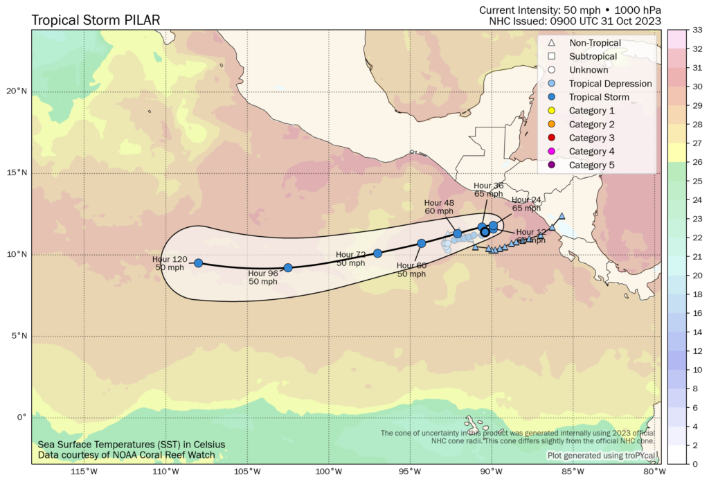
Tropical Storm Pilar will make its 180 degree turn today on approach to El Salvador, shifting back west out into the open Pacific. Conditions should improve in that portion of Central America.
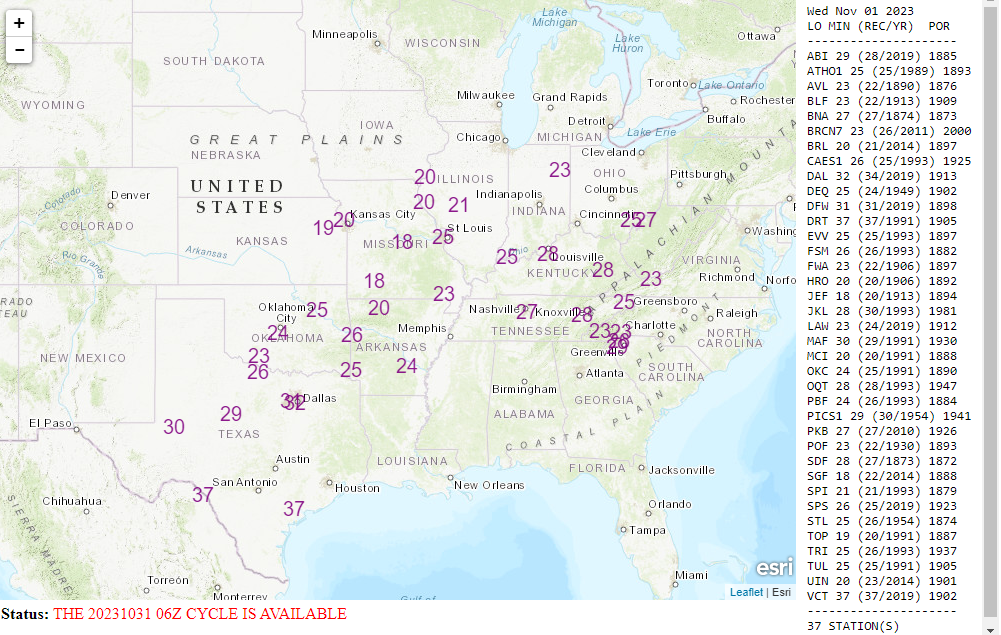
Meanwhile, early season cold continues across much of the country. Quite a few spots will threaten record lows tomorrow morning, ranging from the Ohio Valley into Texas. Places like Oklahoma City and St. Louis are forecast to just eke out new records, while about 35 other locations are within a degree or two of records. Temperatures should moderate for the end of the week.
Otherwise, the only real U.S. weather of note for the rest of the week will be a series of storms into the Pacific Northwest that we discussed a bit yesterday.
After its time in Central America, does 97L have any affect on Houston?
Nope…the Western Gulf is basically closed for the rest of hurricane season.