Headlines
- Weather forecasts verified exceptionally well with the ongoing Mid-South flooding.
- Numerous rivers are experiencing or soon will experience major flooding as all this feeds into the larger Ohio/Mississippi Basin.
- A much quieter week is expected this week.
- Next week may be a good bit stormier, however.
Exceptional flooding, exceptional forecasting
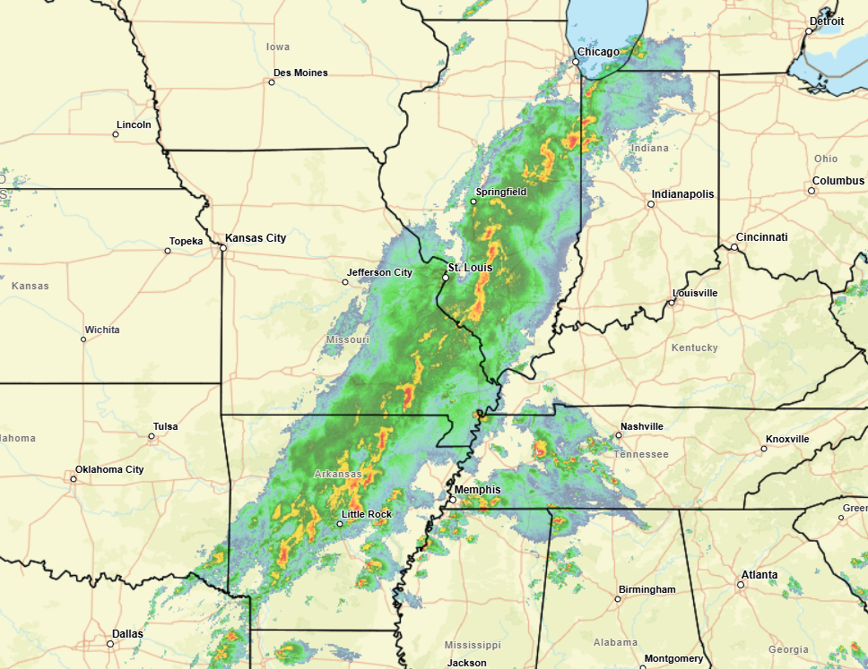
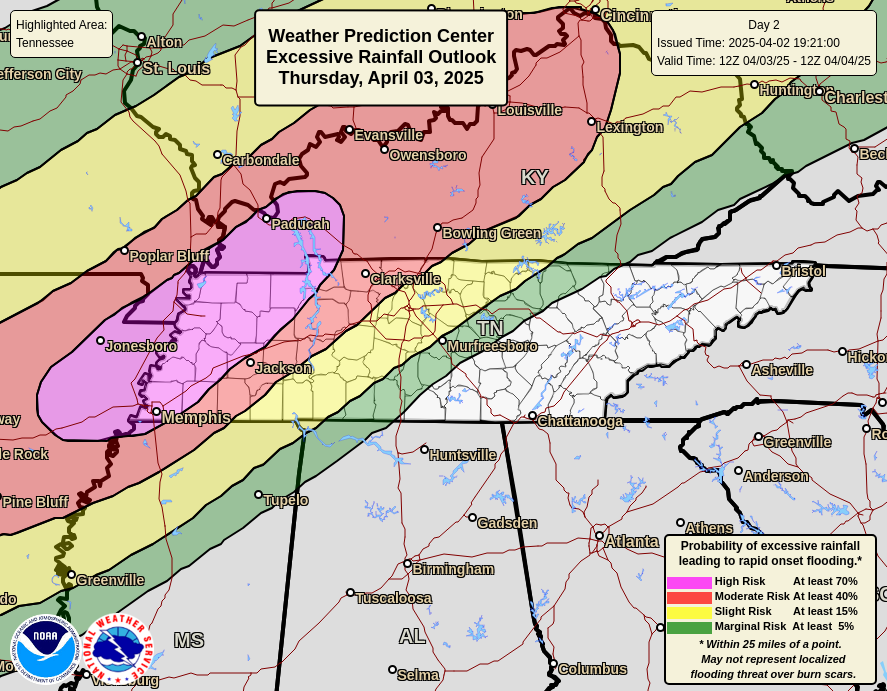
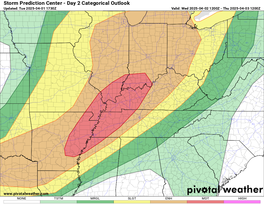
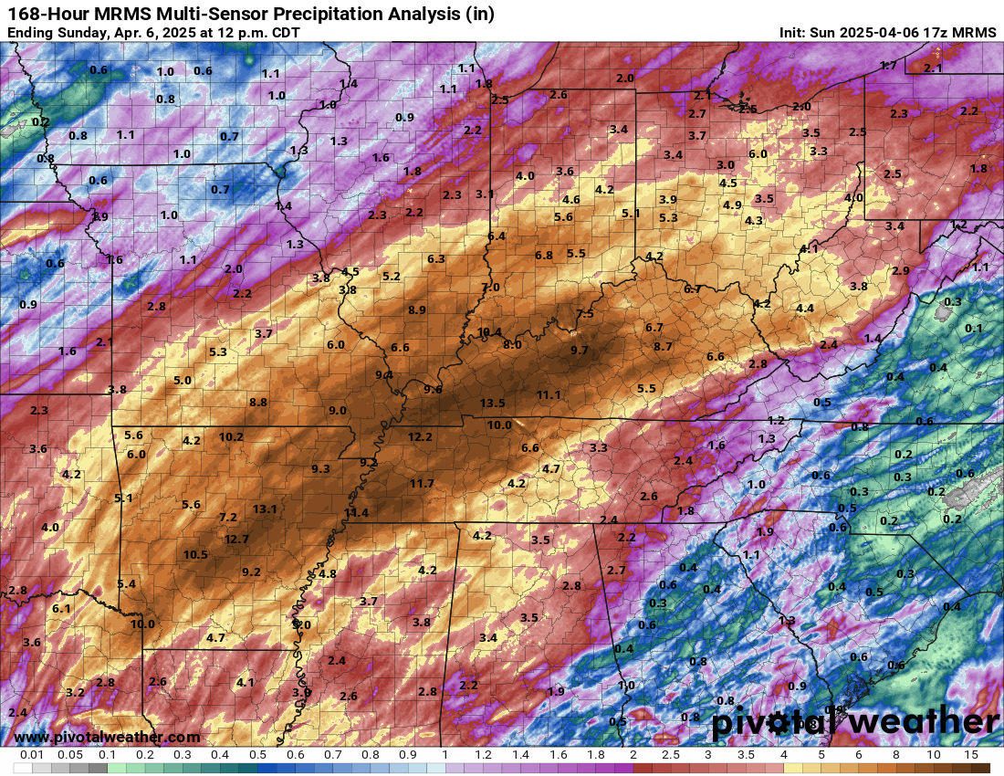
Now that it’s over, we can say that last week and weekend’s rainstorm sadly lived up to the expectations set days before. Take a look at the map comparison below. Use the slider to toggle between the rainfall forecast issued on Monday and the observed rainfall based on MRMS analysis.
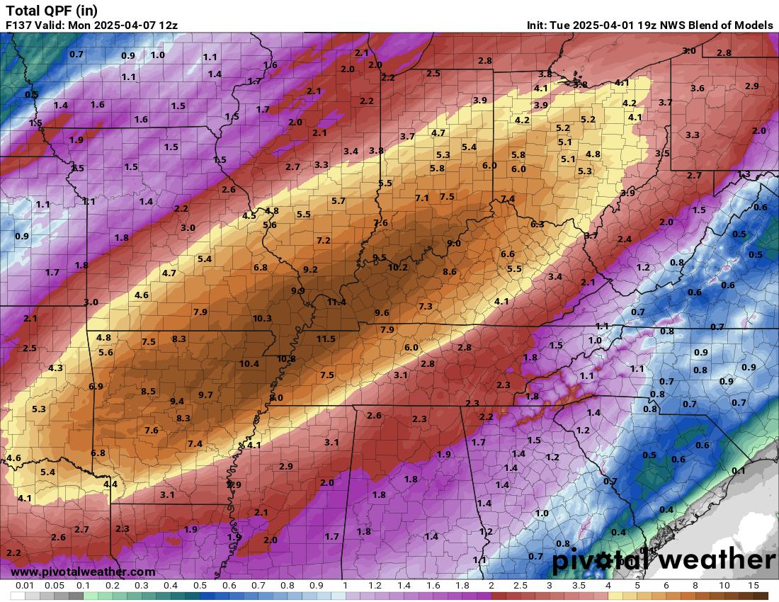
Is this a perfect rainfall forecast? No, but my goodness it’s pretty darn close. The Weather Prediction Center, which is an arm of NOAA issues these larger scale precipitation forecasts daily. I reference these forecasts regular in my day job and for our readers both in Houston and elsewhere. They’re valuable. But they have exceptional utility ahead of major events such as this flood in the Mid-South. The folks at the WPC, much like those at other national centers under NOAA’s umbrella are the absolute best of the best in our field when it comes to marrying forecasts with historical analysis and numerical prediction models. As a public service, I’ll remind you that the budget cuts currently being proposed to NOAA will cost more in both lives and property in the long run than they’ll save in the short run.
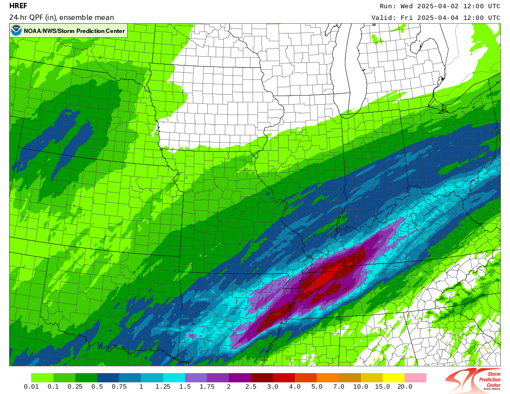
All that said, this forecast was exceptional, but so were the impacts. Here is a look at the wide swath of double-digit rainfall totals seen through this event.
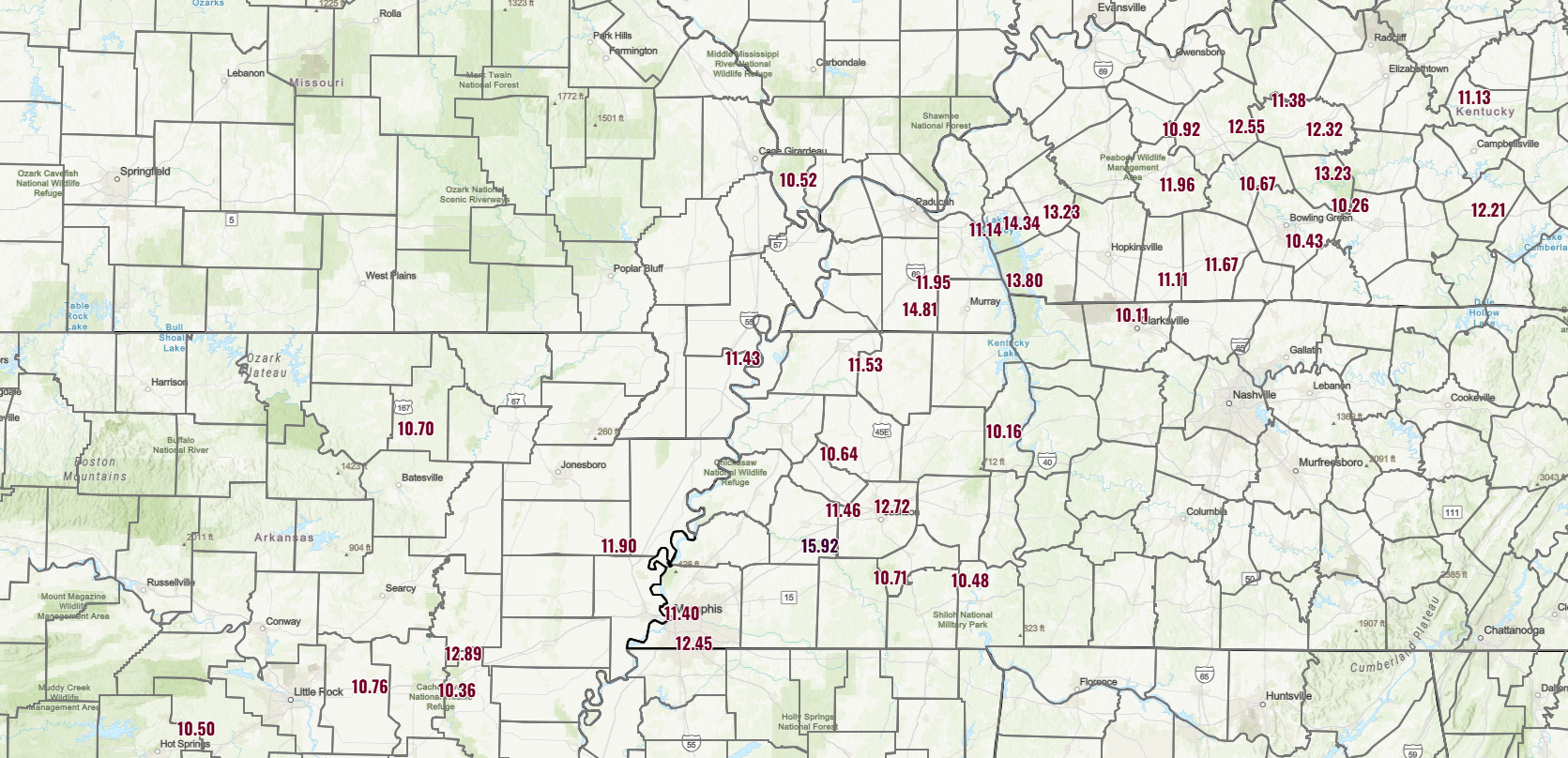
Many rivers in western Kentucky, southwest Indiana, or southern Illinois will be at their highest levels since 2018; in some cases on the White River in Indiana, it will likely be their highest levels since 2005 or 2008 floods. A few spots on the Kentucky River will actually set new records from this event.
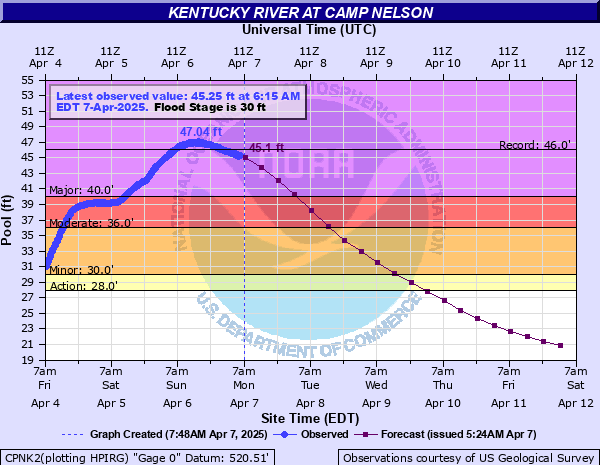
In Frankfort, the state capital, a record from 1978 is threatened from the Kentucky.
Those recurrence intervals are pretty amazing from southwest Tennessee through central Kentucky. For Memphis, this was the 2nd wettest four-day stretch on record, just falling about an inch shy of a June 1877 flood event there. Six flash flood emergencies were issued for the event across Arkansas, Texas, Mississippi, Tennessee, Kentucky, and Missouri.
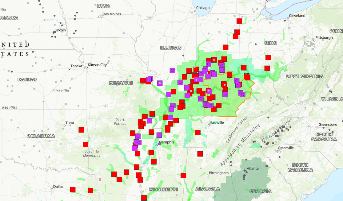
Dozens of river gauge locations are expected to experience major flooding. All this water is going to flow into the Mississippi River eventually, and depending on where you are on the river, the forecast crests right now are the highest since somewhere between 2011 and 2020.
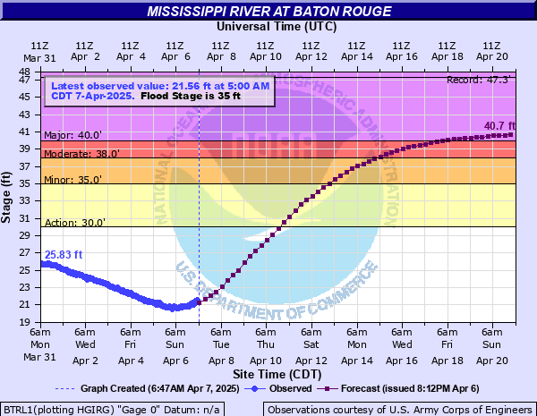
This one will go down in the record books with some of the bigger Mid-South floods.
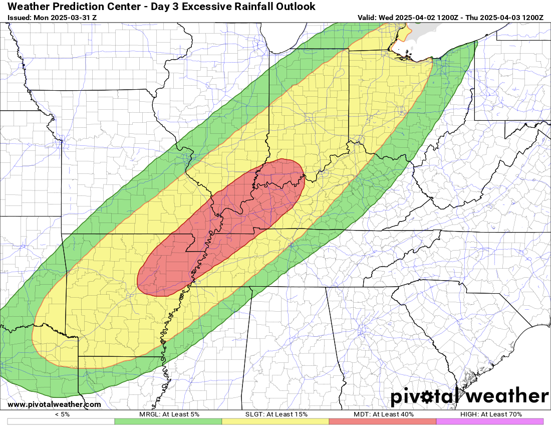
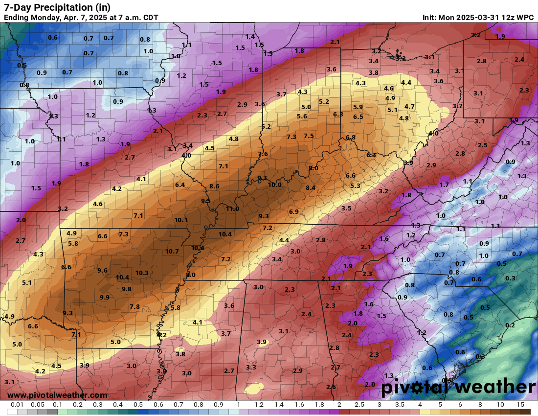
Quiet week for the most part
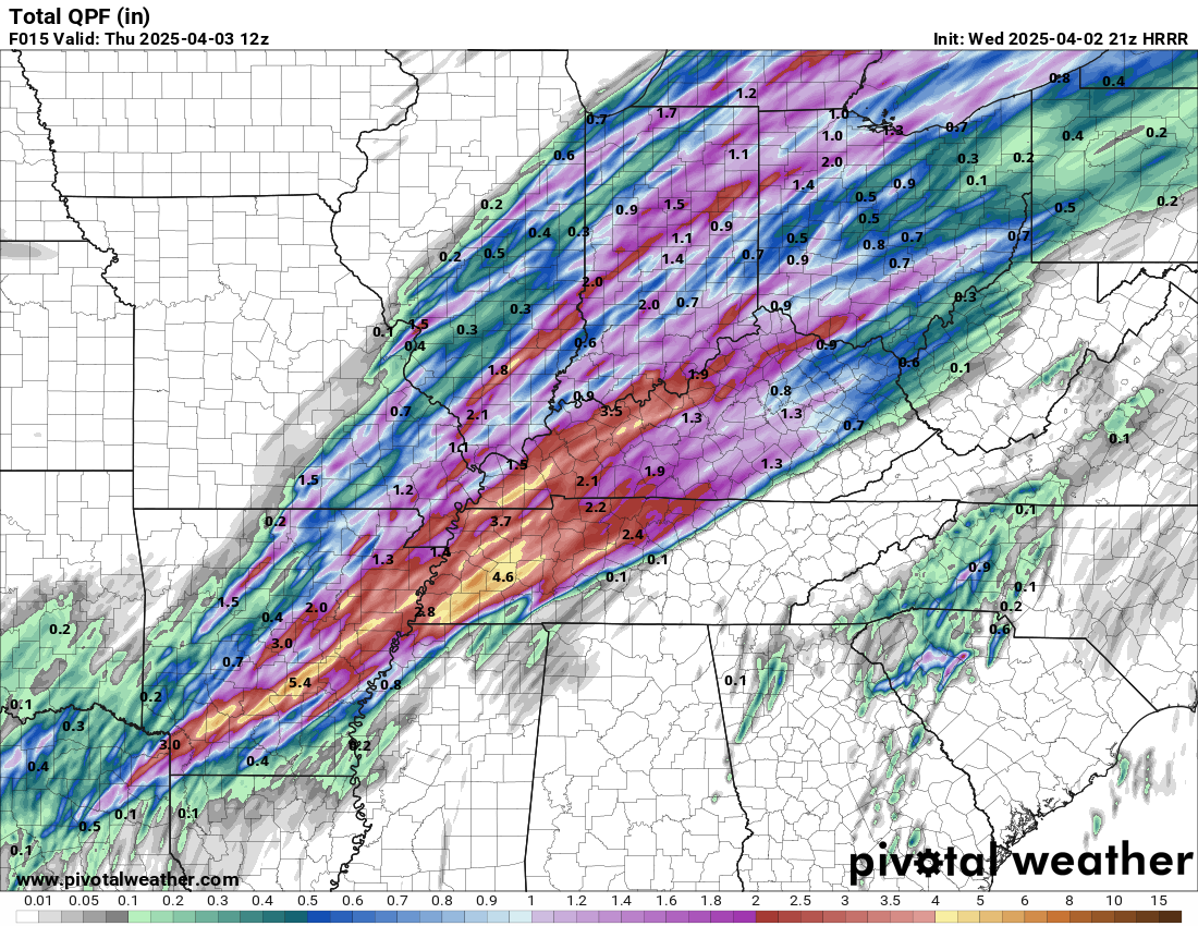
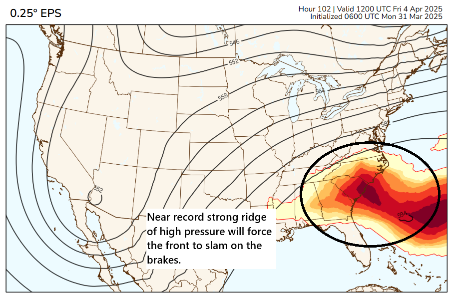
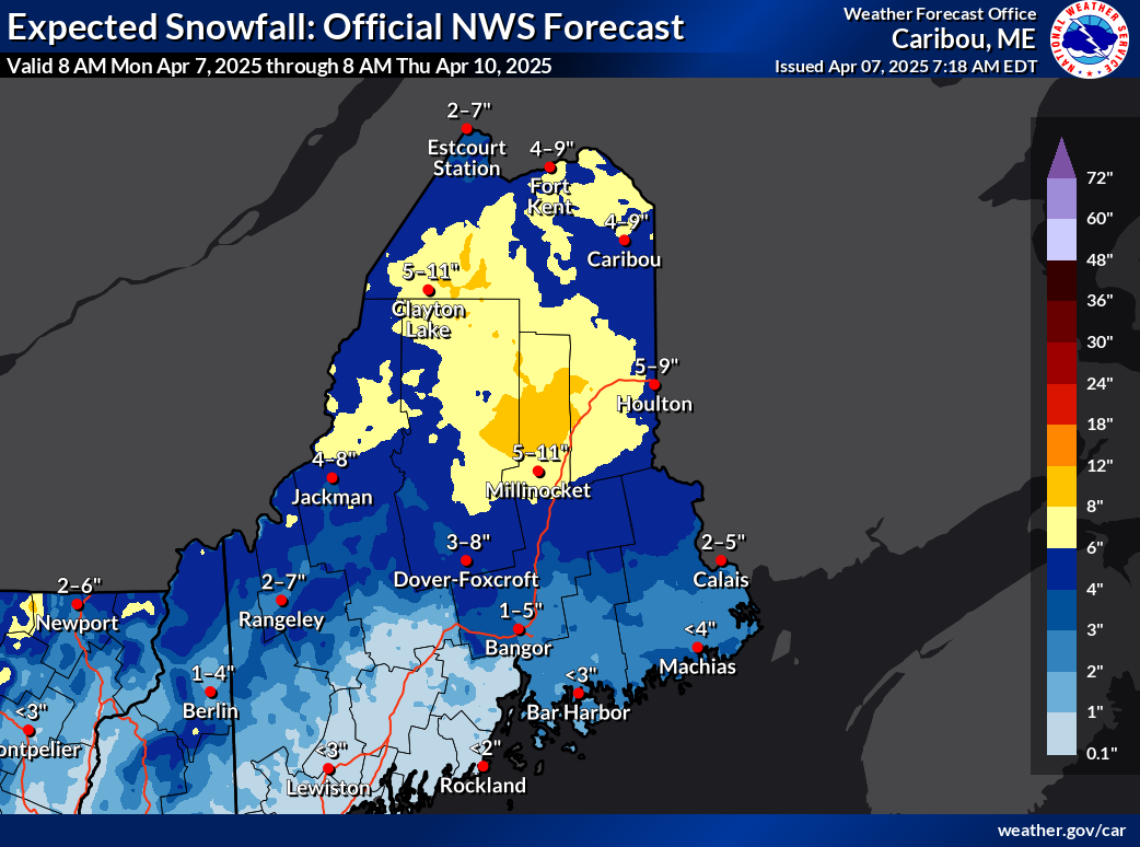
Fortunately, the forecast this week there looks fairly calm with some rain later in the week, likely at manageable levels. Elsewhere across the country, we get to still discuss winter. Cooler temps will allow for some locally heavy snowfall from Ontario, across southern Quebec and into interior northern Maine, where as much as 4 to 8 inches could fall tomorrow.
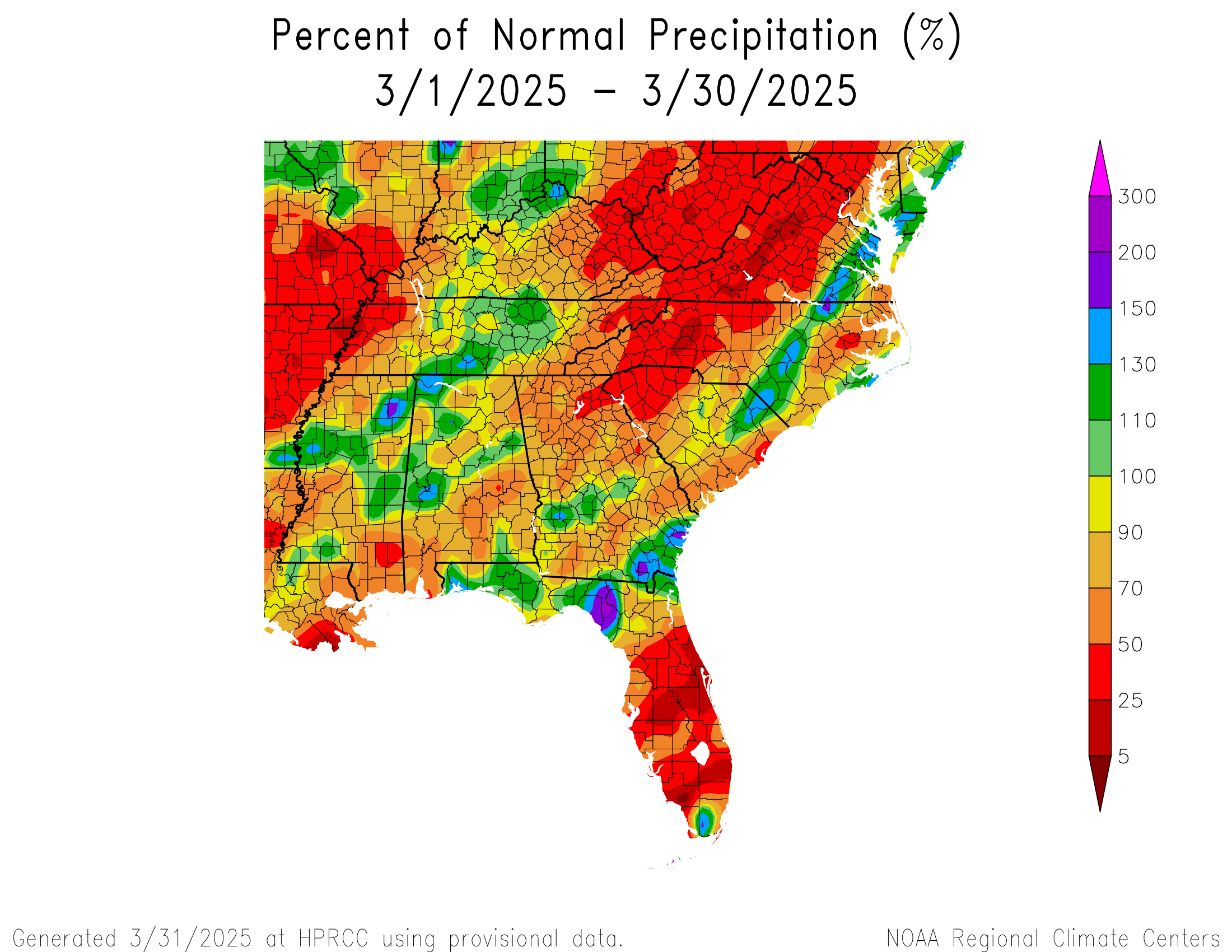
Otherwise, the late week storm system mentioned above may allow for a return to some fire weather conditions in the southern Plains. Unlike in March, however, quite a few areas have seen some decent precipitation recently. So hopefully that puts a bit of a lid on severe fire weather concerns for the Plains.
Back at it next week?
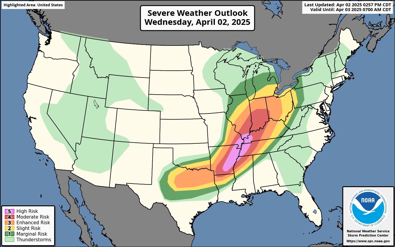
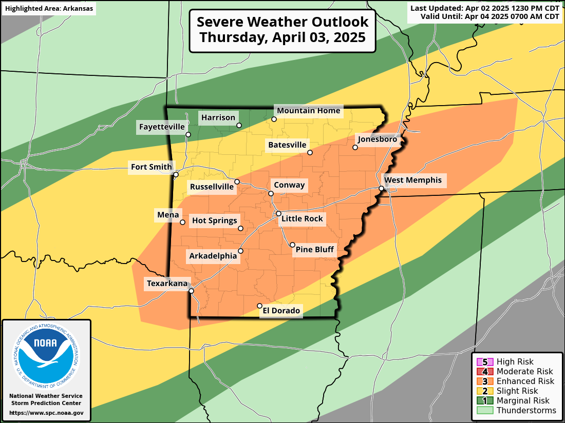
I think the next significant weather item to watch will be a chance for multiple days of severe weather next week in the southern Plains. Exactly what that looks like or how it unfolds is TBD, but there are definitely signs in the models that after a quiet-ish week this week, we pick up the pace again next week.
I’m going to aim for a couple more posts this week. One will discuss the hurricane outlook issued by Colorado State. I may try to get another one later in the week on water issues and low snowpack in the interior West. We’ll see how this week goes!
Going, going, gone?
I want to leave you with a couple fun links today. As baseball season ramps, up, there are two new ballparks in play this year with the A’s in Sacramento and the Rays playing at Steinbrenner Field in Tampa. Over at Fangraphs, Michael Rosen did a two-part look at the weather effects in the new ballparks. Both have interesting quirks. Sacramento’s field will have some of the lowest humidity of any ballpark in the league. Tampa will have some fascinating winds which may make Rays games pretty fun to watch. Anecdotally, I did watch parts of some Rays games during Opening Week, and there were some interesting dynamics in play on fly balls. I encourage you to check those links out!