Summary
- Flooding in Kentucky and West Virginia came to fruition as forecast, with at least 8 people killed thus far and numerous rivers seeing their worst flooding since 2021 and in a couple cases near records.
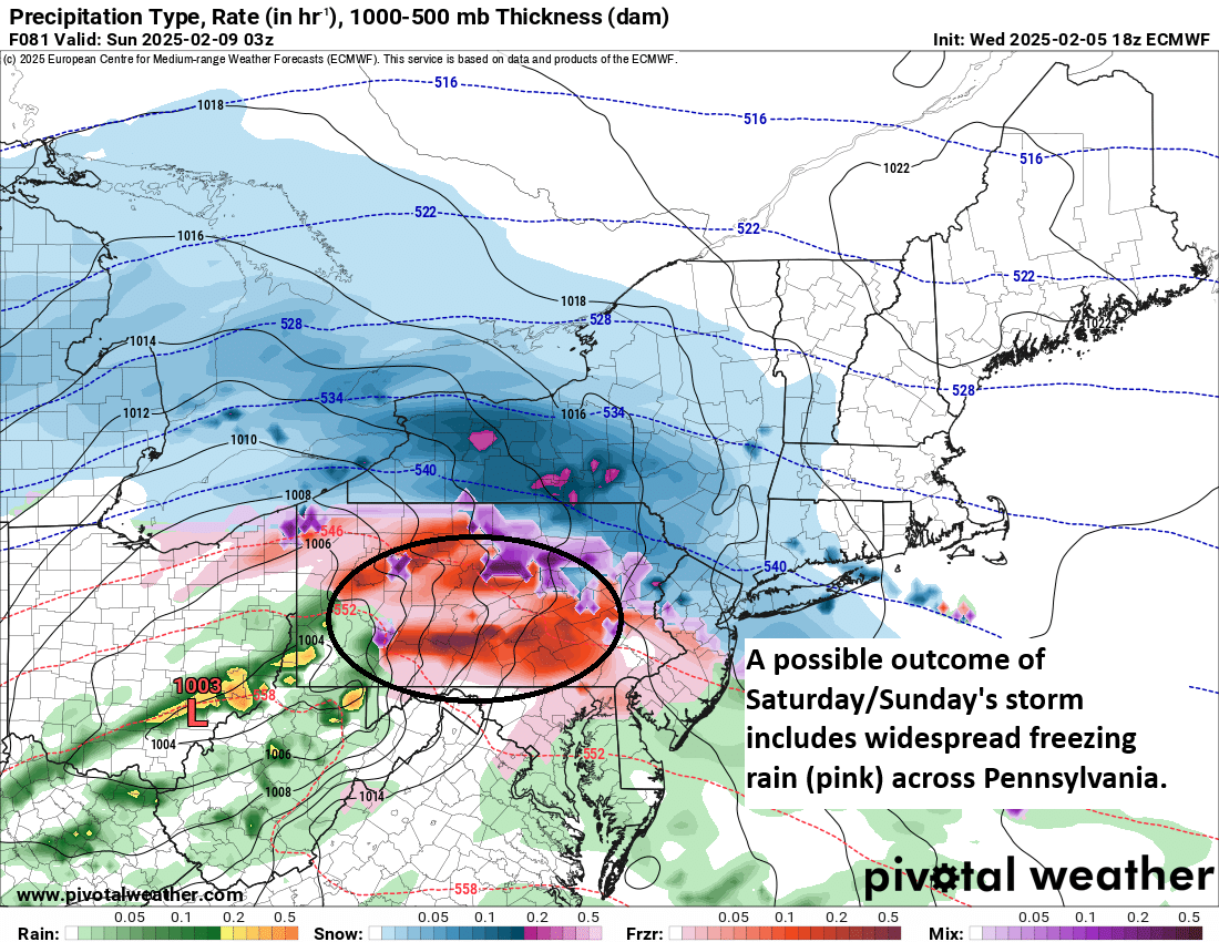
- Next, a major winter storm will bring widespread moderate to heavy snow through the week from the Plains into the Mid-South and Mid-Atlantic, along with possible ice in the Carolinas.
- Some record cold will follow that storm in the Plains, Texas, and the South before a more notable warm-up begins to expand after next weekend.
Kentucky & West Virginia flooding
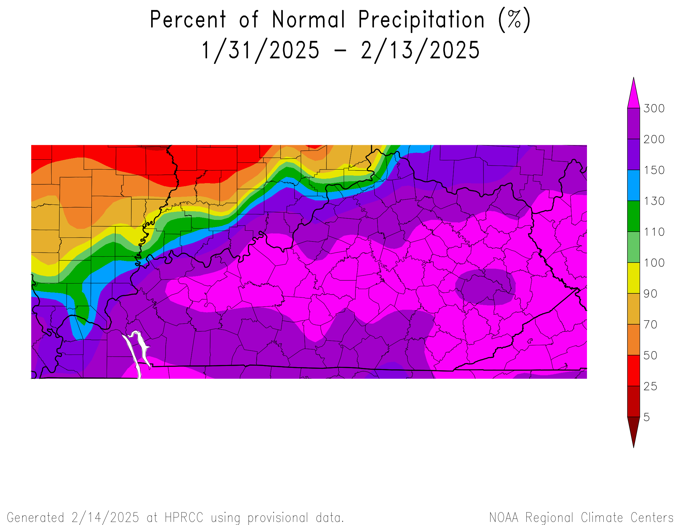
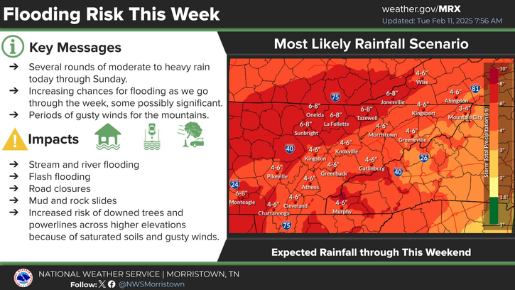
Yesterday’s high risk of rainfall that we noted on Friday came to fruition as forecast unfortunately.
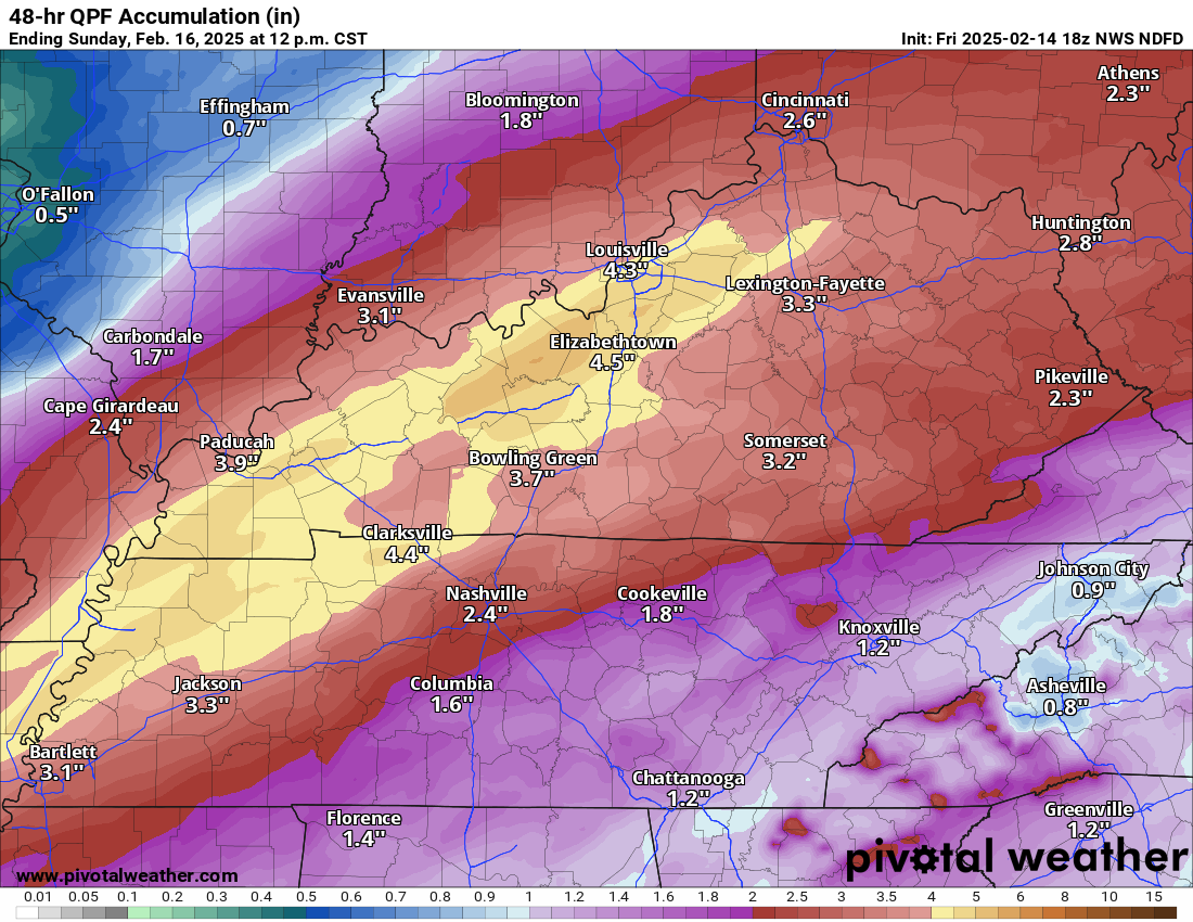

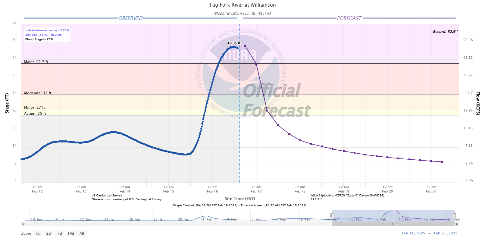
Overall, the NWS forecast was fantastic for the area, with some areas in eastern Kentucky and southwest Virginia seeing a bit more rain than expected. Otherwise, the idea of 3 to 7 inches with higher amounts verified very well. The flooding that’s ongoing is rather bad, and the death toll is at least eight. There are flood warnings all over Kentucky right now, as well as into West Virginia and Ohio and even southwest Pennsylvania. Some notable flooding reports include the Tug Fork River in West Virginia, which saw its second highest crest on record and highest since 1984.
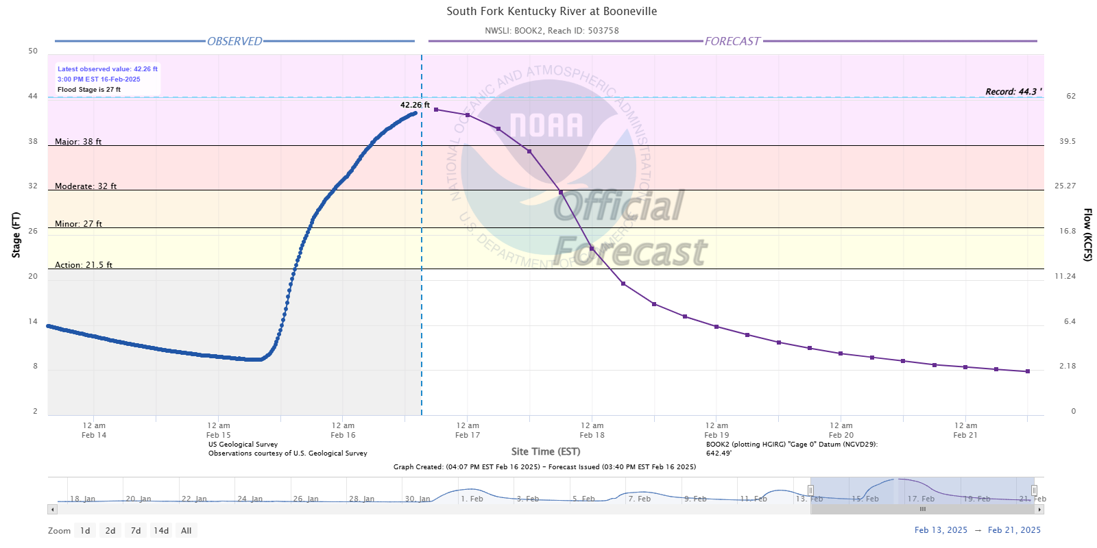
The South Fork of the Kentucky River in Booneville, KY is going to come extremely close to the record that was set there back in 2021.
For many other locations along the Ohio River and elsewhere in Kentucky, the river flooding will be the worst since 2021 as well.
Here comes winter again
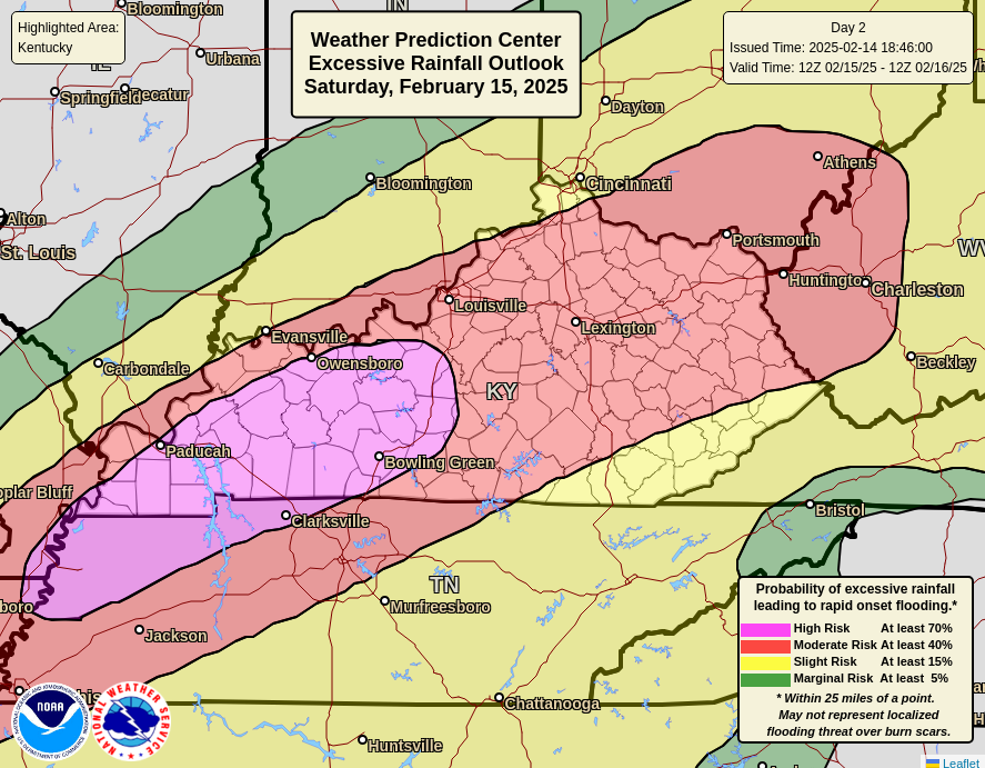
The good news now is that the rain is done, and we will get a little time to get some of this high water flushed through the system, though not all of it, especially on the larger rivers, like the Ohio. But the bad news is that cold and winter weather are on the way to some of these same hard-hit locations. A significant and fairly southern track winter storm is on the way this coming week. The storm will get going as a couple strong disturbances track east of the Rockies and ultimately try to “phase” just off the East Coast, resulting in a large, potent nor’easter.
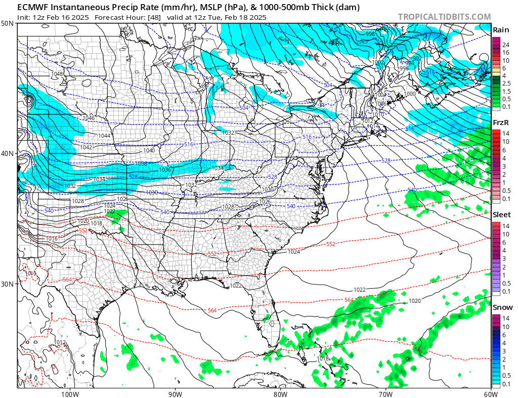
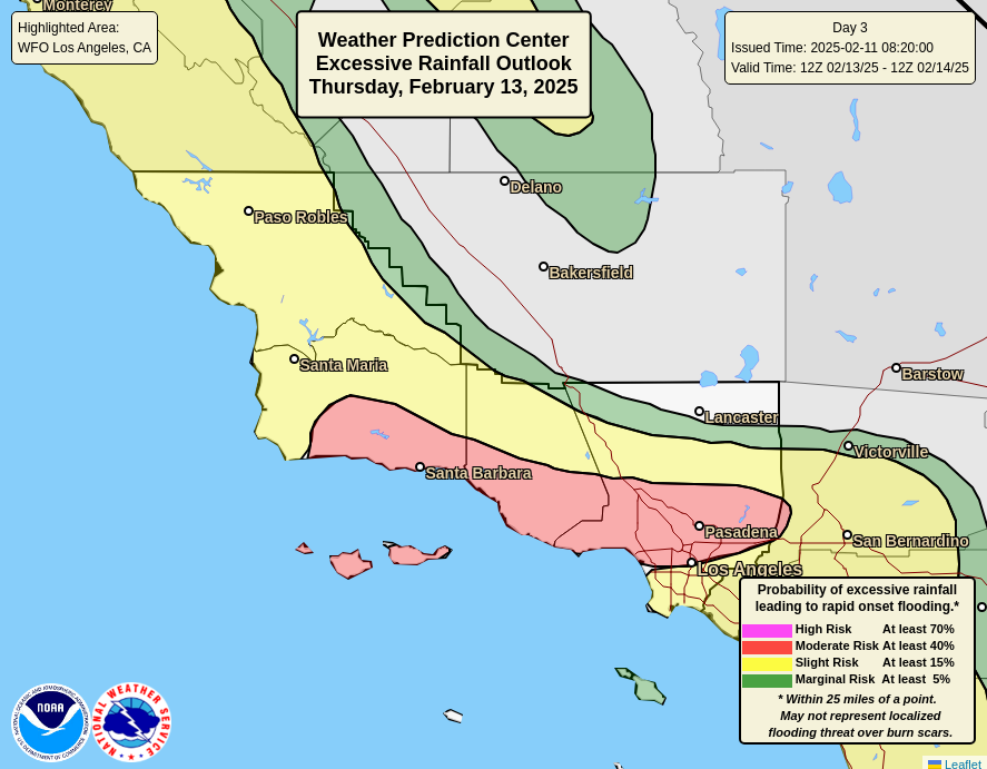
The storm will develop late tomorrow night and Tuesday across the Plains, slide east across the Deep South or Gulf Coast, and then off the East Coast and toward Atlantic Canada, deepening the whole way. This will be a major storm with numerous hazards from heavy rain in the Deep South to potential severe weather to ice or sleet in the Carolinas to heavy snow to the north of there from the Plains into Kentucky to the Jersey Shore and southeast New England.
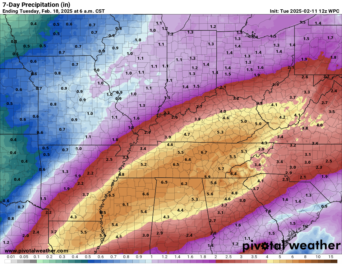
From the NWS Blend of Models below, you can see approximately how much snow is expected to fall. Anywhere in purple may well see 6 inches or more.
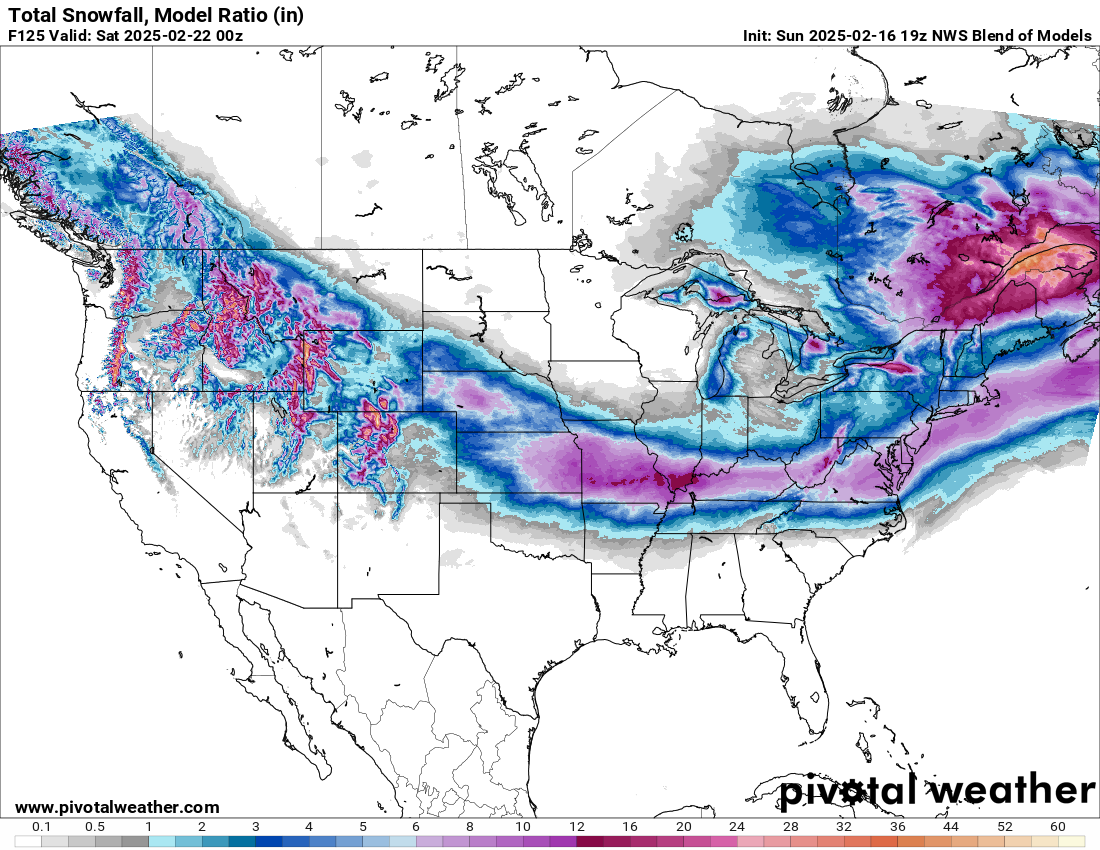
Some select preliminary snowfall estimates include 4 to 8 inches in Kansas City, 5 to 10 inches in St. Louis, 3 to 6 inches in Lexington, KY, 6 to 12 inches in Richmond, 5 to 10 inches in Atlantic City, and 4 to 8 inches on Cape Cod. Visit weather.gov to get the latest forecast for your exact location.
In addition, there are some pretty significant ice accumulations being flagged on a couple models for southeastern North Carolina, including Fayetteville, Goldsboro, and Greenville. A story to watch.
In addition, the cold coming in behind this storm will be notable, with numerous record lows possible on Thursday morning across the Plains, Texas, and the Deep South.
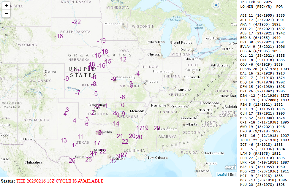
This may not match the intensity of what was seen last month in parts of the country, but it will be dang cold for sure!
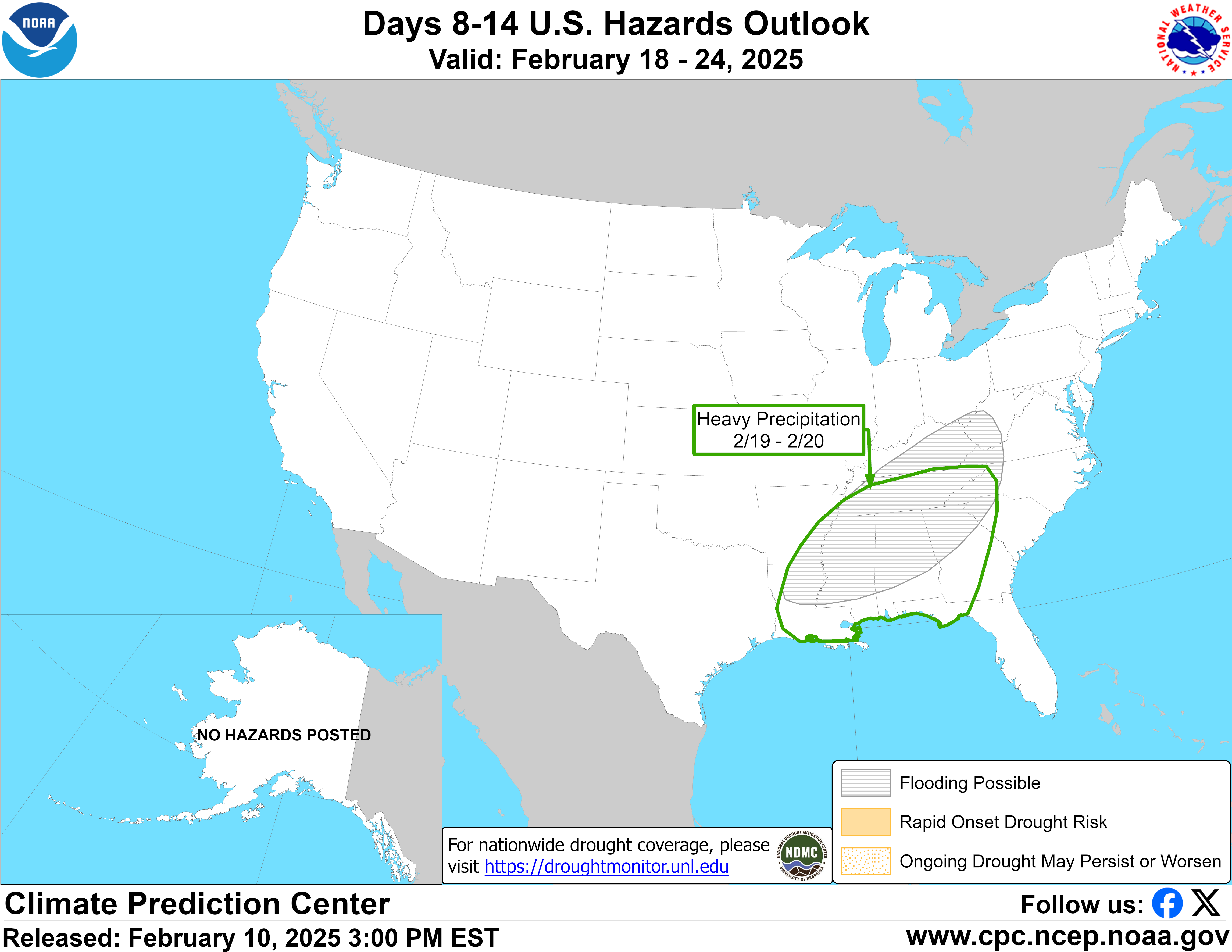
For those who have had their fill of winter for a while, there will be notable changes coming. The 8 to 14 day forecast from the Climate Prediction Center shows high confidence in widespread above normal temperatures across much of the country.
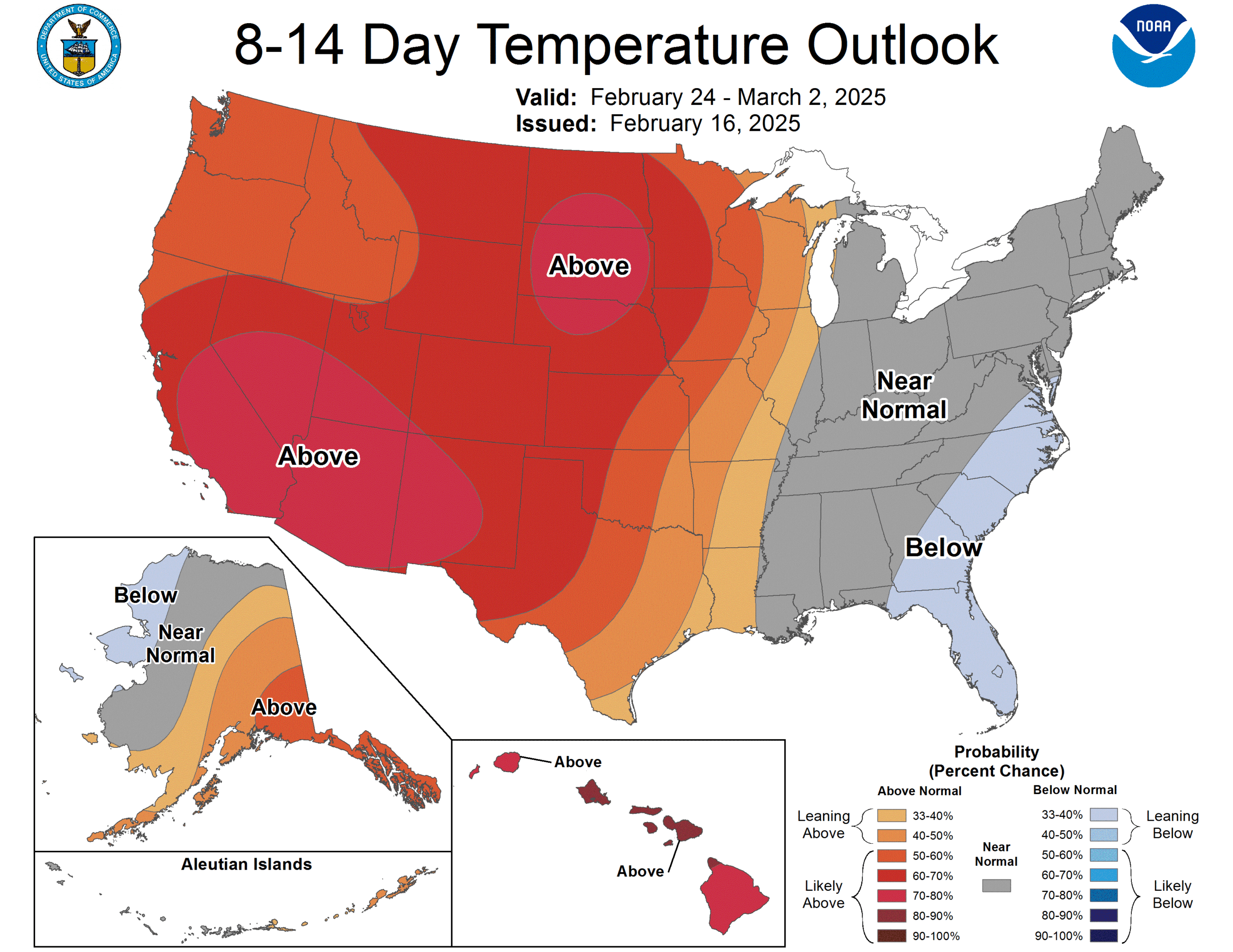
The East Coast may continue to see some colder weather, however. More to come!