Headlines
- Weather pattern change over Florida leads to much wetter conditions next week.
- Model support for any tropical spin up within that pattern change is minimal.
- The broader Gulf will likely see an increase in moisture after Father’s Day with a minimal chance at development, but all of that is likely to be battling a burgeoning U.S. early summer heat wave
Near term calm continues, but Florida gets soggy!
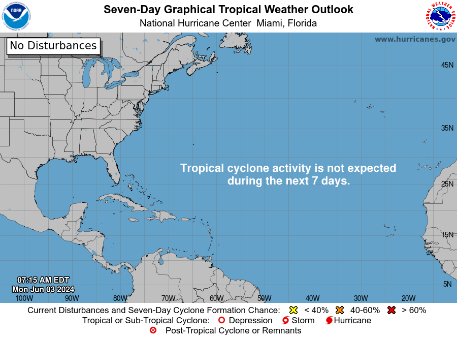
No tropical development is expected in the Atlantic, Gulf, or Caribbean over the next 7 days.
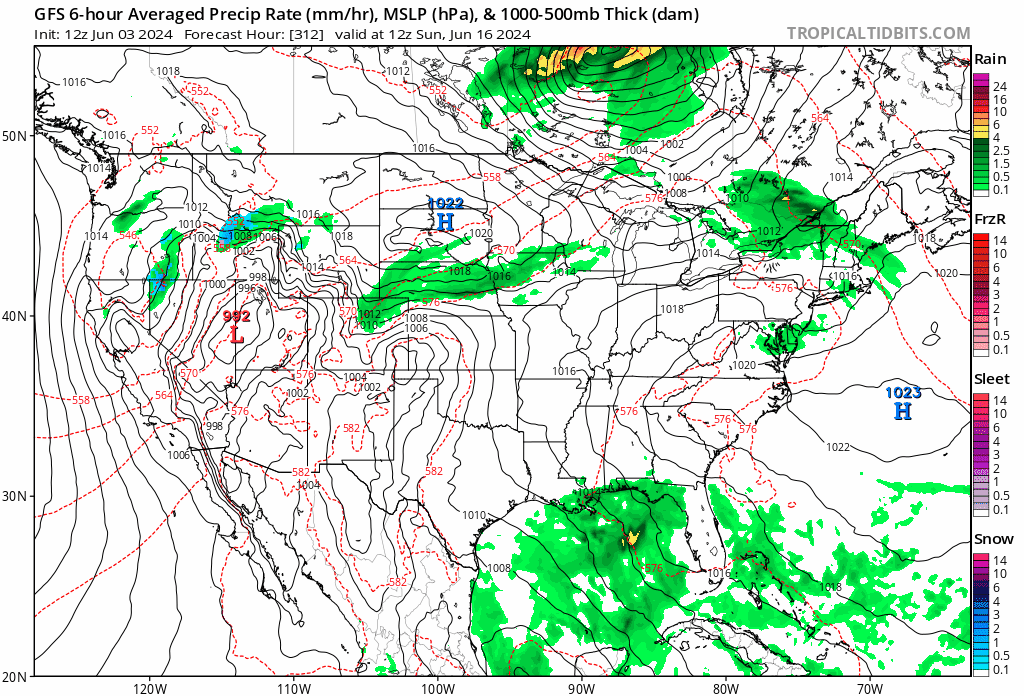
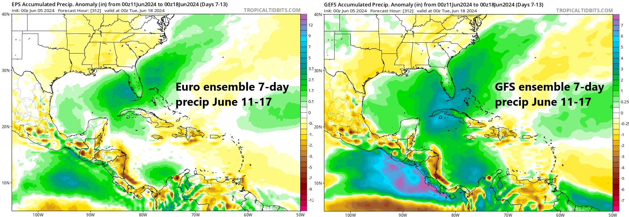
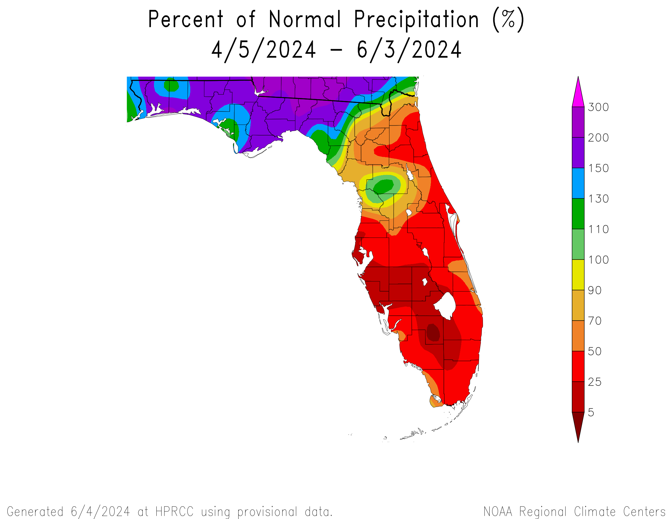
The biggest change over the next few days will be the increase in moisture over Florida. We noted this a couple days ago as more of a next week thing, and it appears that is on track. A few typical Florida thunderstorms are likely through the weekend, but next week sees a significant change. Precipitable water, or how much moisture is available in the atmosphere surges to about 150 percent of normal. This leads to a more significant dose of rainfall for the dry Florida peninsula.
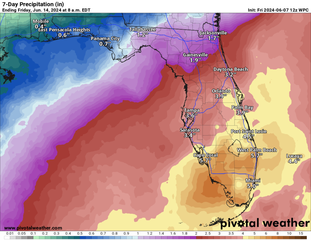
There continue to be a very small minority of ensemble members or models that try to formally develop a weak, disorganized tropical system within this moisture plume near Florida next weekend. I am not really buying into this being a serious concern, but certainly all this rain in Florida could yield some localized flooding concerns eventually.
Next item in the Gulf? Maybe?
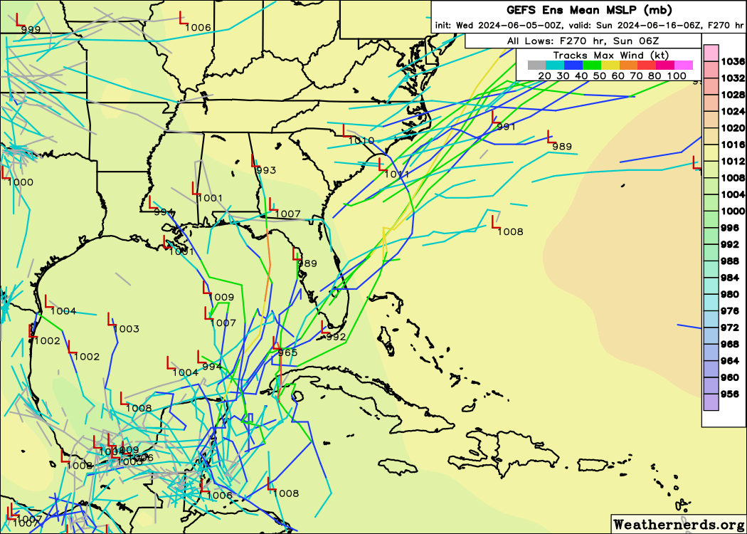
The Gulf is getting a little confusing, and you’ll need to parse this into two separate things. First, you have the Florida stuff and the very low potential for a spin up there next weekend, as laid out above. Secondly, you have this gyre-like feature that looks to sit over or near the southern Gulf, Yucatan, or southwest Caribbean after next weekend. There has been on-again/off-again development, especially on the GFS model, which you expect to see in June. We’ve discussed its poor overdevelopment bias in this region. But there has actually been some modest support for something in this region from the Euro too.

What will be interesting with respect to this is that as this starts to become a feature, it will have to fight against a burgeoning hot summer pattern expanding across most of the Lower 48, including Texas and the South.
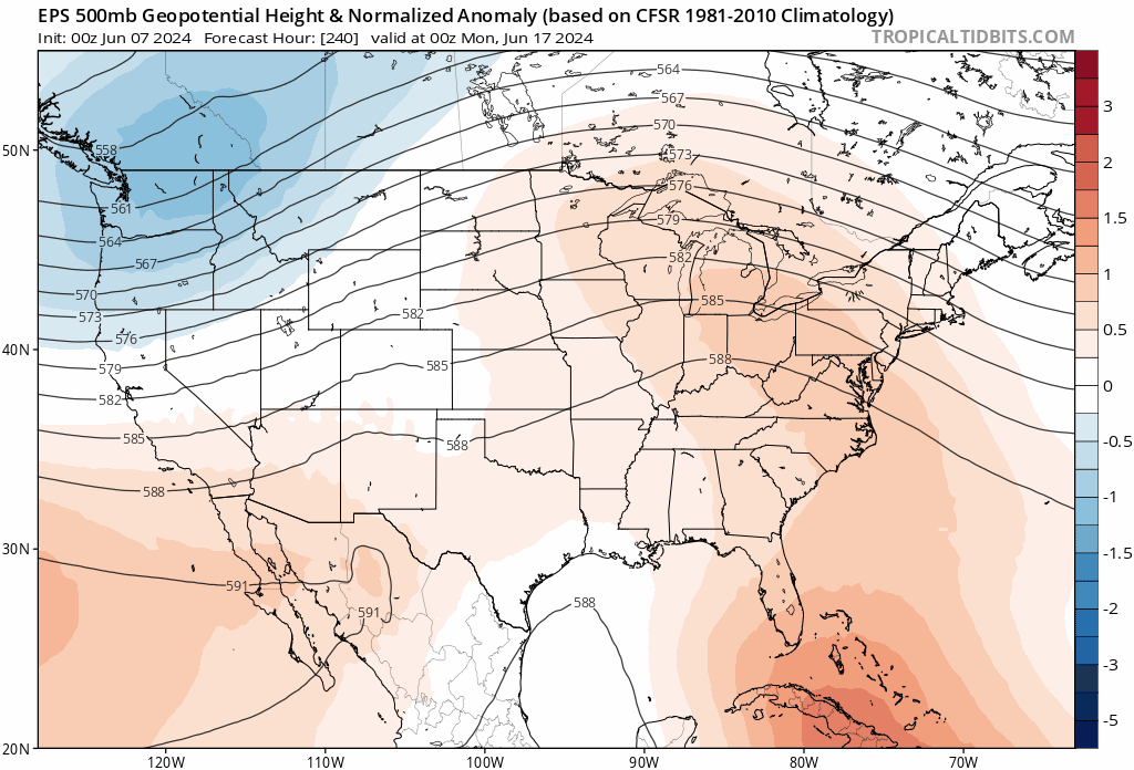
Even looking under the hood at things, that high pressure could be even a bit stronger than shown. If we assume that high pressure beefs up like this as shown and you get a drop in pressure with moisture pooling in the Gulf, it creates an interesting scenario where it may just dump over the Gulf or get squeezed into Mexico or coastal South Texas. I would probably lean against any organized development, but coastal areas of the Gulf could see an uptick in storm activity if this pattern comes to fruition, while inland areas bake.
Either way, it’s a story to monitor over the next week or so. But if you’re looking for a truly busy start to hurricane season, you may need to keep looking.