One-sentence summary
Although Hurricane Lee is expected to weaken as it comes north, it will be expanding in size and capable of punching above its weight class as it brings impacts to eastern New England and/or Atlantic Canada this weekend.
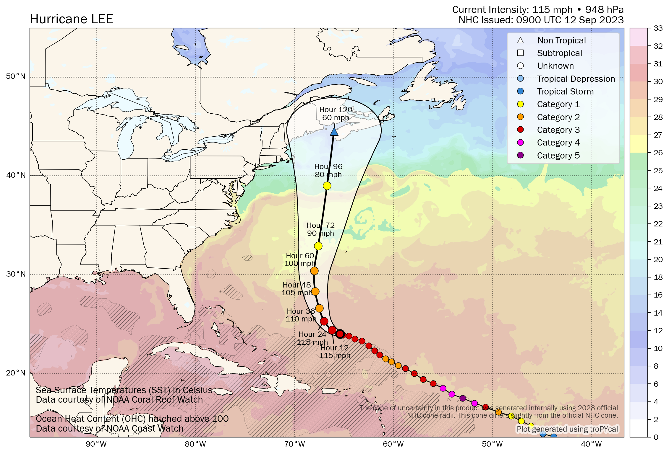
Hurricane Lee: 115 mph, moving WNW 7 mph
What’s changed since yesterday?
Lee’s track forecast is slowly clearing up, with confidence increases in both timing and broad track today. We can now say that Lee will likely take aim at New England or Atlantic Canada or both regions this weekend.
Lee’s track forecast
The forecast for Lee’s path is becoming a bit more straightforward now, but there are still some modest differences we need to sort out.
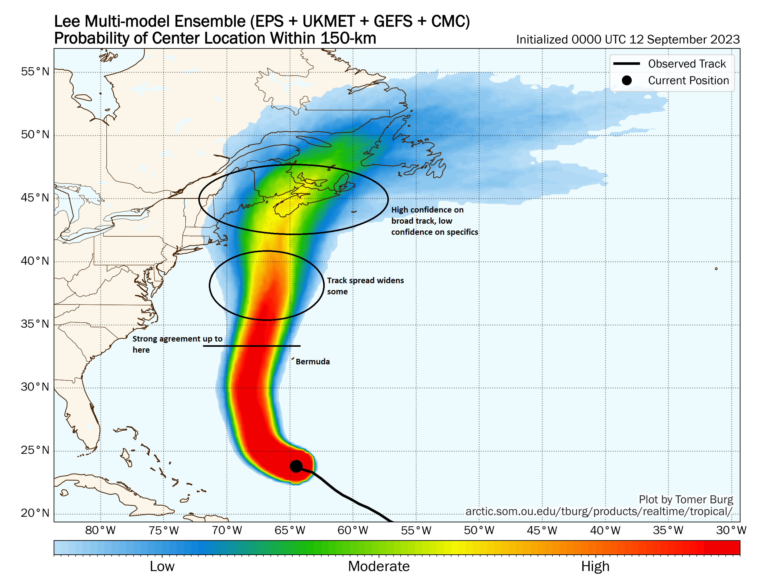
There are two camps now, with one generally proceeding straight north or north-northeast toward Nova Scotia and the other straight north or even bending back northwest toward Maine. These differences may seem minor, and they are to some extent, but they will determine where the worst of Lee’s surge goes and where the worst weather will occur. Historically, there is little precedent for a storm striking the Maine coast from the due south or southeast. Most either arrive from southwest, paralleling the coast or make landfall from the south-southwest. Unique storms have unique impacts. So sorting out the finer details of Lee’s track will allow the impacts to become clearer. If Lee tracks toward Nova Scotia, that’s a more frequent impact zone, and while Lee would certainly be a significant storm there, there is at least some precedent for that.
Lee’s intensity forecast
This part of the forecast is actually a little easier I think. Lee should slowly weaken in the coming days to either a category 1 hurricane or strong tropical storm as it makes landfall wherever. However, because of Lee’s size and intensity and its transition from a tropical storm to more of an extratropical feature (think: very large nor’easter), it will act stronger than what it actually is. In other words, it’s important to recognize that a weakening storm is still a serious storm in this part of the world. And Lee checks the boxes for a potential serious hazard to folks in Canada and New England, even in a weakened state. Tropical Storm force winds extend out almost 200 miles from Lee’s center, so while the exact landfall point will matter for some aspects of Lee, the impacts will extend far from the center.
Lee’s impacts
We’re still honing in a bit on this area of things, but let’s share what we know today.
For Bermuda, it seems that Lee will pass to the west by 100 miles or so, which should be plenty close to deliver tropical storm impacts, and I’d expect Tropical Storm Watches to be issued there today. Additionally, Bermuda will probably see some heavy rain, very rough surf, beach erosion, and rip currents as Lee approaches.
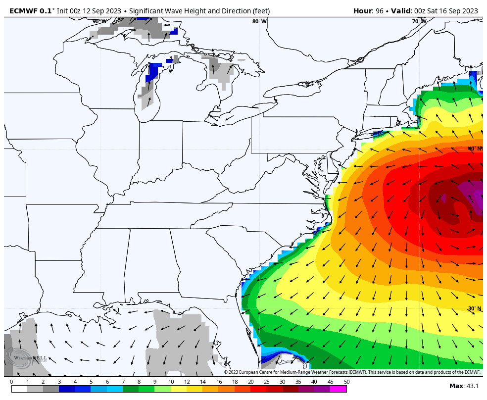
Looking elsewhere at impacts: First, beach erosion, rough surf, and rip currents are a lock for the East Coast and Atlantic Canada. Swimming probably won’t be recommended this weekend anywhere from the Mid-Atlantic northward.
Second, and one area of concern: Rain. Lee’s exact track will determine who sees the heaviest rainfall from the storm. However, with periods of heavy rain likely this week across New England, and some antecedent ground conditions in coastal Maine, New Hampshire, and Massachusetts already wetter than normal, tropical rainfall won’t be ideal.
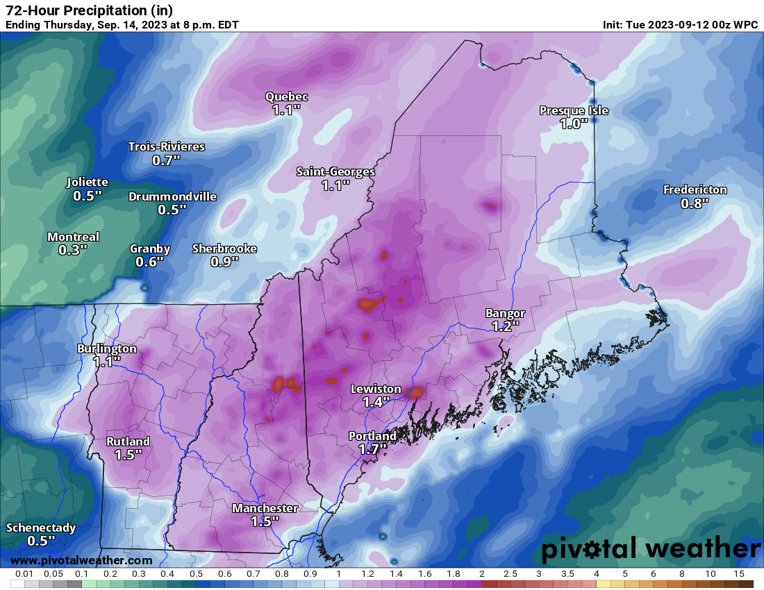
Flooding is one concern obviously, but so will downed trees due to saturated soils and gusty winds. In other words, it won’t take a hurricane in some spots to knock down trees or power lines. The good news in all this is that Lee should be accelerating north as it passes through which will limit the rainfall potential a bit and hopefully avoids serious freshwater flooding concerns.
Wind, as noted, will be an issue as well for obvious reasons. We’ll hone in on that aspect of things as we get closer.
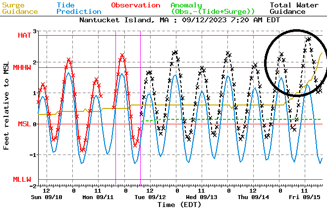
And last but not least, storm surge. Lee will be bringing a fair bit of water north with it as it heads toward Canada or New England. As a result, depending on the exact track of the storm, this could come roaring ashore on the coastline near and right/east of the center. It’s a bit soon to talk about how bad that could be, but given Lee’s larger size, it seems reasonable to think a pretty significant coastal surge event could unfold in Canada or New England.
We will fine tune these impacts as we get closer to the storm. In the meantime, it’s the right time to begin preparations in coastal eastern New England and coastal Atlantic Canada. While the details are still a bit uncertain, the likelihood of potentially significant impacts is increasing.
We will have a brief update later this afternoon, followed by a full update Wednesday morning.
Elsewhere: Margot makes five
Meanwhile, congratulations are in order for Margot, which became the season’s fifth hurricane. It remains unlikely to impact land. Winds are 85 mph this morning.
Behind Margot, we continue to see signs that the next wave will develop in the coming days. Invest 98L is expected to form and track west, then northwest across the Atlantic. It appears likely to go north of the Caribbean islands, but given how much time we still have ahead of us for this one, it remains worthy of continued watch. This one has ruffled a few feathers as some operational guidance shows it getting close to the U.S. at times in the 11 to 15 day period. Frankly, that’s way too far out to proclaim anything one way or the other, but when looking at ensemble guidance, it appears those dramatic solutions are presently significant outliers and unlikely to materialize. Plenty of time to watch.
Thanks guys, yr the best.
From Paula Finkle in Cape Cod.
Sat. Is a religious holiday fr me,
We’ll just have to wait nd c!
Happy Rosh Hashanah!
Thank you! Fingers crossed!
La Shana Tova Paula,
My in-laws are in Lewiston, ME (which made the rain forecast graphic in the article).
😎 great graphics!
(as always 😉)
Ok Matt, we are just north of Rockland ME. Appreciate you keeping us updated. Guess we picked the wrong week to visit the sights around this beautiful Maine coast. Now that you have a personal connection with someone in the area please keep us updated so we know which way to move if necessary!
Thank you! Glad to hear you’re checking us out! Here’s hoping it won’t spoil your travels too much.
Sorry Matt, I saw on Twitter last night that 98L is going to become a Cat 5 and hit the exact same spot that Lee did. And Twitter is neeeever wrong lol
Never wrong!
What part of climate don’t people kunderstand – what goes up must come down – man made catastrophic events can be halted but we as mankind have to gather up some common sense cause if all progress is surrounded by money, then we all have to wake up, shake our heads and get our act together as a human race – that’s the short and long about our future existence- Bill Mc Kenna
Please note you home in on an area and hone a skill. Other than that piece of advice, I appreciate your untangling this complicated scenario. I live in Nova Scotia and was impacted by Fiona terribly. I am keenly following the Lee Hurricane track and intensity.