One-sentence summary
Tropical Storm Ophelia is inland and weakening, providing heavy rain from North Carolina into Virginia today, with local moderate to major tidal flooding possible again this evening in the Mid-Atlantic.
Tropical Storm Ophelia: 50 mph maximum winds, moving N 13 mph
Ophelia is now inland and weakening over North Carolina after making landfall earlier this morning near Emerald Isle, NC as a 70 mph tropical storm. The center is just north of Greenville as of this writing, moving due north at a steady clip. Heavy rain is falling across much of interior eastern North Carolina, as well as most of southeastern Virginia.
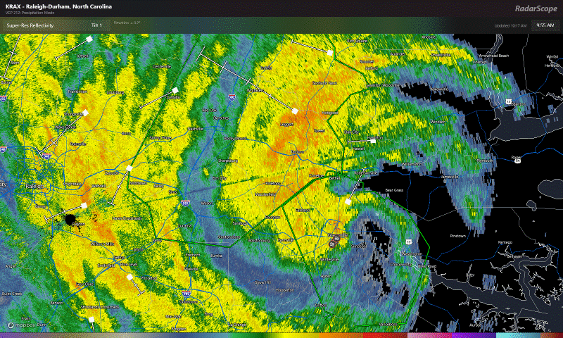
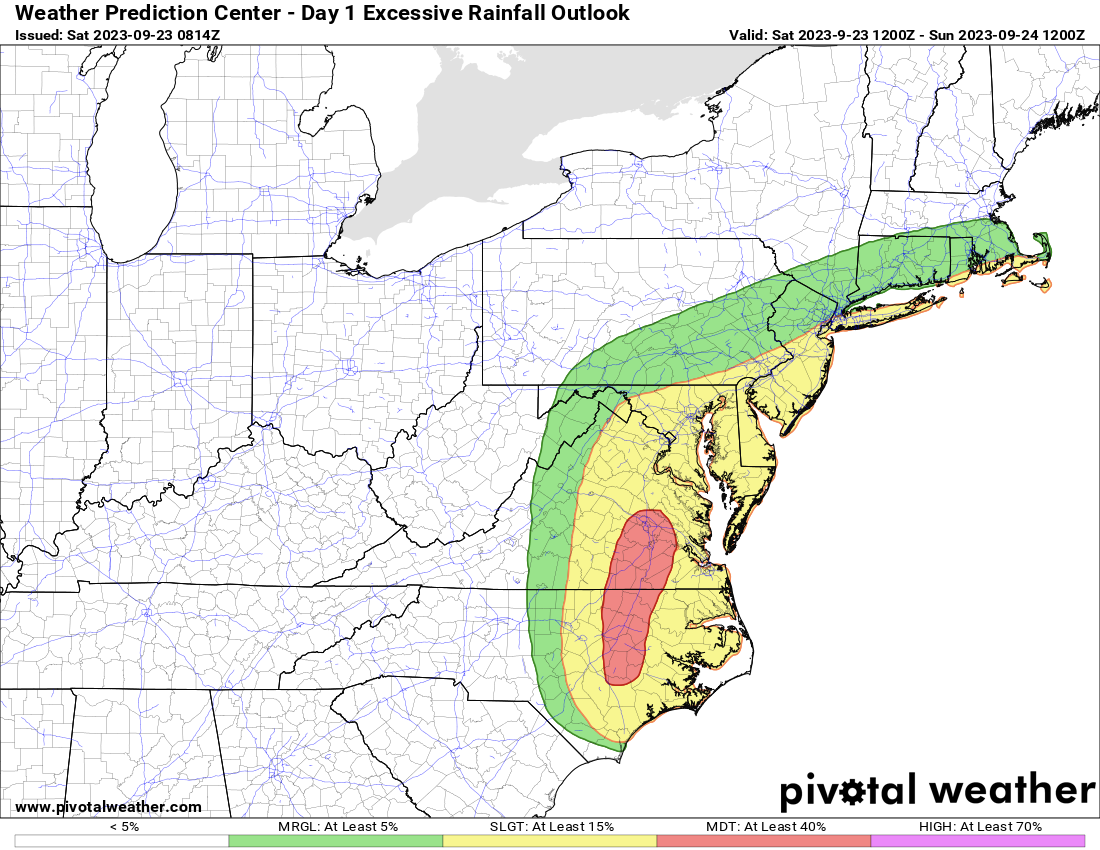
There is a moderate risk of flash flooding (level 3 of 4) today for southern Virginia and northern North Carolina. Another 1 to 3 inches of rain is easily likely in spots. Those that see the heaviest rain will be most prone to localized flash flooding. Expect inconvenient travel across much of the region today.
Tidal flooding remains a concern. The high tide cycle later this afternoon and evening will probably be the last serious one, but we still expect moderate to locally major tidal flooding between Hampton Roads and the Jersey Shore.
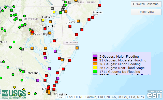
Heed the advice of local officials to ensure you’re prepared for any flooding of streets or vehicles that may occur on the coast.
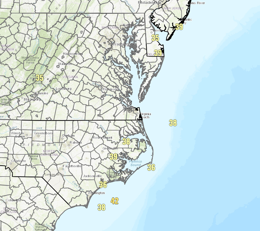
Additionally, winds continue to blow with Ophelia moving inland. Though, truthfully, the most recent map of wind gusts 35 mph and higher is not exactly going to scare anyone.
There are a modest amount of power outages, which right now sit at around 60,000 or so. All in all, not terrible. So the main concerns today will be around the rainfall flooding and the high tide cycle later today. Use caution and don’t drive into flooded roadways.
We’ll get more rain into tomorrow as you work up the coast, with 1 to 3 inches possible and a slight risk (level 2 of 4) of flash flooding from the Philly area up into southwest Connecticut, including much of New Jersey and New York City.
Otherwise, we’ll lose Ophelia tomorrow or Monday, and it will dissipate offshore. Some models do show its remnant “energy” hanging around offshore, but right now that seems like a non-serious concern. We’ll keep tabs on it regardless.
Tropical Depression 17: Deep Atlantic system unlikely to impact land
Within the last hour or so, the National Hurricane Center upgraded Invest 90L to Tropical Depression 17. This is the deep Atlantic system we’ve been watching for awhile now in modeling. The good news is that most trends have adjusted to turn this thing north before it gets near the islands. A “close miss” is not off the table, but this is looking more and more like a clear miss.
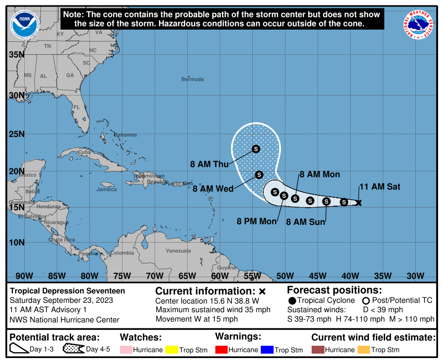
The system is expected to gradually strengthen over the next few days, becoming a tropical storm (named Philippe) later today or tomorrow and eventually a strong tropical storm. It could eventually become a hurricane, but that’s not currently forecast officially. Whatever the case, at present this is no threat to land.
Beyond these two systems, there is not anything of serious concern at this point in the basin. Hopefully we are now past the peak of hurricane season and we’ll see if the secondary, lower October peak brings us anything of note.
South of y’all in Brazoria County. Thanks for ALL y’all do. Fingers crossed 🤞 that we stay quiet till hurricane season is over and done. Take care, Ken
Former Houstonians now living in Raleigh, NC. Thanks for the updates. Just breezy and off and on rain since yesterday evening. Rain gauge so far has picked up about 1.5″. Thanks for all that you do!
Thank you! Glad you’re doing well.