One-sentence summary
Neither Tropical Storm Philippe or Invest 91L are expected to impact land at this time, but there are a couple other areas to keep tabs on beyond this week.
Happening Now: Philippe and 91L are not serious concerns
It’s the last full week of September, and in the Atlantic tropics we continue to pace ourselves with a couple storms per week. This week, we have Philippe, which formed over the weekend. We may add Invest 91L to the mix later this week, as it may have a window of opportunity to become Rina.
First, Philippe. While it has plenty of thunderstorm activity that it is maintaining this morning, it’s very clearly ragged looking, an indication that it is fighting off wind shear.
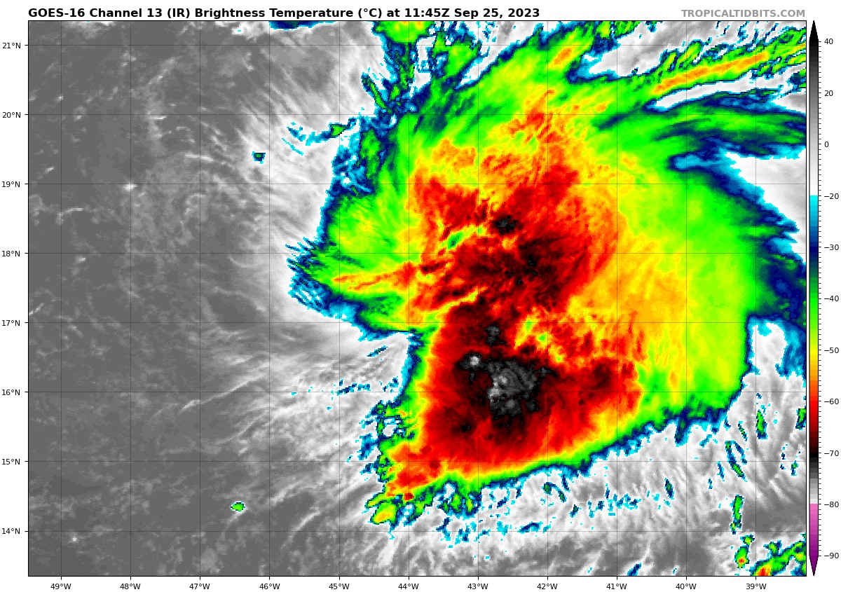
Philippe has 50 mph maximum sustained winds, but with the wind shear it is experiencing, it may struggle to intensify much beyond this over the next couple days. If Philippe can survive this stretch, there is some chance it may take a run at hurricane intensity by later in the week out over the open ocean, no threat to land. If Philippe succumbs to shear the next few days, it may actually stay on a westward course and get close to the islands. However, in that case, it would be unlikely to reintensify and impacts would be minor.
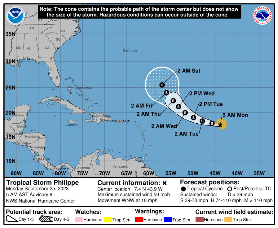
So in terms of impacts in the Lesser Antilles, both a stronger Philippe and a weaker Philippe should make no difference. A stronger Philippe turns away faster and much farther east. A weaker Philippe tracks closer but falls apart.
Meanwhile, Invest 91L got tagged this weekend behind Philippe, and it is essentially following Philippe to the west. I’d expect a slow, gradual intensification this week and maybe an organized depression or storm by Wednesday or Thursday.
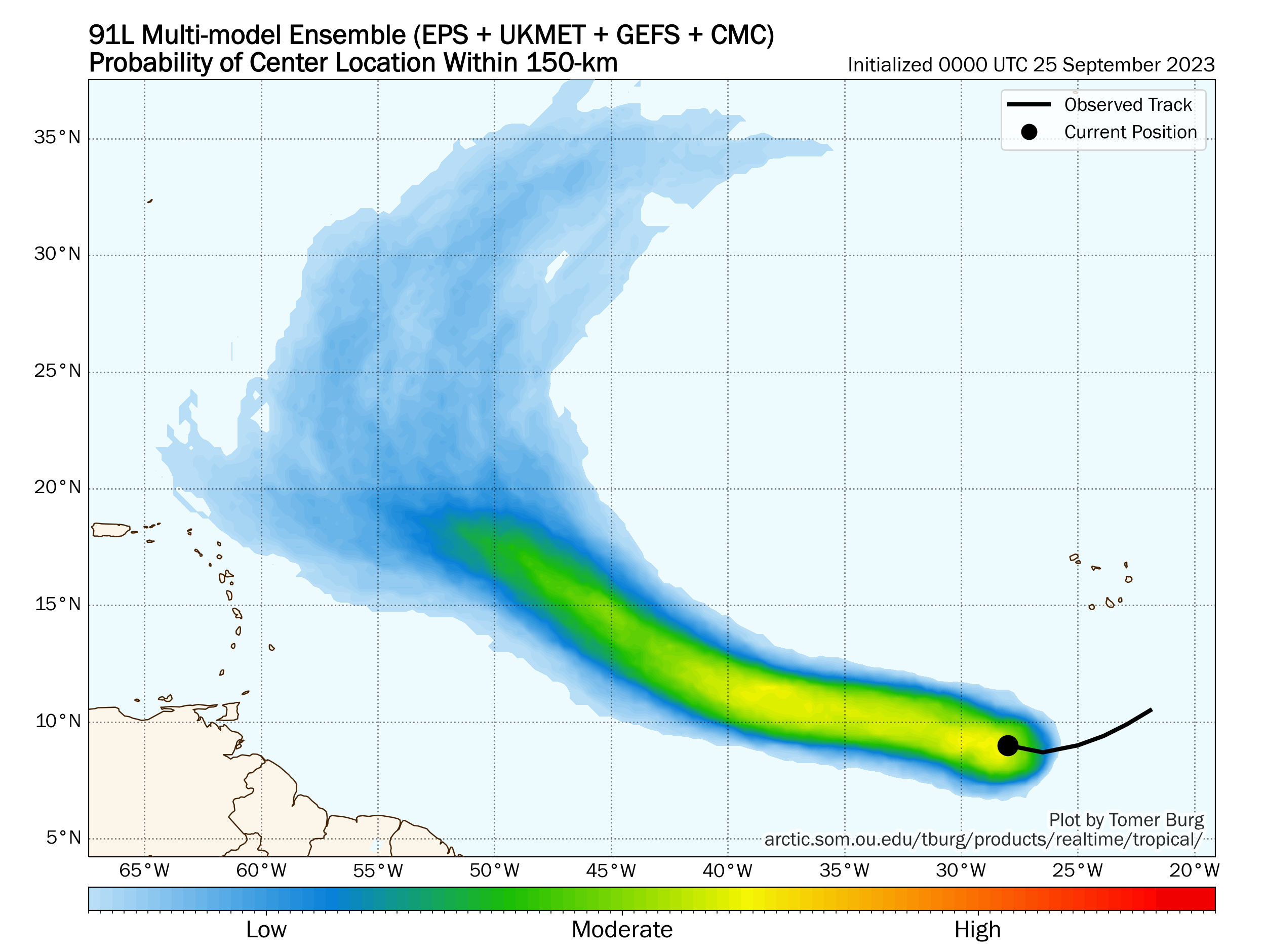
Ultimately, 91L’s future may be dictated (much like Philippe’s) by how strong it gets. A stronger storm would be apt to turn away from the islands quicker, whereas a weaker one would track closer but come with limited impacts. Either outcome produces minimal heartburn for the islands. We’ll keep track.
Finally, the NHC has highlighted an area in the far southeast Gulf with a 10 percent chance of development.
That seems reasonable right now. Wind shear is low for the moment, but it is expected to increase and expand over the Gulf this week, which should essentially shut down anything that tries to develop. So we are not worried about this one.
The medium-range (days 6 to 10): Eastern Gulf or East Coast shenanigans?
Could we do another Ophelia situation on the East Coast or even in the Gulf next week? The answer is maybe. Some modeling has hinted at a disturbance in the mid-levels of the atmosphere coming together somewhere around Florida, perhaps not far from where Ophelia developed last week. I think the ballet here is a little more delicate than it was last week, which would mean that we’d need a few more things to come together perfectly for this to happen. But if it were to do so, we could conceivably be talking about another tropical storm either in the Gulf or off the East Coast next week. Something for us to watch, but nothing I have enough confidence in today to say much more about. This is very much a stay tuned situation.
Fantasyland (beyond day 10): Still a bit noisy
I can’t hone in on anything specific right now, but in looking at all the modeling beyond day 10, I would think that we’re onto something, potentially in the western Caribbean. Again, I’m not certain that this will happen, but it’s the one place I’d be watching into mid-October. We’ll fill in the gaps on this as we get a little closer. It’s frustratingly vague to be sure, but that’s simply the reality of trying to forecast 10 to 15 days out.
The “color-coded” pictures from space of these storm systems are really “in your face”…certainly gets my attention!
What do the Days 6 Thru 10, and the Beyond Day 10 possibilities mean for Houston?
Little to nothing. We’re still all clear in Houston.
Y’all have always said that Sept 24 marks the “unofficial” end of hurricane season for Texas. Can we still hold on to this this weird year?
Tentatively, yes. There is always a chance things will not behave as we expect, but I mean, it’s getting pretty late.
That’s happy.