One-sentence summary
Tropical Storm Philippe and Invest 91L in the Atlantic remain no serious concern at this time, and while things look to stay a bit active next week, it’s tough to say exactly what that means with any specificity.
Happening Now: Annoying Atlantic
We have Philippe, and we have Invest 91L that continue to churn in the Atlantic. Philippe has gotten virtually no stronger since yesterday. Invest 91L continues to have high odds of development, probably by tomorrow or Thursday.
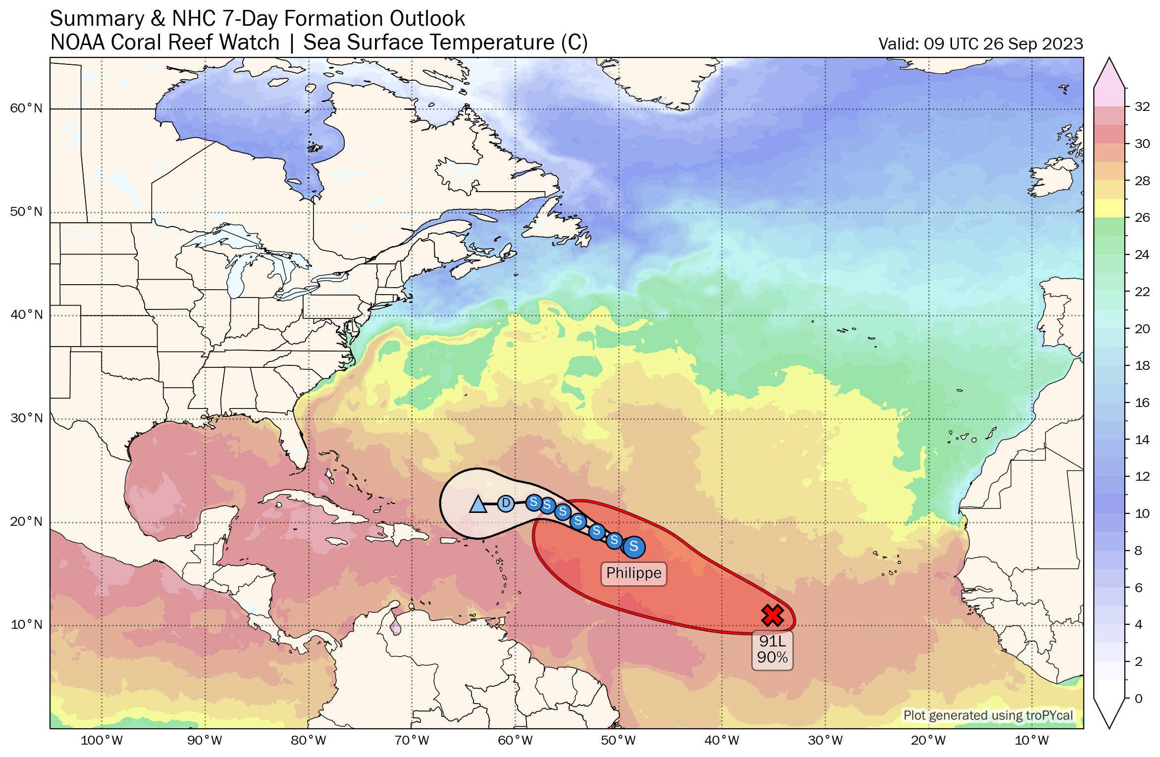
You can see from the map above how the track of Philippe is essentially trailed by the area of potential development from 91L, which is the red highlighted area. The intensity of each system will determine just how close it gets to the islands. The current thinking is that Philippe will dissipate north of the islands in the coming days. Invest 91L should take over as the better organized system, but even in the most extreme case, it would most likely pass north and east of the islands. Even if it did track farther south and west and closer to the islands, that would be due to a weaker system. So, it’s probably wise to keep watch on how this all plays out if you live in the northern Leeward Islands or Puerto Rico, but the vast majority of decent data seem to support a miss.
The medium range (days 6 to 10): Noisy near Florida
Early next week should be dominated mostly by what we see in the Atlantic. But as we get to the middle and end of next week, we have noise continuing to percolate in the modeling on either side of Florida. We’ve had some bizarre solutions printed out by modeling since the weekend, including systems backpedaling southwest from off the Carolinas to something in the eastern Gulf moving northeast across Florida and out to sea to some model solutions showing absolutely nothing whatsoever.
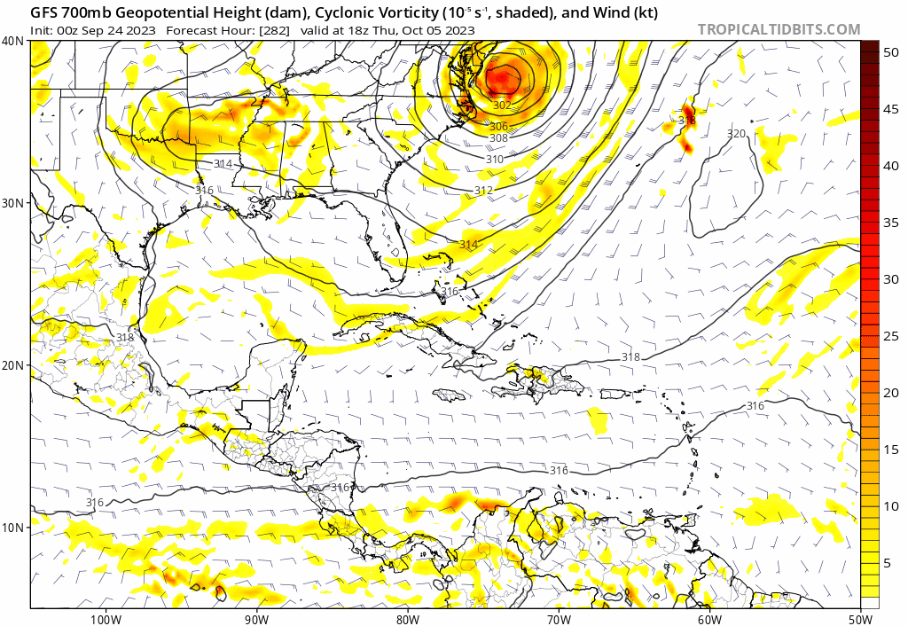
I think that’s an important element of this. Usually when you have this kind of inconsistency and only tepid ensemble model support, you have enough justification to be skeptical that anything will occur. So while I think this is certainly a region to watch in the days ahead, the most likely outcome is probably that nothing of note happens. We’ll obviously continue to watch to see what evolves in the days ahead.
Fantasyland (beyond day 10): Noise but no signal
We’ve seen no change in modeling since yesterday with respect to the extended range period. There are signs of potentially something in the western Caribbean or southeast Gulf, but there’s no signal whatsoever to what is there. In other words, I see some ensemble members of the various models showing me signs of development, but I see no consistency and no real consensus yet.
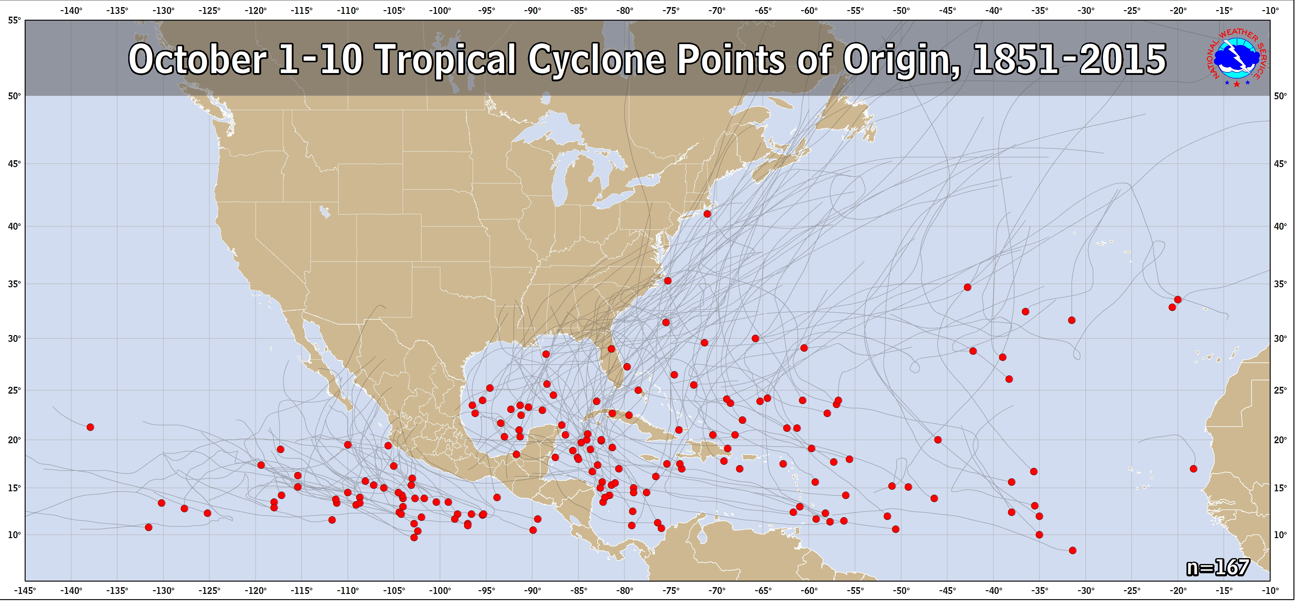
Climatologically, that’s exactly where you would be looking in early October. So it’s not a surprise that that is what we’re doing. But until we see any kind of signal in this soup, there’s little we can say beyond “it’s worth watching.” Especially for the eastern Gulf or northwest Caribbean.
On Space City Weather you noted that you think Hurricane Season is over for Houston. On here you note a possible disturbance in the southeast gulf/northwest Carribean.
If this forms is it highly unlikely to impact Houston?
Correct. We believe it would stay in the eastern Gulf.