In case you missed it yesterday, we had our first real non-tropical post in which we discussed the ongoing salt water intrusion issues in Louisiana related to low-flow of the Mississippi River. While today’s post functions as an outlook, we will also discuss the developing flooding situation for New York City.
One-sentence summary
Philippe and Rina will dance, with Philippe eventually taking over as the dominant system, lifting into the Atlantic, while today we also check in on flooding in New York City.
Tropical Outlook: Philippe & Rina dance, while the rest of the basin settles down
Philippe & Rina
These two. Tropical Storms Philippe and Rina are now unable to be dissociated from one another, as we are seeing the Fujiwhara effect play out in real time. The two storms will interact and probably repel one another, with Rina likely taking a backseat to Philippe.
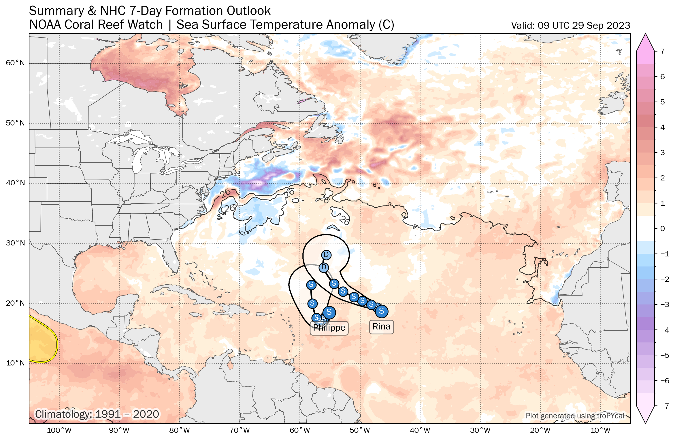
Basically, Philippe will stall, Rina will sling shot over the north side of Philippe, turn north and dissipate, and then Philippe will begin moving out to sea again. There has been a good deal of model uncertainty, particularly with respect to Philippe’s future intensity. And that is normal for a Fujiwhara interaction. When two storms engage like this and are this close together, inherent uncertainty increases, and that leads to a bit of forecast uncertainty. It’s becoming more likely however that Philippe becomes a stronger storm that pulls north, and I wouldn’t be to see the National Hurricane Center bump up their forecast intensity as it moves north into the open Atlantic.
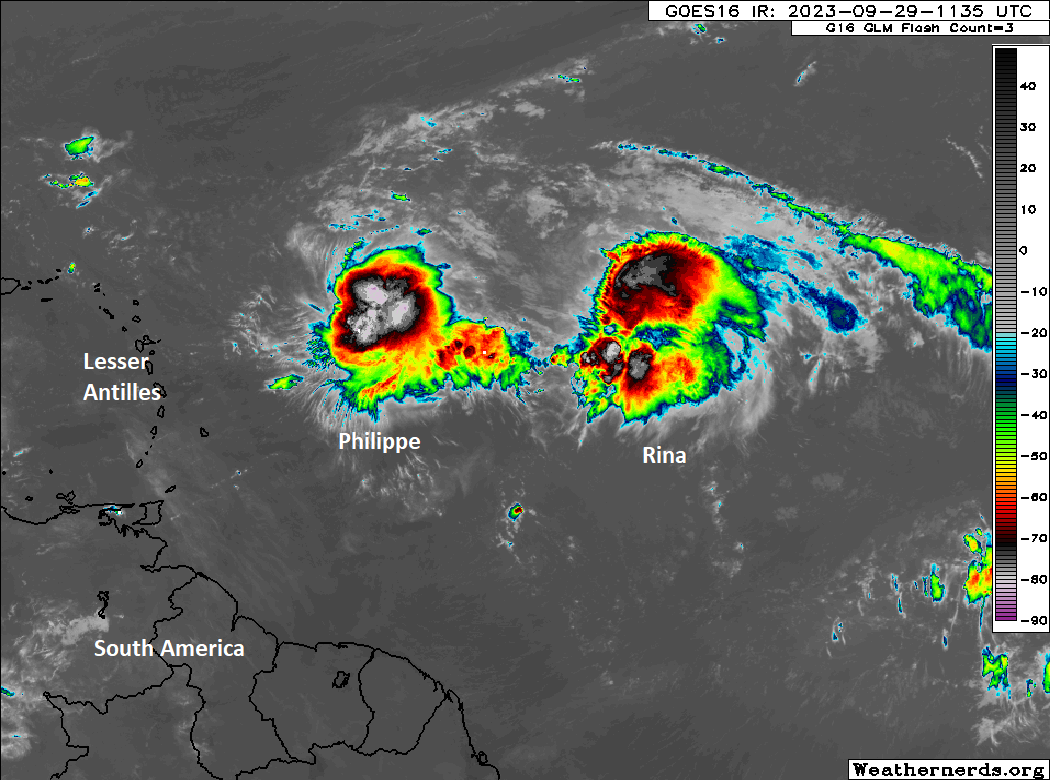
As we’ve noted through the week however, even in the unlikely event that one of these systems ends up in the islands, it will be on the lower end of intensity and unlikely to create too much trouble. But confidence seems to be building in a no-impacts scenario. Both of these systems should be on their way out by later next week.
What else is out there?
Throughout the week we’ve also told you a bit about potential upper low or weak tropical development off the Southeast coast next week. Support for that has faded as a pretty decisive autumn cold front sweeps across the Southern and Eastern U.S. later next week. Finally! The hope would be that this leads to quieter tropics for a time. The season is by no means over (though for the northwest Gulf and Cabo Verde region it probably is), not with record warm water temperatures out there, but the pace should finally slow a bit. We’ll have more on this next week.
Metro New York City flooding underway
A few flash flood warnings have already been posted for the New York City area this morning as heavy rains stream into the area. Most of the City outside of the Bronx has seen some flooding with 1 to 3 inches of rain so far and the potential for a good deal more to come.
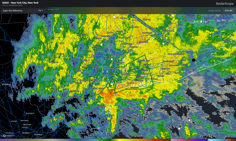
This should continue the flash flooding threat across northeastern New Jersey, New York City, Long Island, and southwest Connecticut. It’s likely that the heaviest rain will fall somewhere between Islip on Long Island and Newark, NJ. The worst conditions will be this morning into early afternoon with gradual improvement this evening.
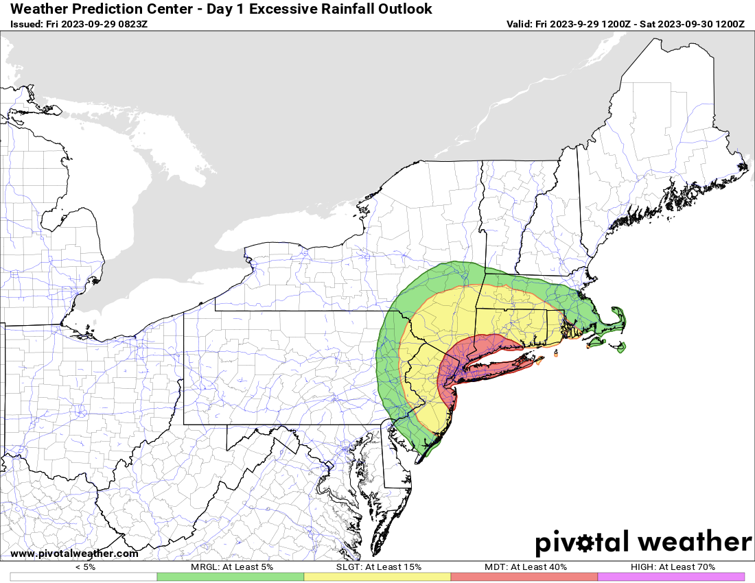
Some places could see in excess of 3 or 4 inches more rainfall which will likely lead to considerable street and some local creek or river flooding. Be safe in the New York City area today, and if you’re traveling that direction, be prepared for some delays and hassle.
Matt- we have a trip planned to go to Antigua and Barbuda next week Wed 10/4 – Mon 10/9 – when you say should be out by later next week, will we still be in uncertainty when we are on our way on the 4th? Thanks!!
Unlikely I think. These should be out of the way by then. Or at least on their way out east of the islands.