One-sentence summary
Invest 95L is expected to become a depression or tropical storm soon as it comes west across the Atlantic, likely passing just north of the Caribbean islands, though it merits some continued watching.
Invest 95L
On satellite, Invest 95L is beginning to slowly get itself together. It has thunderstorms that have persisted, indicated by the brighter colors on the satellite loop shown here. It’s got a little swirl to it, but probably not quite enough to indicate a surface low is present.
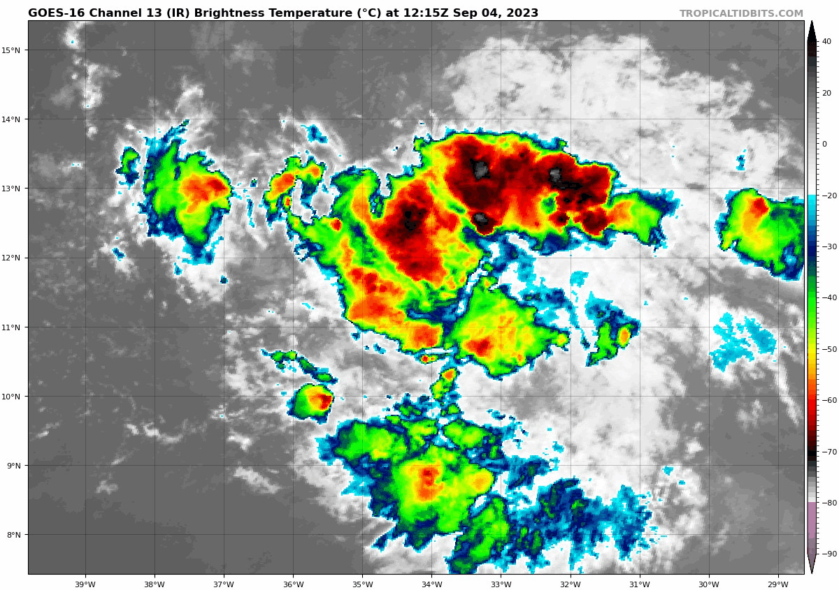
But it’s getting there, and that’s the takeaway today. The National Hurricane Center has boosted odds of development to 90 percent over the next several days. And this seems to be in line with almost all model guidance that shows this developing.
Invest 95L’s track
The track and intensity forecasts are somewhat intertwined. As is often the case, a stronger storm will be more apt to get steered poleward, or toward a recurve north. A weaker storm won’t get as much latitude. So the speed at which 95L organizes is somewhat important. Given that it is already starting to establish some structure, my thoughts today lean toward the stronger outcome and a faster recurve. That said, this remains a very close call in the islands.
Models have actually been in very good agreement through about day 4, which gets 95L some decent latitude. By day 5 (shown on the Euro ensemble mean below), 95L should already be near the same latitude as Puerto Rico. As long as that occurs, it should miss the islands to the north.
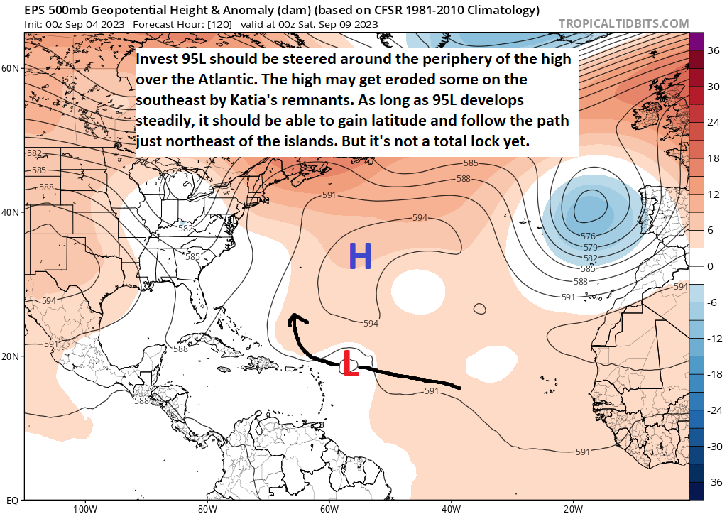
So we believe that 95L will stay north of the islands, but it will be close. Of the many model ensemble members from the GFS, Euro, and Canadian models, about 90 to 95 percent or so stay north of the islands.
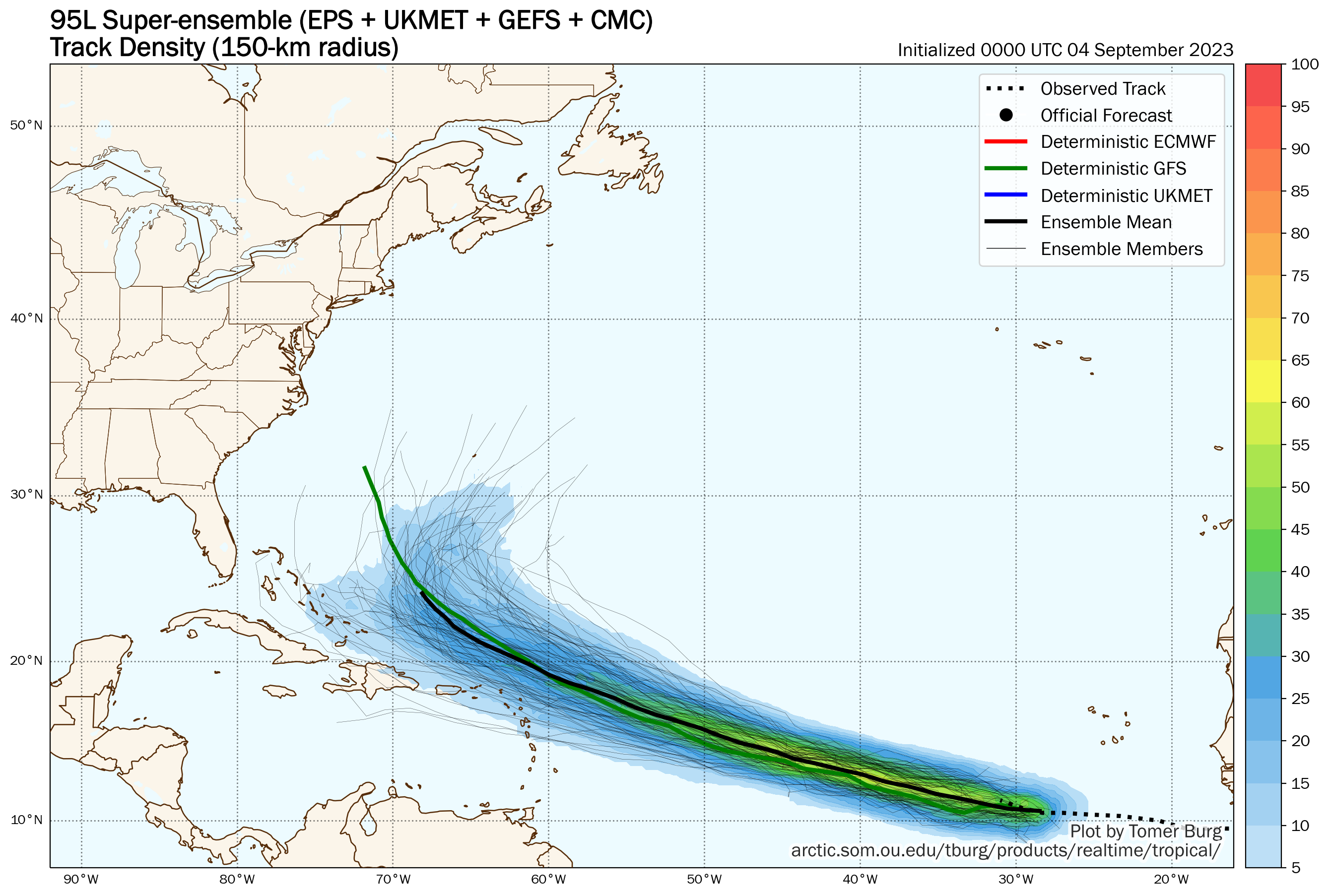
So the odds are generally good for minimal land impacts as 95L comes west. This is good, as the majority of model guidance shows this becoming a major hurricane in about 4 days. But still, you don’t rest entirely with 5 to 10 percent bringing it much closer. We’ll keep watching.
Beyond the islands
Once 95L (or likely Lee by that time) gets north of the islands, where it goes is a bit of an open question. Will it truly recurve north and threaten Bermuda or turn out to sea? Will it turn north but then turn back more west-northwest and threaten the Bahamas or the U.S. coast? How will the cooler water recently upwelled from Franklin and Idalia impact it if it comes north? It’s too early to say anything with confidence here, so we’ll leave it at that for now. Stuff for us to watch this week.
Elsewhere
We may see another system attempt to develop and basically follow in Katia’s footsteps way out at sea in the open eastern Atlantic. But aside from that and 95L, truthfully things look quiet, a potentially decent outcome for mid-September in the Atlantic.
I am surprised major typhoons aren’t covered here. One super typhoon hit Hong Kong recently and another is around Taiwan.
If you spent the 30 seconds you took to write a complaint and instead read the about you would know why that is
“This website is dedicated to covering tropical activity in the Atlantic Ocean, Caribbean Sea, and Gulf of Mexico”
Correct. It would be difficult for us to run this part time while covering everywhere. We will branch out as we’re able. Unfortunately, the system hitting Hong Kong happened rather concurrent to Idalia, so.
Good graphics!
😊