One-sentence summary
Invest 95L is very close to becoming our next tropical depression or storm, and it is expected to rapidly intensify this week passing just north of the Caribbean islands and worth keeping an eye on in Bermuda.
Invest 95L
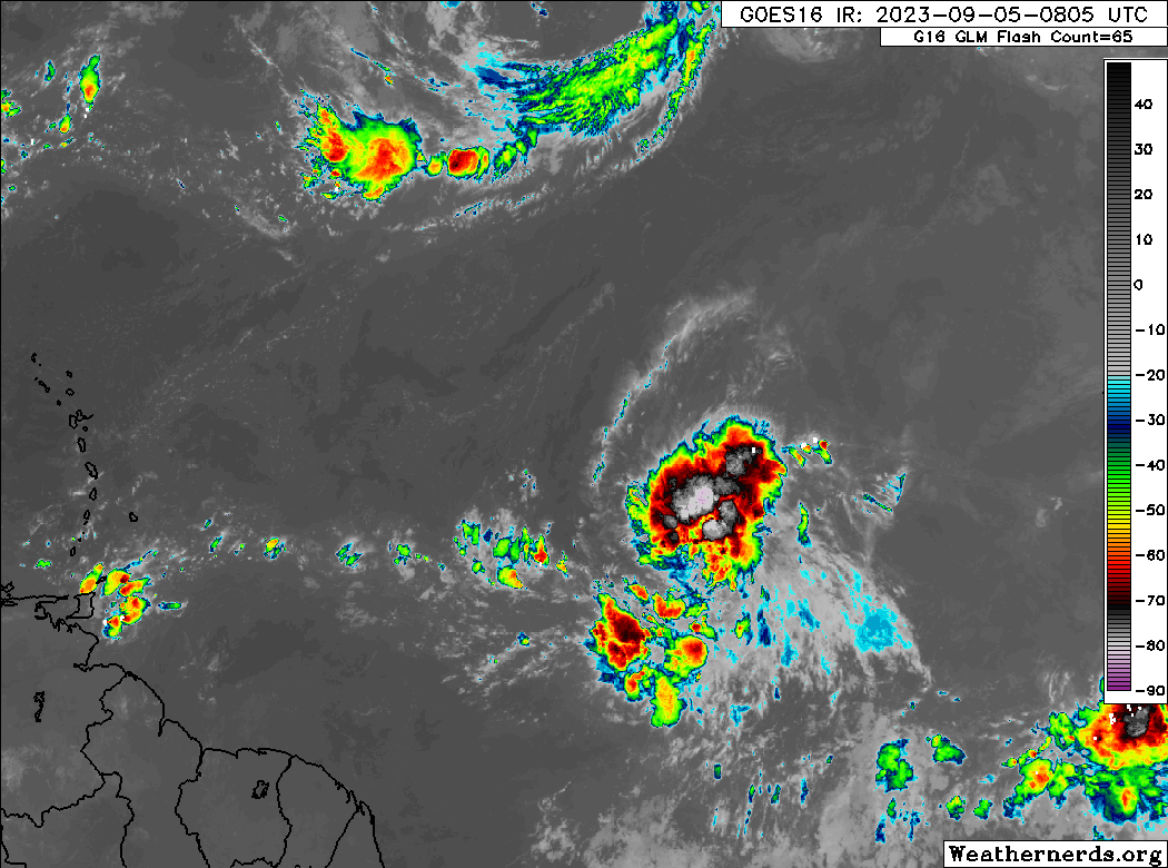
Invest 95L is close to becoming a depression or tropical storm this morning. It’s got plenty of thunderstorm activity associated with it, and it’s beginning to show a little “twist” now on satellite loops. I would expect Tropical Storm Lee to form before day’s end.
We expect this system to go off to the races over the next few days. Thankfully, that should allow it to gain the latitude needed to bypass the islands to the north. Because I have to tell you, the intensity forecast for 95L is one of the most impressive I have ever seen for an Atlantic tropical system.
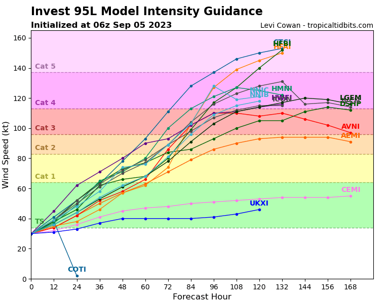
For those that are astute watchers of hurricane models, you’ll know the HWRF model tends to bias to the high side with intensity, and we’ve seen some wild forecasts over the years from that one. But seeing essentially all the tropical models close to or all aboard the Cat 4 train with this one from pre-inception has been something to witness. Expect to see quite a show in the Atlantic this week.
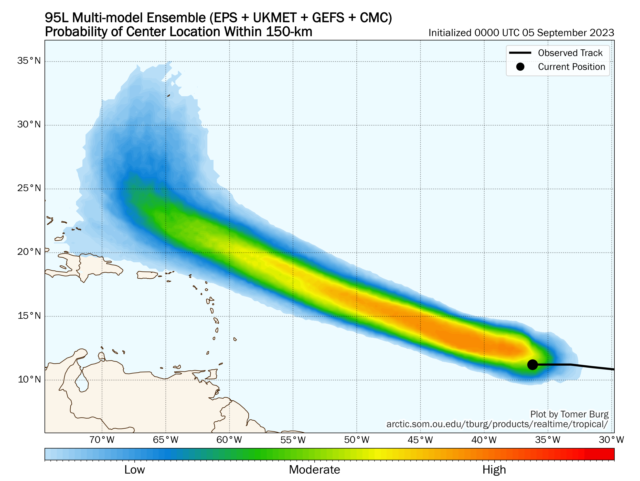
Assuming we have the next 72 to 96 hours mostly baked in, the biggest concern now is what will happen once this thing turns. Will it split the gap between the Carolinas and Bermuda and hook back out to sea? Will it turn sooner than that and actually go east of Bermuda? Or will Bermuda be in the way? The quick intensity gain expected this week is great for the Caribbean, but it may be precarious for Bermuda. As the system grows and rounds the periphery of the ridge, it will also probably erode the western flank enough to turn from northwest to north fairly quickly. You can see hints of that on the map above. From there it becomes a game of exactly where that happens and how much space it has to erode the northwest periphery of the ridge to turn northeast and ideally away from Bermuda. It will be close. Hurricane Sam in 2021 may be a decent analog to this one.
Either way, at this point, if you’re in Puerto Rico or the Virgin Islands, keep tabs on this to make sure it does what is expected. If you’re in Bermuda, watch closely later this week to see how it trends. If you’re on the U.S. Eastern Seaboard, another round of rough surf and rip currents may be on the menu next week.
Elsewhere
Things look mostly uneventful in terms of land impacts over the next 7 to 10 days. We have another wave emerging off Africa today that has a chance to develop over the next 5 or 6 days way out in the eastern Atlantic.
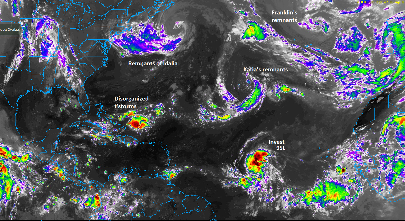
The remnants of Hurricane Franklin are back on the map today, as it circles back south to a spot in between the Azores and Portugal. Significant development seems unlikely, but whatever is left of this could end up near Iberia later in the week or next week.
Otherwise, that’s about all. The Gulf and Caribbean look quiet for the foreseeable future.
Later this morning, we’ll have a post looking at how we stand as we arrive at the peak week of hurricane season. How have seasonal forecasts done so far? And what do we expect from the rest of the season? Look for that around 11 AM ET/10 AM CT.
What’s prevent the current 95L from getting into the gulf?
It’s intensity will allow it to gain latitude quickly and follow the periphery of high pressure over the Atlantic. The Gulf is basically blocked right now.
Is there anything you’re looking for with AL96L, the new one, that would give it a way to find the Gulf?
Nope. This one will probably go straight northwest and meander for a bit way out in the eastern Atlantic.