As we zero in on Monday’s solar eclipse, we have one clear area emerging as probably the best for viewing. And one area remains the most pessimistic. The forecast remains fairly fluid elsewhere. We explain and tidy up the snow forecasts today into Friday below.
Headlines
- Winter weather will continue impacting the western Great Lakes today, while snow gets going in New England later, lingering into tomorrow.
- Watching some severe weather and fire weather potential this weekend.
- Eclipse weather continues to look most favorable the farther north you go, with a solid bullseye between Plattsburgh, NY and Fredericton, NB.
Eclipse weather still looking best in the Northeast
Here’s our daily eclipse forecast check in. The biggest change today is that conditions look a little better for northern Arkansas, Missouri, and southern Illinois. Cloud cover probabilities have continued to drop some there.
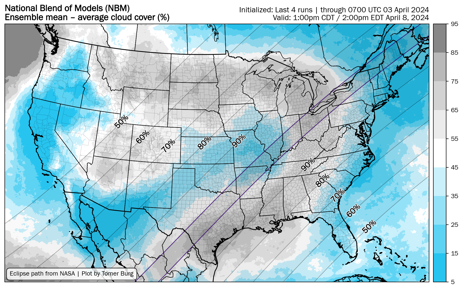
Working from north to south: It still looks great in Canada, Maine, and back through Watertown, NY. Conditions get sketchier for western New York into the Midwest before likely improving some across Illinois and Missouri.
For those of you in Texas, the news remains pessimistic. The highest odds of low cloud coverage (the best conditions) are probably located near Dallas or Texarkana. As you back toward Austin, San Antonio, and the Rio Grande Valley, the cloud coverage is in the 60 to 80 percent range per forecast modeling right now.
Houlton, ME, Sherbrooke, Quebec, and Burlington, VT/Plattsburgh, NY look like the safest options today. This continues to evolve, so look for more updates tomorrow and Friday.
Quick weather hits
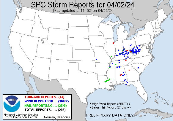
Thankfully, the higher-end portion of the tornado risk yesterday does not appear to have materialized. Kudos to the folks at the SPC for indicating in their discussion yesterday that it was rather conditional. If you read their discussion in the morning, you understood why they did what they did and why the forecast would (or would not) reach its potential. This is why we attempt to focus on facts not fear-mongering here. Is it sexy? No, but it works.
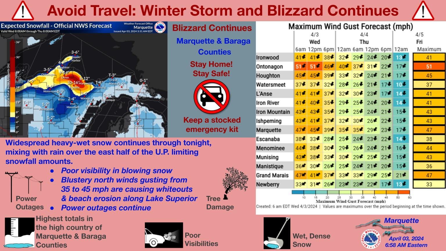
Heavy snow will continue in the U.P. of Michigan, where Blizzard Warnings are in effect for Marquette. Snow totals of 1 to 2 feet for the higher terrain just south of Lake Superior are expected.
Snow continues to be on the way for Canada and New England. That develops this afternoon, and the snow total forecast has even increased a hair in spots in New England.
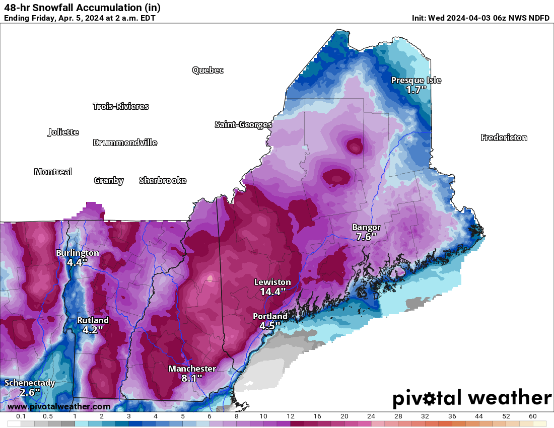
Look for that continue into Thursday before winding down. For southeastern Canada, expect a wide swath of 10 to 20 cm of snow from Sherbrooke and southern Quebec into the Ottawa River Valley back toward Sudbury, Ontario. Higher amounts will be possible there, in the Cape Breton Highlands, New Brunswick, the Gaspe Peninsula of Quebec and the north shore of the St. Lawrence, perhaps in excess of 25 cm.
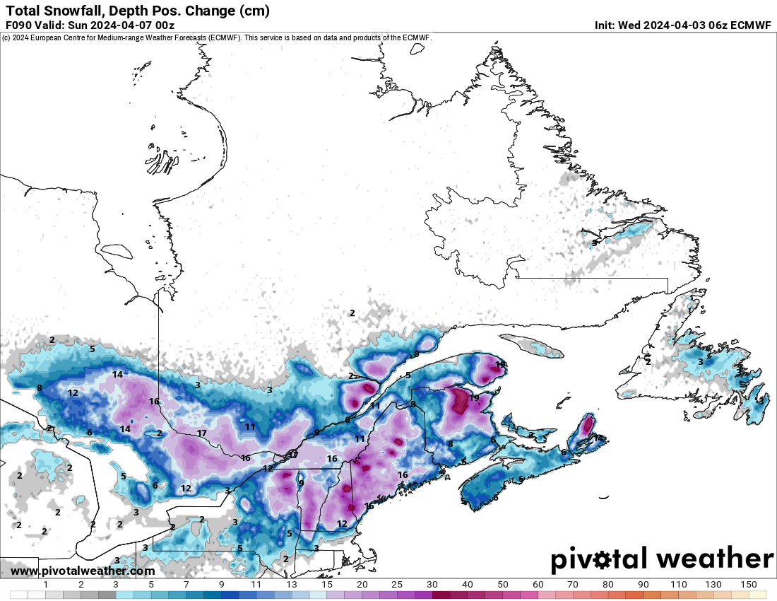
In addition to heavy, wet snow, gusty winds will be likely, capable of producing sporadic power outages in this region. A major snowstorm for April.
Looking ahead, the next weather items to watch will be severe weather risk in the southern Plains on Saturday, along with some critical fire weather conditions in the Texas Panhandle and portions of New Mexico. More on that tomorrow or Friday.