One-sentence summary
Lee’s forecast is mostly unchanged today as we watch it forecast to bring significant surge to Nova Scotia and widespread wind and rain in New England and Canada.
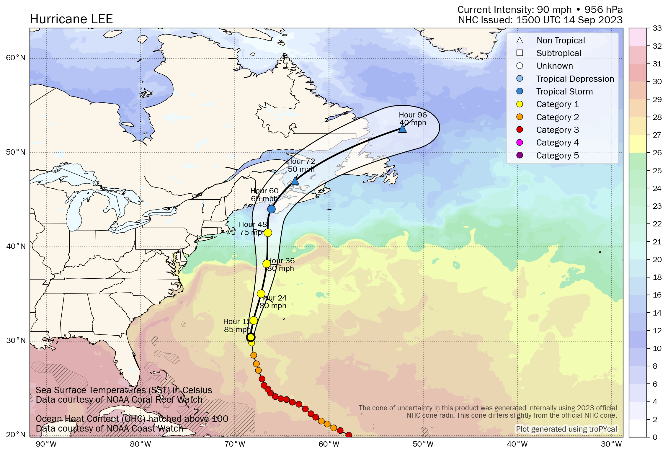
Hurricane Lee: 85 mph, moving N 15 mph
What’s changed since this morning?
Tropical Storm Watches have been upgraded to Warnings for Nantucket and Martha’s Vineyard, as well as for the coast between Westport, MA and the Canadian border. Hurricane Watches remain in effect for a portion of Maine coast, a portion of the New Brunswick coast, and a portion of Nova Scotia. Tropical Storm Watches were expanded east a bit in Nova Scotia to Point Tupper.
The Storm Surge Watch for Cape Cod and the Islands was dropped, and the surge forecast lowered to 1 to 3 feet.
Lee’s wind field has grown to 345 miles from the center.
Lee’s impacts update & focus on New Hampshire, Maine, and Canada
Earlier today we talked about Massachusetts more in depth. Let’s focus farther up the coast for New Hampshire and Maine, as well as in Canada.
In general, winds are expected to be about 40 to 60 mph along and west of the track of Lee for eastern New England. Gusts of 60 to 80 mph will be possible just offshore of Maine. We could see higher gusts capable of bringing down trees in the Presidential Range or White Mountains in New Hampshire, as well as the higher peaks in the lakes region of Maine, Kennebec Valley, and Highlands. I suspect there will be some impressive wind gusts atop Mount Washington, as well as atop Katahdin.
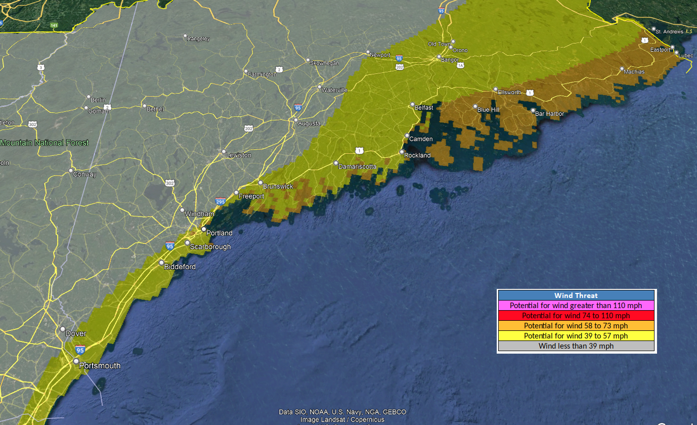
Higher gusts will also be possible along the Midcoast and for the coast and mainland of Downeast Maine.
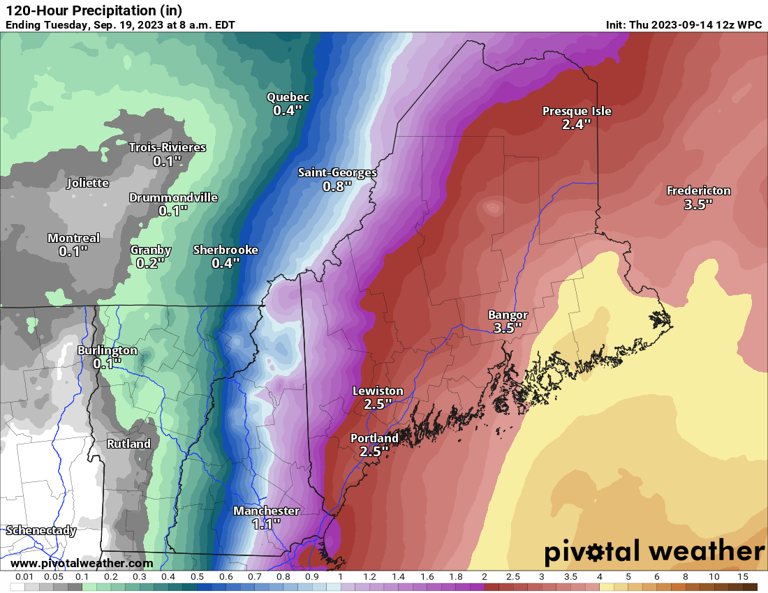
The rain forecast for Maine is a pretty uniform 1 to 3 inches for most of the state, with higher amounts basically south and east of Bangor, where Downeast could see 4 to 5 inches or so. Expect about an inch or less in New Hampshire, except along the coast or near the Maine border. Vermont will probably see clouds and some lighter rain. Expect heavy rain to impact New Brunswick as well as Nova Scotia too with 3 to 6 inches (75-150 mm).
In terms of timing, look for tropical storm force winds to arrive Friday evening in southeast Massachusetts, just before sunrise Saturday on the North Shore of Mass and New Hampshire, Saturday morning for southern Maine and the Midcoast, and Saturday afternoon from Downeast into Atlantic Canada. Rain should spread southeast to northwest along the entire coast from Rhode Island through New Brunswick on Saturday morning after 12 AM or so. Nova Scotia may see rain begin late Saturday afternoon.
Note: The rain today in Nova Scotia, PEI, and New Brunswick may be a predecessor rain event (PRE) ahead of the hurricane. We’ve seen as much as 30 mm in spots from this rain, especially near Digby.
I remain concerned about surge impacts in both the Bay of Fundy and along the Nova Scotia coast in particular. The combination of high waves and high tides and surge will likely cause coastal flooding. Per Environment Canada, the most likely area for significant impacts is the Atlantic coast of mainland Nova Scotia. Rough seas and flooding issues are likely in the Bay of Fundy and perhaps to the north of Nova Scotia over the Gulf of St. Lawrence or Northumberland Strait.
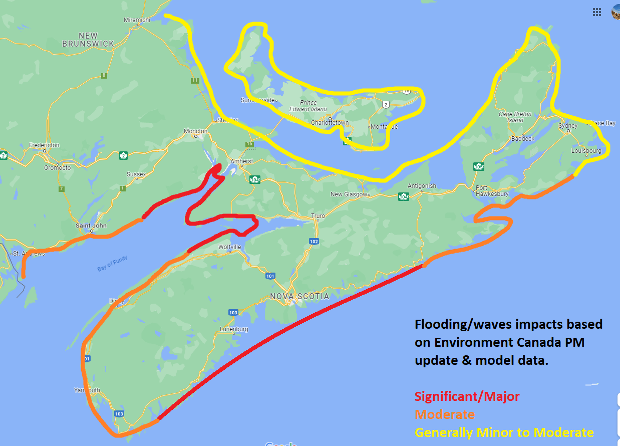
The second high tide cycle on Saturday, the one during the evening hours is likely to be the most severe one in Nova Scotia. Flooding is likely between Queens County and Halifax County. Water levels may be up over 3 feet (1m) above high tide levels, and a storm surge warning may be required for that time. I still want to watch the Bay of Fundy to see how much water gets funneled in toward the Isthmus of Chignecto.
We will have more details and info tomorrow morning at the usual time, around 8 AM ET.
What about Invest 97 L? It looks like it is headed directly for the U.S.
Looks like a fish storm
https://www.weathernerds.org/tc_guidance/storm.html?tcid=AL97
Correct…97L is destined for out to sea, though Bermuda may need to watch.
Such great, in-depth information – the Eyewall is superlative! 🌟🌟🌟