In brief: There are three items in the Atlantic today. Dexter is heading out to sea. A low pressure system may develop off the Carolina coast this week, keeping wet weather in play for the Southeast. A third area emerging off Africa this week has some chance to develop, but it’s getting one model with a poor track record excited.
Atlantic tropics
We have our fourth storm of the hurricane season today, thankfully not a threat to land. We’ve also got some other business to attend to in the basin. So, let’s get started.
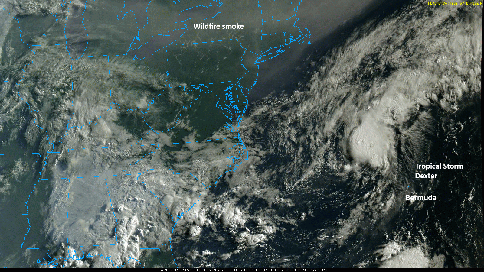
Tropical Storm Dexter
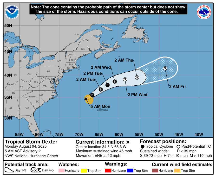
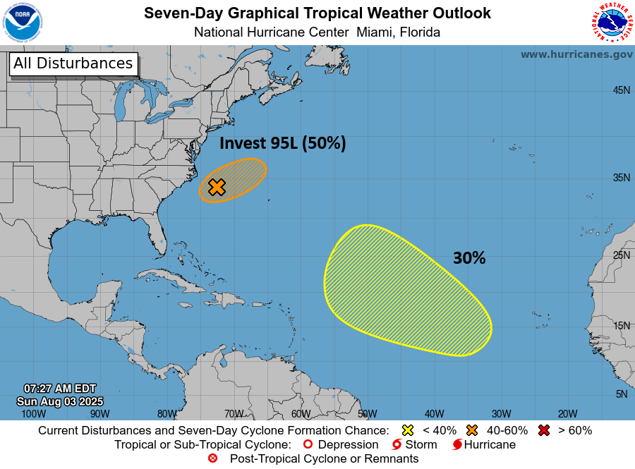
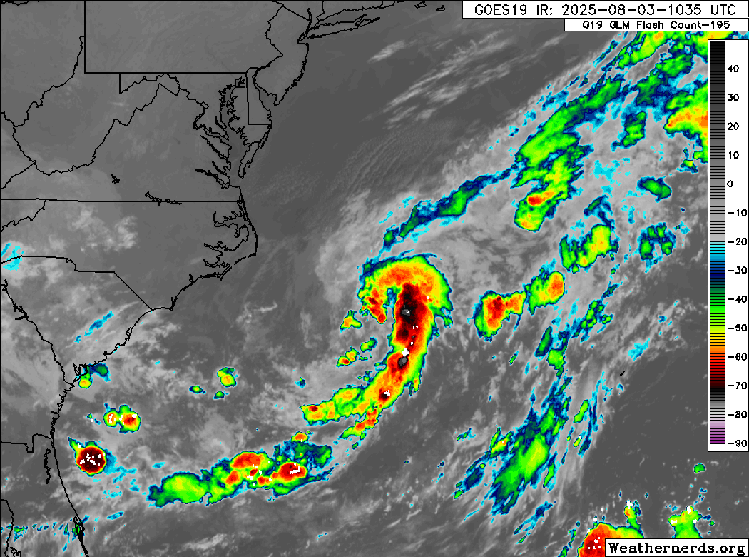
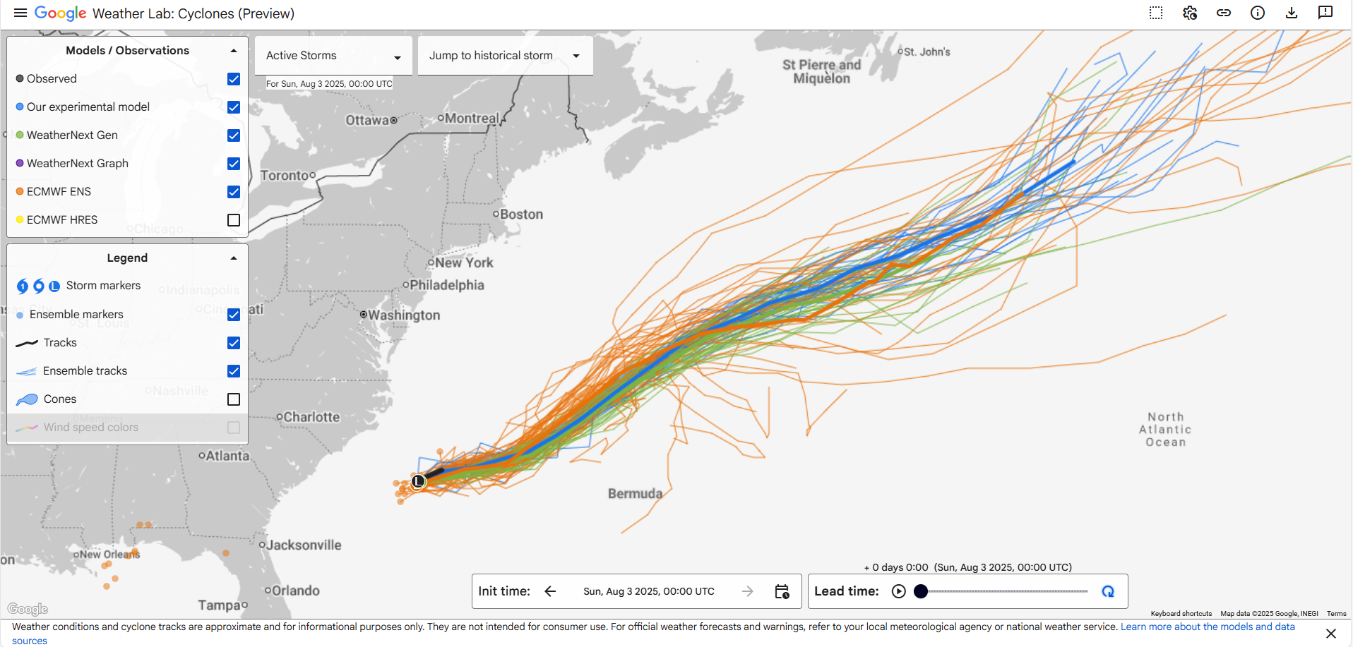
Invest 95L became Tropical Storm Dexter late yesterday. Dexter is already exiting stage right, moving east northeast around 10 to 15 mph. By the end of the week, Dexter should be post-tropical. Eventually, this will probably end up in the British Isles, either as part of another typical European storm or as a passing disturbance. Either way, it’s mostly just a curiosity than anything else.
Deep Atlantic area of interest
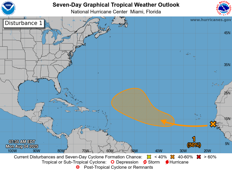
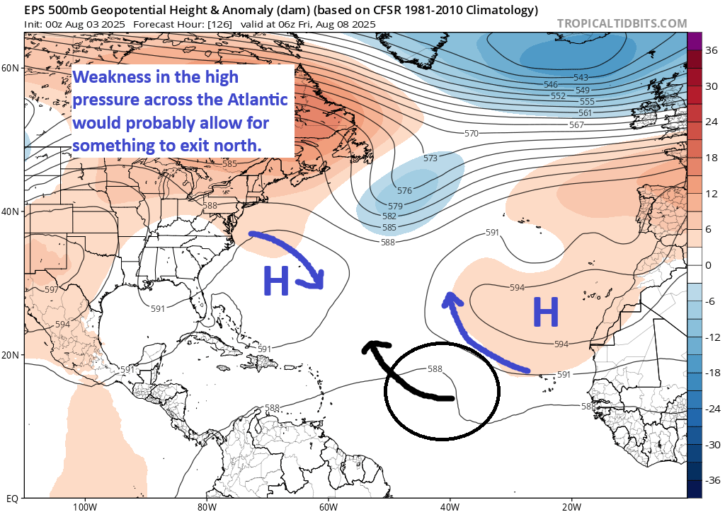
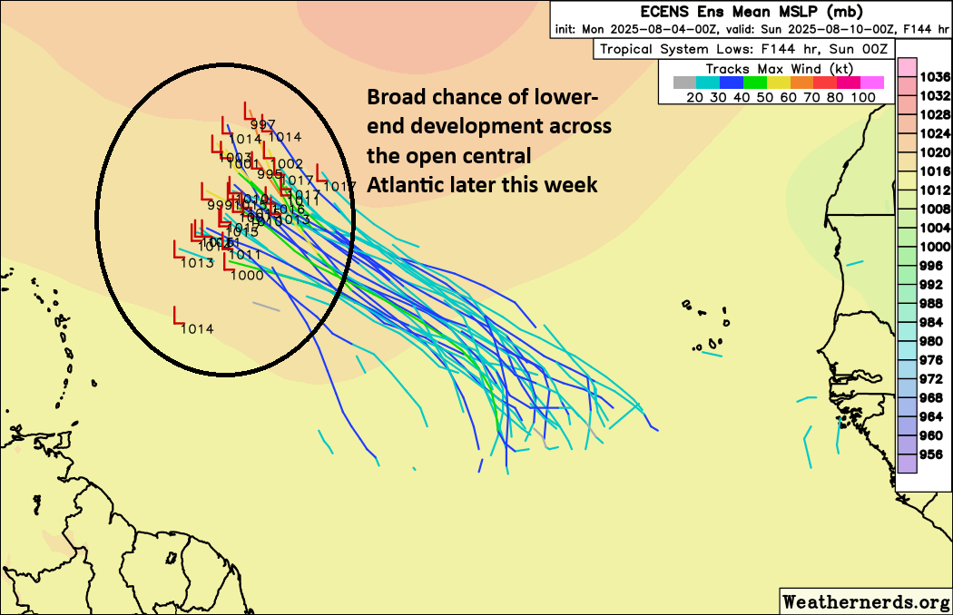
A tropical wave emerging off Africa today carries a 50/50 chance of developing as it moves into the open Atlantic this week. Currently, there is little to see with this tropical wave, as it’s basically producing no shower or storm activity. However, by the time we get to later Tuesday or Wednesday, we do expect this thing to fire up some. From there, model guidance is in good agreement on decent odds of development. The European ensemble is probably the most bulled up about this one (see below), but the various AI modeling and ensembles also support development.
Some GFS operational model runs have gotten a bit spicy with this, keeping it middling into next week before trying to push it due west toward the Southeast as a strengthening system. There’s not a whole lot of additional support for this scenario, so the GFS appears to be an outlier in this regard. The reason it seems to be doing this is similar to what we described in yesterday’s post, about a “weakness” in the ridge over the Atlantic that would allow the system to turn north and exit. The GFS keeps the system fairly weak, which would make it a little less likely to turn north into the weakness and out to sea. Then, as the system it strengthens, it rebuilds the ridge to the north, basically forcing it to continue due west or northwest toward the Southeast.
The timing of this diversion from the overall consensus view of out to sea seems to be in the Sunday through Tuesday timeframe, so we’ll get a fairly quick resolution to this through the week as the overarching weather pattern clears up. I suspect we’ll have a good idea if this is an actual Southeast concern as the GFS operational suggests by midweek. Historically, the GFS does not have a good track record when going it alone in scenarios like this, so we’ll keep an eye on it but we’re far from being concerned about it at this time.
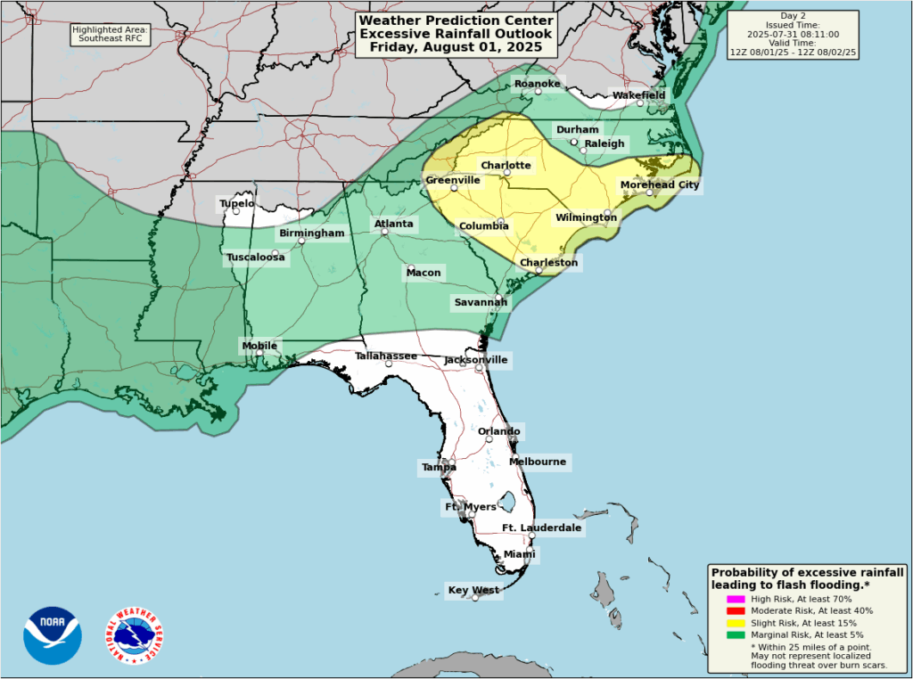
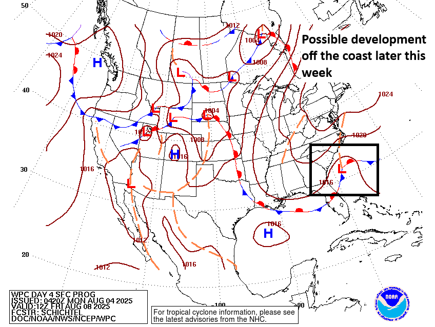
Closer to home
Meanwhile, a newer 30 percent area got drawn yesterday afternoon off the Southeast coast.
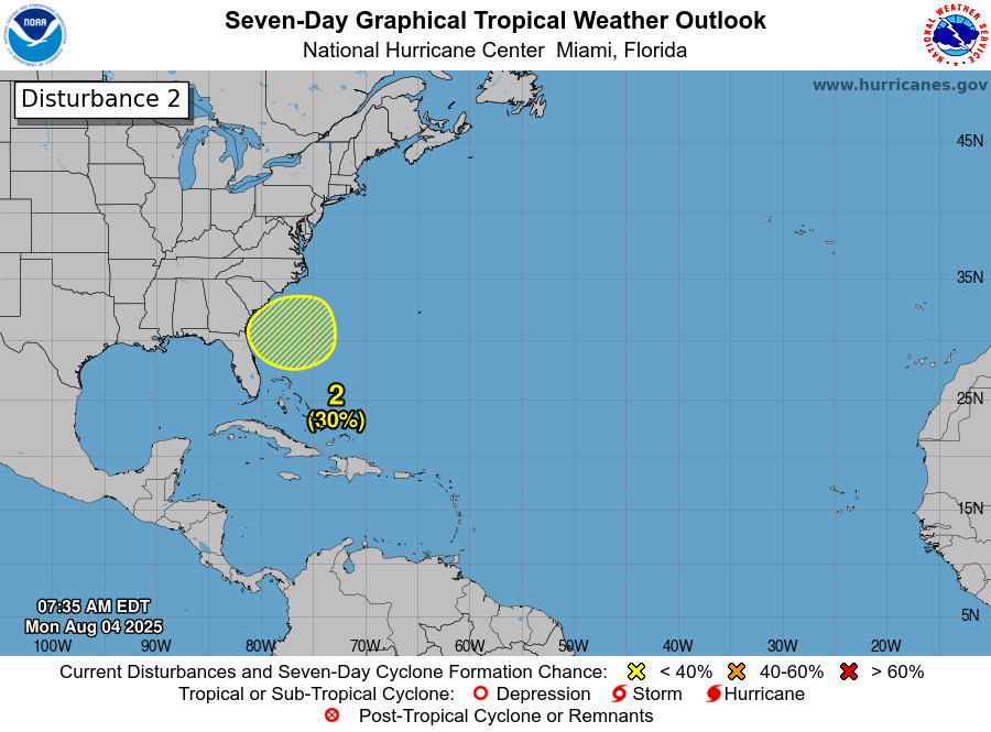
Behind Dexter there is still a remnant stationary front off the coast of the Southeast. Over the next few days, we’re probably going to see a weak area of low pressure develop along that remnant boundary. Unlike Dexter, this won’t get whisked out to sea. Rather, it looks likely to just kind of sit and spin for a bit.
To be honest, I’m not super concerned about significant development here. However, this may make for a somewhat dreary week along the Carolina coast. Rain totals may begin to add up some in this area as well through the week.
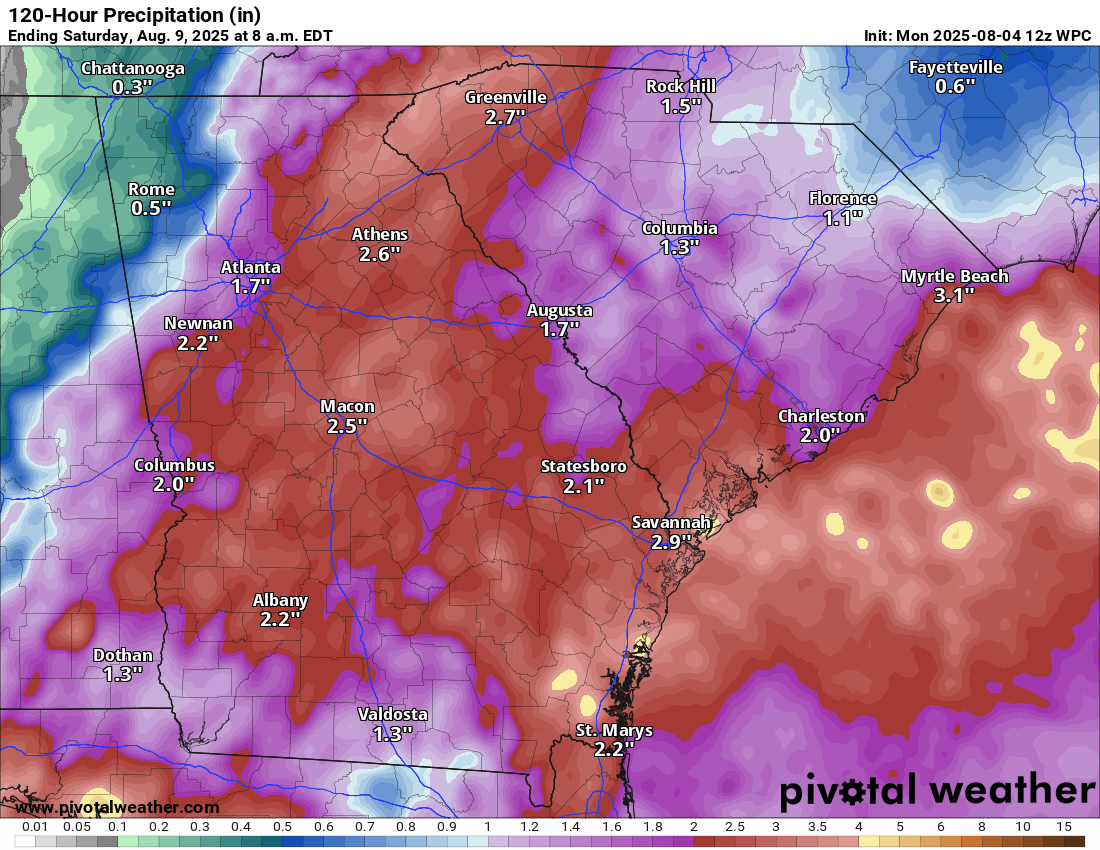
So overall this is worth keeping tabs on, but it is probably not a serious concern.
There’s more to discuss non-tropics, but we’ll save that for later or tomorrow.