Headlines
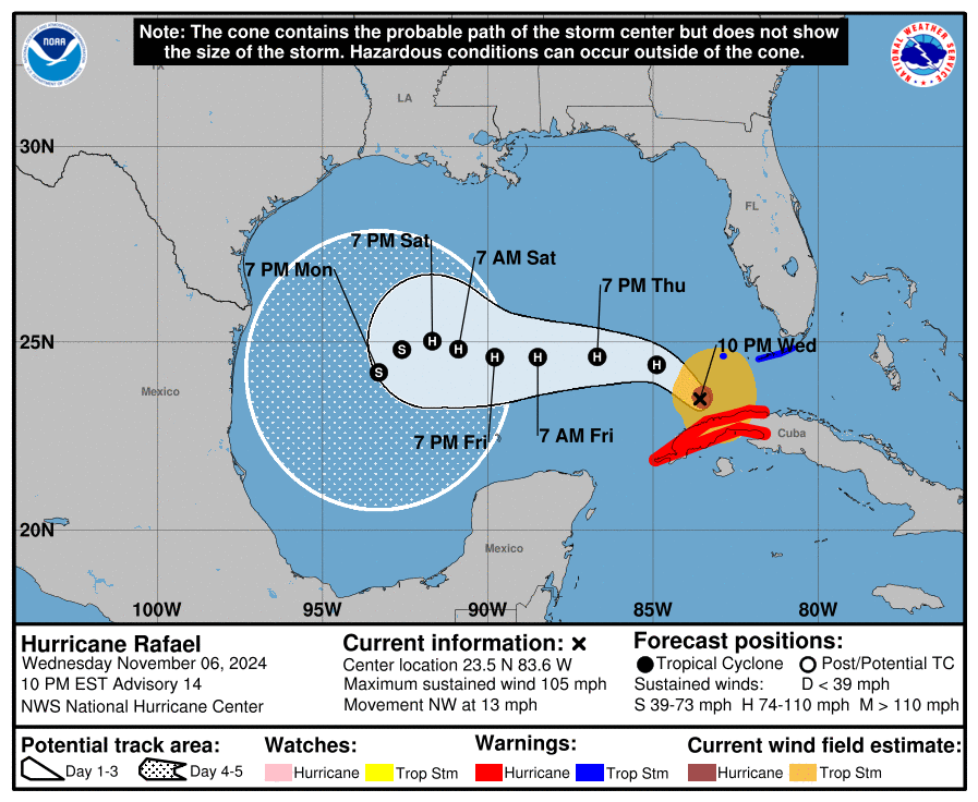
- Hurricane Rafael briefly attained 120 mph intensity this morning, matching Hurricane Kate from 1985 as the strongest November Gulf hurricane on record.
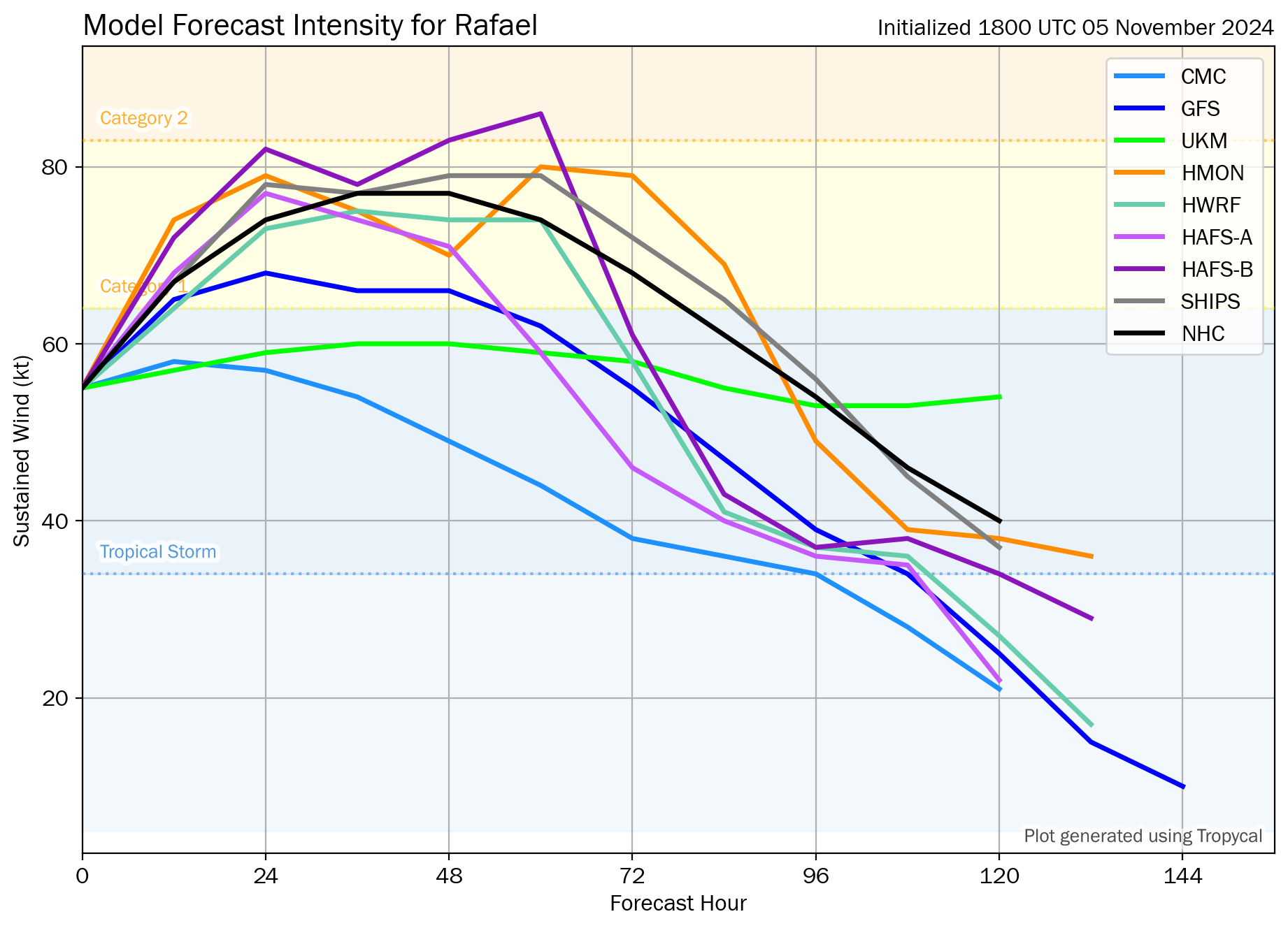
- It now appears to have stabilized and should weaken somewhat as it tracks west, then north, then probably east and south, decaying on the way.
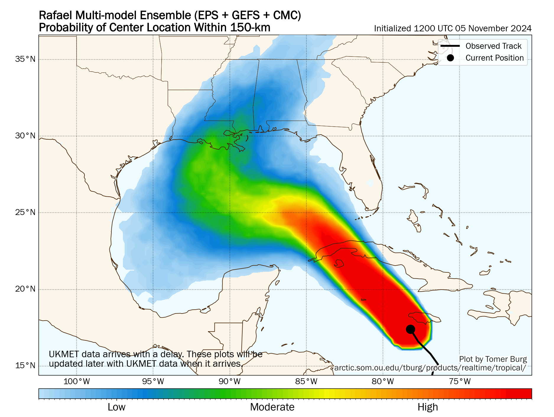
- While a track north toward the Gulf Coast cannot be entirely ruled out, even the models that do this are in good agreement on substantial weakening between now and then, and even in a worst case scenario, impacts are likely to be minor.
- Regardless, rip currents, rough seas, and minor tidal flooding is possible this weekend between Texas and the Florida Panhandle.
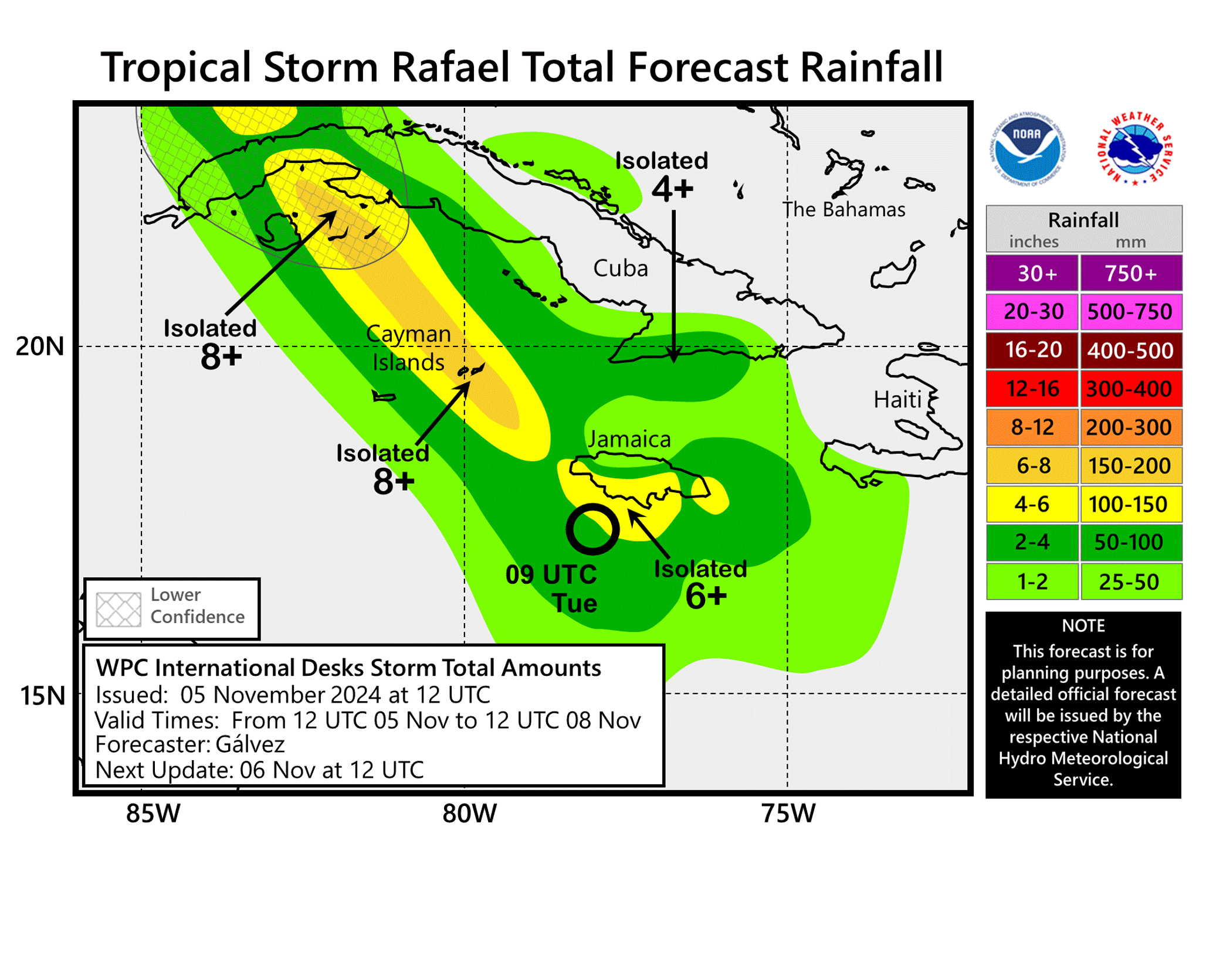
- Another system is unlikely north of the Caribbean islands, but locally heavy rainfall is possible between Puerto Rico and Cuba this weekend.
Rafael the adventurer
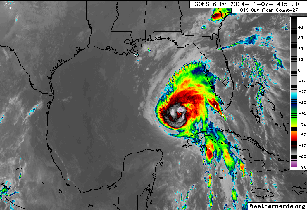
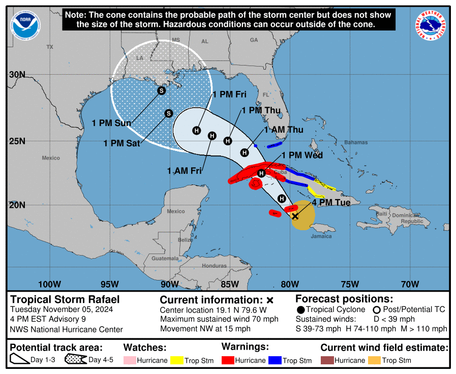
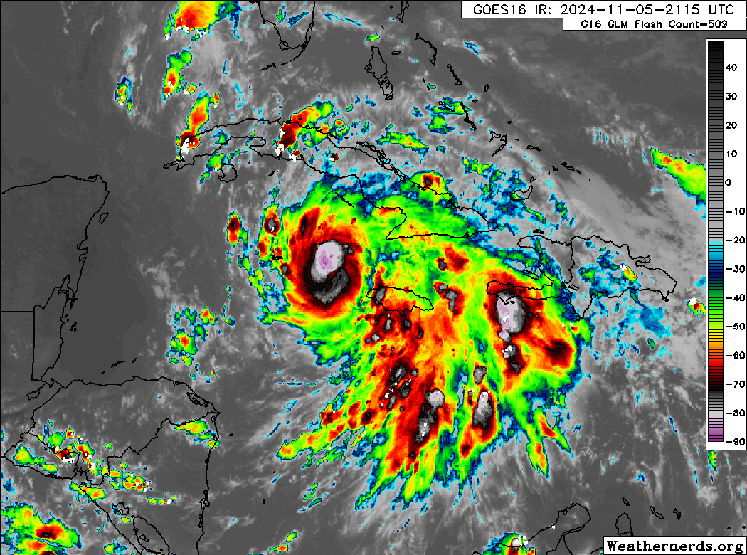
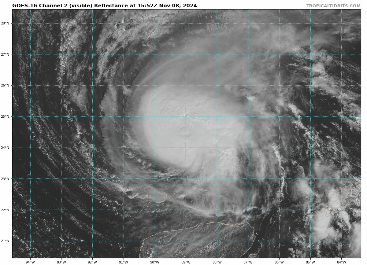
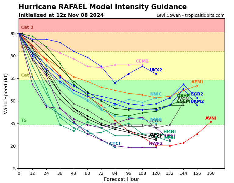
Hurricane Rafael is certainly a meteorological oddity given the time of year and its intensity. As a 120 mph category 3 hurricane this morning, it became the strongest November hurricane in the Gulf since 1985’s Hurricane Kate, which also matches the strongest November Gulf of Mexico hurricane on record.
Rafael is now weakening again, sort of, and it should continue to do so over the next couple days. We’ll see if Rafael has one final burst available to hold or strengthen further, but given model guidance and the extremely hostile environment it’s moving into now, this seems unlikely. But, for now at least, this is clearly still a fairly potent hurricane.
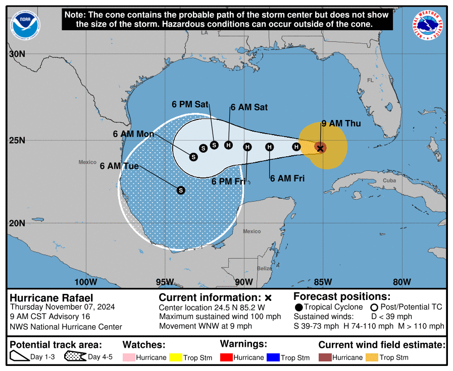
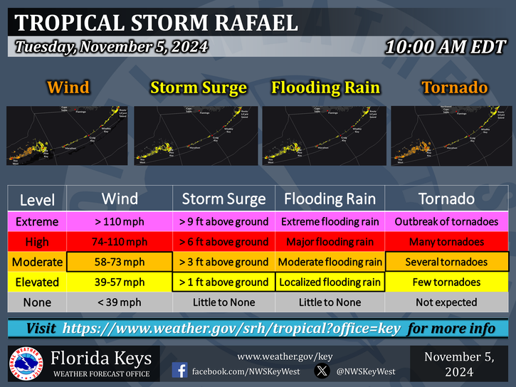
Rafael is a bit diminutive, more than it appears from satellite. Tropical storm force winds only extend out about 90 miles right now, with hurricane force winds only around 30 miles from the center. That’s one reason why we aren’t especially concerned about significant impacts far away from the storm. Still, there are coastal flood advisories, rip current advisories, and high surf advisories posted for portions of the Gulf Coast between Florida and Texas. If you’ll be spending a weekend at the beach for Veterans Day, please be careful in the water.
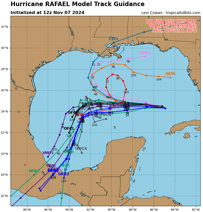
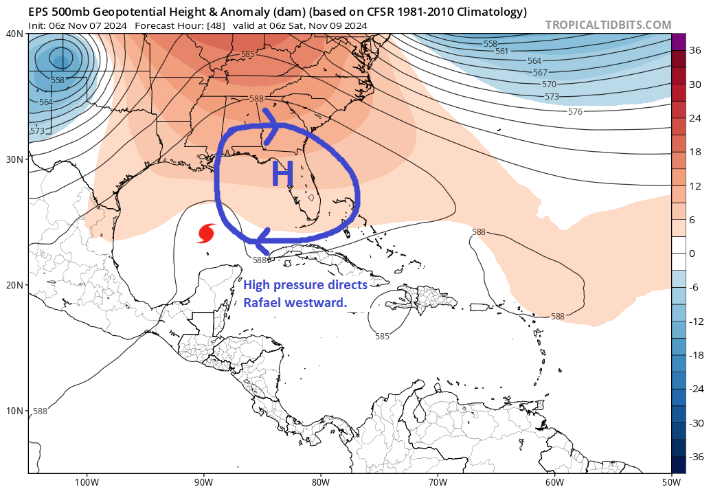
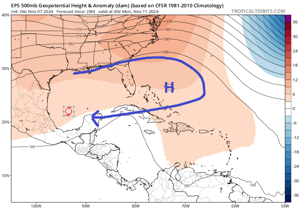
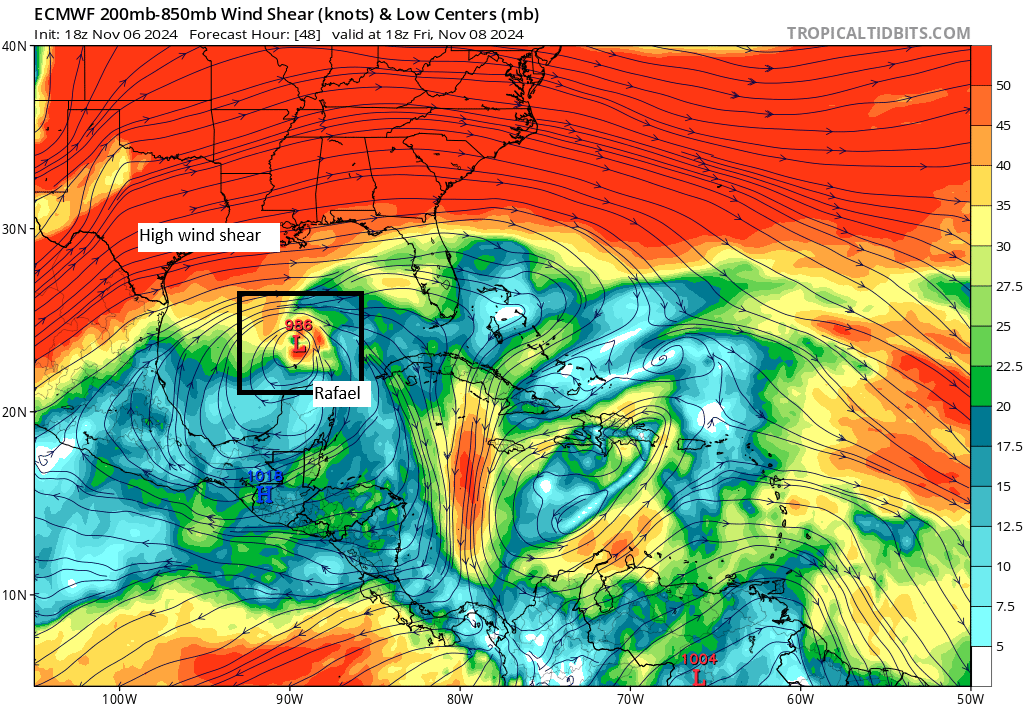
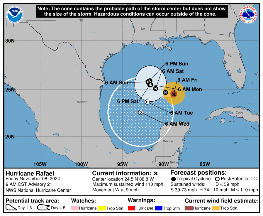
Rafael’s track remains as bizarre as ever, with loops and southward movements all forecast. Ignoring the Canadian model (CMC) on the map below, you can see how Rafael is likely to slow down, turn northward, then eastward, then southward in the coming days as it gets pushed around by high pressure and varying steering currents. This should shove Rafael into the Bay of Campeche next week, while also weakening it as it goes.
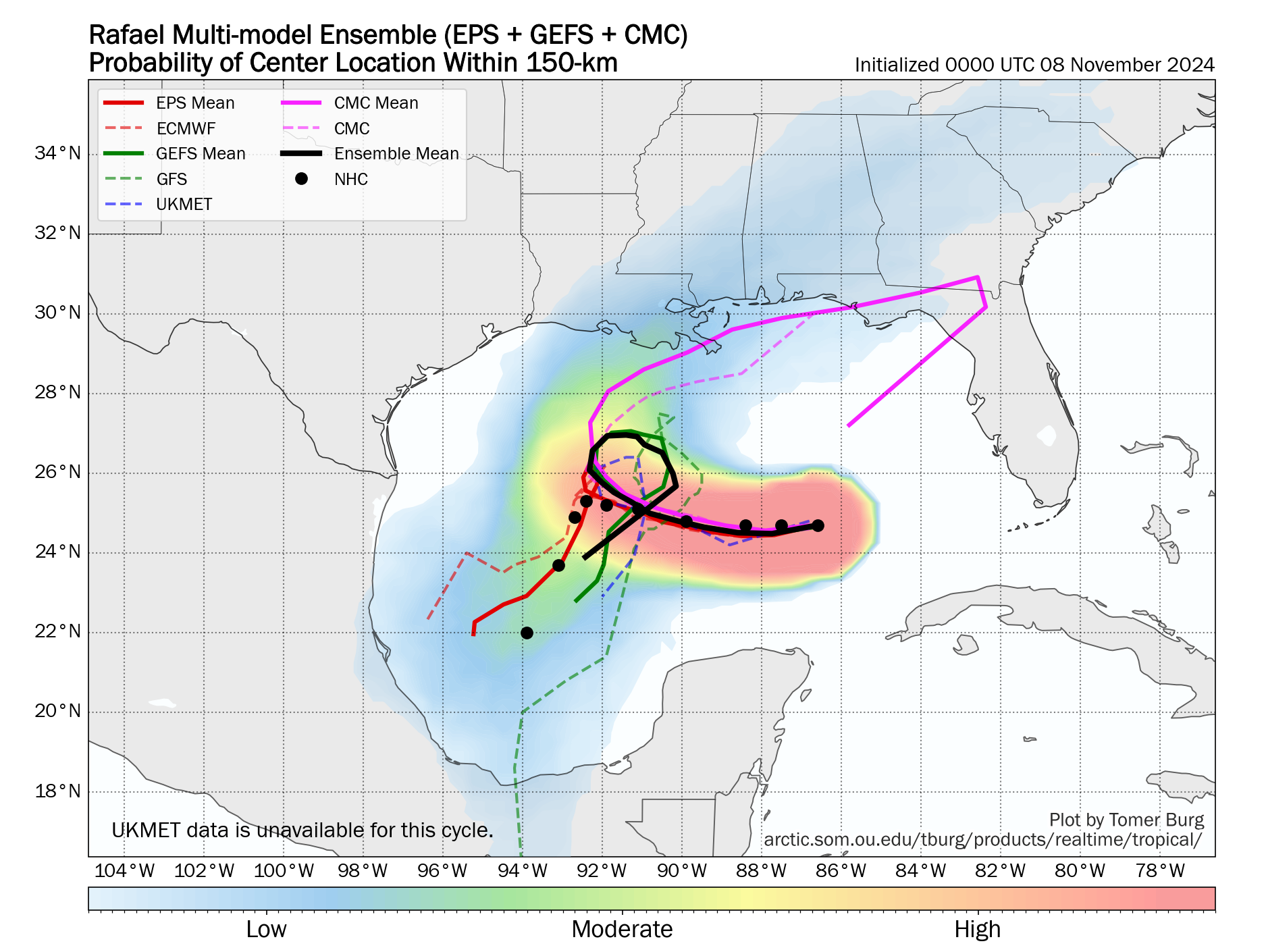
Understandably, we’ve been snake bitten so much on the Gulf Coast since 2017 that it’s tough to just assume something isn’t a threat. But in this case, there is actually strong, broad model agreement that this is indeed what will occur.
Two of the better models in the Gulf this season, the ICON and European AI model do show a track a little closer to the CMC one above, but they are firmly in line with the intensity forecast of a weakening storm. So even in a “busted” forecast where this comes farther north than anticipated, you’d still likely see a moderate to minimal tropical storm at worst with generally minor impacts. We’ll keep an eye on things through the weekend to be safe.
More to come?
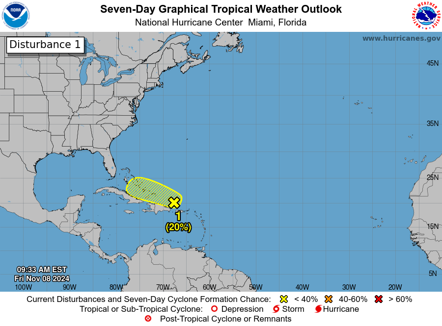
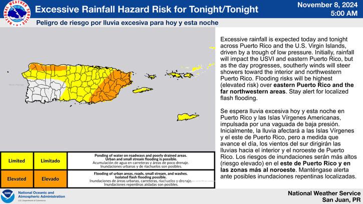
Meanwhile, another tropical system is unlikely but there will be something to at least eyeball near the Turks and Caicos and Bahamas. There is a risk of excessive rain for portions of Puerto Rico as this disturbance passes by, in addition to a risk of heavy rain in the Greater Antilles and Bahamas and Cuba in the coming days.
Beyond this, there are hints of another Caribbean system later in the month, but I would not hang my hat on that right now. We’ll keep watching.