Headlines
- Texas has seen extremely heavy rain with more to come, including in Louisiana through Friday.
- A Caribbean tropical wave still merits watching, though any real serious risks are quite low, though it will bring heavy rain to Mexico.
- The rest of the Atlantic looks quiet for the foreseeable future with a background of suppressed air likely keeping a lid on any disturbances.
I just want to take a quick moment to thank our sponsors this season for partnering with us on the site! Give them a look. Also, I want to just remind people of our social media sites:
Facebook
Instagram
TikTok (we will occasionally cross post from Instagram there)
Twitter
Threads
Bluesky
Mastodon
Thanks for your support!
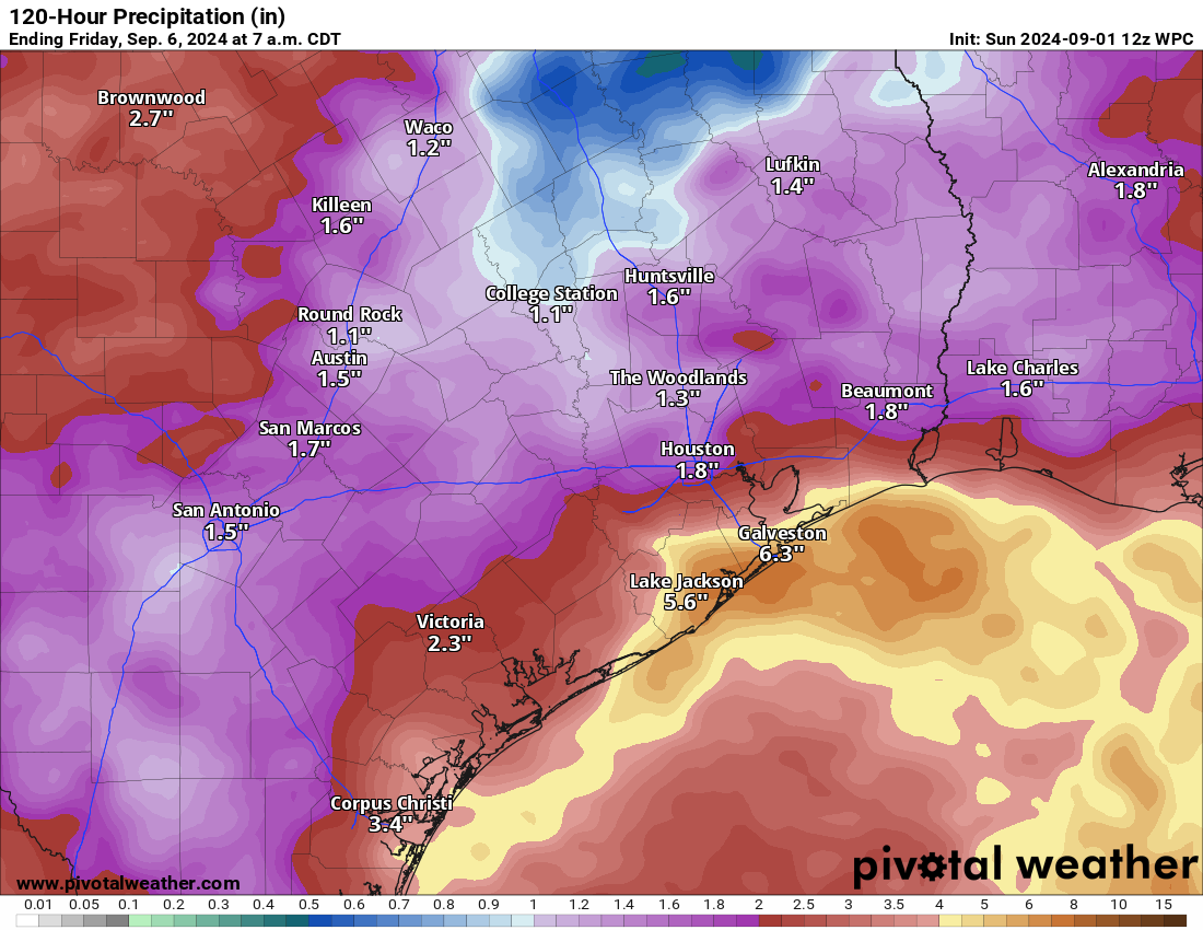
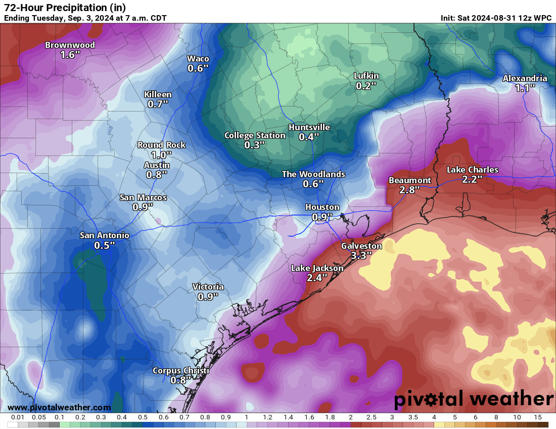
Unnamed storm system pounding Texas with heavy rain
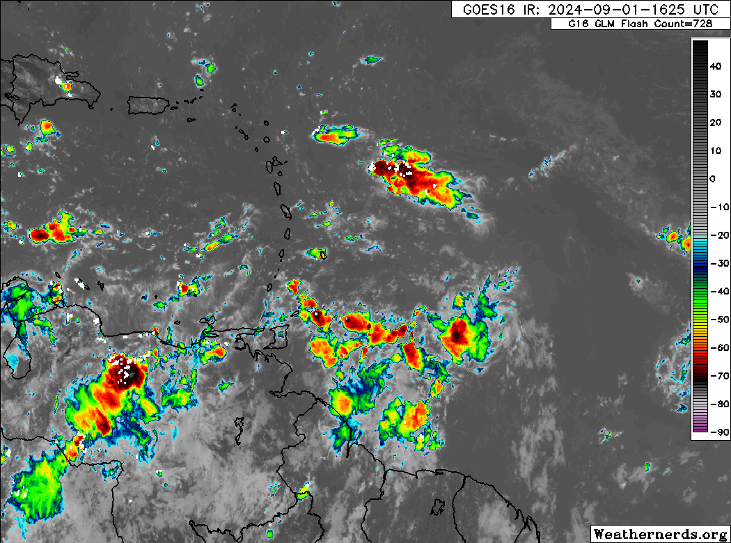
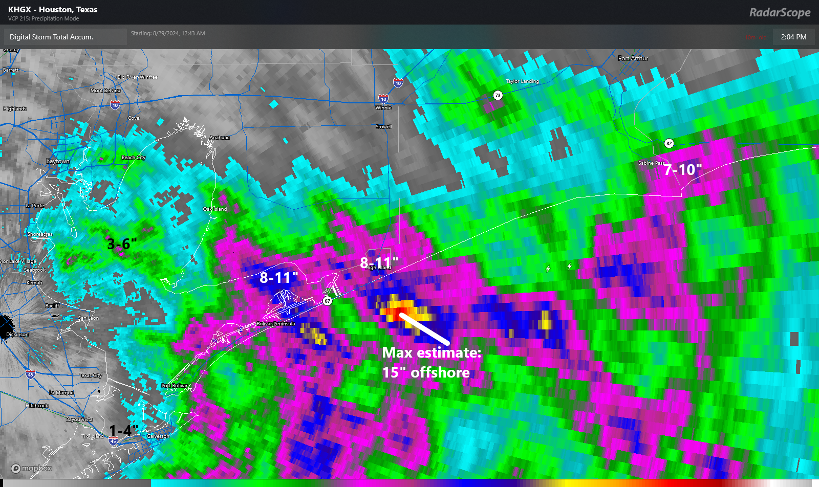
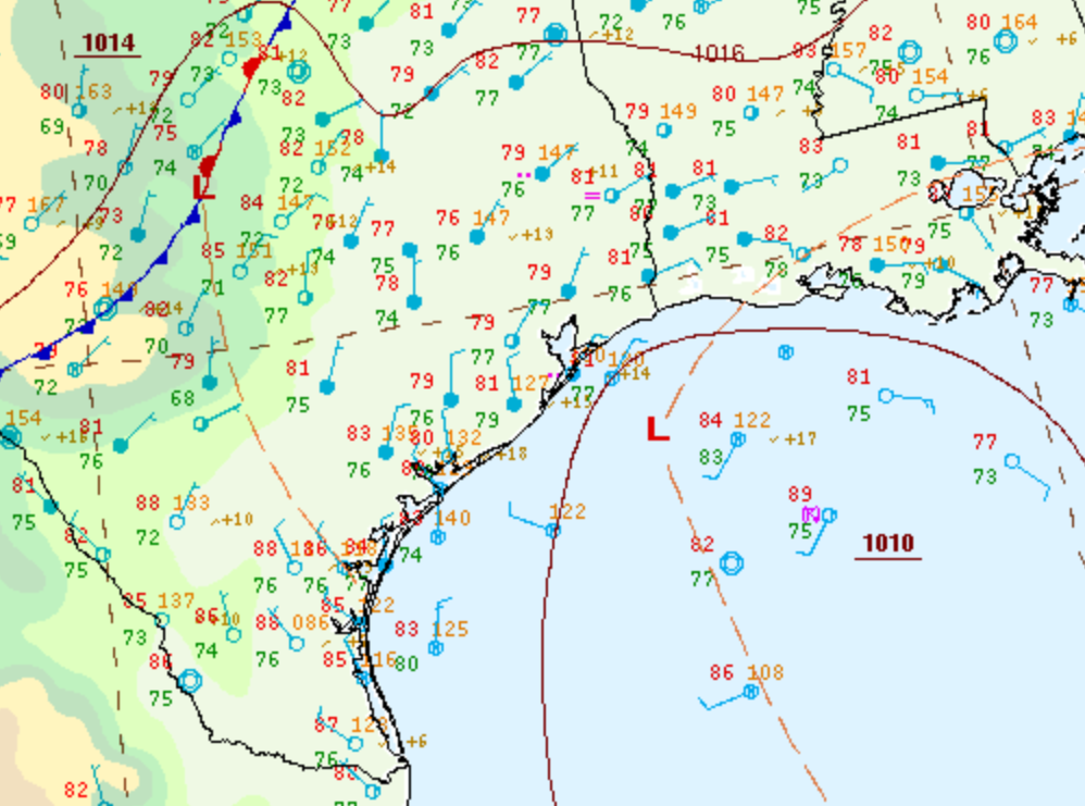
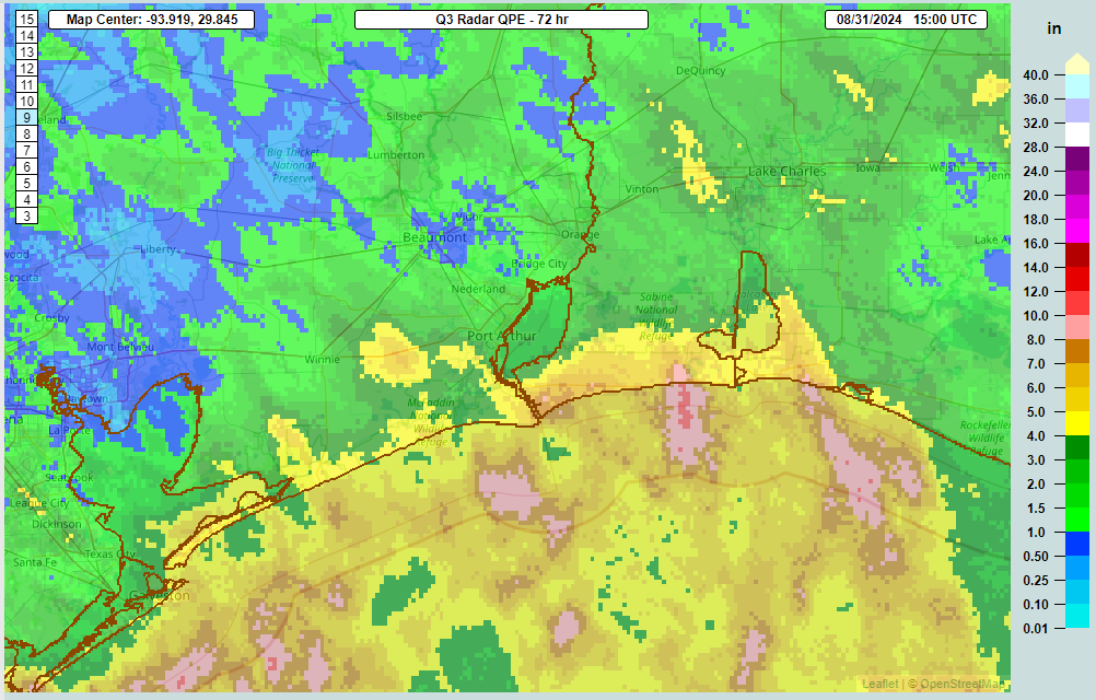
While the Atlantic is net quiet overall, there remains the one area to monitor in the Caribbean and eventually Gulf. In fact, the whole western Gulf is a mess still with a stalled front and surface low pressure continuing to produce widespread showers and pockets of heavier rain. Some locations just north of Corpus Christi saw upwards of 8 to 9 inches of rain this morning, and heavy rain continues in some spots there.
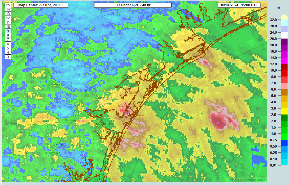
The problem is that with steering currents basically collapsed here, everything has moved slowly. As I write this, there’s a band of heavy rain aimed at Aransas and Calhoun Counties that has produced roughly 2 inches of rain in an hour. These bands get stuck and hit one location like this for 2 to 4 hours, leading to 4 to 8 inches of rain and flash flooding.
On top of this, we have had a persistent pattern with a stalled front in interior Texas that has led to massive rain totals of 2 to 8 inches or more across Hill Country, a place that will happily take most of this rain as prolonged drought has hammered this beautiful part of Texas. The stagnant pattern is going to begin unclogging over the next 36 hours, but not before another round of heavy rain likely impacts Louisiana and the upper Texas coast.
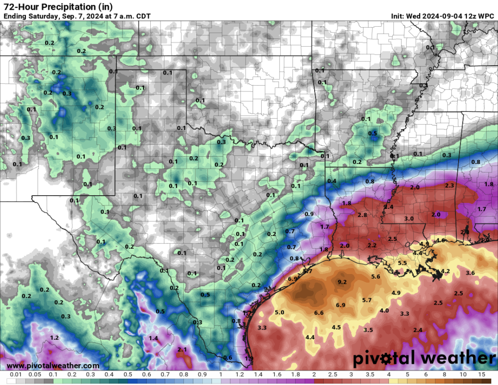
After another 4 to 8 inches is likely along the upper Texas coast and into Louisiana, this “no-named” system will probably leave some places with just shy of 15 to 20 inches of rain since last week when all is said and done.
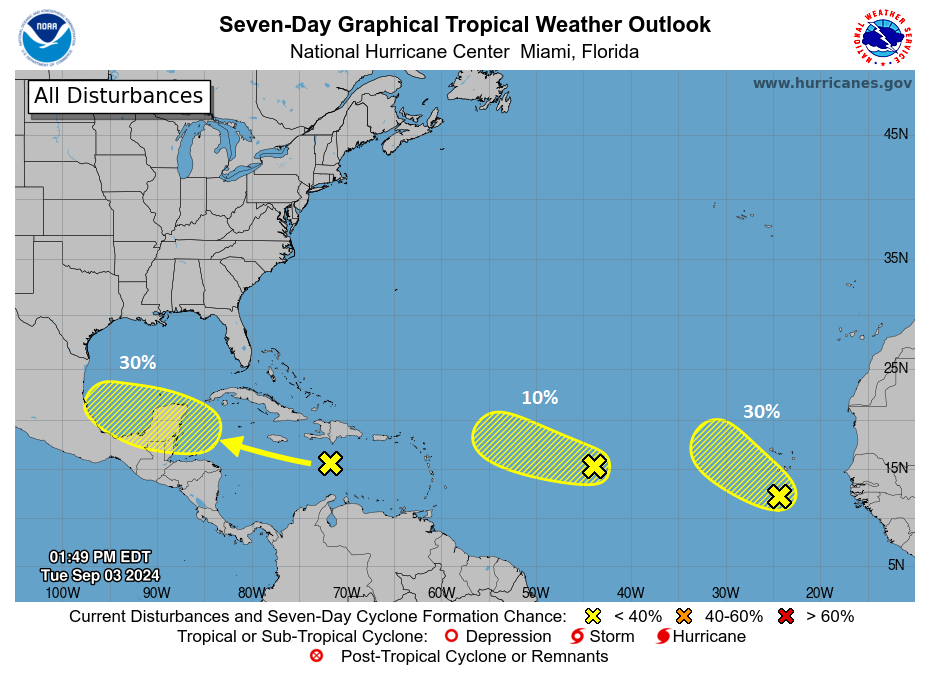
Caribbean tropical wave remains a stubborn low risk
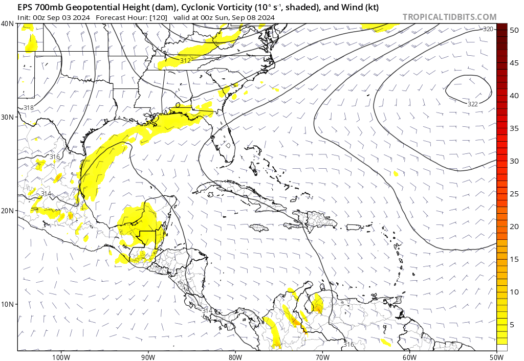
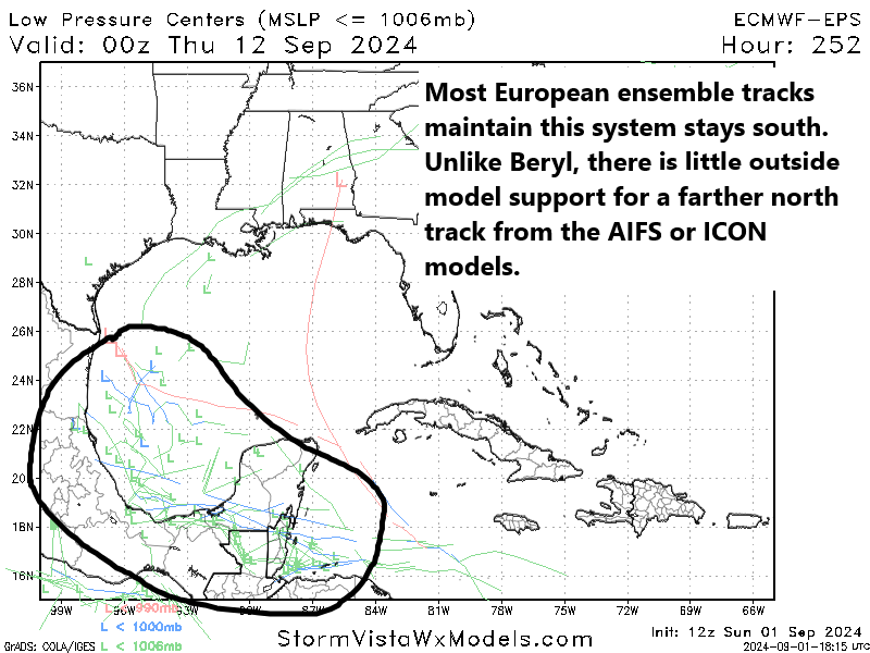
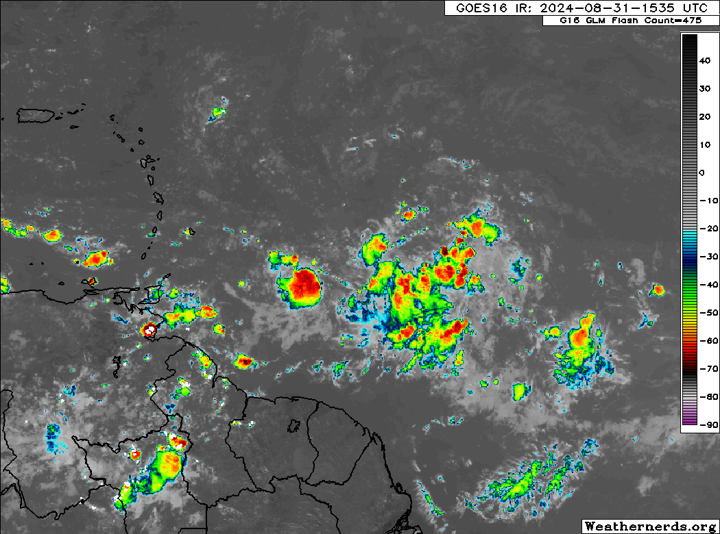
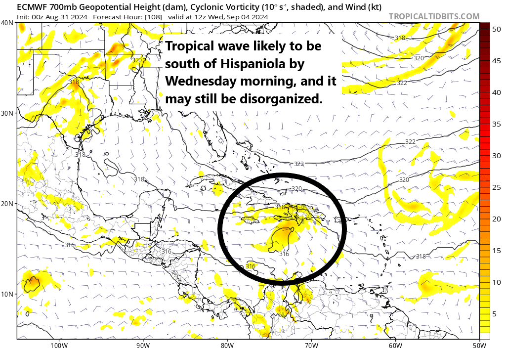
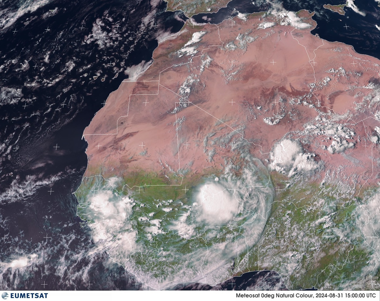
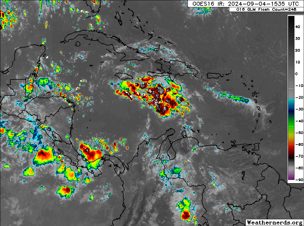
A cold front will sweep all this away from Texas and Louisiana over the weekend. By then, the Caribbean tropical wave we’ve been watching since last week should be over the Yucatan or Central America. Development odds remain about 30 percent this morning, and looking at satellite, it remains a poorly organized mass of disjointed thunderstorms south and southwest of Hispaniola today.
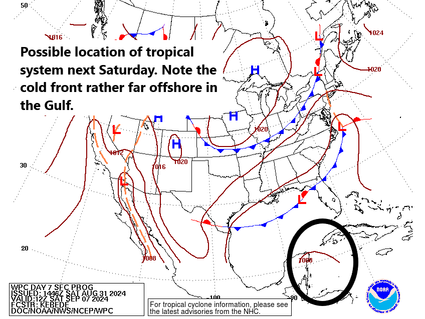
As this wave moves westward, any development will be sluggish before it comes ashore in Belize or the Yucatan. From here, it remains uncertain how things will play out, but any sort of re-emergence into the Bay of Campeche would bear some watching. That said, is that the likeliest outcome? Not necessarily. Of the 51 European ensemble members, about 20 percent push this into the Bay with some development. Of the 51 members, about 5-10% maybe bring it north into the Gulf. Never tell me the odds, but I like those odds right now.
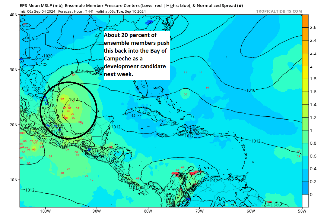
So, yes, we should continue to monitor the progress of things here of course! But as of right now, other than the ICON model, which is quite aggressive in developing this, and the European AI model, which brings it north and northeast into the central Gulf as what appears to be a subtropical storm, there is no significant model support from our traditionally best performing models for this to become a huge deal.
That said, we are looking at anywhere from about 5 to 15 inches (over 300 mm) of rainfall for portions of Mexico from this, so flooding could become an issue there.
Rest of the Atlantic is unimpressive
We continue to look for signs of life in the deep Atlantic, and while there remain two waves of note, neither appears to be a meaningful concern to anyone really.
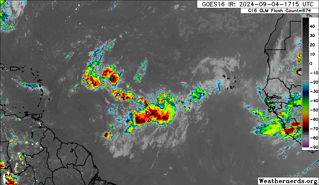
The two tropical waves in the open Atlantic have about a 10 and 20 percent chance west to east respectively of developing. The lead wave may bring some showers and storms to the islands, while the trailing wave is likely destined to go out to sea. There’s nothing emerging off Africa right now, and then next wave is a few days away. That wave may have a decent chance to develop I guess, but it too looks to remain out at sea right now.
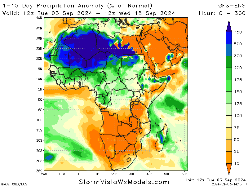
Again, there’s just nothing inspiring in the Atlantic. And I’m not sure we’re going to see much either. If we look at what’s happening in the background of the Atlantic, we have broad sinking air dominating the western two-thirds of the basin, much as it has since early August. Any rising air has shifted from the Indian Ocean more toward Oceania and Indonesia. Sinking air tends to suppress storm development, while rising air tends to help storm development along. So, this doesn’t support robust disturbances in the western Atlantic. This strongly argues that we’re going to see muted activity continue through mid-month. Again, this is one of those intraseasonal signals we cannot predict in April or May that can have an outsized impact if they setup correctly. And in this case, they have certainly done so.
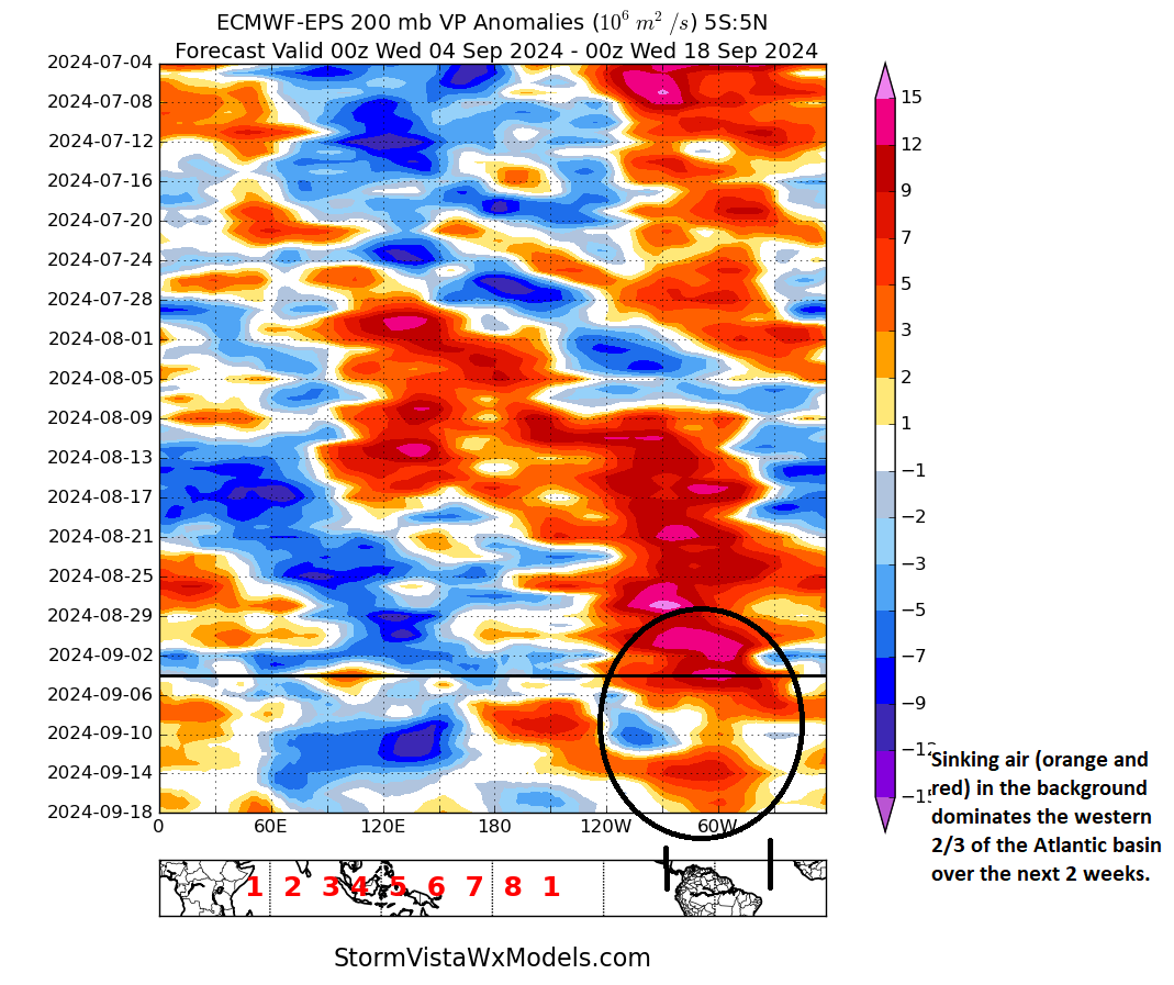
Even a couple weeks ago, this signal seemed to indicate it would become less hostile to tropical development by early to mid-September. That’s now getting kicked down the road. Unless you chase hurricanes for a living, it’s hard not to be thrilled by this situation sitting here on September 4th. We’ll keep an eye on things.