Headlines
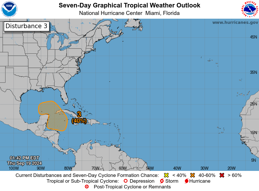
- We are likely to see development in the Caribbean or near the Yucatan next week.
- Model guidance suggests that there are a few possible outcomes, including a quicker, stronger storm that tracks north or northeast or a slower, weaker outcome closer to the Yucatan.
- Folks on the Gulf Coast, particularly between New Orleans and Florida should be flexible with their preparedness plans and be ready to implement them if necessary early next week.
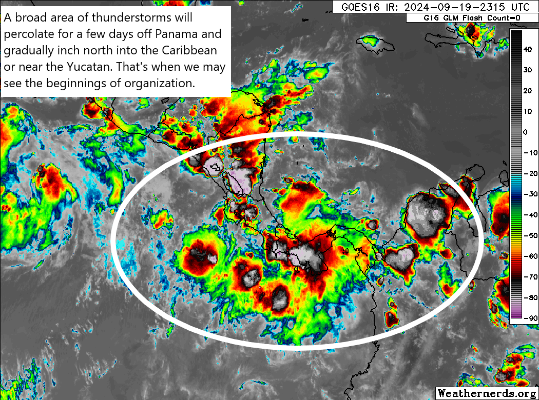
We are still a few days from Caribbean development
I feel like we’ve been talking about this potential development in the Caribbean for days now. That’s one element of hurricane season that has gotten worse in recent years: The availability and democratization of weather data has kept any and every potential disturbance in the conversation for a week or two before they even form, then for a week or two as they do their thing. In some cases, you can be talking about one system from pre-inception to finish for a month! But the availability of all this information has made our job more important to help y’all make sense of what it’s saying.
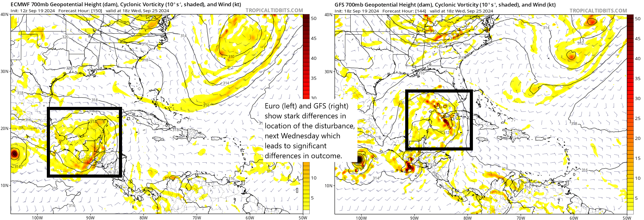
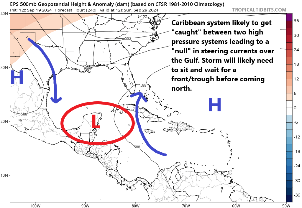
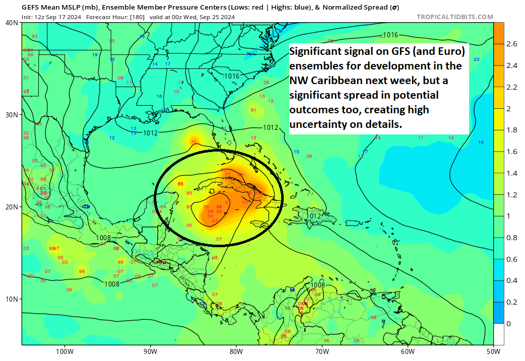
Yesterday’s post has aged pretty well, thankfully. Frankly, not a whole lot has changed. But I think there’s a clear dichotomy taking shape now between the European modeling and the GFS modeling Yesterday, I noted how the Euro was apt to consolidate the disturbance next week near or over the Yucatan, whereas the GFS did so mostly in the Caribbean. Those models have not changed their view on this today. Trends over the last couple days have led to the European AI modeling, the AIFS to trend a little closer to the GFS solution of stronger, faster, more north and east. The ICON model is also taking that stand, so there is some slowly building support for the GFS here, I think.
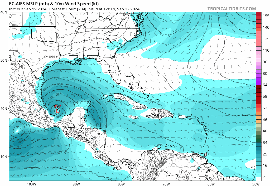
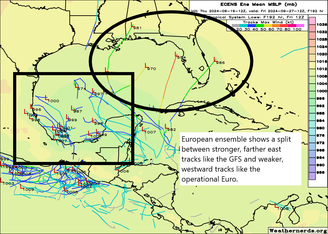
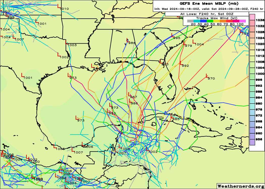
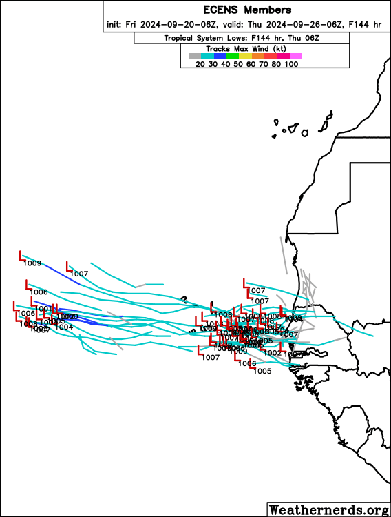
That said, if we look at ensemble guidance, there continues to be a gigantic split among the 30 to 50 ensemble members in both the GFS and European suite. The Euro seems to be split about 80/20 favoring the western/weaker outcome, whereas the GFS is more of a 40/60 blend favoring stronger and more east/north leaning outcomes.

It may have even gotten more confident in that eastward lean in today’s 12z model guidance as seen above. The one big, big takeaway from both of these examples showing the AIFS and GFS Ensemble members is that there is still *very* little agreement on track, just many generalizations that can be inferred from this output.
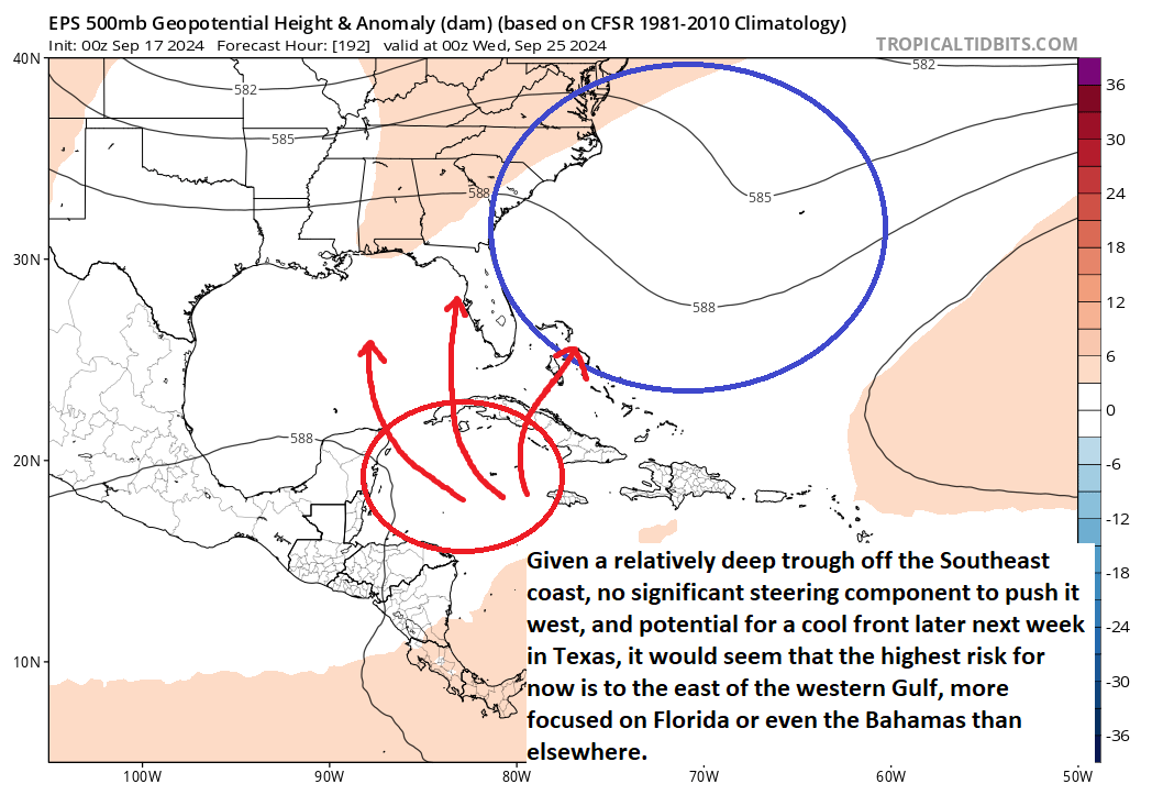
I continue to think this sort of scenario favors either a Mexico or Yucatan impact or a Florida through New Orleans type impact on the northern Gulf Coast. I remain convinced that Texas is *not* the most likely outcome here, but I would continue advising Texans to monitor things heading into next week.
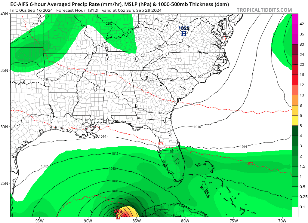
There are also gigantic timing differences here. The storms that come north and northeast tend to do so quickly, with impacts possible as early as next Thursday. So for folks in Louisiana through Florida, you would need to be ready to act as soon as Monday if this looks like a building threat. For Texas and Mexico, if the western outcome happens, this would likely remain a middling system for several days before organizing later next week and coming north next weekend. This would deliver impacts to the central Gulf Coast by next Sunday or so. That’s a large spread of timing options, so folks on the Gulf Coast should be flexible with their preparedness and be ready to act early next week once things become clearer.
We will have daily posts this weekend to keep you all informed.
Elsewhere in your tropical Atlantic!
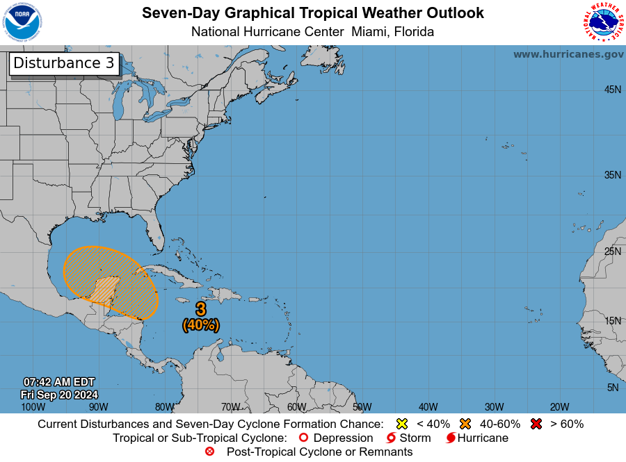
Invest 96L has developed in the open Atlantic, and between it and the remnants of Gordon, we could maybe see something try to form over the next few days. Neither system is likely to impact land.
More interestingly, we have potential for a Cabo Verde system to develop later next week. The European ensemble has been quite bullish on this. There is plentiful support for this from other modeling as well. Expect this potential to show up around midweek next week.
Now, is this system likely to be a land threat? It’s too early to say definitively, but the current thinking is that this would probably end up moving out to sea ultimately. Plenty of time to watch. No other threats are seen closer to home right now after next week’s Caribbean/Gulf story.