Tropical Depression 2 struggling over the open Gulf; isolated heavy rains for Florida

Good morning, and welcome again to The Eyewall, where we provide hype-free, measured coverage of the Atlantic tropics all season long.

Today, we wake up to Tropical Depression 2 in the Gulf no better organized than it was yesterday evening, and struggling somewhat. TD 2 itself is more of a meteorological curiosity than anything else, although heavy rain continues to be possible in portions of the Florida Peninsula.

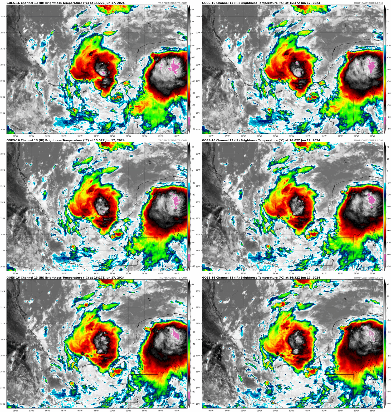
Tropical Depression 2’s center is displaced south and west of the main cluster of storms, indicating a poorly organized, heavily sheared system. (Tropical Tidbits)

One-sentence summary

Tropical Depression 2 is expected to drift south toward Cuba and dissipate this weekend, and although it may still technically attain tropical storm status and will aid in Florida storms, it is not a direct threat to anyone.

All things Tropical Depression 2: Meteorological curiosities and rain in Florida

Again, the system itself is not really an issue for anyone. It’s fairly weak and over open water. From the satellite loop above, you can actually sort of see the center of TD 2, exposed to the south and west of the green-yellow-orange colors, which are thunderstorms south of the Panhandle. That’s an indication of an unhealthy, sheared system. As visible satellite imagery becomes available today, we may see this enter “naked swirl” territory (where the center is completely displaced from any storms). Still, per the National Hurricane Center 4 AM CT discussion, TD 2 may technically be close to being a tropical storm. All you need is an area of 34 knot (39 mph) sustained wind to technically classify it, hence this is mostly a meteorological curiosity at this point.

At a high level, the forecast track for TD2 is mostly unchanged versus yesterday. It drifts south in the Gulf before dissipating near Cuba on Sunday.

The curious track of TD dissipates it near Cuba this weekend. (NHC)

Several of you have mentioned, “You know, that’s a bizarre track. Is that normal?” The answer is “No, it’s not technically normal.” It is certainly funky, but often (especially in early season), storms can take these weird tracks. All tropical storm tracks are generally a function of the environment around them. And if we look about 20,000 feet (at what meteorologists call the 500 mb level) over our heads at what’s happening, it becomes fairly clear to see why TD 2 takes this type of track.

The 500 mb (~20,000 feet up) map shows that TD 2 is being steered by a strong north or northwesterly push aloft, which helps to drive it southward. (Tropical Tidbits)

The red “L” in the middle of the map, which is a forecast of 500 mb vorticity this afternoon is the approximate location of TD 2. The pattern features strong northerly or northwesterly winds which help to direct the western portion of TD 2’s broader circulation south. Steering currents over Florida and Georgia are fairly weak, so there’s little influence from there, hence all this northerly push pretty much forces TD 2 southward. Winds out of the southwest across Cuba and into the Bahamas help to give it that little eastern turn late, but of course by then, it will have pretty much dissipated.

So, TD 2 is not a direct threat to any land, but the convoluted pattern around the system will help to continue aiding rainfall in parts of Florida today. Flood watches continue for the southeast coast, from Miami-Dade through Palm Beach Counties and around Lake Okeechobee. Over the last three days there have been isolated spots seeing in excess of 3 to 5 inches of rain.

Rainfall over the last three days has led to a couple “bullseyes” (yellow & orange) around South Florida. (NSSL MRMS)

Because of this, and because of the potential that some showers and storms could produce a few more inches of rain and lead to flash flooding, the flood watch continues.

A flood watch continues for much of South Florida, with another 1 to 2 inches of rain (or a bit more) possible in isolated spots today. (NWS Miami)

Not all of South Florida will see heavy rain, but some will today and perhaps even Saturday too before things start to return to normal next week and TD 2 experiences its demise.

Medium range (days 6 through 10): Nothing doing

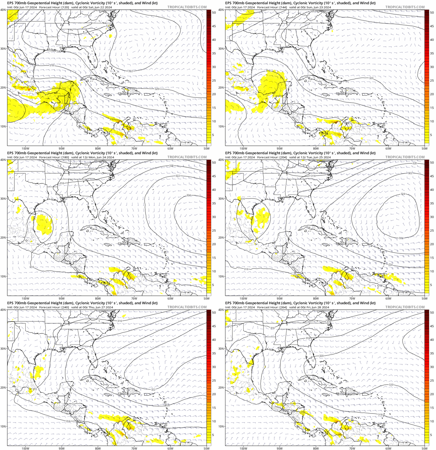
The day 6 through 10 period looks pretty quiet. I would expect the majority of the basin will be covered by decent wind shear, which acts to limit storm development. In addition, it looks like we’re in an unfavorable upper level pattern overall, with more sinking air across the basin as well. It is June, after all, so that shouldn’t come as a surprise.

Fantasyland (beyond day 10): Also quiet

This quiet will probably extend firmly through mid-June and possibly (hopefully?) into late June. Nothing is showing up in the long range that should ruffle any feathers right now.

We’ll be back tomorrow with a quick update on TD 2. Look for our normal daily update on Monday morning, where we’ll tackle what is normal for June as the season begins.

Tropical Depression 2 forms in the eastern Gulf of Mexico; no change to expected impacts

Good evening! Welcome again to The Eyewall. We did not expect to be actually covering a storm on day one, but here we are. This is the type of coverage you’ll get with every Atlantic system on this site.

Based on data collected from Air Force Reserve Hurricane Hunter aircraft this afternoon, Invest 91L was classified as Tropical Depression 2 in the eastern Gulf of Mexico.

Wait– Why TD 2? What happened to TD 1?

Back in mid-May, the National Hurricane Center (NHC) determined that a subtropical storm formed off New England back <checks notes> January. Thus, when the 2023 season is in the books, that storm will have the honor of being Storm 1. However, it did not take on the name Arlene since it was classified after the fact. Thus, since this is the second cyclone of the season, it is classified as TD 2. If it becomes a tropical storm, it will be named Arlene. Got it? Good.

Where will TD 2 go?

The official forecast from the NHC looks good. It’s headed south.

TD 2 will track due south over the next couple days, possibly strengthening to a tropical storm before dissipating near Cuba this weekend. (NOAA)

This system is unlikely to maintain status long enough to make landfall anywhere, so there are no watches or warnings posted for any coastlines. TD 2 will drift southward through Saturday before likely dissipating on Sunday (if not sooner) near Cuba.

What impacts should we expect? Florida rain!

As we noted earlier today, the primary thing to watch will be rainfall in the Florida Peninsula. Hardest hit so far today has been central Brevard County in Florida, where radar estimates 3-5″ of rain has fallen. Also, the north side of the Tampa Bay area has seen some heavy rain as well. The map below shows rain totals since about 5 AM today for places that have received over 1.5″ of rainfall.

Click to enlarge rainfall totals exceeding 1.5″ so far today across central Florida. (NOAA)

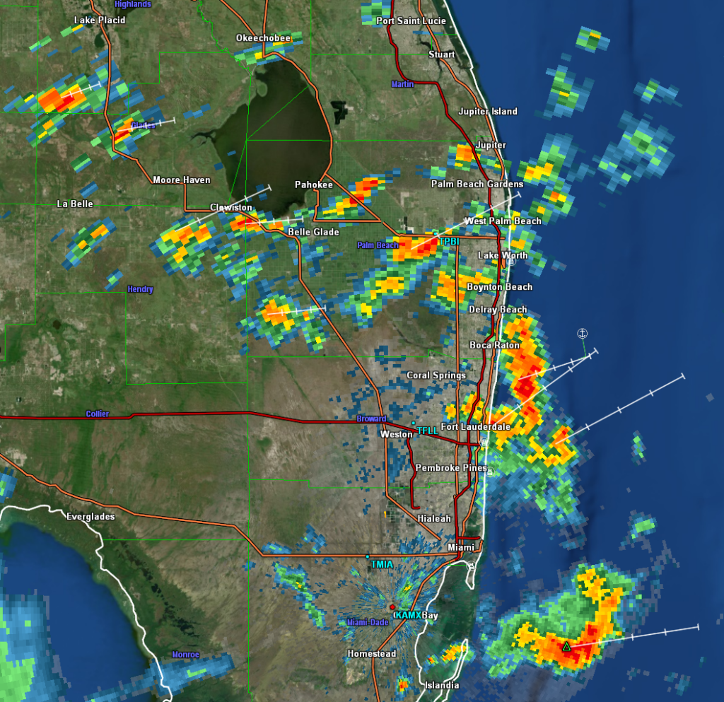
Radar shows pockets of heavy rain extending from the Tampa area south and east across the Peninsula to near Lake Okeechobee before things tail off some. There are also very heavy storms over Delray Beach on the east coast, up through Boynton Beach as well.

Radar through 5:40 PM ET shows areas of heavy rain and lightning from near Tampa south and east to Lake Okeechobee. (Weathernerds.org)

The bottom line in all this? Localized flash flooding is possible. You can see from the rain totals that some areas have seen manageable rain so far. Others have seen up near 5″ the last couple days. Those areas will be most sensitive to flooding, and that’s why there’s a flood watch for South Florida. More showers and storms will be likely tomorrow before things settle down a bit.

The final word?

TD 2 may briefly become a tropical storm tonight or tomorrow before it drifts south toward Cuba and dissipates this weekend. The main issue will be heavy rain and localized flash flooding across the Florida Peninsula, as well as perhaps in portions of Cuba (Havana has seen some very heavy rain today). But it’s likely that there will be little trace of TD 2 left by Sunday.

More in the morning!

June 1, 2023 Tropical Outlook: Welcome to the 2023 Atlantic hurricane season

Good Thursday morning, and welcome again to The Eyewall! We hope that we can be your companion through hurricane season, with daily updates on what’s happening and in depth coverage if storms threaten. Today is the first day of the 2023 Atlantic hurricane season, so settle in for the next several months.

We have a couple resources for you on the site. First, we’ve compiled some tips and a whole bunch of links to preparedness and evacuation information. You’ll find links to local pages where you can view evacuation zone maps, locally themed preparedness pages, and more. Additionally, we have compiled some links to sites we feel good about when it comes to real-time weather information on the tropics. We hope these are helpful for you.

With the start of hurricane season, one of the most common questions often revolves around the name list. Well, here you go, courtesy of NOAA:

The other common question is “what’s the forecast?” While it’s important to remember that only one bad storm can make it a bad season for you, we recognize the interest in these forecasts. NOAA released their outlook last week, calling for a “near average” season. Colorado State is expected to update their outlook shortly after this post is published, but it should not deviate a ton from their April view of (also) a near average season. Much of this somewhat reined in expectation is due to El Niño, which is emerging quickly in the Pacific. You can read more about that in those agency’s outlooks, and we’ll certainly get into more on the Niño as the season progresses.

Today marks the beginning of a lengthy marathon through October and into November, and we’re not starting off the year quietly. Just last weekend, we saw a storm system move into the Carolinas with some strong wind gusts and almost 6 inches of rain in the mountains of North Carolina. There was also a cruise ship incident. Today? We’re watching a disturbance in the Gulf of Mexico that has been tagged as Invest 91L. (A reminder: In the Atlantic basin, “invests” are basically defined as “areas of investigation.” In other words, they’re areas of interest that are “tagged” by the National Hurricane Center that allows for a bunch of additional weather model data to populate as a result. There’s no strict definition, and many invests go on to dissipate in time. “L” indicates it’s in the Atlantic, and the number preceding the letter rotates between 90 and 99 and recycles throughout the season)

One-sentence summary

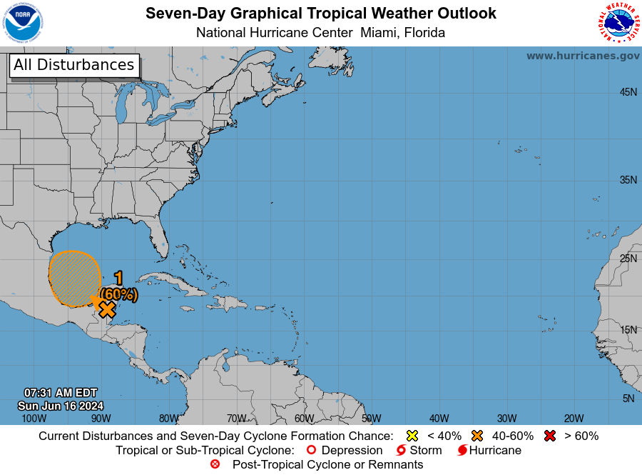
Invest 91L in the Gulf of Mexico has about a 50/50 chance of developing into a depression or low-end tropical storm over the next couple days as it tracks generally south and east, across Florida and into the Atlantic, dumping locally heavy rain in parts of Florida.

Happening now: A difficult road ahead for 91L

This morning, Invest 91L looks a bit “blobby” in the northeastern Gulf. There’s basically an area of storms south of Panama City that is sort of stationary or drifting southeast — thankfully offshore.

Invest 91L isn’t the best looking or worst looking invest we’ve seen in the Gulf, but it’s got enough to it to possibly become a depression or weak tropical storm over the next couple days. (Weathernerds.org)

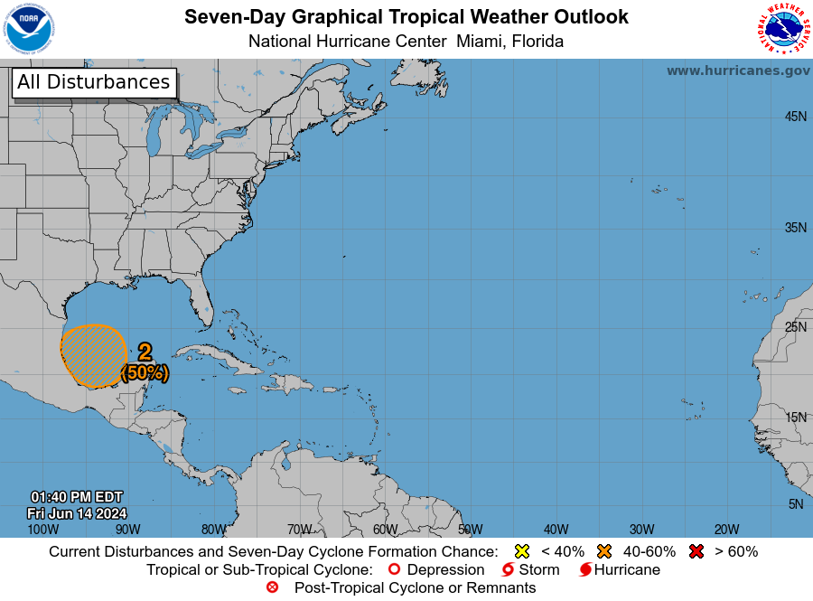
Radar estimates that 8 to 10 inches of rain has fallen over the open water of the Gulf. If you look close enough, you can definitely see a little “spin” to the cluster of storms as well. There is not a super well-defined low pressure system in the Gulf, but there’s something defined there. Thus, the National Hurricane Center bolstered odds of development to 50 percent over the next 48 hours this morning.

The National Hurricane Center says 91L has about a 50 percent chance of developing into a depression or storm — briefly — over the next couple days. (NOAA)

Wind shear is going to be a significant inhibiting factor for development of 91L. I would not say it’s in a low shear environment by any means right now, but in about 48 to 72 hours, it’s going to be in a very rough one.

This image shows a good proxy for the kind of shear environment 91L is experiencing at the moment, with darker colors indicating higher shear. 91L is currently in a relative “lull” in this high shear environment, which is not hindering its development today. This will change by the weekend and shear will act against 91L’s future development. (Weathernerds.org)

When tropical systems develop, they like a generally calm atmosphere around them. Wind shear indicates a lot of turbulence and usually acts to slow or even prevent storm development. It’s important to note that with systems this close to shore, wind shear does not prevent impacts; it can still rain a lot or be breezy or even flood some at the coast. But it does usually put a cap on how strong or well-organized a storm can become.

For Florida, the main impact from 91L should be a bolstered chance of showers and storms with locally heavy rainfall. We saw this yesterday with portions of DeSoto and Manatee Counties in southwest Florida seeing over 4 or 5″ of rain.

Yesterday, portions of Florida’s west coast saw upwards of 5 inches of rain, primarily in DeSoto and Manatee Counties, east of Sarasota and Bradenton (NSSL MRMS)

Additional rains are expected in Florida over the next few days, with amounts generally 1 to 2 inches with isolated higher amounts possible. Because of that, there is a flood watch in effect for coastal southeast Florida, including Miami-Dade, Broward, and Palm Beach Counties, as well as around Lake Okeechobee.

Miami’s National Weather Service office has a flood watch hoisted through tomorrow for Miami-Dade, Broward, Palm Beach, Hendry, and Glades Counties. (NWS Miami)

Bottom line: Invest 91L has about a 50/50 shot of becoming a depression or weak tropical storm before Saturday, but it would likely remain on the weak side. That said, there is a legitimate risk of flash flooding due to heavy rain, particularly in southeast Florida but also potentially in a few other Peninsula locations as well. 91L will race off to the east next week into the open Atlantic.

This is a good reminder to get your hurricane kits stocked and review your evacuation plans for later in the season.

Medium term (Days 6-10): Minimal action

There is not a lot showing up in the medium range horizon right now that supports tropical development. There will be a non-tropical system in the Northeast next week, leading to rain and ugly June weather for New England, with Boston not escaping the 50s for a couple days. But nothing is out there in the tropics.

Fantasyland (beyond day 10): Quiet

We will cover the “fantasyland” section each day. We often see models place rogue storms late in their runs (day 10+), and often that is what drives social media fear and hype over storms. We’ll let you know a little about the extended range period here, and if there’s reason to take those periodic scares seriously. Today, there’s little to nothing to speak of in fantasyland. The models have been fairly well-behaved of late in terms of showing any rogue systems. So, we expect mostly quiet conditions overall through mid-June.

Our next update will come tomorrow morning, or this evening if 91L happens to get an upgrade, as hurricane hunters are scheduled to investigate this later today.

Welcome to The Eyewall!

Today marks the first day of the Atlantic hurricane season. It also marks the launch of our new website, The Eyewall. Welcome, and thank you for visiting!

Who are we?

Writing this post today is Matt Lanza, managing editor and meteorologist for Space City Weather, a Houston based weather blog that has gained a large following both in Houston and along the Gulf Coast for our honest, to-the-point, and hype-free coverage of weather. Joining me is Eric Berger, founder, editor, and meteorologist of Space City Weather. You can read more about us here. While we are based in Houston, Eric and Matt have both covered Gulf storms rather aggressively since Space City Weather was established. Matt is also a native of New Jersey and is very familiar with coastal storms and Mid-Atlantic hurricanes and tropical storms. In fact, Matt’s interest in weather stems from Hurricane Gloria in 1985, which moved up the Eastern Seaboard knocking out power to millions and causing over $1 billion (2023 dollars) in damage.

Seaside Heights, NJ after Hurricane Sandy in 2012 (National Archives)

Why do we exist?

In our work with Space City Weather, we have found an audience that is both receptive to our style and is fiercely loyal. We are often asked if there is an “us” equivalent in other places. The Eyewall aims to be the “us” in other places, at least as it pertains to hurricanes. With Space City Weather, we’ve learned a couple things:

In world where you are constantly being pinged on your phone with alerts and can frequently see scary maps of big storms shared in social media groups, there is a desire to have a source for weather that is not going to try to bait you into meaningless engagement or click on hyperbolic headlines. When the weather is boring, we’re boring (though we do try to note interesting meteorological things!), but when the weather gets serious, so do we. Basically, our philosophy is that if we amp up the language or tone in our posts, then you know it’s actually serious. Too much weather coverage centers around engagement and competition for page views, even when weather is not serious. We don’t have any metrics to target or compete for, so all we’re trying to do is build your trust. We view ourselves as a mission-driven public service. As such, we will gladly syndicate our content to any publication or non-profit facing a tropical threat. Please contact us for permission.

We try to humanize weather coverage. Houston has been through a lot, so we know what it’s like when our community suffers. We’ve had family, friends, and colleagues impacted by some of the other major storms in recent years like Ian in southwest Florida, Laura in southwest Louisiana, and Sandy in New York and New Jersey. We’ve seen how bad it can get, and we relate to what you’re going through when disaster strikes. We will try our best to be efficient with your time, clear in our coverage, and empathetic in our tone. The science is cool and important, but people first and foremost just want to know what it means for them and their community. That’s where we will focus our efforts.

Houston rescues during Harvey in 2017 (US Forest Service)

What you can expect from us

As noted above, you can expect us to be reined in when the weather is not serious and very serious when the weather requires that. You can expect posts that are clear and transparent as to our expectations with upcoming storms. When we aren’t sure about the forecast, we’ll tell you and explain what the possible outcomes are. We will do our best to answer your questions as we can here or on our social media accounts.

As far as content goes, for those of you familiar with Space City Weather, the cadence will be similar. You can expect a post each morning with a tropical outlook for the Atlantic basin. Look for our first one later this morning. We will cover what’s happening now, any tropical waves or disturbances of note, and focus on possible impacts. We will also tackle what we call “fantasyland,” which is often where the most misinformation on social media comes from. If a model is showing a storm on day 14, we’ll note it and explain why (in most cases) it will not happen or why it’s worth watching.

When a storm threatens, be it in Portland, Maine, Port St. Lucie, Florida, Puerto Rico, or Port Aransas, Texas, we will cover that storm in depth. We’ll have more frequent posts, explain risks, impacts, and share updates as needed both in the run up and aftermath. You can expect the same style of coverage we have devoted to Houston for big storms to be with us here at The Eyewall.

Outside of tropical storms and hurricanes, our coverage will be modest for now. We may post some items of interest at times. In fact, next week, look for a post here at The Eyewall that will tackle the question, “Why are we seeing so many frequent big storms in the Gulf of Mexico?” High end major hurricanes have made landfall on the Gulf Coast in 2017, 2019, 2020, 2021, and 2022. We will explain what the research says about this issue. If we establish ourselves and are able to build a large enough audience, we will expand our coverage to other weather events in time. For now, hurricanes are what we know best, and that’s what we’ll stick with.

How can you help us grow?

We know we’ll have a small base of excited and loyal readers to start. All we ask is that you share the site with friends and family that may live on the coast or in inland hurricane prone locations. If a storm threatens, let them know about us, much as our Houston audience just happened to do during Harvey and Laura. Otherwise, we’ll let our coverage speak for itself and, as we did with Space City Weather, work to grow organically and over time.

Meanwhile, give us a follow on our social media platforms:

Facebook
Instagram
Twitter
TikTok

And on the right side of the page, sign up for email updates, so you get our daily updates in your inbox.

Let us know your feedback, thoughts, and questions. We are here for you, and we look forward to serving you this hurricane season, and hopefully in the future. Thanks for visiting!