Headlines
- Ernesto is moving through the northeast Caribbean as a moderate tropical storm.
- It may strengthen into a hurricane as it approaches or passes the Virgin Islands and east of Puerto Rico.
- Impacts to Puerto Rico will be mainly heavy rain and flooding on the south and east sides of the island.
- Impacts could be a bit stronger for the USVI, Vieques, and Culebra.
- Ernesto will then possibly take aim at Bermuda heading toward the weekend.
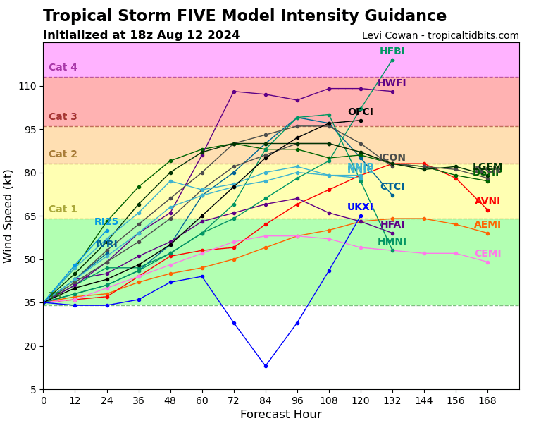
Ernesto making an effort to intensify
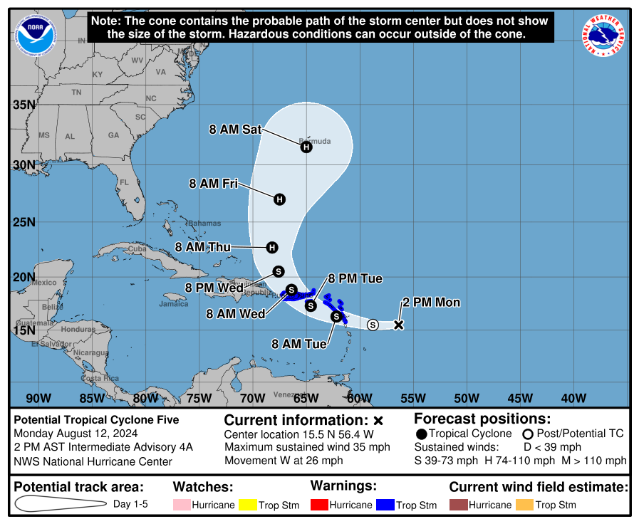
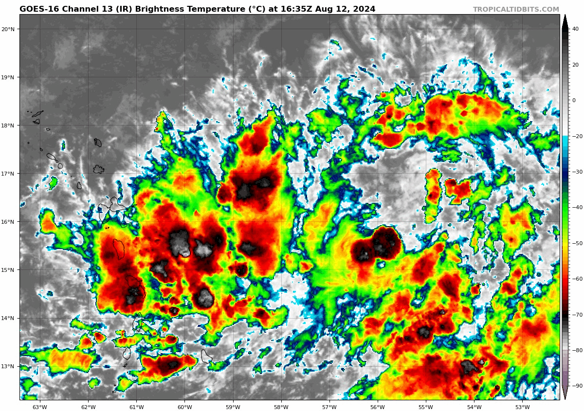
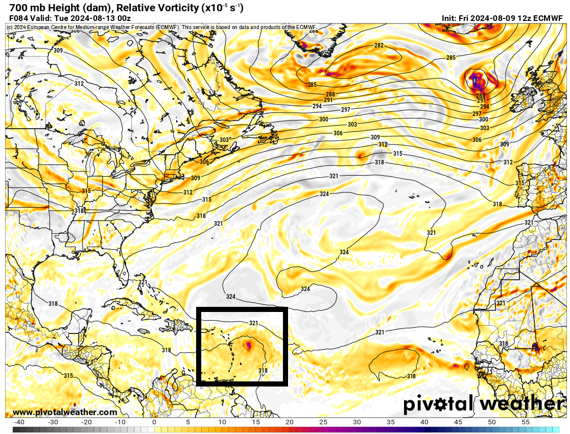
Tropical Storm Ernesto is working through the far northeast Caribbean this afternoon, strengthening in the process. Currently, Ernesto has 50 mph winds and is located just south of St. Kitts and Nevis.
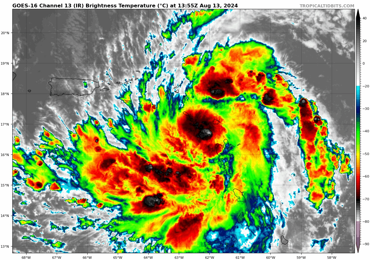
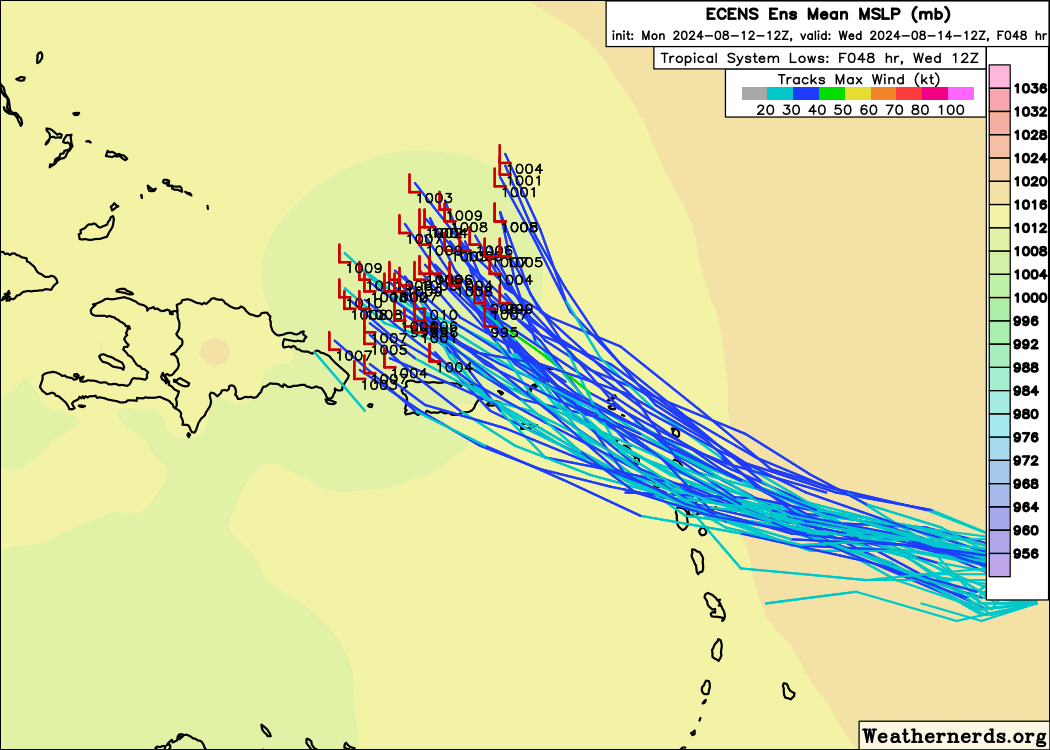
Over the next 12 to 24 hours, Ernesto is going to track west northwest toward the Virgin Islands, Culebra, and Vieques. Hurricane Watches have been issued for the US & British Virgin Islands, as well as Culebra and Vieques. Puerto Rico remains under a Tropical Storm Warning, as are a number of other islands in the Leewards. Given the atmospheric conditions surrounding Ernesto, it’s possible that this could become a hurricane in the next 18 to 24 hours as it approaches and passes the islands east of Puerto Rico. By tomorrow afternoon. Ernesto will be north of the islands and conditions will improve.
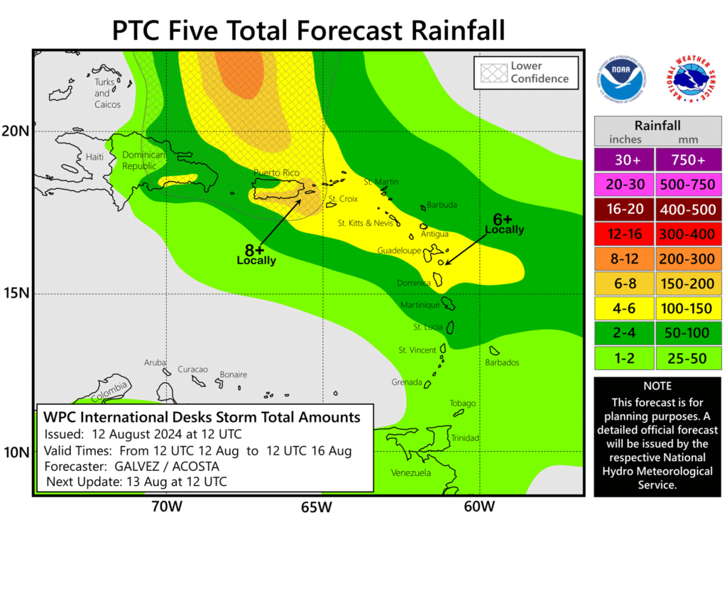
In terms of impacts, the main threat is probably still rainfall.
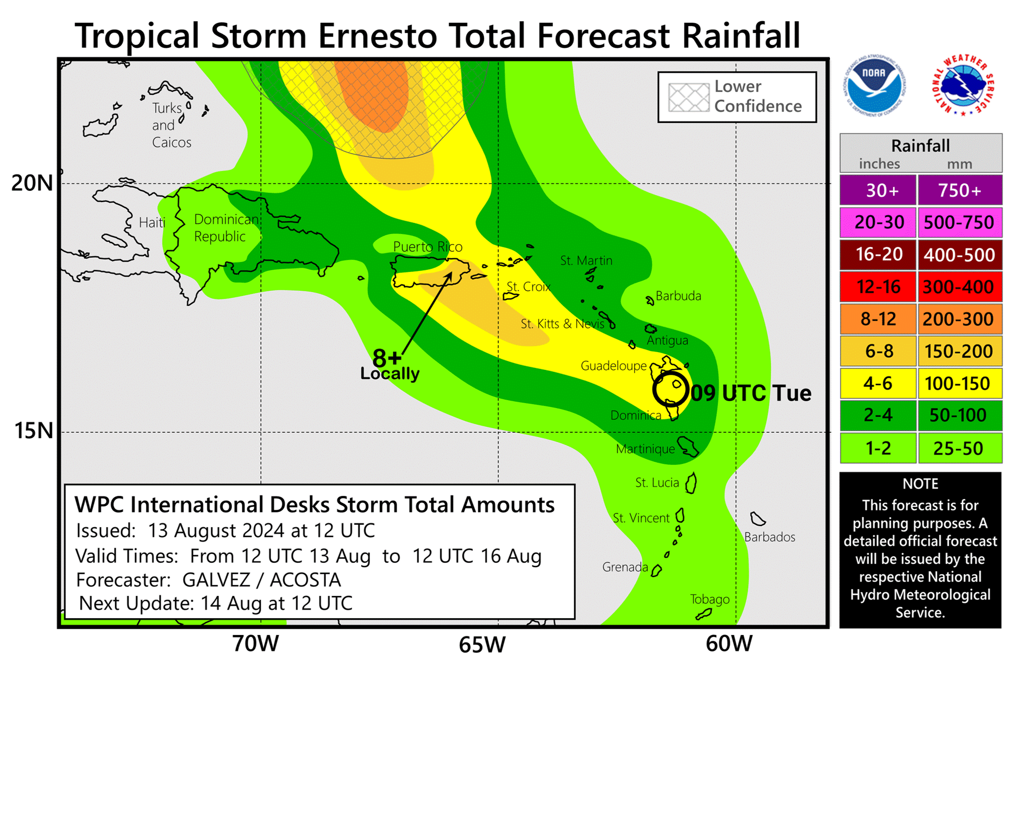
Flooding is a good bet on parts of Puerto Rico, mainly on the south and east coasts of the island. Additional heavy rain may impact the US Virgin Islands, Vieques, and Culebra. Lesser heavy rains will impact the British Virgin Islands and other portions of the northeast Caribbean. Obviously, wind will be a bit of an issue, especially north and east of where the center tracks, hence the hurricane watches for the islands just east of Puerto Rico. And rough marine conditions will continue in the northeast Caribbean through tomorrow.
Bermuda bound?
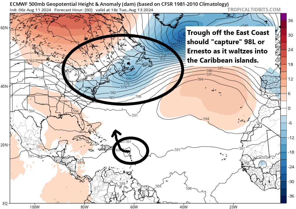
Beyond the Caribbean, Ernesto is likely to turn northwest and then northward, steering clear of the Turks and Caicos Islands, but tracking toward Bermuda. The threat to Bermuda is a potentially serious one. We can examine that closer in the days ahead, but at this point, suffice to say model agreement is good on a track that brings Ernesto very near Bermuda as a hurricane in about 4 or 5 days.
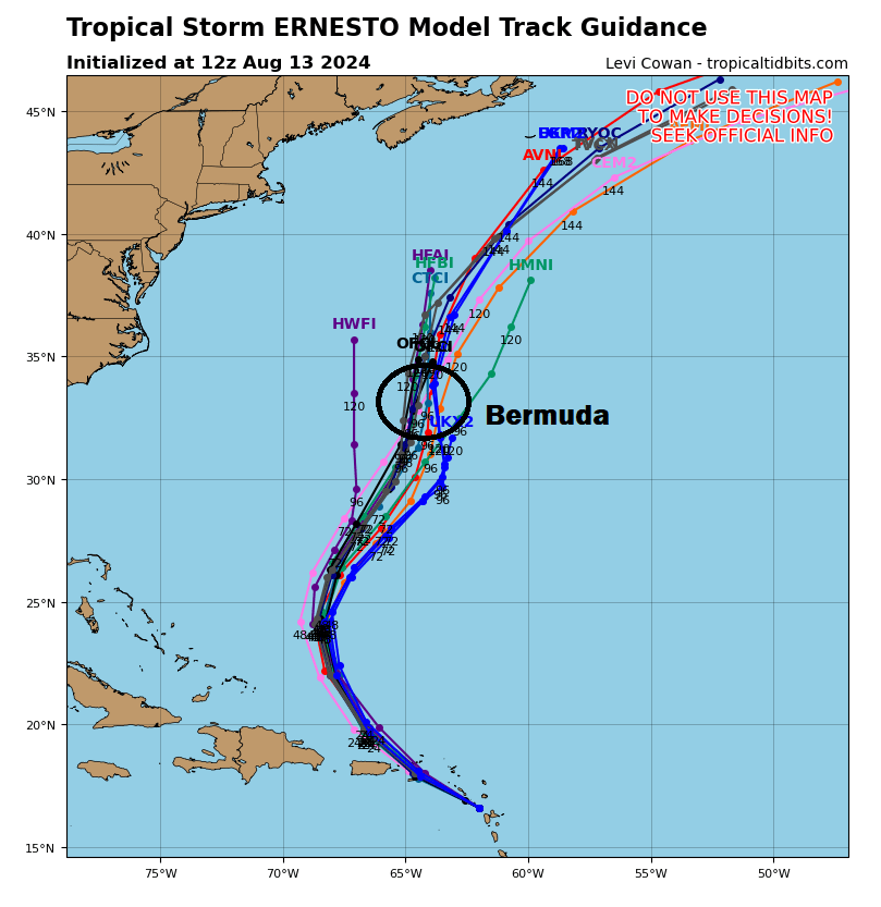
There are some questions as to how strong Ernesto will get as it tracks toward Bermuda, with the current official forecast keeping it just shy of major hurricane intensity. Modeling has backed off a bit on the high end of intensity as well, but there is always a chance that Ernesto could outpace model forecasts in terms of intensity in the next few days. So for folks in Bermuda, it’s probably a good time to start reviewing your hurricane plans with Ernesto sending a pretty clear message this far in advance.
Beyond Bermuda, there are questions as to exactly how Ernesto is steered which could have implications for Atlantic Canada in time. We’ll review that in more details as we get into tomorrow and Thursday.
The rest of the tropics are quiet with no threats noted.