In brief: Today’s post discusses our increasing confidence in the track for Tropical Storm Erin, and takes a look at some of the near- and long-term risks from this system, which should become a hurricane by this weekend. We also discuss a new Blobby McBlobface in the Gulf.
Status of Erin
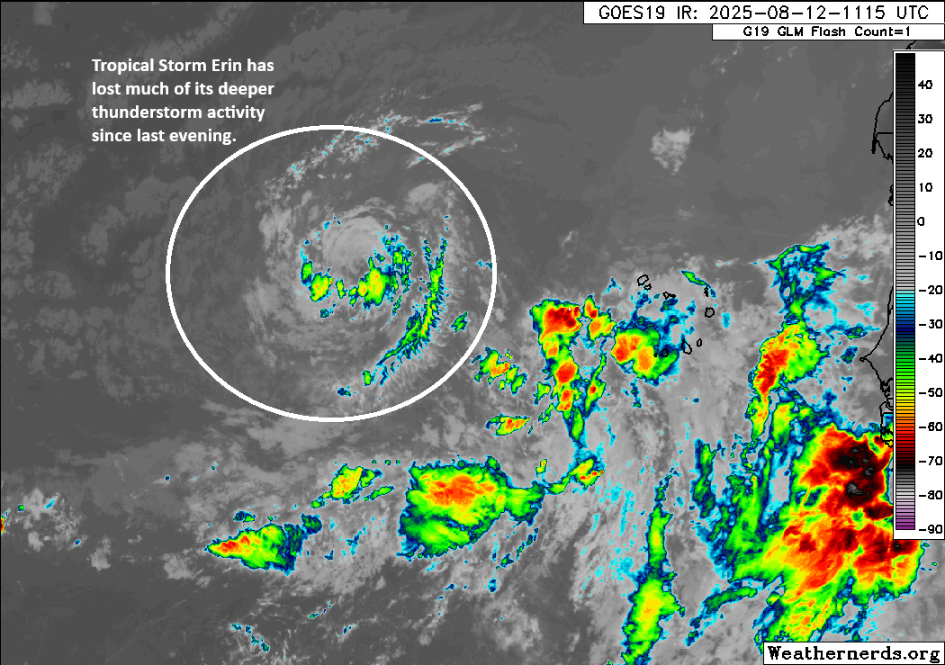
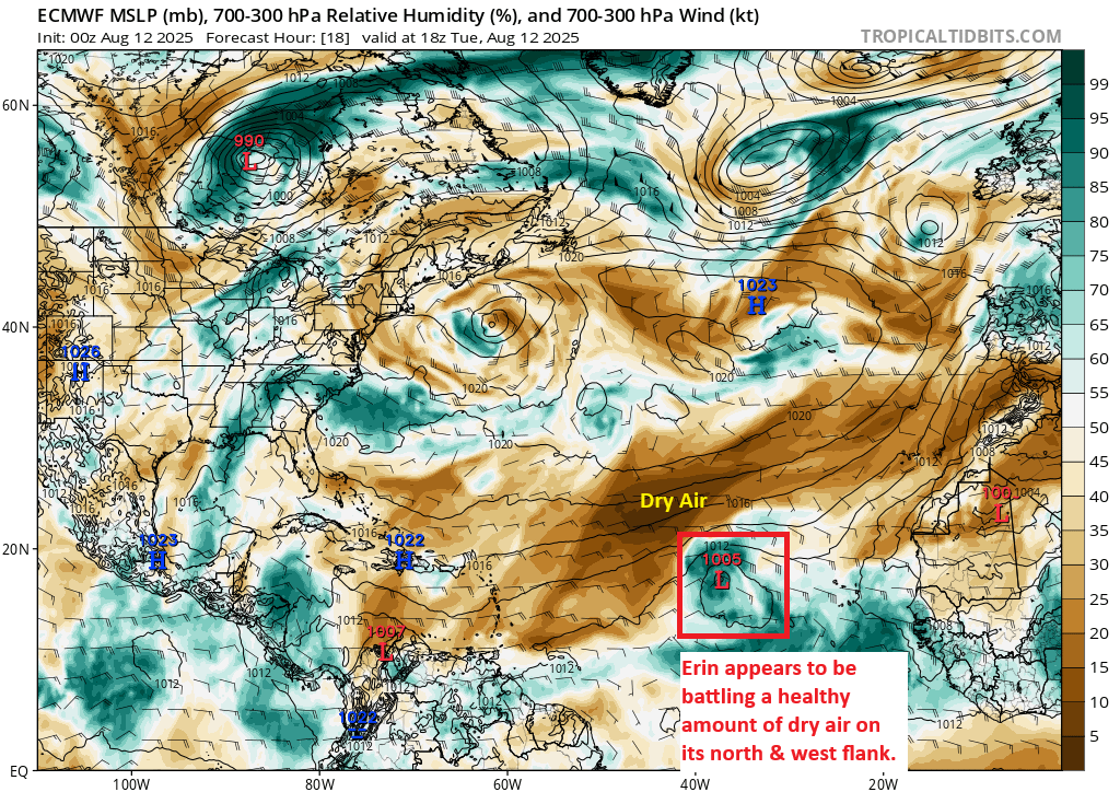
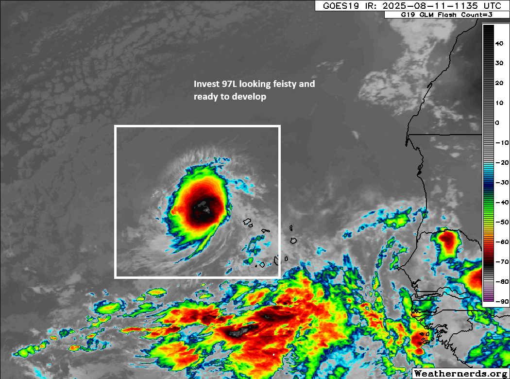
As of Wednesday morning the Atlantic season’s fifth named storm retains a fairly ragged appearance on satellite, with the National Hurricane Center (a bit generously, maybe?) holding Erin’s intensity at 45 mph. The system continues to encounter somewhat dry air, and sea surface temperatures that aren’t exactly sizzling. So Erin is just kind of slogging westward across the Atlantic. But it is making progress, having moved about halfway between Africa and the Leeward Islands; and Erin continues moving with purpose, at about 20 mph. On this path the storm should find more favorable conditions in the coming days.

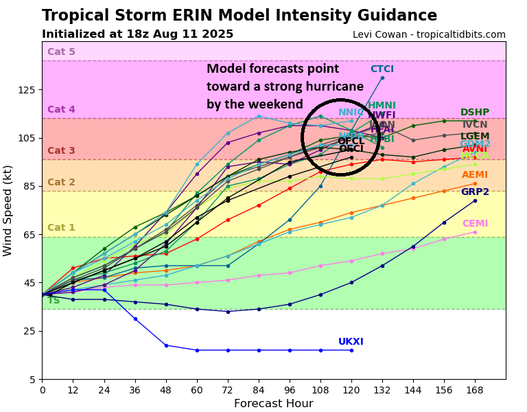
Those conditions include warmer water and, crucially, rising air that should support further intensification. Accordingly, the National Hurricane Center expects Erin to become a hurricane by Friday, and potentially a major hurricane by this weekend. This is well supported by a suite of models we look at, and seems like a reasonable best guess. Bottom line, Erin is still very likely to become this season’s strongest storm to date, by far.
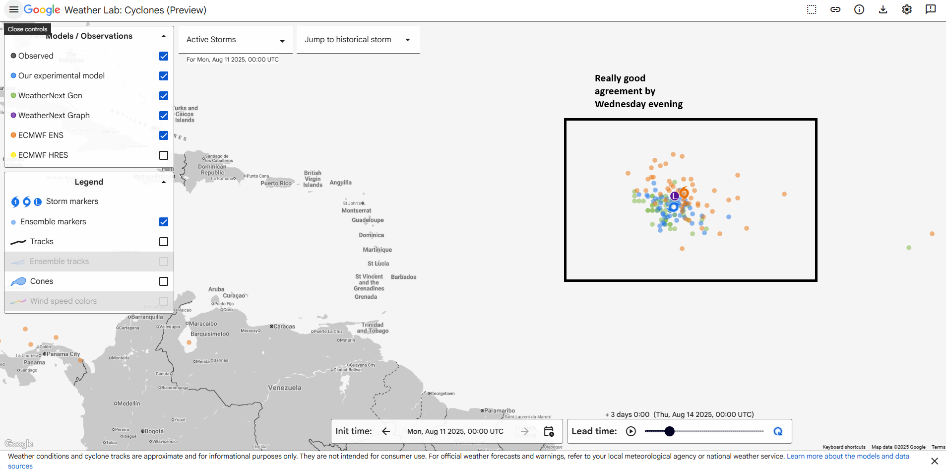
OK, so where is Erin going?
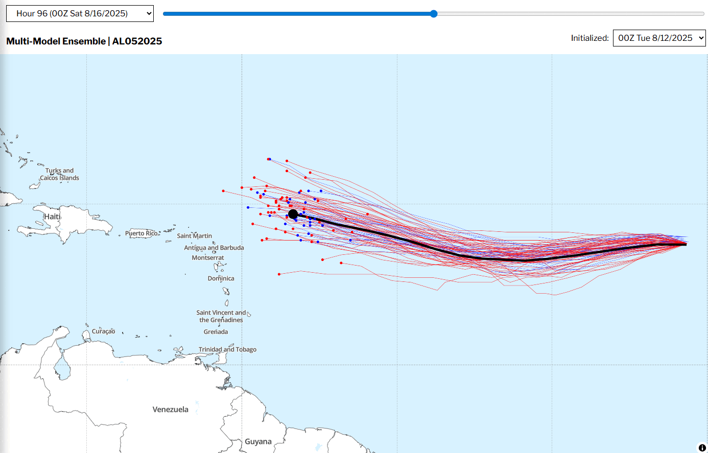
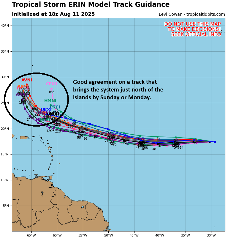
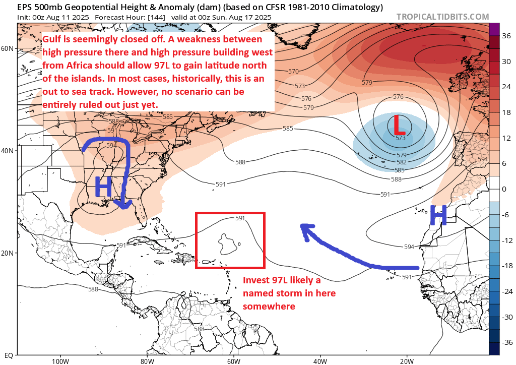
After several days of uncertainty, our confidence in Erin’s track is increasing. Although it is moving west now, it should slowly turn west-northwest by Friday or Saturday, and then northwest on Sunday as it finds a weakness in the high pressure system to its north. By early next week the storm’s center should lie somewhere to the north of Puerto Rico or Hispaniola, and be turning further north.
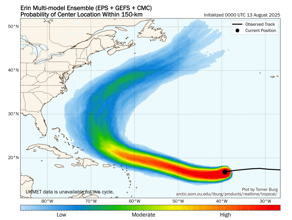
If we look at the overnight guidance there is a lot of support for this track, and it helps build our increasing confidence. Along this track the center of the storm should approach Bermuda by Wednesday (give or take a day) next week. We’re not saying the track of Erin is a done deal here, as there remains a broad range of outcomes beyond day four or five of the forecast. And we’re going to discuss other risks below. But at this time our land mass of biggest concern is the island of Bermuda. Residents there should be keeping very close tabs on the system.
Other concerns with Erin?
Yes, we have some. Depending on how quickly Erin strengthens (i.e. a slower-to-organize storm would remain further south) we would advise people living in the northeastern rim of Caribbean islands, including Antigua and Barbuda, the Virgin Islands, and Puerto Rico to remain vigilant. These islands are unlikely to see a direct hit from Erin, but they are at risk of higher waves and heavy rainfall beginning late Friday and running through the weekend.
Areas of the US East Coast, such as the Carolinas and Virginias, should also keep an eye on Erin. The risk of a landfall there is very low, but it remains non-zero. More importantly, like the Caribbean islands discussed above, there could be impacts to seas along with heavy rainfall. Overall our concern level for the mainland United States is fairly low, but at a week out we cannot say anything definitive about impacts there.
What about the Gulf?
What about it? I like living there. Good people. Great seafood. This week even the waters near Galveston have even been blue-ish. Oh, you mean the new tropical blob there highlighted by the National Hurricane Center this morning.
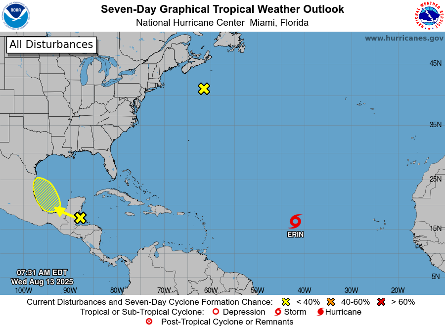
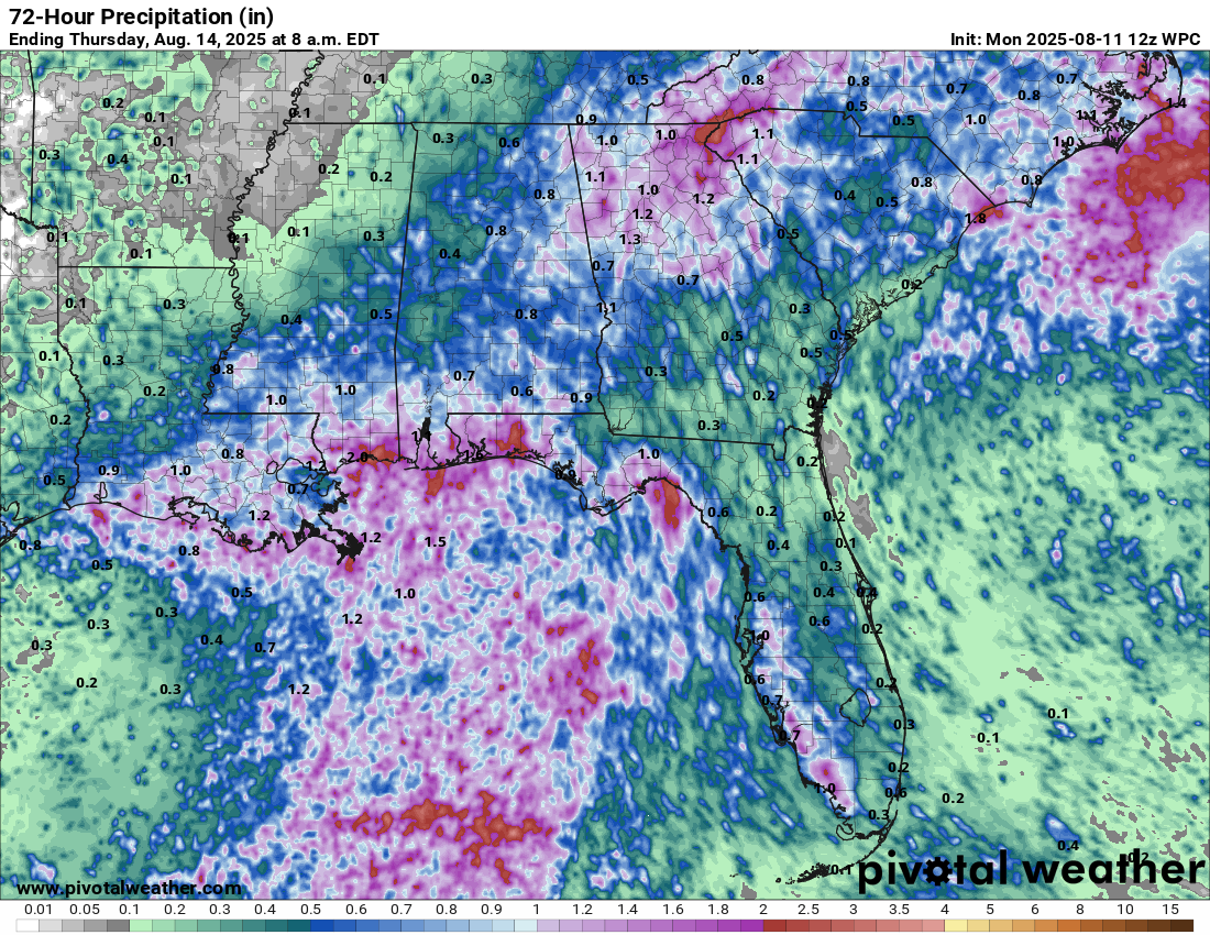
Well, I don’t have much to say about this this morning. On one hand, yes, the calendar says it is August. So anything tropical in the Gulf at this time of year raises one’s eyebrows. But I’m having a hard time getting too worked up about a tropical low that will find only marginal conditions for development. If we dig into the ensembles there does not even appear to be too much of rainfall threat. For example, based on the European model, the probability of rainfall amounts of 4 inches or greater is near zero for all but a few isolated areas of Mexico. So yes, we’re going to watch this thing. But no, we’re not going to get too excited about it.
What else?
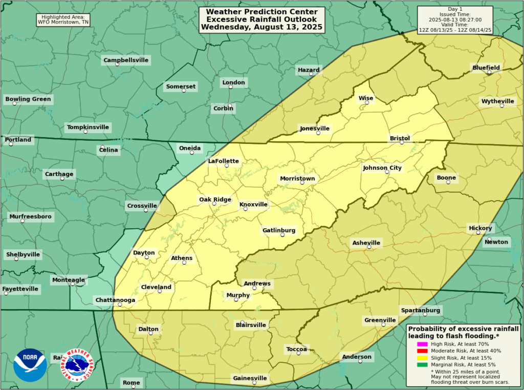
Overall it’s fairly quiet out there today. We’re watching for some flood concerns in southern Kentucky and Tennessee, including the Great Smoky Mountains area. A flash flood watch is in effect for much of this area, where there could be some training rainfall and higher wind gusts. The threat of heavy rainfall should pass this evening or tonight.
Beyond that, it’s mostly just hot out there in the United States, which is to be expected in August.