Headlines
- Helene recovery is likely to take a very long time, and we have some links where you can donate.
- More rain the next couple days in Virginia and West Virginia.
- Another Gulf system is becoming possible late this week or weekend and may again track north and northeast toward the eastern Gulf, but there is high uncertainty.
- Isaac and Joyce will dissipate this week, with Kirk likely to develop in the open Atlantic.
- Another system behind Kirk may bear watching in the Caribbean after this week.
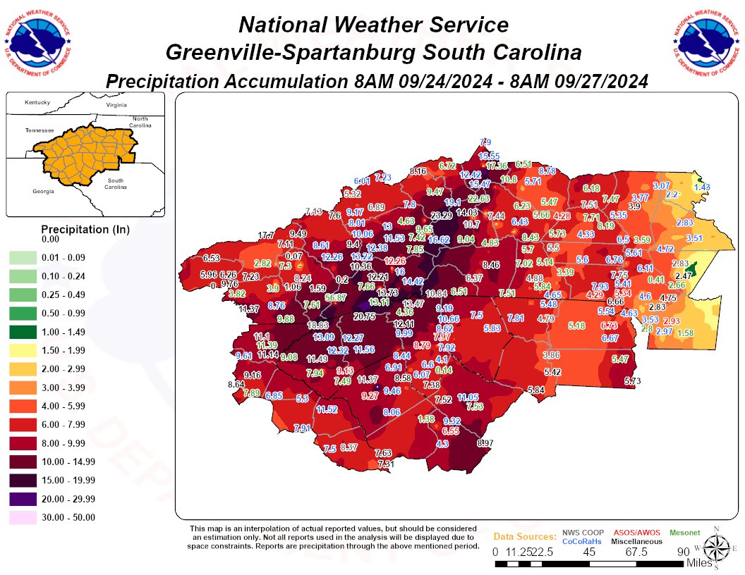
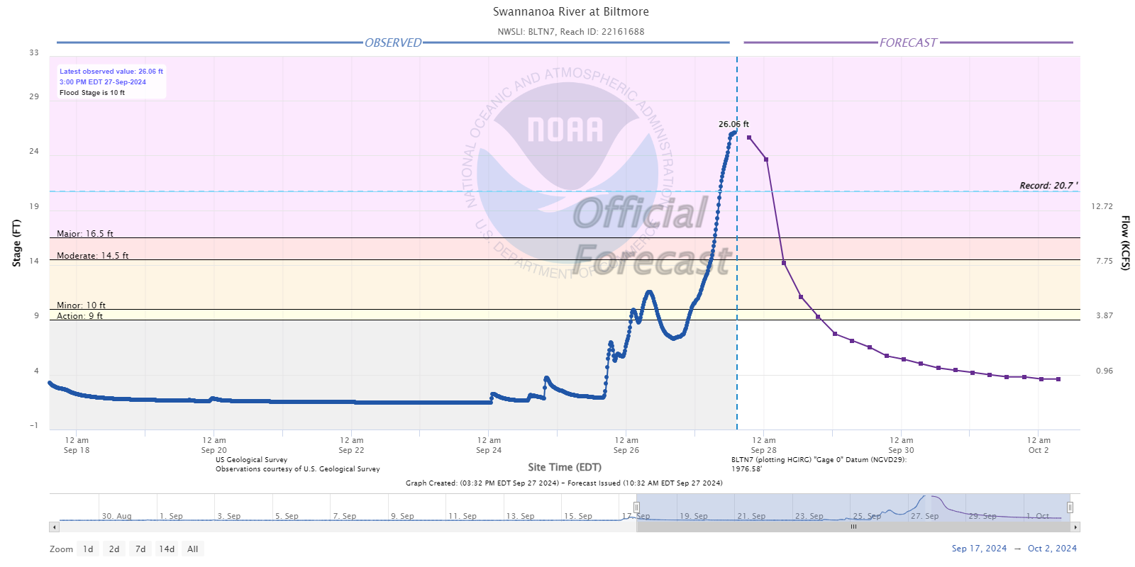
Our thoughts are with folks impacted by Hurricane Helene. From what I have read and seen and heard about some parts of western North Carolina and Tennessee, it’s really, really bad. Worse than might be known at this point. Speaking as someone from Houston, which was has dealt with floods and then been flooded with resources after storms, these more rural communities are likely to be dealing with this for a long time and will need a *lot* of help in the weeks and months ahead, as the resources and media attention don’t always focus on places like that.
Keep in mind that after catastrophes like this, “stuff” is nice to donate but what is really needed is money. So consider that if you’re looking for ways to help. The United Way of North Carolina has a fund setup specific for Helene. Blue Ridge NPR has a nice list of organizations you can donate to as well. There is also the East Tennessee Foundation for folks there. Please post any other organizations in these areas in the comments.
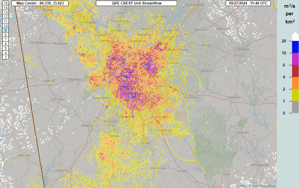
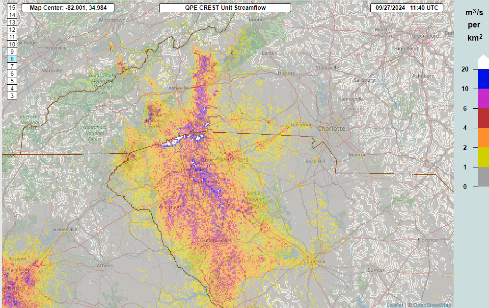
As of late Sunday morning, there are still about 2.5 million customers without power from Florida to Ohio. This is down from a peak of around 4.5 million. It will take a long time to get to some areas in mountainous and rural western North Carolina and eastern Tennessee though, and some of these locations could be without power for weeks; the damage is just that complete in these areas.
Storm surge is the deadliest aspect of a landfalling hurricane, but inland flooding can dwarf that sometimes. We’ve seen it time and again in the last several years. If you live inland in the Southeast, Mid-Atlantic, or Northeast, you need to be prepared for hurricanes too.
There will be a lot more to discuss with Helene which we’ll save for another day. But suffice to say we have seen the worst-case scenario play out a lot more often in recent years. And this is going to be a big discussion point going forward both in how forecasts are communicated and how communities prepare for storms. You can’t rely just on the known lessons from past disasters anymore.
Forecast this week
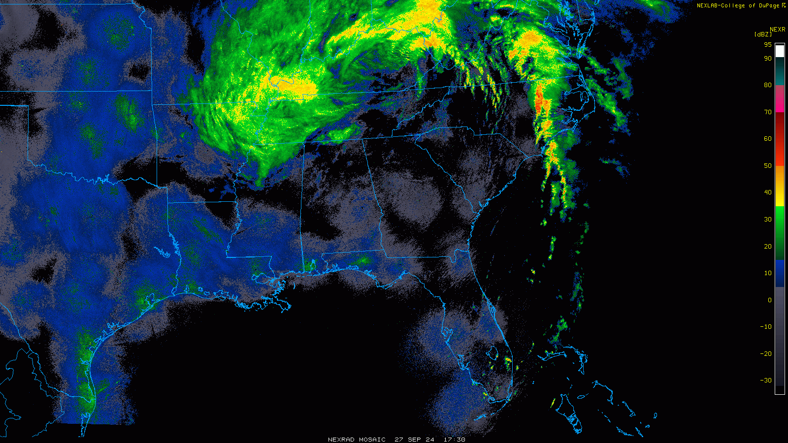
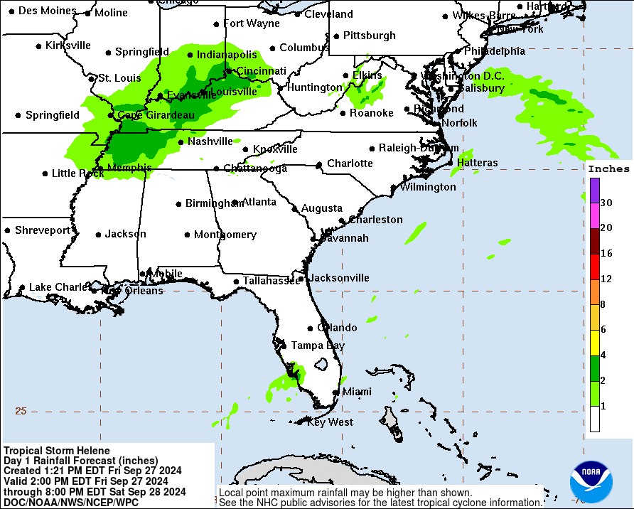
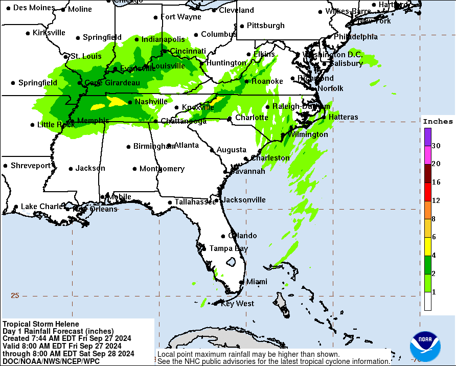
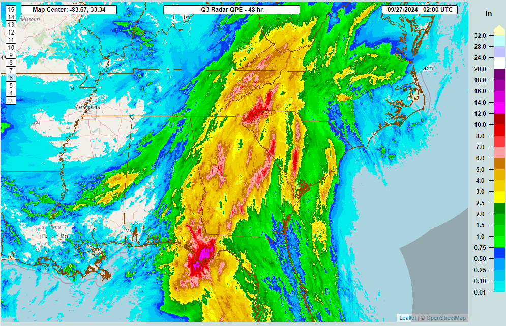
The upper low and remnants of Helene will continue to produce generally light showers across the Midwest and East the next couple days before finally being ushered off to the east later this week. There will be pockets of steadier rain though, particularly in Virginia and West Virginia. Total rainfall over the next 5 days could add up to a couple inches there.

Localized flash flooding is possible today and tomorrow in the mountains there or Shenandoah Valley. These areas were not as severely impacts as areas to the south, but they remain vulnerable to localized flash flooding impacts.
Gulf & Caribbean: Something to watch
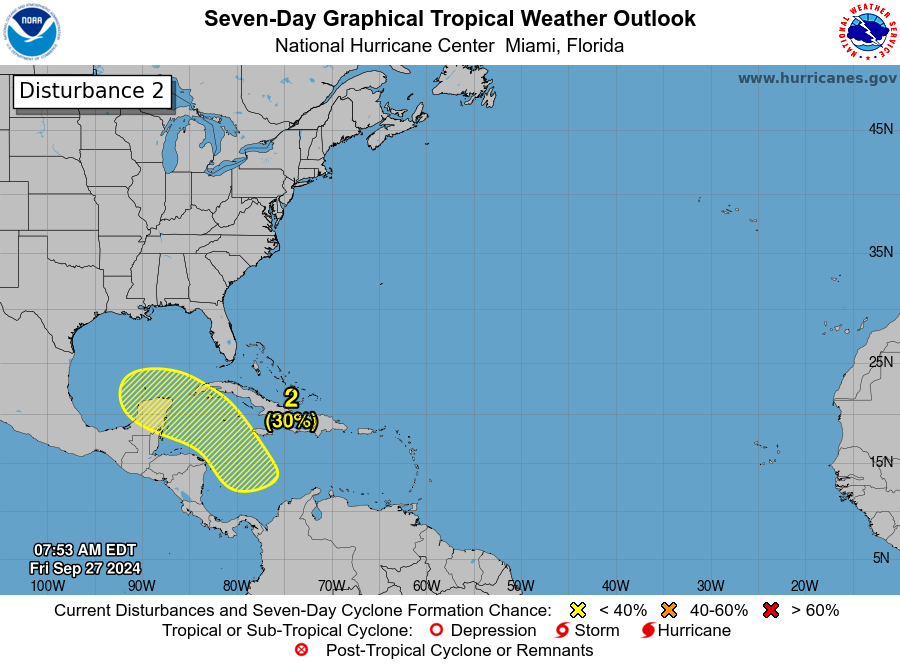
So what comes next? Unfortunately, the NHC now has a 50 percent chance of development somewhere between the Gulf and northwest Caribbean over the next 7 days.
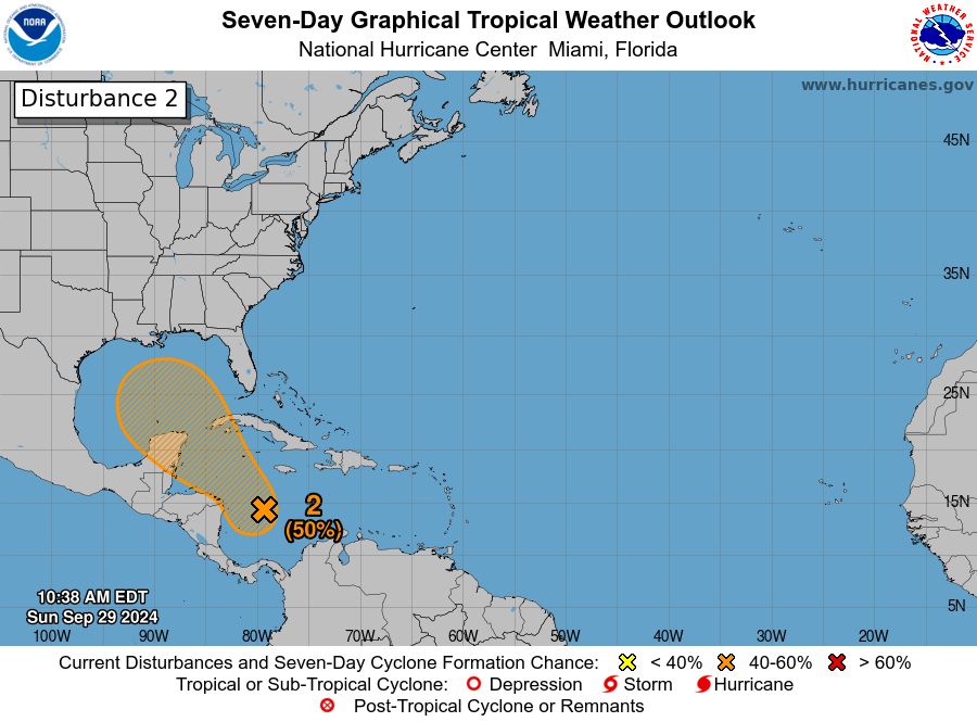
For our many readers in Texas, at this point, I would not expect this disturbance to come this far north and west. It will take at least the next 3 to 4 days to develop, and by the time it matures enough, it appears a cold front is headed toward the Gulf that will likely carry this back to the north and east. What this means for places from New Orleans through Florida is still a bit unclear. Modeling is sort of all over the place. At this point with Helene, we had basically two very distinct camps, one that buried the storm near the Yucatan and another (that got it right) carrying it north and northeast as a stronger storm. For this system, we have a similar sort of mixing of outcomes but there’s not exactly a distinct grouping of camps. In other words, there’s a good deal of uncertainty. The GFS ensembles are mixed, with some favoring a stronger storm headed back toward Florida and another group that ends up weaker. Some modeling doesn’t develop this at all. The ICON and European AI models generally show slower development and slow movement.
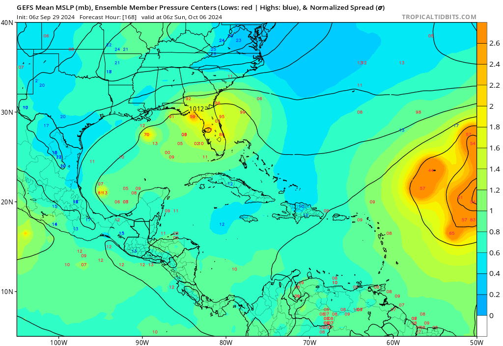
Given the uncertainty here, it’s important to continue to monitor this over the next couple days, especially in the eastern Gulf. But I will say that the more mixed nature of things in modeling makes me feel that a Helene redux is unlikely in this scenario. That said, keep watching. Impacts, assuming the system develops would likely occur next weekend.
Elsewhere in the Atlantic: Kirk to come
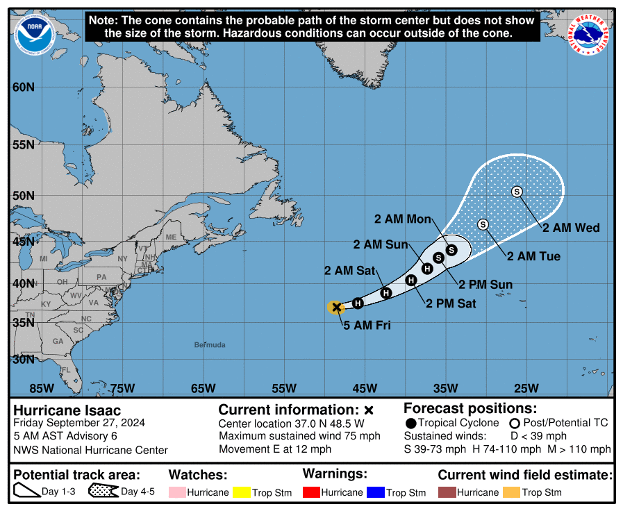
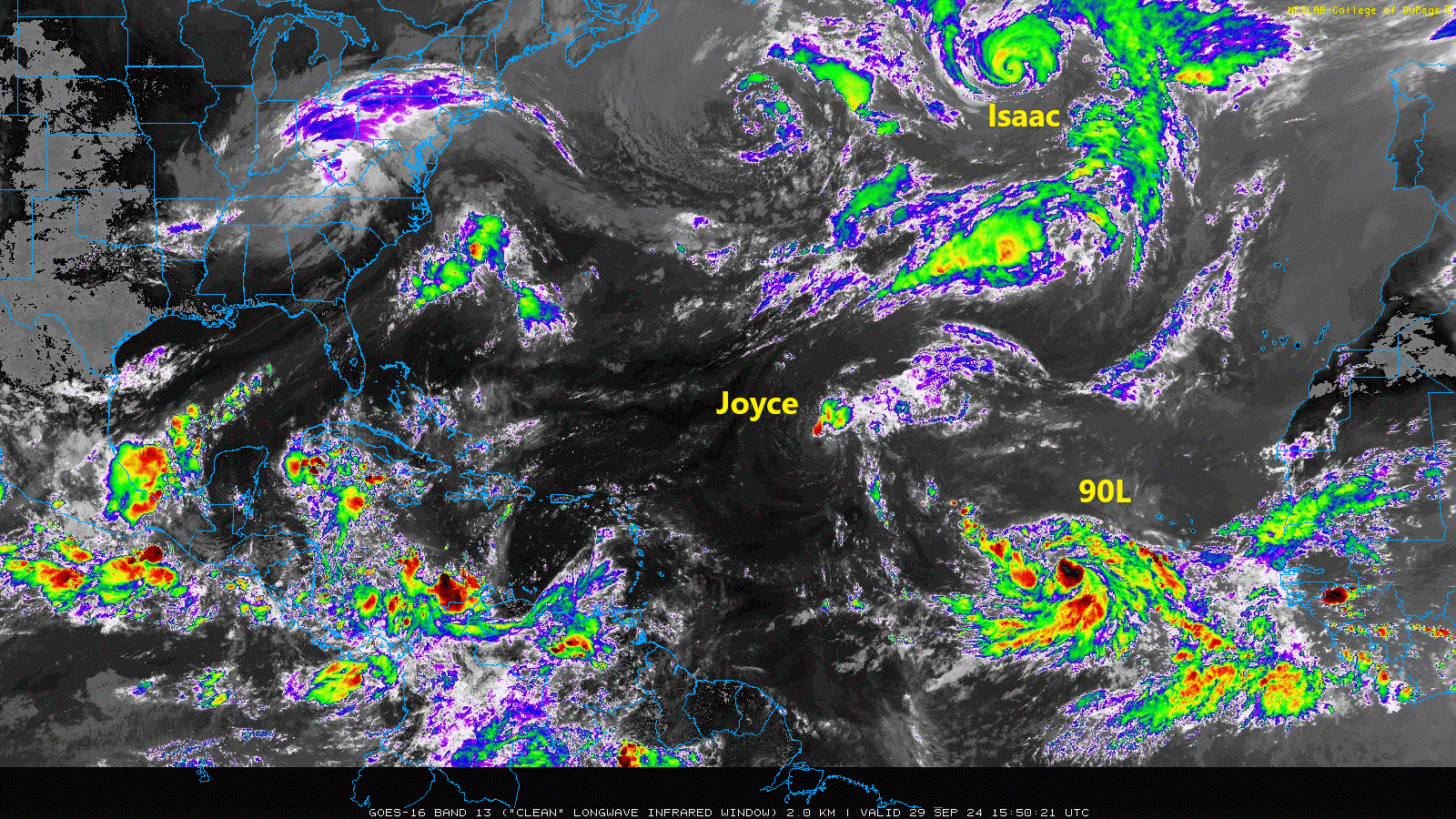
We currently have two active systems, Hurricane Isaac and Tropical Storm Joyce. Neither are direct threats to land.
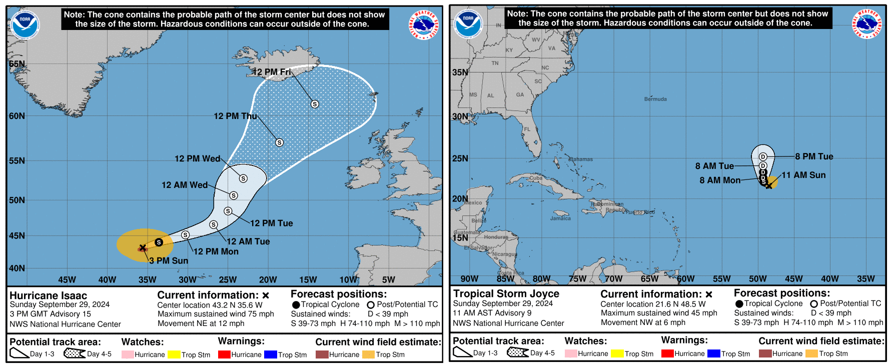
Both storms should lose tropical characteristics over the next 3 to 4 days and dissipate. Isaac will become part of a larger storm just north of the British Isles, as is periodically the case with North Atlantic storms.
Meanwhile, there are two additional areas to watch in the eastern Atlantic. First, there is Invest 90L, which looks like it’s ready to go off to the races. This one should turn northwest and north, generally following Joyce.
The next name up is Kirk. Although this one is expected to go out to sea it’s worth keeping a side eye on for the Caribbean and Bermuda at least.
Behind 90L we look to have another disturbance in that cloud cover back off Africa. This is not expected to develop quickly meaning that it could come a bit farther west across the Atlantic. I might say that this one is more concerning in some aspects that what should become Kirk. If this can sneak west enough, it may find its own little environment to get going in. There’s not a ton of model support for this one either way, but interests in the Caribbean should at least keep an eye on it over the next 5 to 7 days as it comes west.
So over the next 7 to 10 days we likely have at least one more Atlantic storm and one more Caribbean or Gulf system. We may get a third storm in the Atlantic toward the end of that time horizon. Getting to (L)eslie or (M)ilton would put us at 12 or 13 storms for the season with a good 3 to 4 weeks of potential to go. Still far short of preseason expectations but somewhat less of an error. We’ll watch everything over the next couple weeks and keep you posted.