Headlines
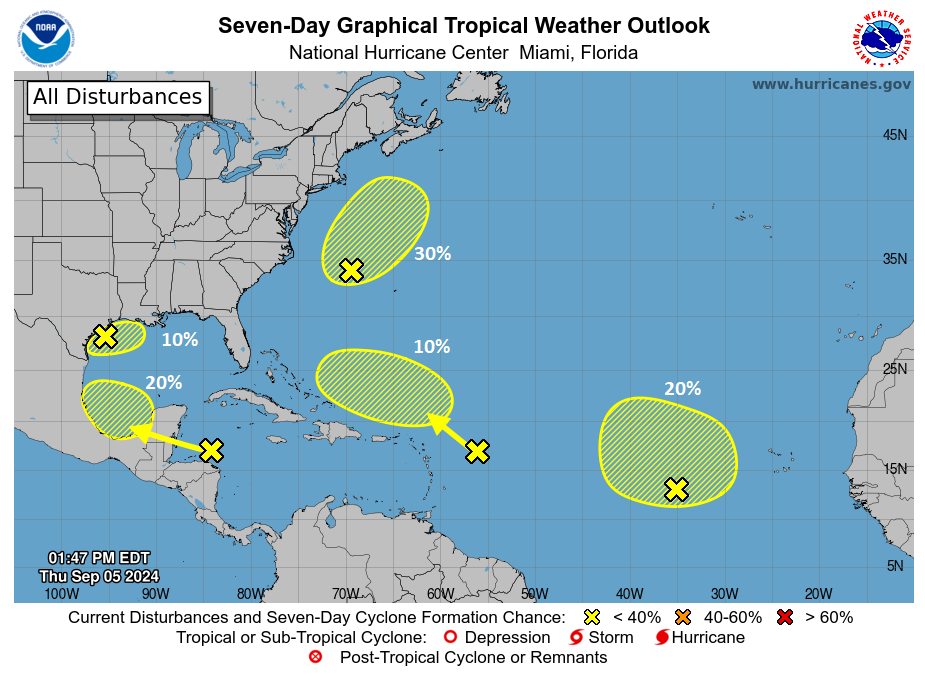
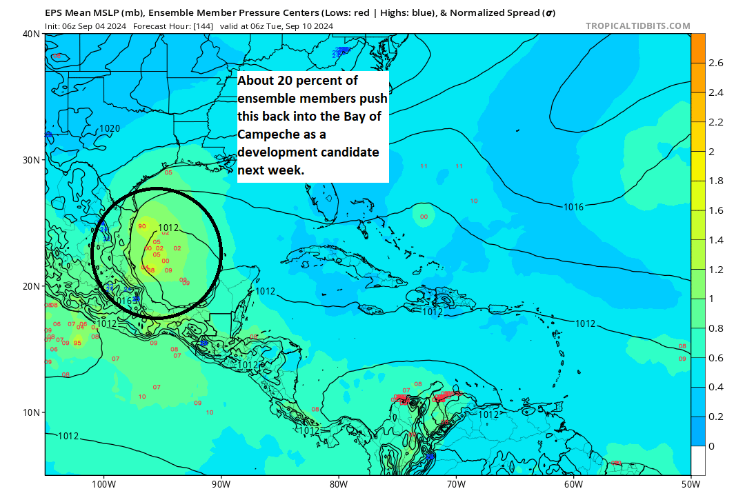
- Invest 90L will drift south into the weekend and eventually partner up with a tropical wave moving into the Bay of Campeche.
- Development odds are up to 40% on that as it tries to get started off the coast of Mexico.
- There is uncertainty on whether it will develop or how close to the coast it will be if it develops.
- We do not currently see much risk that this becomes a hurricane.
- Regardless, interests between Mexico and Louisiana should monitor this disturbance, and we are watching the potential for another round of locally heavy rain, with or without a named tropical system.
The Gulf will not stop making noise
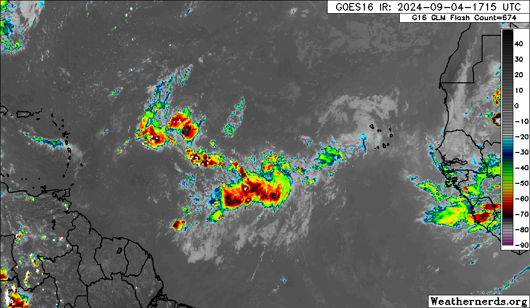
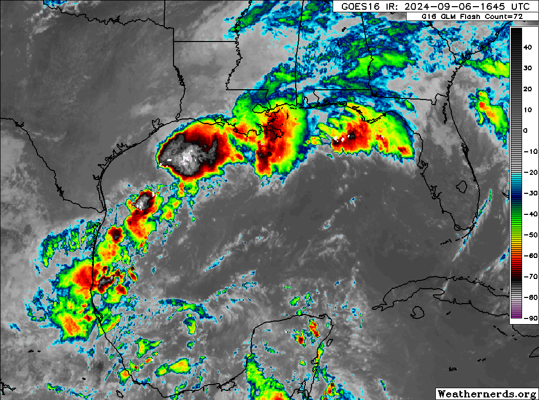
The main focus of activity, at least in terms of any practical, meaningful impact of late has been the Gulf of Mexico. After I posted yesterday, the low pressure system was defined as Invest 90L, our second cycle through the list of invests. I would have predicted we’d be on the third cycle through by now. (Invests are numbered 90 to 99 and then repeat, as they’re really just placeholders to run models on)
Anyway, looking at the Gulf today, you can see Invest 90L in all its glory. It’s drifting southward, while a lot of its moisture gets sheared off to the east. Basically, it’s beginning the transition into its next phase of life now.
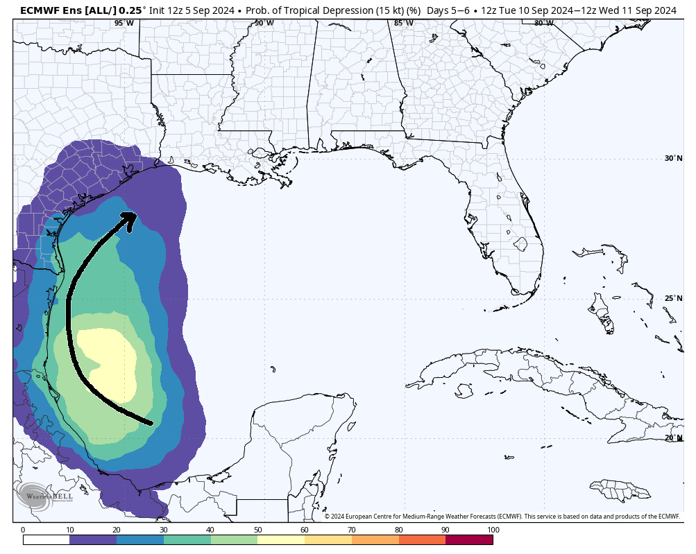
From here, 90L should drift all the way south into the Bay of Campeche where it’s going to finally meet up with the tropical wave we’ve been discussing ad nauseum that’s exiting the Caribbean today. Whether this gets classified as Invest 91L or stays 90L, I don’t know. It’s a procedural mystery. Whatever the case, I’m going to refer to it as 90L.
Anyway, by the time we get to Sunday, this whole mass congeals in the Bay of Campeche. It probably won’t develop right away, but it will begin to stir a bit.
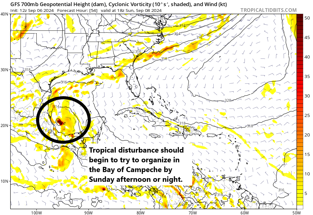
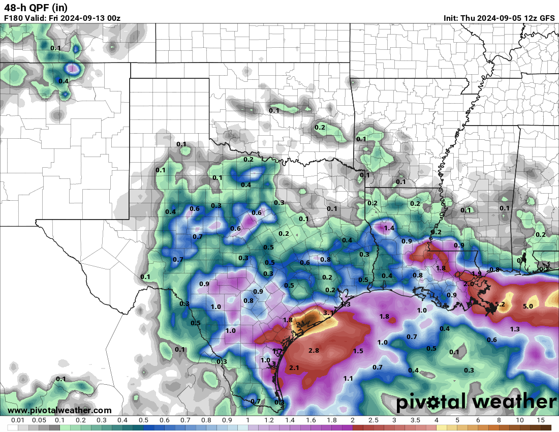
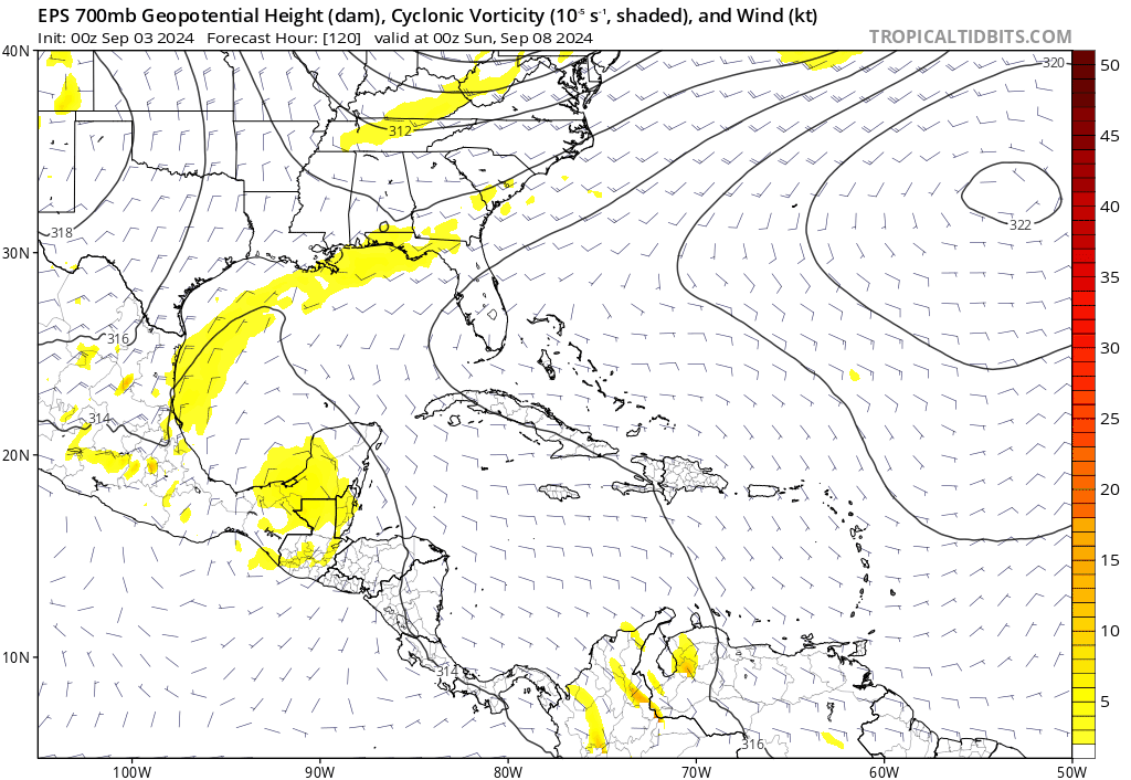
In general, from here we expect this thing to track northward. I think we stop at this point in terms of talking about specifics. Everything becomes kind of theoretical. If 90L forms farther offshore, it may have a better chance to organize a bit more and track more due north or north-northeast toward extreme east Texas. The stronger it gets, the farther northeast it will go, deeper into Louisiana. If 90L continues to hug the coast of Mexico, as shown on the GFS here, it would likely try to become a tropical storm and then slide inland. A weak system would probably come ashore *in* Mexico, whereas a slightly more organized depression or tropical storm would track more toward the Texas coast.
The ceiling on this is *probably* below hurricane intensity right now, if it develops. Never say never obviously, but virtually all the signals we are getting from tropical models, operational models, and ensemble guidance keeps this as a tropical storm or weaker. So from a “will we see widespread power outages and/or major hurricane damage” perspective, the answer is almost certainly not at this point.
But, I would advise folks between northern Mexico and Vermilion Bay in Louisiana to keep monitoring this through the weekend.
Gulf Coast rainfall concerns
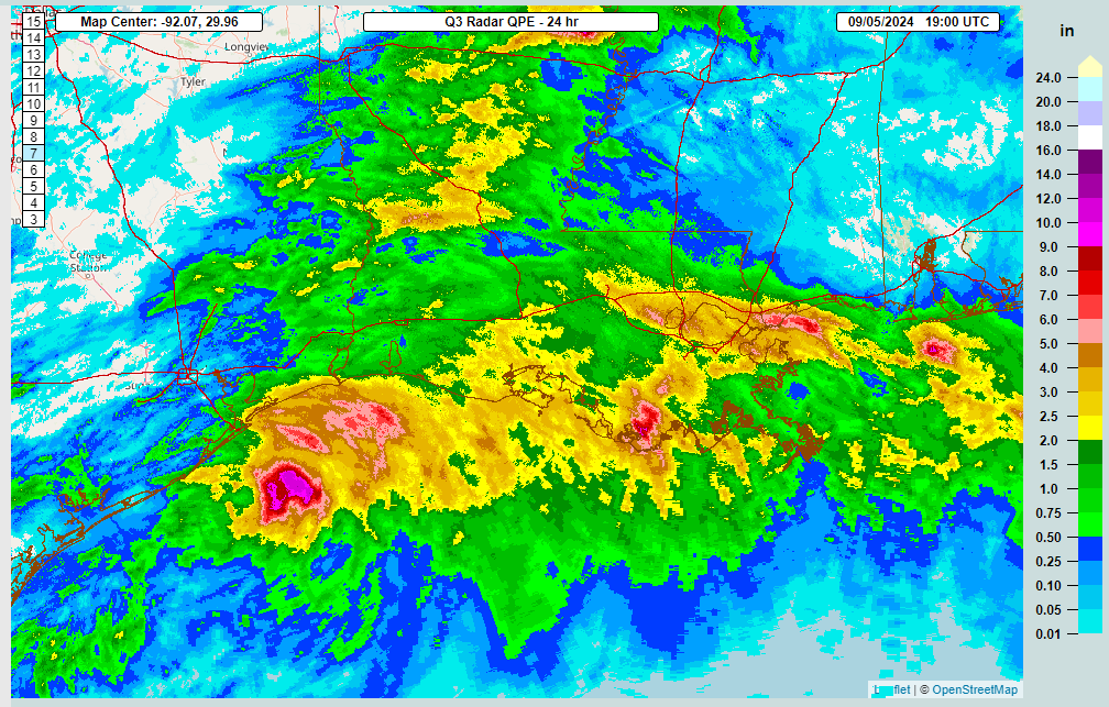
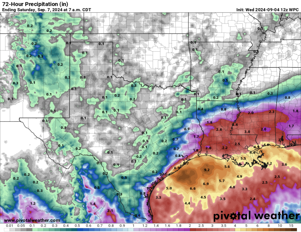
Now, the bigger concern I have with this system is rain. Rainfall over the last 10 days or so has been prolific in portions of Texas and Louisiana.
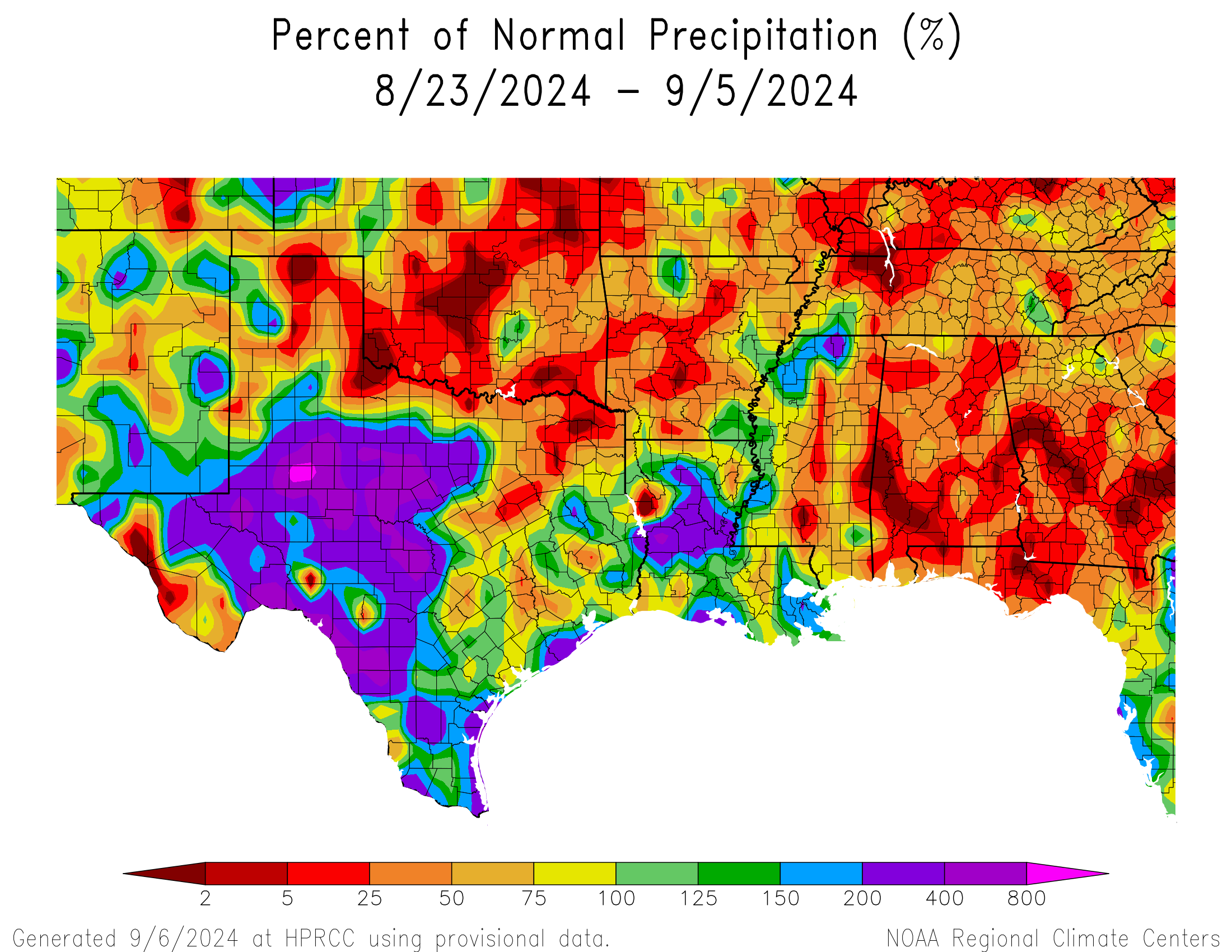
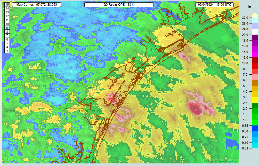
The Houston area has been primarily spared significant rain, but Galveston has seen over 10 inches. Louisiana has seen significant totals also. As has Corpus Christi. So there are a lot of vulnerable areas in between some areas that could handle rain fine next week. I won’t post a rainfall forecast because that outcome will depend on if a storm develops and how it tracks. There will be locally heavy rain even without a formal named storm, so no matter what, we’re looking at the potential for another 4 to 8 inches of rain or more in spots next week as this comes northward Tuesday through Thursday.
Bottom line: Check in on this again this weekend.
Elsewhere
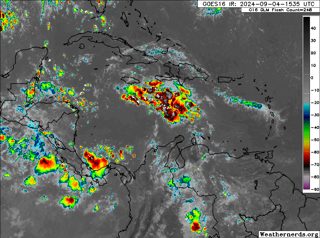
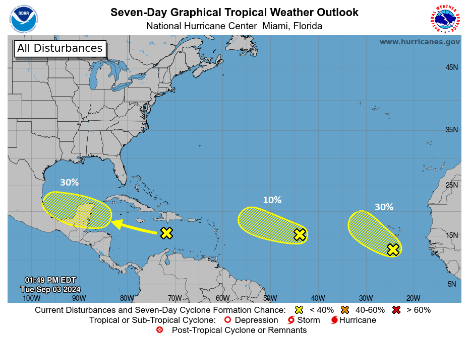
There is one system in the deeper Atlantic that has some potential to form next week, but it almost certainly looks destined to track out to sea right now. Either way, it’s so far off and so undeveloped at this point that it’s barely worth mentioning.
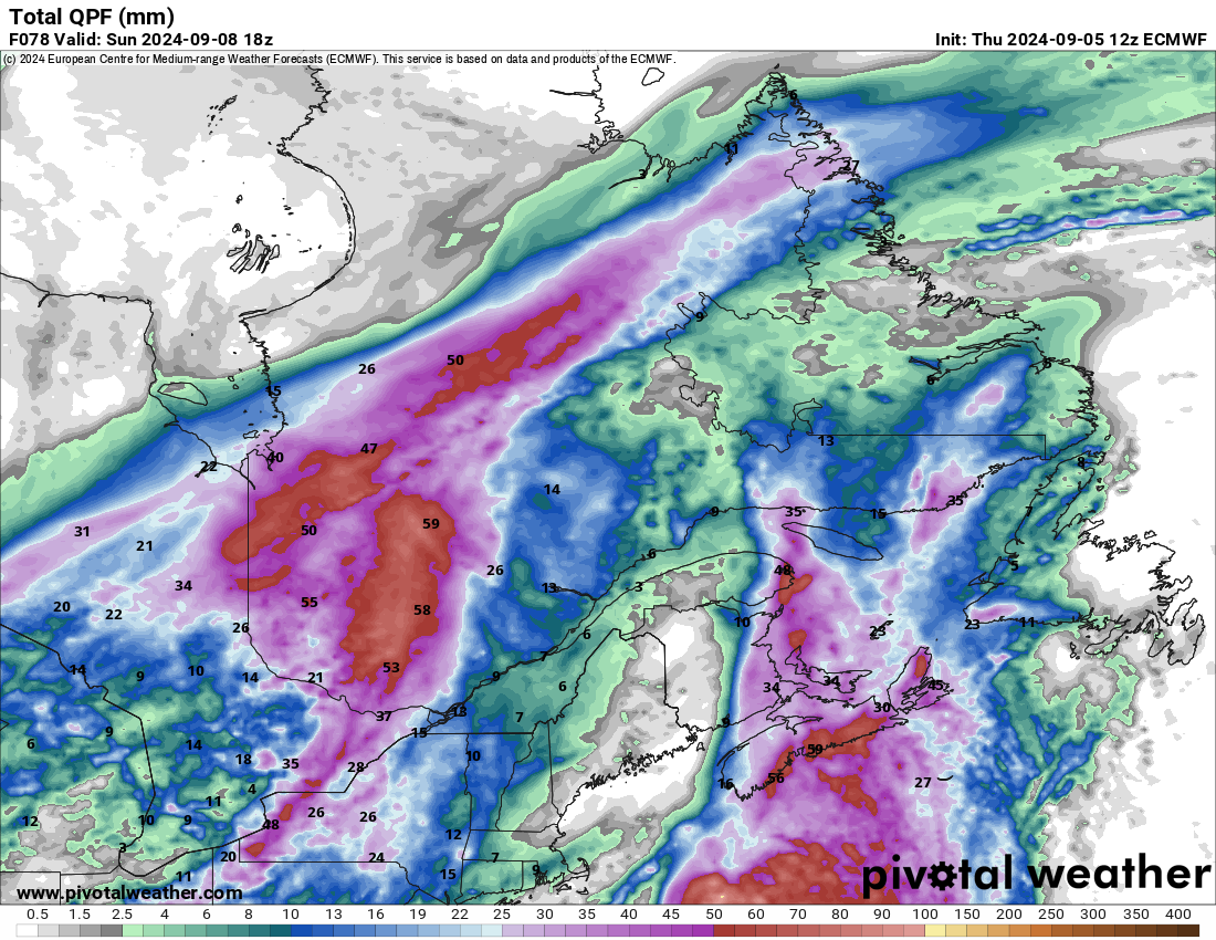
Atlantic Canada will see heavy rain and gusty winds from the remains of Invest 99L in the North Atlantic this weekend. That should be fairly quick moving but reasonably noteworthy.
Beyond all that, I don’t see anything of note outside the Gulf right now. We’ll have more tomorrow!