Headlines
- Slow tropical development is becoming a growing possibility in the western Gulf of Mexico heading into next week.
- Though there are no signs of rapid development, any organized tropical system would be slow to move and may impact rainfall forecasts for next week in Texas, Louisiana, or Mexico.
- The Atlantic tropical wave may hold off on development until it moves across the Caribbean, and it merits watching beyond later next week.
Watching the Gulf because we can’t not
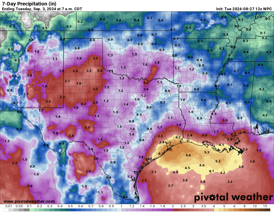
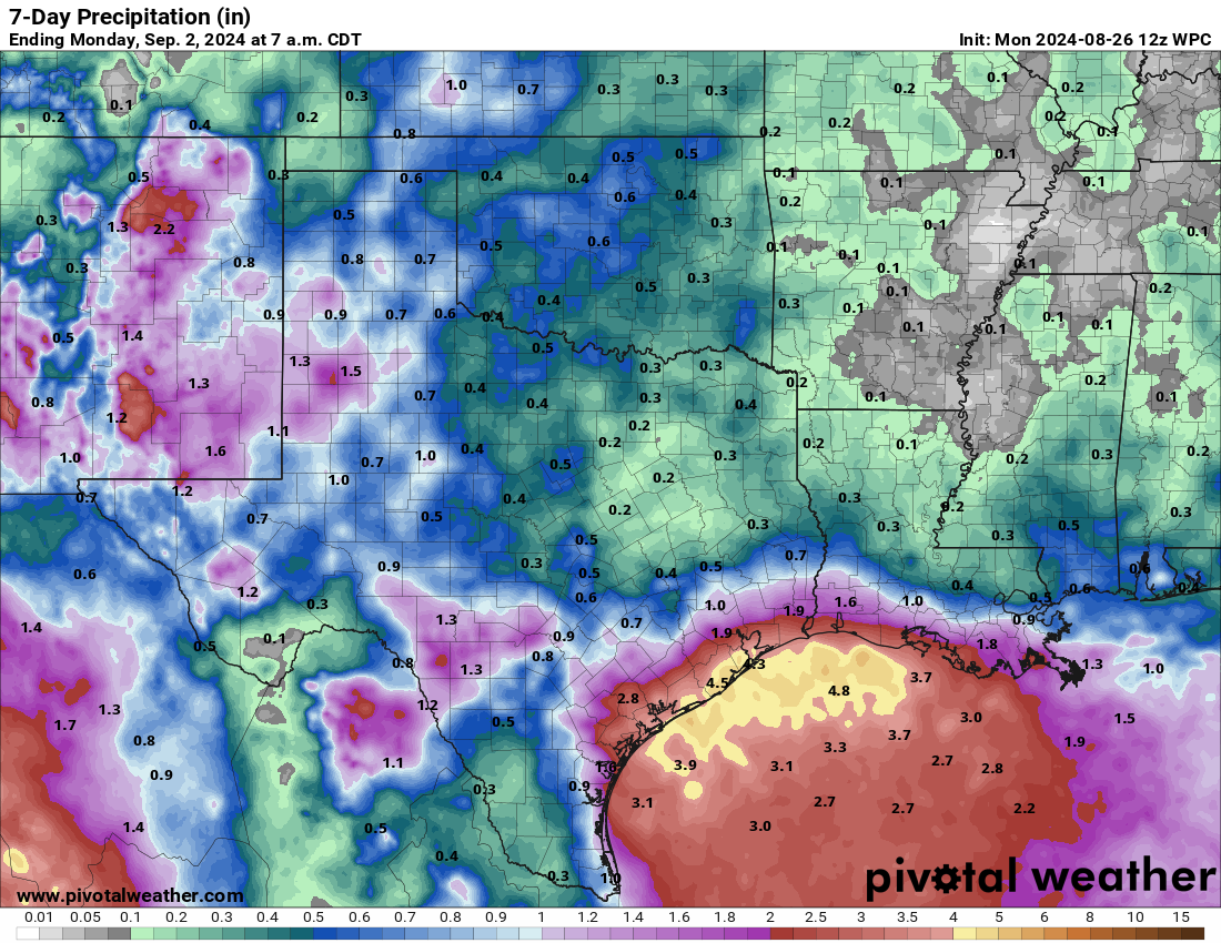
For anyone who forecasts or lives on the Gulf Coast, during hurricane season you know that when stuff just kind of festers offshore you at least want to pay attention. That’s where we are right now. There’s no imminent sign of development, modeling is generally muted on development over the next week, and it’s pretty clear that the primary issue on the Gulf Coast over the next five to seven days will be rainfall.
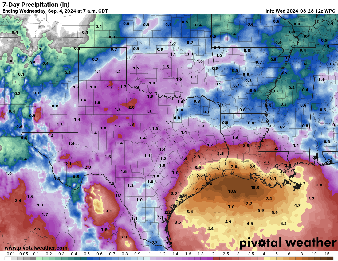
The good news for now is that the pace of the rain will come steady enough to hopefully avoid any meaningful flooding risks. Still, flash flooding and street flooding are always issues on the Gulf Coast in these patterns, so you should expect at least that.
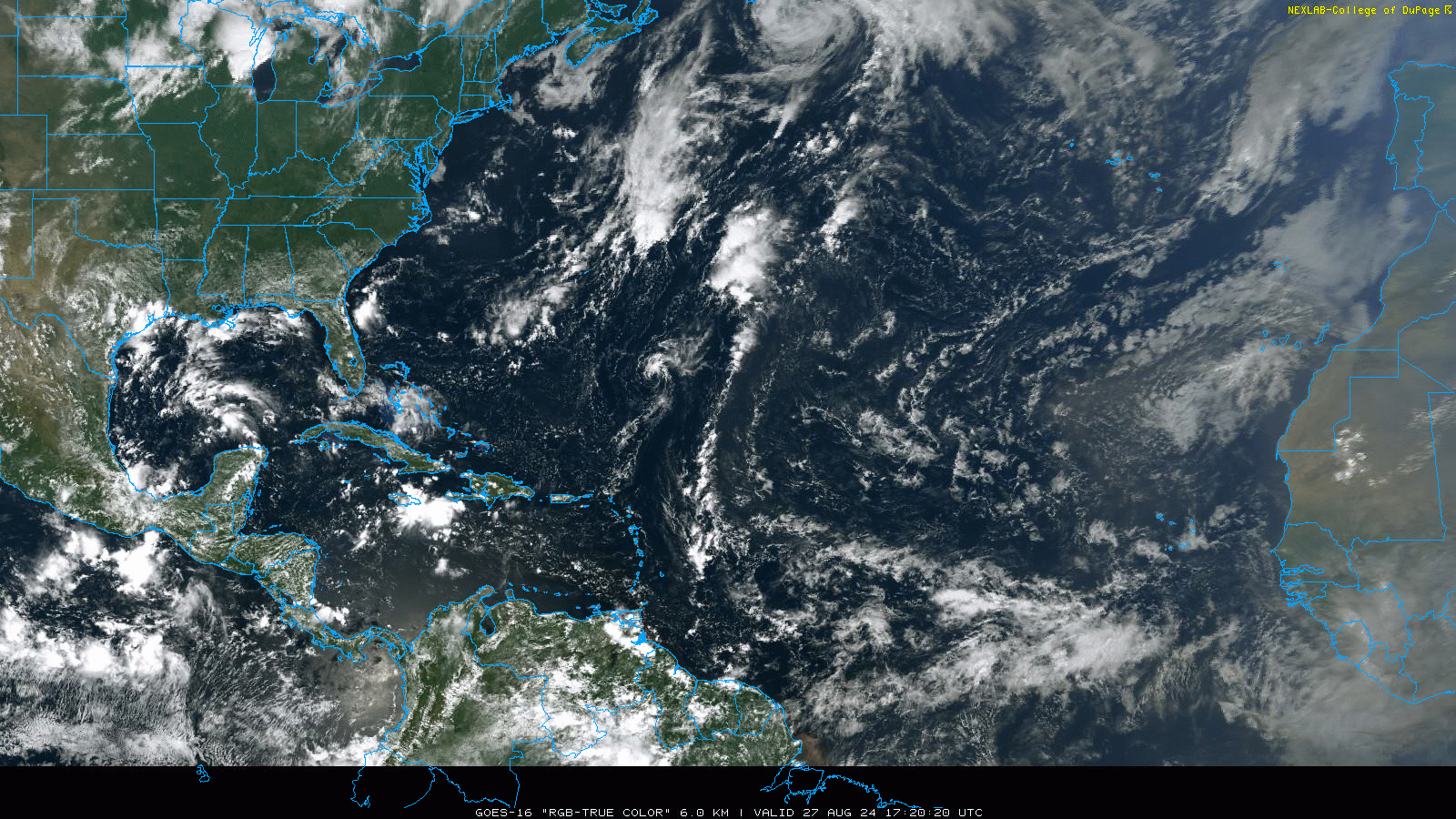
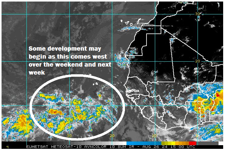
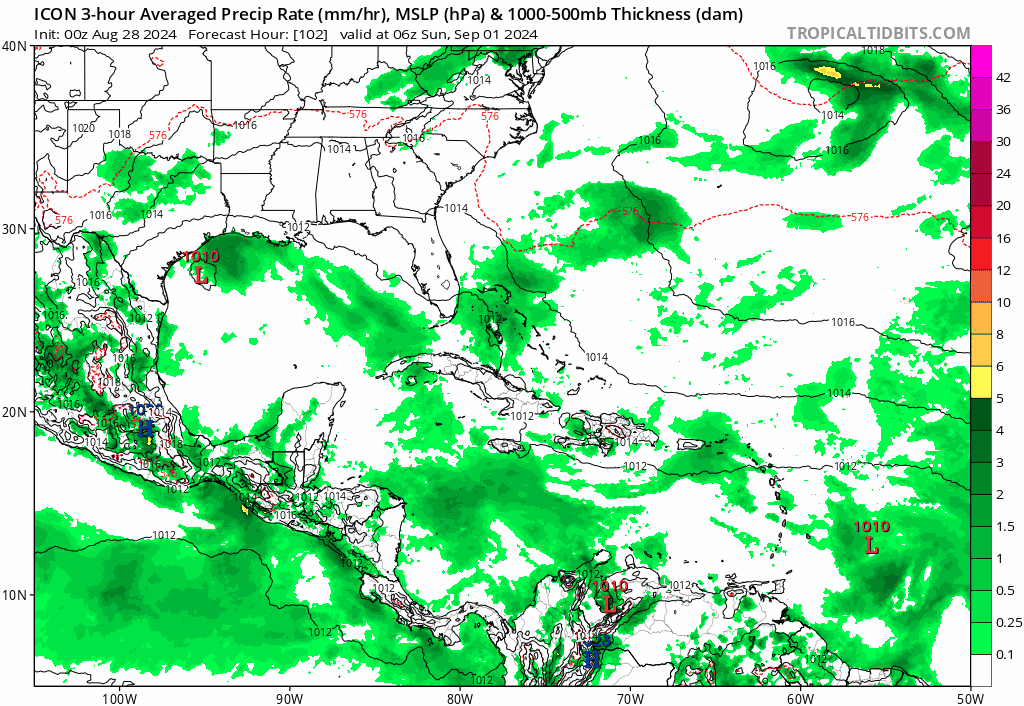
Back to the chances of tropical development. If you look at a satellite loop over the western Gulf today, you definitely see a lot of thunderstorms.
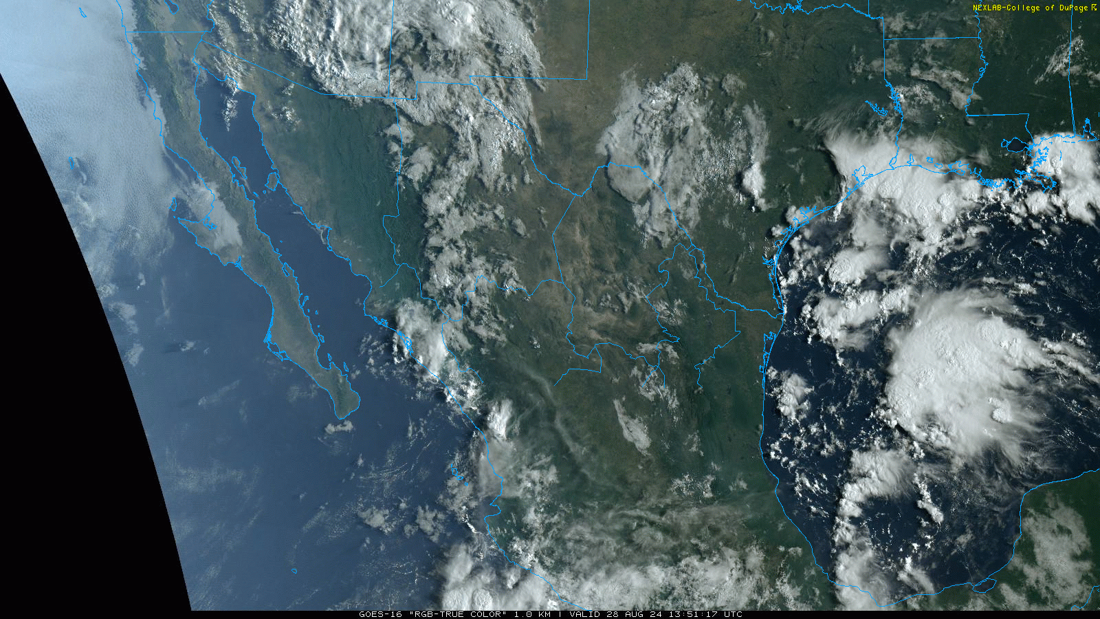
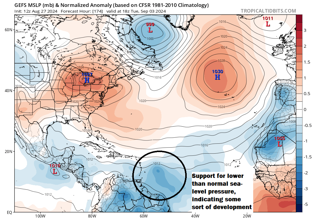
The good news is that these storms are associated with an upper-level low, not a surface low. Tropical storms and hurricanes develop at the surface, not upper levels. That being said, it’s not unprecedented for a setup like this to eventually yield a surface low. If that happens, you could perhaps see some slow tropical development. You could also see the heavier rainfall totals shift around into next week. Some modeling does bring a surface low to fruition over the next five or six days.
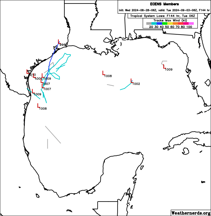
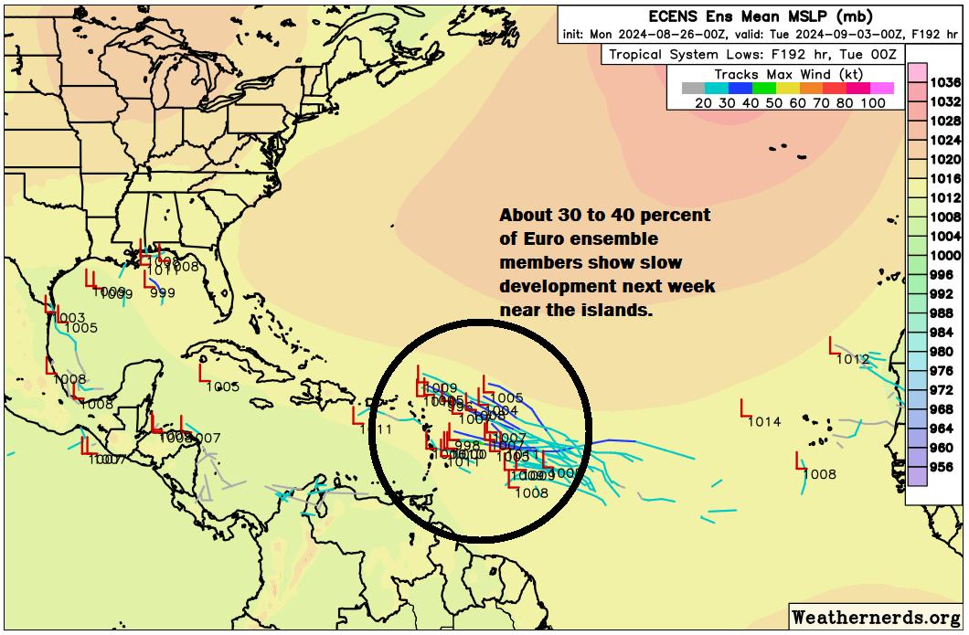
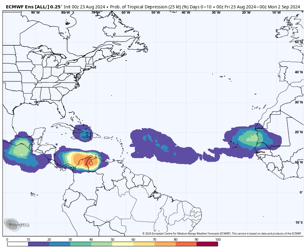
A handful of European ensemble members shown above do this. There’s a pretty consistent signal for this in the ICON model as well, not a one-off that leads to its somewhat divisive reputation as a tropical model. There are also hints of this in European model AI guidance too.
So what am I saying? We have enough model support to justify this as a potential area to watch over the next several days. Now, the good news is that none of these models develops the system into a hurricane. That said, a slow-moving system sitting off the Texas coast could produce some heavy rainfall, even beyond what’s currently forecast. Steering currents in the western Gulf are essentially dead calm next week, which means anything that does organize would move very slowly. If this just sits offshore and rains offshore, that’s no problem at all. But if things move farther north or west, then you have another story for parts of Texas, Louisiana, or Mexico.
So in summary…
- Tropical development may not necessarily be likely, but it’s a very real possibility over the next 5 days or so off the Texas coast.
- Any tropical system would likely be slow to organize and slow to move.
- There could be volatility in rainfall forecasts for next week if this comes to fruition.
- As always, uncertainty exists, so stay tuned and check back each day for the latest.
Looking in the Atlantic
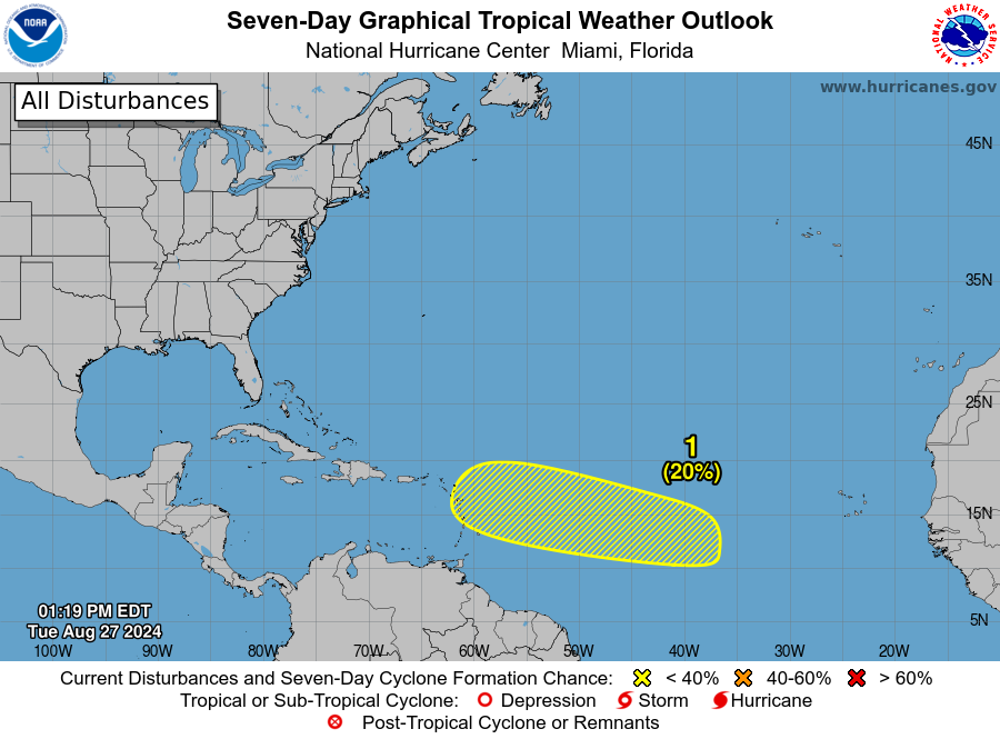
So we’ve flip flopped today, focusing more on the Gulf than the Atlantic. That’s because support for any development of the tropical wave moving into the islands next week seems to have ebbed a good bit today. Not to say it’s impossible; there’s still a 20 percent chance shown by the National Hurricane Center. But model support seems to have peaked. That said, with slower development chances, this means the system may wait til it gets into the Caribbean to organize. You can see that on the ICON loop above which ends with the disturbance sitting south of Hispaniola by the middle of next week. Something like that seems reasonable right now. Any development looks slow.
So where would it go from there? Obviously, this is a bit of a shift west from earlier this week when it looked as if this might follow in Ernesto’s footsteps off the East Coast of the U.S. I would anticipate now that this follows the base of high pressure east of the Bahamas toward the northwest Caribbean. From there, all bets are off.
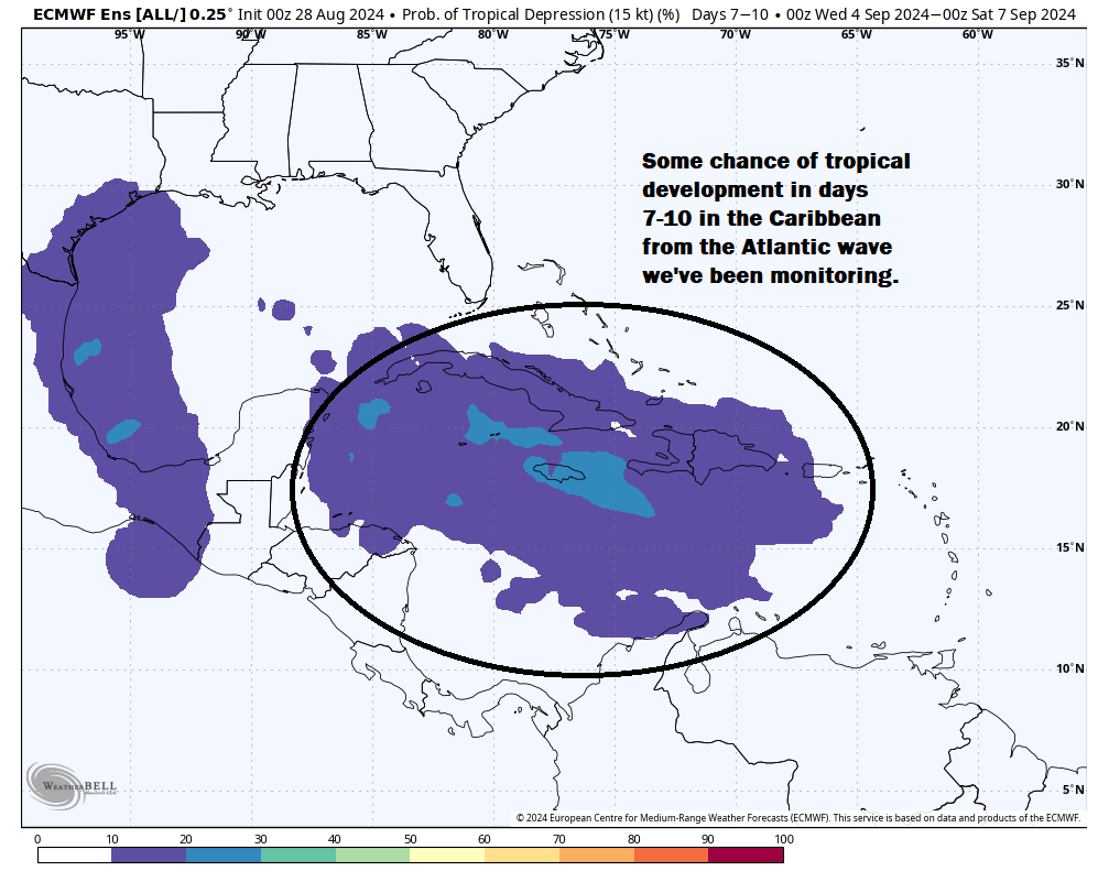
I would assume it comes into the eastern Gulf or toward the Yucatan, but it’s far too early to speculate much. Either way, while nothing is imminent with this one, it’s a sign to pay attention to things as we head into hurricane season’s peak month.
Behind this one, there continues to be model support for another wave emerging off Africa that could harmlessly turn north in the eastern or central Atlantic. We’ll keep tabs on that in case anything changes.
The NHC does have another area outlined in the open Atlantic southeast of Bermuda that has a very low chance of development, but it should not impact anyone.