June 21, 2023 Outlook: Bret muscling its way toward the Windward Islands

Good morning. Tropical Storm Bret continues to churn west in the Atlantic, working its way toward the Caribbean. It’s very clearly running into some challenges that are impeding it from strengthening a whole lot at this point, and it has about 24 to 36 hours left before those challenges get even more difficult to fend off.

Tropical Storm Bret should peak in intensity sometime today or tomorrow before running into some serious hurdles in the Caribbean. Tropical Storm Watches are posted for several Caribbean islands. (NOAA)

One-sentence summary

Tropical Storm Bret, ragged as it looks this morning, could bring heavy rain and tropical storm conditions to several islands in the Lesser Antilles tomorrow before steadily weakening once it enters the Caribbean.

Happening now: Bret feeling the thorns of the rose

Besides Bret, we continue to watch Invest 93L, which has an 80 percent chance of developing over the next several days. More on that below. First, let’s walk through our main item.

Tropical Storm Bret

As of the 5 AM advisory, Bret is a moderately strong tropical storm with 60 mph winds. Tropical Storm Watches have been posted for Barbados, Dominica, Martinique, and St. Lucia. Those should be adjusted or expanded later today.

Bret is clearly fighting off some shear and dry air this morning as it works west. (Tropical Tidbits)

The environment around Bret is a bit tough right now. There is about 20 to 40 knots of westerly wind shear zipping across the northern quarter of Bret’s circulation. In the satellite loop above, you can see how ragged the northern half of Bret looks compared to the southern half, and that’s likely due to wind shear. On the northwestern side of Bret, there is a bit of dry air as well. Because of Bret’s size (it’s got a fairly large circulation), it can’t quite fend that off completely. In fact, Bret’s size may be working against it some, as it is being exposed to more adversity than a smaller storm might be.

Wind shear is impacting Bret to the north right now, and it will only get worse as Bret moves into the Caribbean. (Tropical Tidbits)

So to summarize: Bret is an acceptable tropical storm by June standards for sure, but it is dealing with some dry air and a good bit of wind shear that will probably cap Bret’s intensity and trend it weaker as it moves into the Caribbean. An Air Force reserve hurricane hunter aircraft is expected to investigate Bret today to get a better idea of what’s happening out there.

From here, Bret’s track is pretty straightforward. Virtually all of the hurricane models and global models and ensembles are in good agreement that Bret will basically track due west or just north of due west into the Caribbean, somewhere between about Dominica and St. Vincent, and near or just north of Barbados. Because of Bret’s size, many of the Leeward and Windward Islands will experience heavy rain and some version of tropical storm conditions. Because of Bret’s speed, those conditions will probably pass relatively fast.

Virtually all models have Bret degenerating into a depression by Saturday. Its remnants should continue west toward Central America, bringing some locally heavy rain along the way.

Forecast rainfall from the European model suggests about 1 to 4 inches across the southern Lesser Antilles, with the heaviest rain likely in Barbados, St. Lucia, and St. Vincent. Depending on the exact intensity and track, this could shift a bit north or south. (Weathernerds.org)

Rain totals are expected to be on the order of 1 to 4 inches from Bret due to its speed and disorganization as it tracks through the islands. Max rain totals will probably occur somewhere between Martinique and Grenada. For Puerto Rico, the Virgin Islands, and Hispaniola minimal direct impacts are expected, though seas could be a bit choppy.

Invest 93L

Meanwhile, we continue to watch Invest 93L behind Bret.

Invest 93L has a good deal of thunderstorms with it this morning, but it remains fairly disorganized. (Tropical Tidbits)

It still needs a bit of work before we start seriously considering this for upgrade status to a depression. But, it’s certainly got a good bit of storms with it, which doesn’t hurt. At this point, 93L is expected to turn northwest as it comes west, passing north of the islands and out to sea. It too will likely have a window to develop before it hits wind shear that overwhelms it and leads to weakening. Something to keep tabs on but nothing to worry much over at this time.

The medium range (days 6-10): Ain’t no party like an MDR party

The main development region (MDR) of the tropical Atlantic is more on fire than Stockton & Malone in NBA Jam (though I was more of a Barkley/Majerle guy myself). Behind Bret and 93L lies another tropical wave that will make an effort to develop in the medium range. Whether it does or does not is TBD, but even the fact that we’re talking about three systems in late June in the deep tropics is virtually unheard of. This next wave may be a bit too far south to really get going, but we’ll see.

Fantasyland (beyond day 10): Some pattern shuffling in the U.S. & Atlantic?

At this time, we don’t believe any systems will become notable in the day 10 to 15 timeframe, but there may be a little reason to watch some things. The pattern in the Atlantic, as well as high pressure responsible for extreme heat over Texas and Mexico are helping to direct traffic either out to sea or toward Central America as weak disturbances. But once we get into the day 10 to 15 timeframe, the pattern may change some. We will detail what that means in the coming days, but to reiterate, we have nothing specific to watch beyond day 10 right now.

June 20, 2023 Outlook: Extreme sea temperatures are fueling Bret and a second Atlantic system

The National Hurricane Center began issuing advisories for Tropical Storm Bret on Monday, and we’re also tracking a second system not far behind that likely will also become a named storm. Both of these systems have formed in the “main development region” of the Atlantic where tropical systems often begin their lifetimes. However, the season for storm formation in the main development region typically does not kick off until August.

So what’s happening out there? Well, it’s blazing hot.

Graphic showing temperature anomalies in the main development region. (Ben Noll)

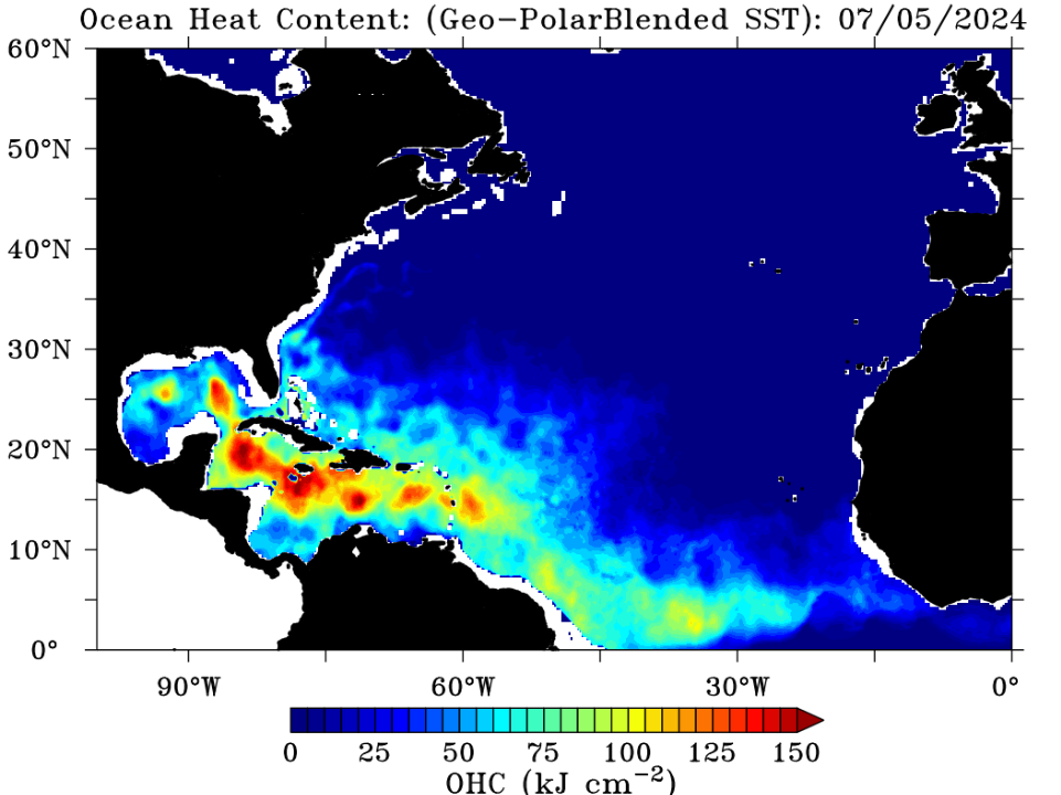
Ben Noll, a New Zealand meteorologist, noted on Monday that sea surface temperatures in the main development region are the warmest they’ve been on record for June. In fact, the seas are as warm now as they typically are in late August or September, when the Atlantic hurricane starts to peak. That’s one reason why we’re seeing a spate of early season activity.

A second chart from Ben is equally concerning, as it shows temperatures in this region presently exceeding those of the 2005 and 2010 Atlantic hurricane seasons, both of which produced frenetic activity. The 2005 season remains the most active year in my lifetime, and Gulf Coast residents will doubtlessly remember Katrina, Rita, and Wilma all reaching Category 5 status in the Gulf of Mexico.

Well, that’s concerning. (Ben Noll)

Warm seas are not the only factor in storm formation, of course. This year, with El Niño in the Pacific, we can have some hope that wind shear will counteract the formation of storms. But worryingly, so far, warm seas appear to be winning out against El Niño. I have to say that I am starting to get mildly concerned about what is to come this year, particularly in August and September.

One-sentence summary

We’re tracking Tropical Storm Brett as well as Invest 93L, which has been given an 80 percent chance of developing this week into a depression or named storms in the coming days.

Brett is being followed by a system that would be named Cindy, if it develops. (National Hurricane Center)

Happening now: The stage is set for Bret, with a possible encore

Here’s what we know about the two tropical systems out there.

Tropical Storm Bret

First of all, with apologies to fans of George Brett, this system has just one “t.” After forming on Monday the storm has changed little in intensity overnight, with sustained winds of 40 mph. This is likely due to some moderate wind shear nearby. Not enough to break the storm apart, but enough to keep its organization at bay.

The system has about three days to get its act together before shear is expected to increase, in which case Bret should start to weaken. At present the National Hurricane Center brings Bret to hurricane strength briefly, before winding it back down on Thursday night as it approaches the Lesser Antilles islands in the Caribbean Sea.

Bret is bound for the Caribbean Sea. (National Hurricane Center)

No one wants to see a tropical storm headed their way, and Bret is something that people in the Caribbean Islands, including Puerto Rico, the Dominican Republic, and Cuba will want to keep an eye on. Damaging winds and heavy rainfall are definitely possible with Bret later this week or weekend, although I don’t think we’re looking at a situation where this storm really blows up. My biggest concern is flooding, but it’s not really possible to say where the heaviest rain will occur. We should have a better handle on the overall threat tomorrow morning.

Invest 93L

Much like its predecessor, Bret, how well this tropical system gets organized is tied up with where it goes, with a better organized disturbance likely turning northwest before the Caribbean and a less organized one likely following 92L to the west and into the islands. For now the most likely outcome, I believe, is that this system turns north before reaching the Caribbean Sea. That would be best for all concerned, except maybe for the fish.

The medium range (days 6-10): And then there were three?

As Matt noted on Monday, there are some signs in the models that yet another disturbance will emerge off Africa soon, and that this may be something that could develop over the weekend or next week. However the models don’t appear too excited about this system becoming a big deal, likely due to a fairly uninviting environment overall for development. Certainly at The Eyewall we’re rooting for shear to have its day.

Fantasyland (beyond day 10): Possibly calmer to end June

After this present spate of activity, the overall tropics may turn a bit quieter to end the month and start July.

Hopefully?

June 19, 2023 Outlook: Is it June or September?

One look at the satellite image over the Atlantic this morning, and it’s sensible to ask what month it is currently. Even when one factors in the idea that we’ve been able to name more small storms in recent years, this is a bit ridiculous.

There are two robust disturbances in the Atlantic and a third wave emerging off Africa. While the Caribbean and Gulf are quiet, the Atlantic looks more like late August or September. (College of DuPage)

Thankfully, both systems of note in the Atlantic will probably have relatively short shelf-lives, but folks in the Lesser Antilles, Virgin Islands, and Puerto Rico should monitor the progress of these systems.

One-sentence summary

Two disturbances in the Atlantic, Invest 92L and Invest 93L have been given 100 percent and 40 percent chances (respectively) of developing this week and could become depressions or named storms in the coming days.

At least one, if not both of Invest 92L and 93L will develop in the central or eastern Atlantic this week. (NOAA)

Happening now: Investment prospectus

Two invests means two systems to discuss, so let’s take a look at their futures.

Invest 92L

Looking at Invest 92L this morning closer in on satellite, it’s pretty clear that this is almost ready to go.

Invest 92L is fairly close to becoming a depression it would seem. (Weathernerds.org)

After struggling for a couple days, the thunderstorms seem to have consolidated and there is a noticeable “spin” to the disturbance. This is likely going to become a depression not long after we publish this post.

Over the next couple days, the question becomes how much better organized 92L gets. Let’s look first at atmospheric moisture tomorrow evening.

Both 92L and 93L are likely to be initially sheltered from dry air due to their small sizes. As 92L develops and grows, the dry air to the north and west may eventually pose issues but for the next couple days, it should be good to go. (Tropical Tidbits)

Both systems are highlighted above, but looking at 92L specifically, it looks good into Tuesday evening, with ample moisture and dry air off to the north and west and far enough away for now to prevent problems for development.

What about wind shear?

Wind shear may inhibit 92L more than 93L initially, but both systems will have to fight some shear off over their life cycles. (Tropical Tidbits)

I don’t think that shear will be prohibitive to 92L, but it may keep it from intensifying as much as some models have been saying. By tomorrow evening, it’s dealing with a fair bit of shear “in the neighborhood” but perhaps not enough to keep it from becoming a tropical storm.

So where will this system go? Obviously, that’s the $10,000 question. We have enough clues in the data to make a decent call of at least what to watch and when to watch it for planning purposes in the Lesser Antilles, Virgin Islands, and Puerto Rico. If we use the GFS ensemble as a guide, we can see that 92L’s intensity is likely to “peak” in about 72 to 96 hours, or on Wednesday/Thursday. When you run 30+ different versions of the model to generate the ensemble, you get the map below.

Invest 92L will probably organize over the next 3 or 4 days before eventually hitting an inflection point, where a strong storm would turn out to sea and a weaker one would trek into the Caribbean. (Weathernerds.org)

From this point, the GFS ensemble at least takes stronger outcomes more north into the open Atlantic while weaker ones (with 1 or 2 exceptions) track into the Caribbean. It’s notable that all the European ensemble members (not shown) keep 92L weaker and track it into the Caribbean. But I prefer using the GFS ensemble as a guide, as it opens up a wider array of options for us to see right now.

Beyond day 3 or 4, it seems likely that whatever 92L becomes is going to run into a good bit of northerly shear and some broader dry air that could lead to it becoming less organized. This is why we believe that if it makes it to the islands or Caribbean, it will likely do so as a tropical storm and rain producer, certainly not without hazards but something a little less extreme for late June. But we’ll have a good idea by midweek of what this does and who it impacts.

If we look at the European ensemble mean for rainfall over the next 7 days, we can see a corridor of locally heavy rain that moves into the Lesser Antilles, with Guadeloupe through St. Lucia being in the heaviest rain. Depending on intensity and exact track, that “bullseye” could shift north or south a bit. For now, the ensemble mean prints out 1 to 4 inches of rain, but there could be some locations that see more and some flooding concerns, again depending on track and intensity, a picture that should become clearer later this week.

The heaviest rainfall from 92L will depend on the exact track and intensity. For now it looks manageable, but we’ll watch this through the week. (Weather Bell)

Invest 93L

From the maps above, it’s clear that Invest 93L is going to be in a slightly more intriguing environment for development. Much like 92L, how well organized this gets will lead to some track outcome, with a better organized disturbance likely turning northwest before the Caribbean and a less organized one likely following 92L to the west and into the islands. I want to see more of how 92L behaves before worrying much about 93L, and besides 92L is the more immediate system to watch for the islands.

The medium range (days 6-10): More to come?

It seems funny that for the last 2 weeks the GFS operational model has been all about the western Caribbean and yet it’s the Atlantic that’s off to the races. There are some signs in the models that a third disturbance emerging off Africa may be something that could develop over the weekend or next week. Much like 92L and 93L, it seems unlikely it will become a big deal but this meteorologist can’t recall a busier late June in the deep Atlantic in recent memory, if ever. Of course, record warm water temperatures in the Atlantic likely mean record-type outcomes, despite El Niño.

Fantasyland (beyond day 10): Calmer?

As of right now, a cursory glance at operational models and ensembles seems to indicate that things may begin to quiet down some heading into July. We’ll see.

Follow our social media for any updates should 92L develop today.

Twitter
Instagram
Facebook
TikTok

Otherwise, we’ll be back with you on Tuesday morning.

That Atlantic system is nearing tropical depression strength

Good afternoon. We hope everyone is having a great Father’s Day—here in Houston I am enjoying some time with the family but this face-melting heat and humidity is something else. The situation is little different out across the Atlantic tropics, where sea surface temperatures are at or near record levels for this time of year. And lo and behold, the warm tropics are producing uncharacteristically robust activity for mid-June. Hence this post on a holiday weekend.

An area of interest, known for now as Invest 92L, has continued to show signs of organization today as thunderstorm activity increases and it passes through an area of relatively low wind shear. As a result, the National Hurricane Center now gives the system a 90 percent chance of becoming a tropical depression or tropical storm in the next two days. In all likelihood, we’re looking at Tropical Storm Bret by early next week. In other words, I’d bet on Bret. Sorry for the dad joke, but today is Father’s Day you know.

Not Tropical Storm Bret. Yet. (NOAA/The Eyewall)

This tropical system should continue to have a reasonably favorable environment for strengthening into the middle part of next week as it continues to track westward across the tropical Atlantic, toward the Windward Islands. After that? Well, if the storm continues trucking westward it will eventually face more hostile conditions. This means that a tropical storm could move into the Eastern Caribbean Sea by Thursday or so, but then likely weaken. The other scenario is that the storm begins to turn more northerly before entering the Caribbean Sea. Along this path the tropical system would find more favorable conditions, but should spin harmlessly out in the ocean.

The bottom line is that if you’re in (or traveling to) the Windward or Leeward Islands—basically from the Virgin Islands all the way south to Barbados—it’s worth keeping an eye on this system. I don’t think anything too troublesome is coming, but the Atlantic is very warm so it’s worth monitoring. As for other parts of the Atlantic basin, including the United States, this probably is not anything more than a curiosity. We’ll have bigger fish to fry later this season, no doubt.