Headlines
- Development of some sort of tropical system is becoming increasingly likely in the western Gulf next week.
- There are two general thoughts on outcome: Either a better organized system that tracks offshore toward Louisiana or a lesser organized system that tracks offshore but closer to the Texas coast.
- Either outcome will produce rough seas, gusty winds, and heavy coastal rainfall with flooding possible on the coast.
- Houston & Corpus Christi proper likely don’t have to worry about significant impacts, but coastal areas between Matagorda Bay and central Louisiana should be on guard for tidal flooding and potential strong winds (mainly in Louisiana).
- No other notable tropical concerns exist at this time.
Gulf of Mexico development odds increasing
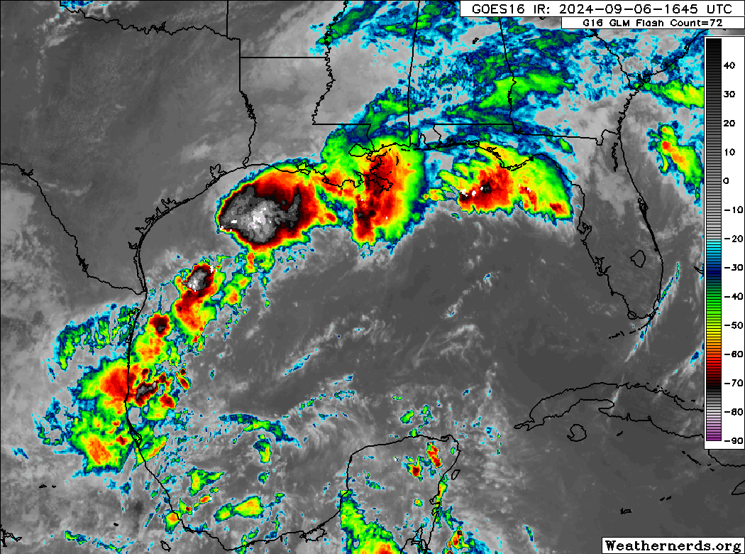
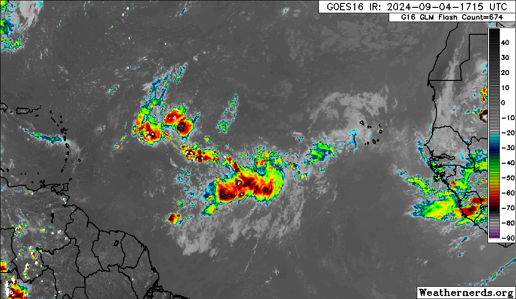
First, a point of clarity: Invest 90L was declassified yesterday, and Invest 91L will be the designation for the tropical disturbance in the Gulf this weekend.
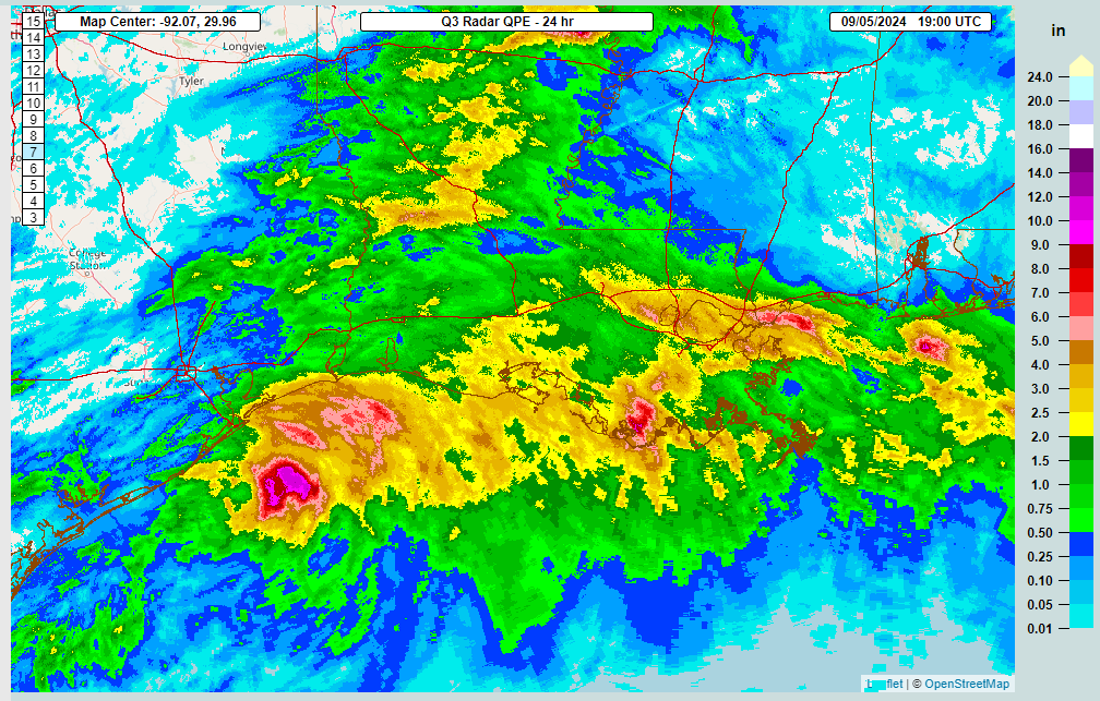
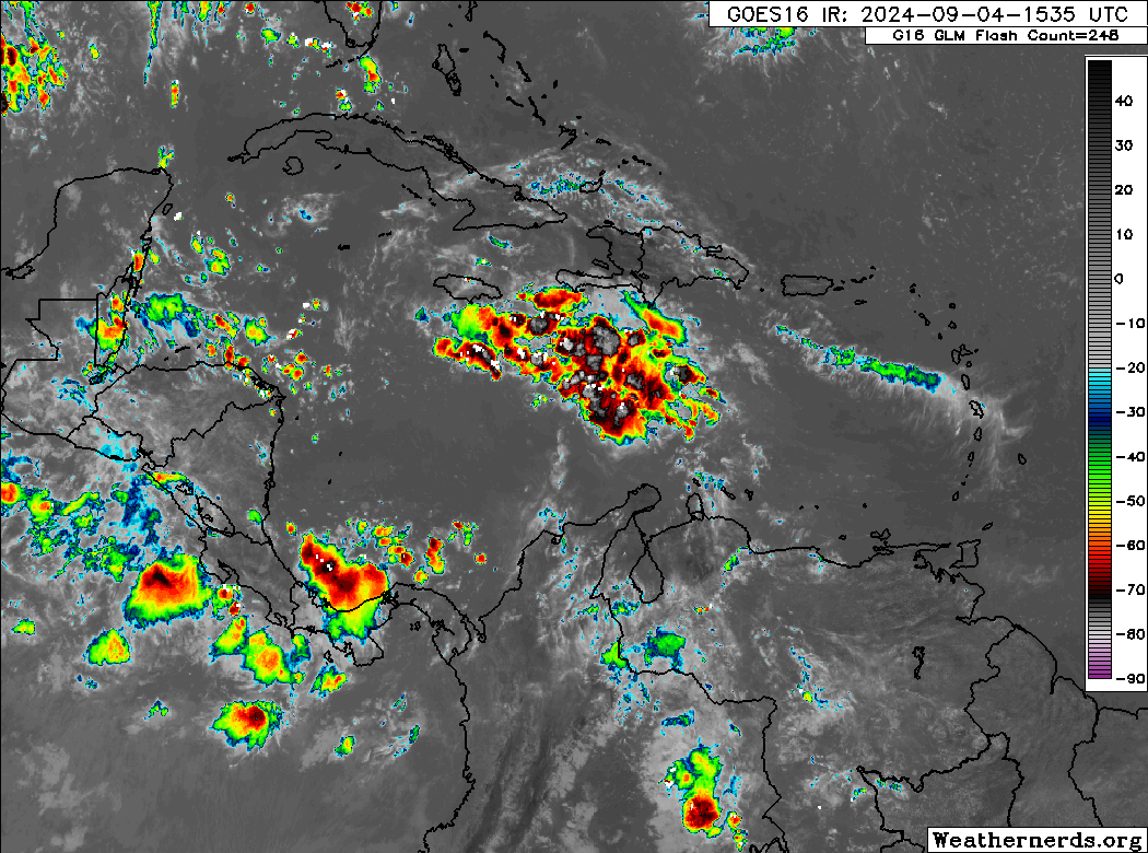
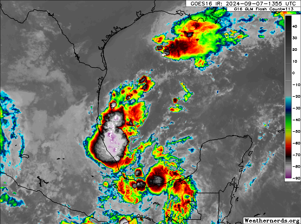
Starting off this afternoon, we have Invest 91L with thunderstorm activity in the southern Gulf but no real organization. We think this will take a couple days to do anything.
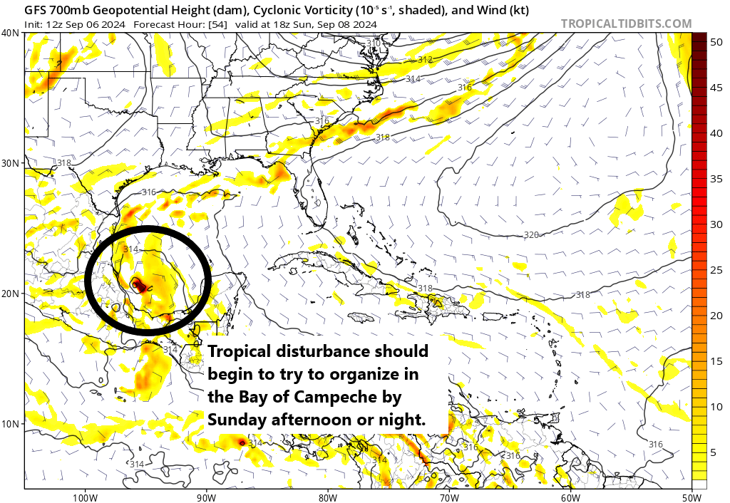
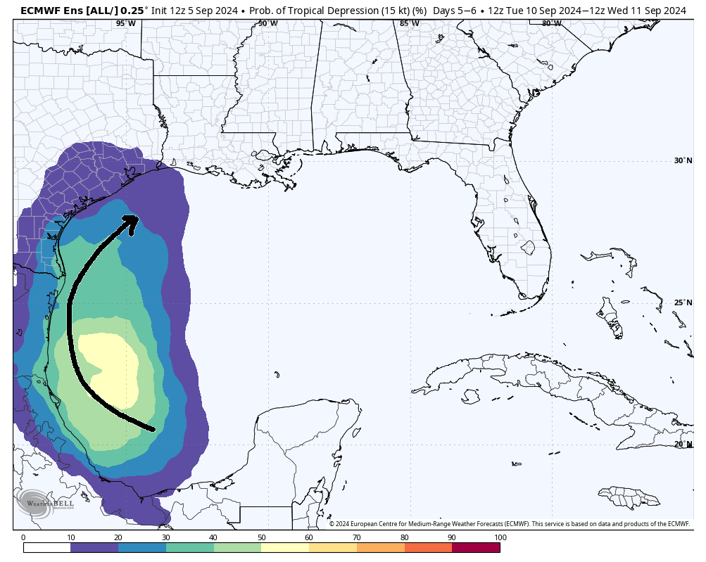
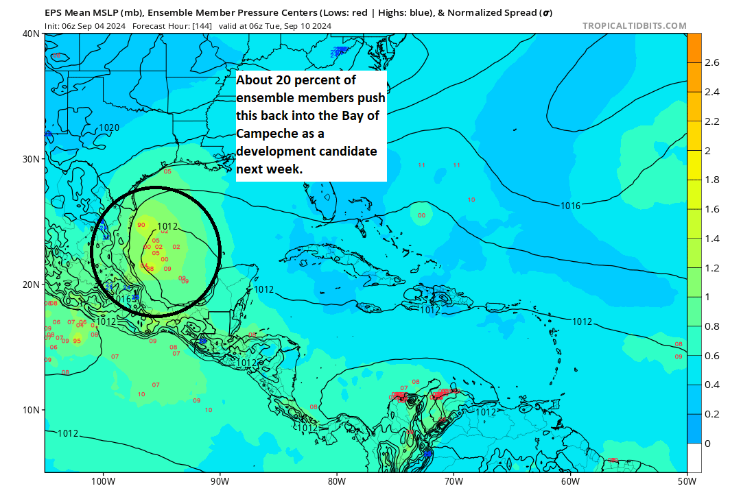
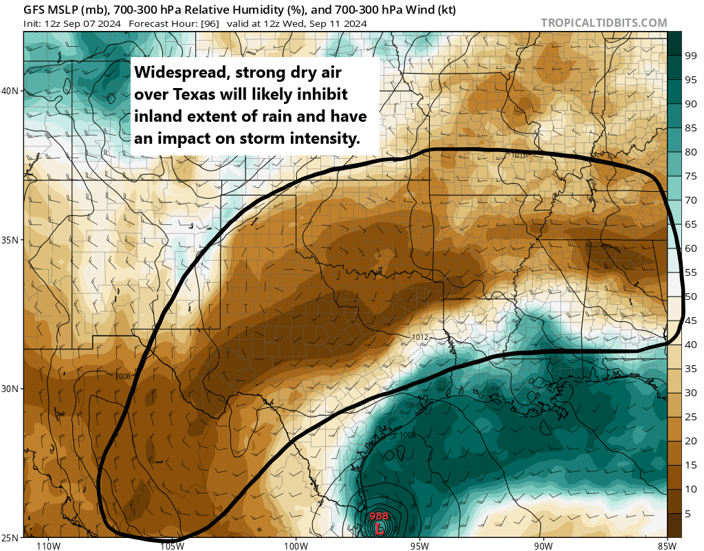
At some point heading into later tomorrow, Invest 91L will probably halt its southward progress, slow down and begin to make a turn back northward later on Monday. From here, we’re beginning to see some model consensus increasing. And development odds have increased to 70 percent as of this afternoon. As 91L comes north, it will enter a tricky environment from a forecast point of view. On the one hand, you will likely have low shear and warm Gulf waters to help it along. On the other hand, there is likely to be a lot of dry air over Texas thanks to this weekend’s early fall cold front. That dry air works against tropical development. We’ve seen dry air in Texas take its toll on tropical systems before, so that’s one reason to be cautious about some of the more bullish models.
Whatever the case, slow, gradual development is likely late Monday and Tuesday as this comes north about 100 to 200 miles off the coast of Mexico. Modeling is actually in very good agreement on all this through Tuesday morning. From that point, the models diverge. The European model, which I might argue would have a better handle on more of the nuance at play here, tends to develop this slowly. The GFS, ICON, and Euro AI (AIFS) modeling shows a slightly faster development path for 91L on Tuesday into Wednesday.
This poses an interesting forecast challenge. The upper pattern on Tuesday night/Wednesday morning will support steering currents around the periphery of high pressure off the west coast of Florida. This should allow for a north and northeast track in the Gulf. A stronger storm would probably be more apt to take that northeastward movement, where as a weaker storm may come more due north. We see this as both the ICON and AIFS show a faster, stronger storm farther out in the Gulf headed toward Louisiana, whereas the European model keeps it weaker and close to the mouth of the Rio Grande River.
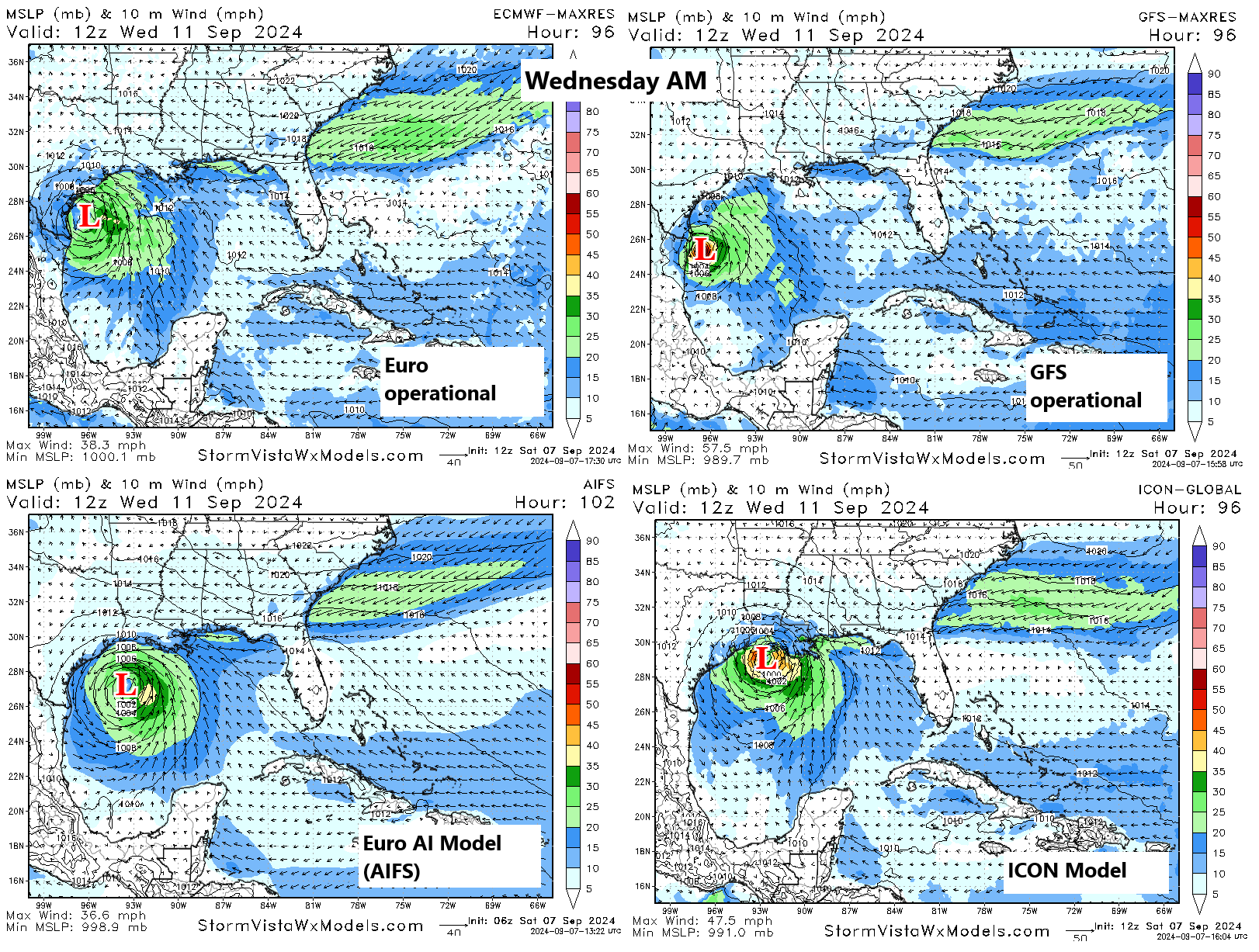
The GFS eventually caves and strengthens it, allowing the system to follow the AIFS/ICON group toward Louisiana, whereas the European model just brings it into Texas as a depression or low-end tropical storm.
Obviously, this gives us a forecast challenge, but I think we’re in two very distinct camps right now.
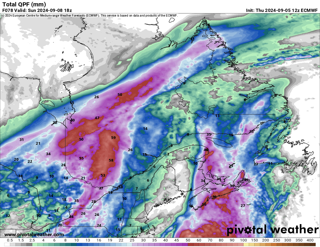
Camp 1: A strong tropical storm or hurricane that tracks off the Texas coast toward Louisiana arriving Wednesday-ish.
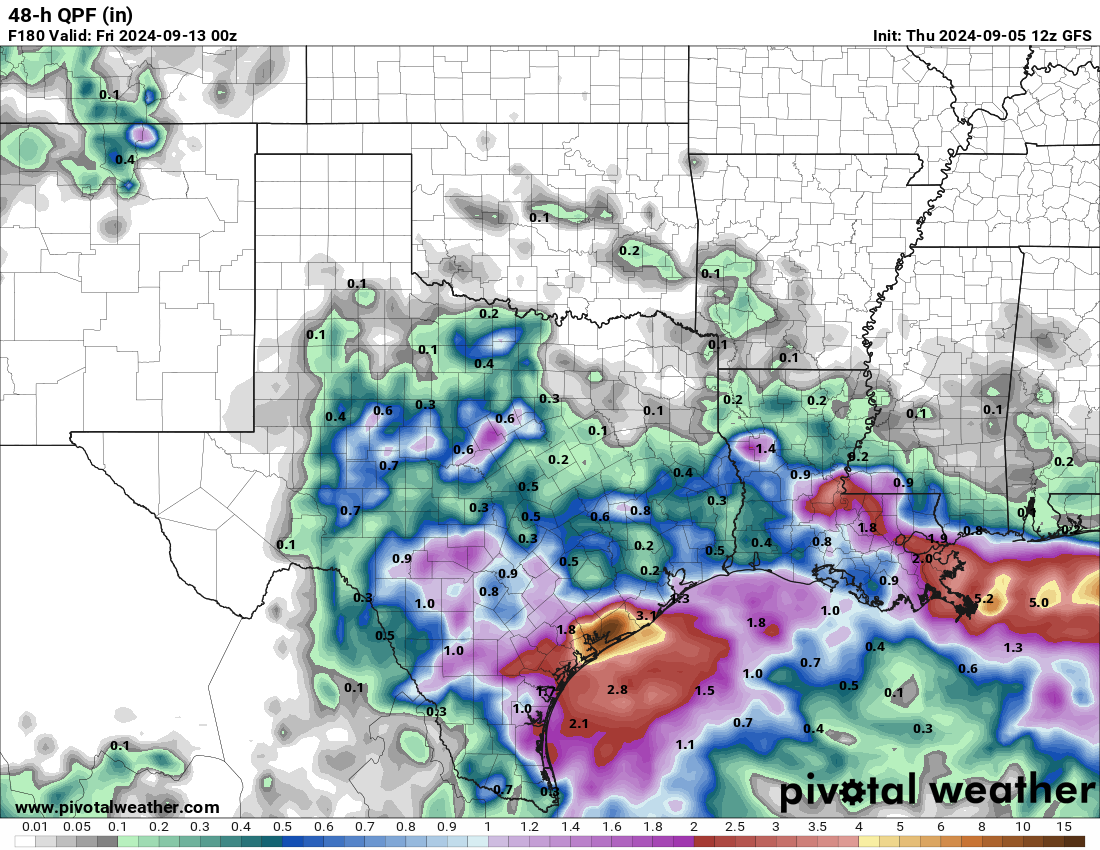
Camp 2: A depression or loosely organized tropical storm with a lot of rain that impacts Texas, especially at the coast Tuesday through Thursday, coming ashore between Galveston and Cameron, LA.
I am not a betting man, but I would probably say the odds right now are 70/30 in favor of camp 2, but that 30 percent is a weighty one given that the system could be a hurricane in that scenario. Normally, I’d discount the ICON model, but given its performance this season and the consistency it has had with track and intensity here, I think there’s merit to considering it with this particular system.
So what do you do? You check back in again tomorrow for more. If you’re in Louisiana, it’s probably a good idea to make sure you have your hurricane kits up to date and know what you’ll do in the lesser chance this comes your way as a stronger storm. In Texas, I think Houston and Corpus Christi are fine. However, I think folks from Matagorda Bay through Sabine Pass along the coast and bays should probably be aware of both a rainfall flooding risk and a tidal flooding risk that may develop from this. More to come.
Elsewhere, nothing else of note in the tropics today.