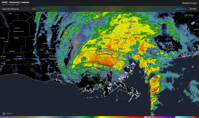
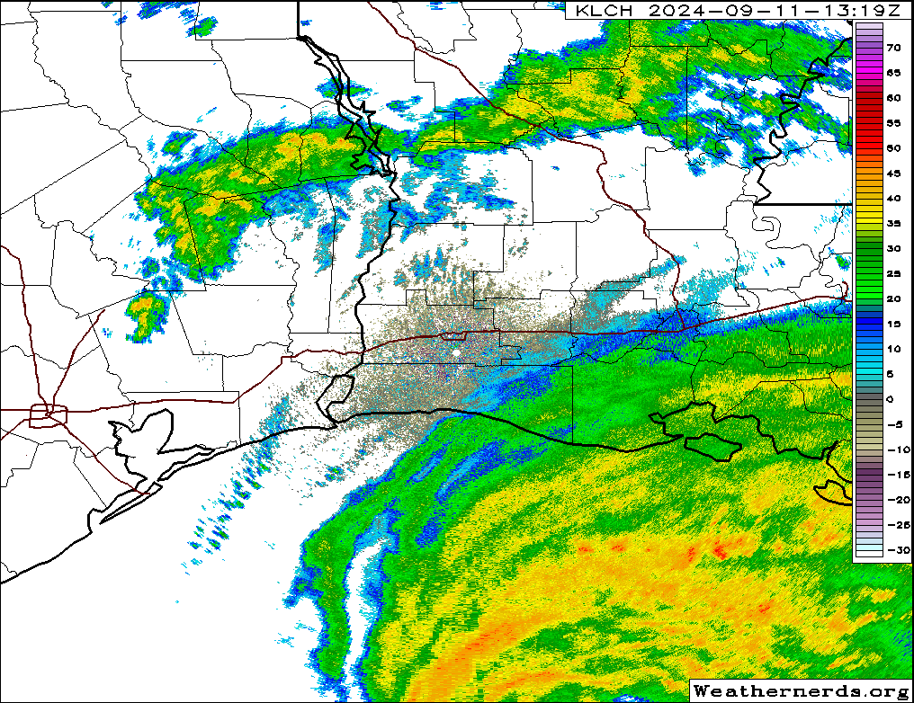
9 PM CT Update: Severe flash flooding is ongoing in the New Orleans metro area. There is a flash flood emergency posted for portions of Orleans, St John the Baptist, St Charles, and Jefferson Parishes. The NSSL’s MRMS tool is useful because you can quickly see areas where excessive rainfall is likely occurring or has just occurred by using the CREST product. Blue and white coloring is about as bad as it gets.
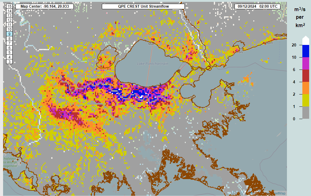
And that’s what we have over the western portions of the New Orleans metro area and south shore of Lake Pontchartrain right now. The flash flood emergency goes until 11:45 PM CT. Some videos I’ve seen circulating on social media show some pretty wicked flooding ongoing due to the rainfall. Shelter in place until things settle down. The good news is that the worst of the rain is exiting, but it will take some time for all the water to flush through the system. Flash flooding concerns will expand to the Northshore and into Mississippi.
Francine is down to 75 mph as of the 8 PM position report and should be at tropical storm strength with the next advisory. That said, winds are still gusting to 60 mph in the New Orleans area and even 64 mph back west toward Donaldsonville. Almost 300,000 customers are without power now.
This will be our last regular update of the evening. We’ll have a full recap and post on what else is going on in the tropics tomorrow morning. Thanks for following along! -Matt
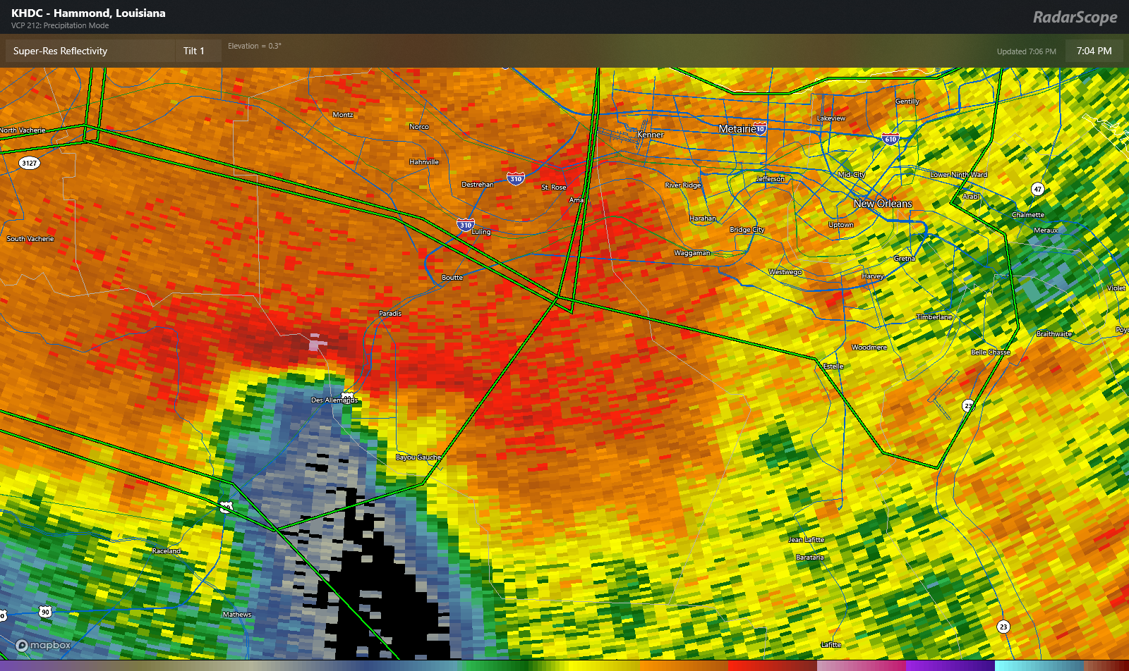
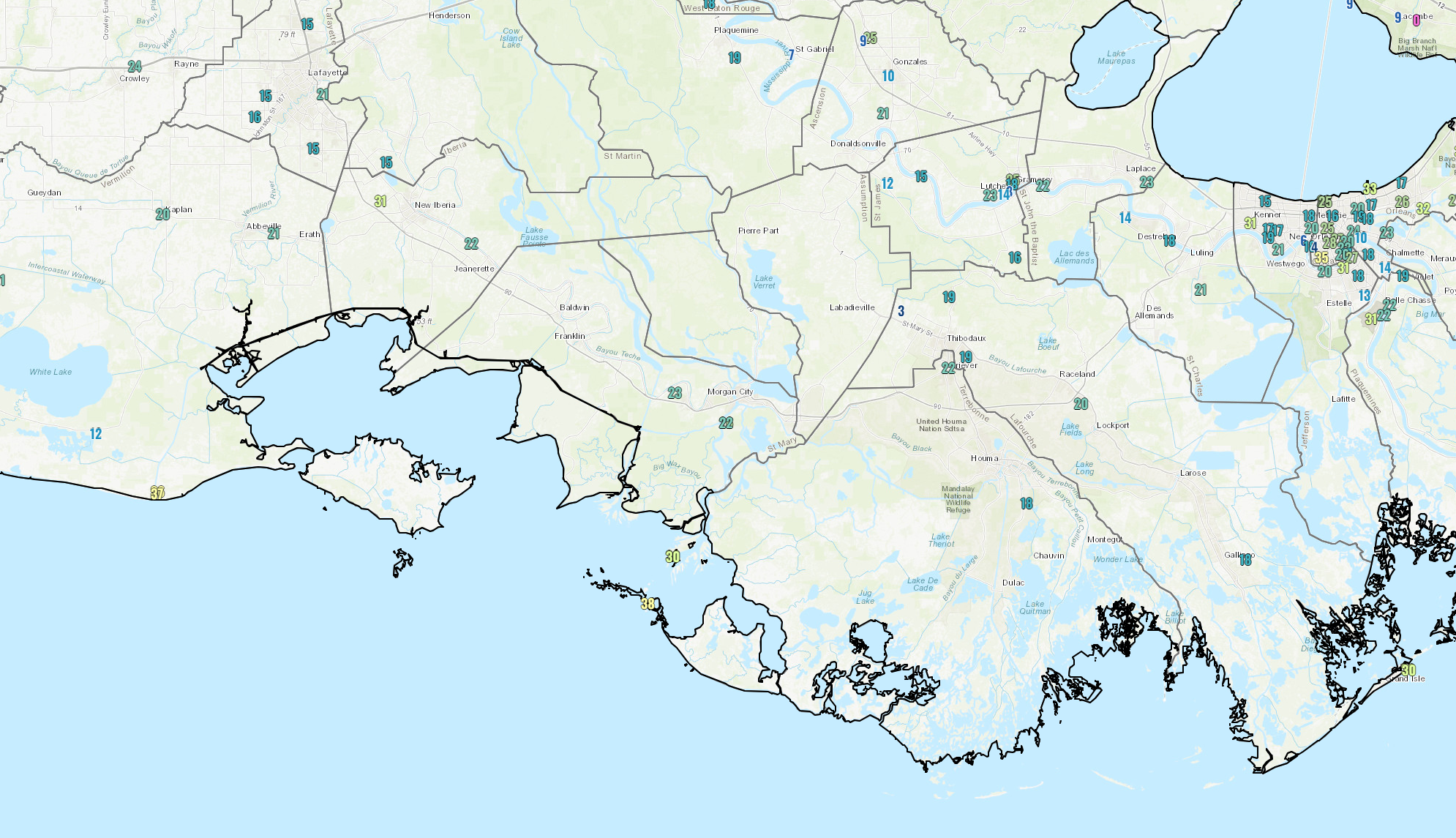
7 PM CT Update: We’ve seen wind gusts up and over 60 mph now on the southwest side of the New Orleans metro area. Entergy is currently reporting about 125,000 customers without power right now. According to poweroutage.us, there are about 140,000 out statewide. Radar as of 7 PM shows intense rainfall occurring just southwest of New Orleans, along Highway 90 moving into St. Charles Parish. Intense rainfall will move into metro New Orleans over the next hour or so.
Francine’s winds are down to 85 mph, with continued weakening expected through the night.
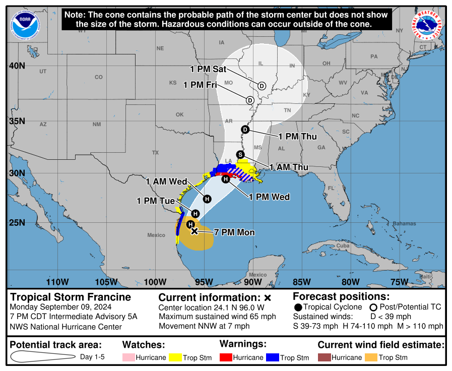
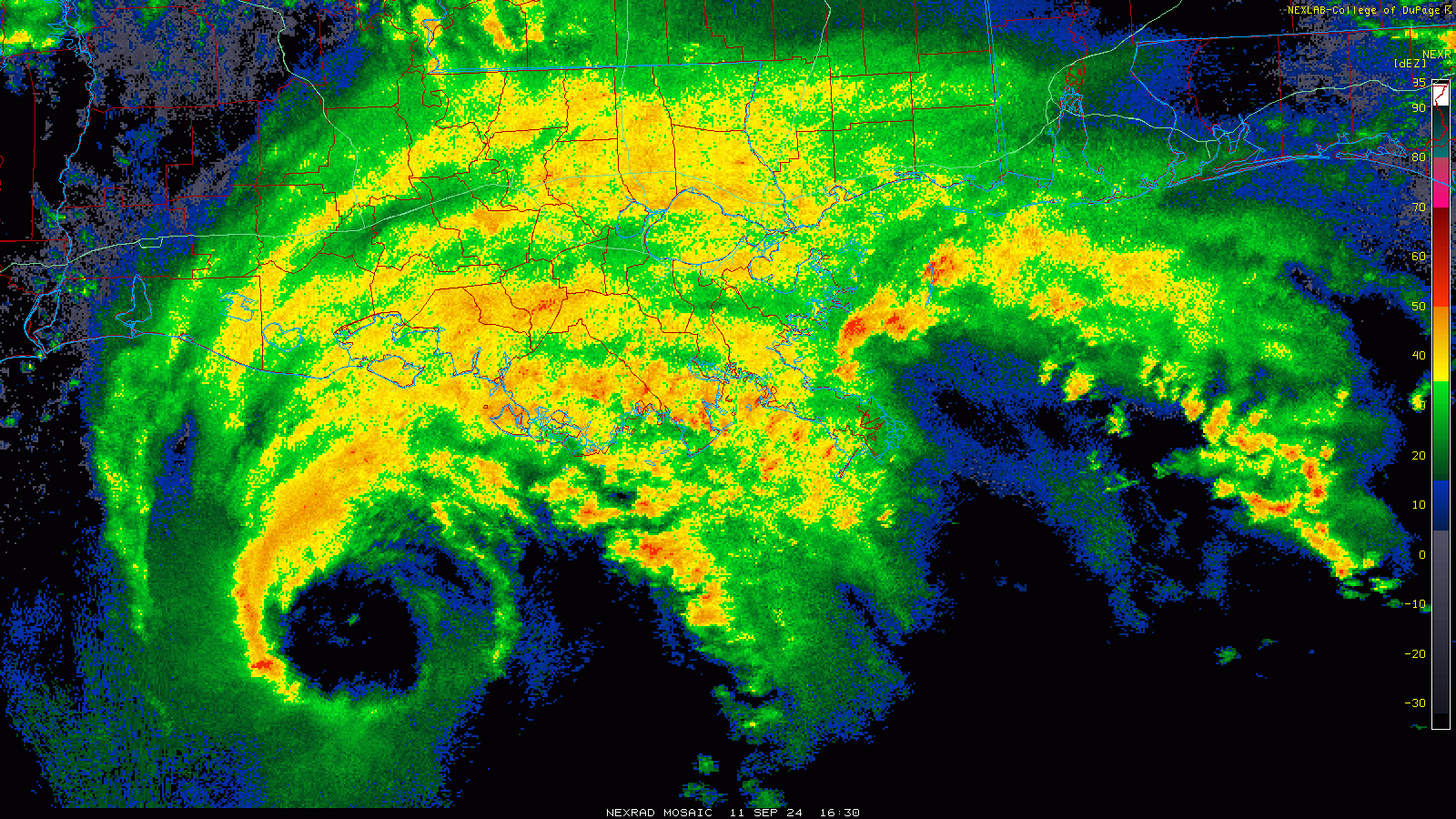
5:30 PM CT Update: Francine has made landfall this evening in Terrebonne Parish south southwest of Morgan City as a category 2 hurricane. The storm is moving inland now, and it appears that it is tracking a bit east of where it was expected to go. The northeast portion of the eyewall is about to move into New Orleans. We’ve seen wind gusts mostly in the 50 to 65 mph range with this areas as it comes northeast, but it will get a bit nasty in New Orleans over the next hour or two.
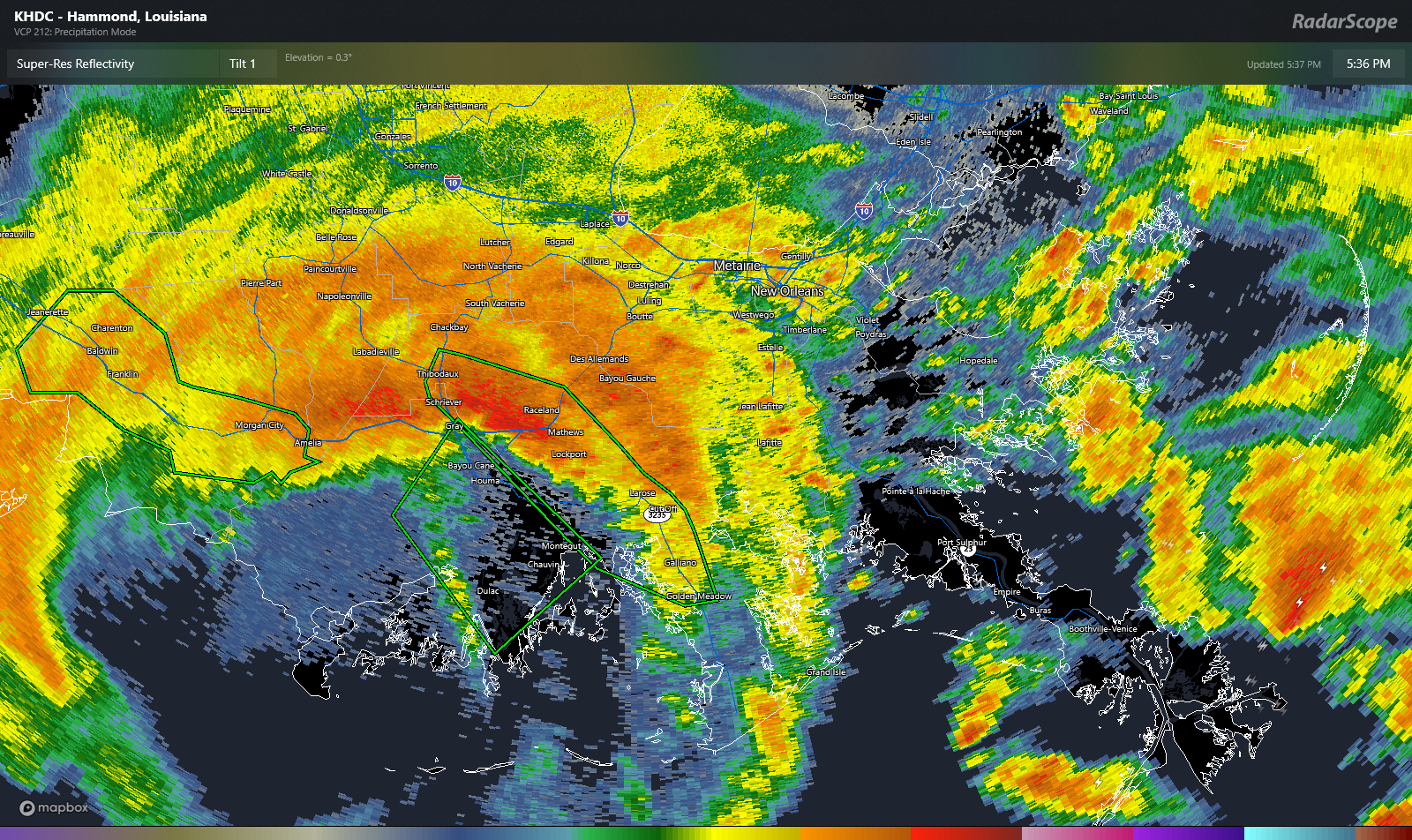
The highest wind gust I found was 105 mph near Eugene Island in Atchafalaya Bay. Heavy rainfall is occurring with this as well as it comes northeastward, leading to a few flash flood warnings southwest of New Orleans. These will likely expand northeast in time as well. Hunker down in southeast Louisiana and the New Orleans area for the next few hours.
4 PM CT Update: Francine is now a category 2 hurricane with maximum sustained winds of 100 mph.
3:30 PM CT Update
Francine was about 60 miles SSW of Morgan City, LA and approaching the coast with its eyewall.
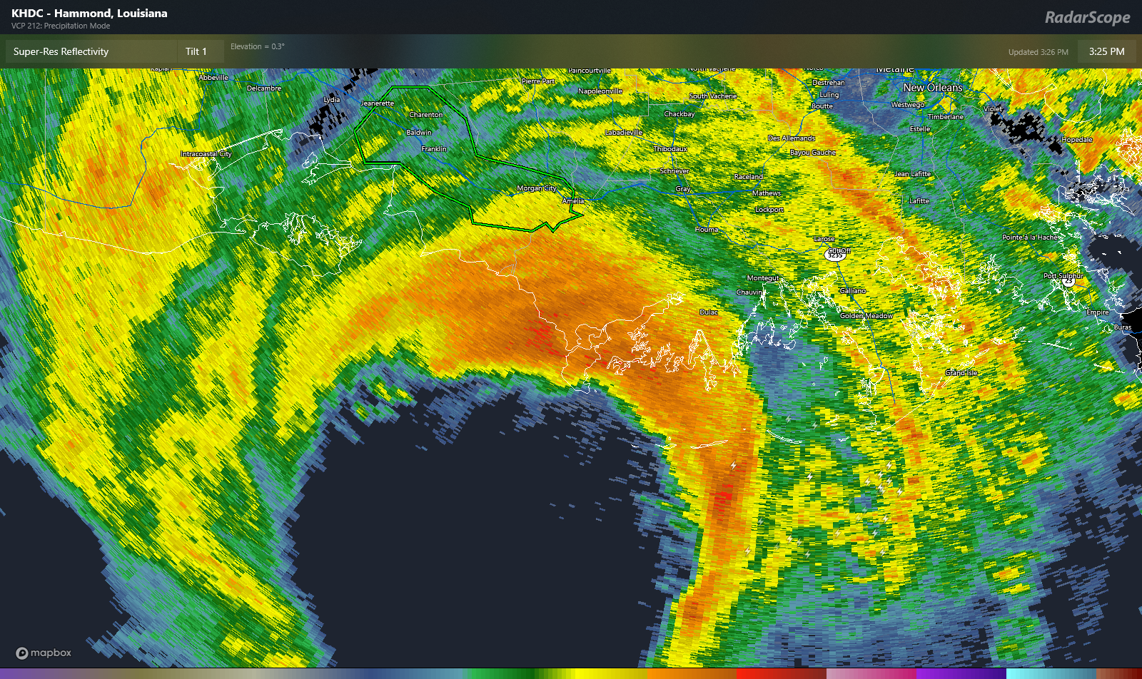
Conditions will rapidly deteriorate as this area moves ashore. The eyewall contains the strongest winds of the storm, so look for wind gusts to kick up in the area around Morgan City, Houma, and elsewhere in southern Louisiana soon.
Wind gusts have hit as high as 70 mph near Eugene Island, LA. New Orleans is in the 40s to near 50 mph now. Offshore oil platforms have registered 100 mph, but given their elevation, it is likely that those winds are a decent bit lower at ground level on land.
Francine is moving off to the northeast, if not east-northeast around 17 mph, and it should make landfall within the next 90 minutes to 2 hours, probably just south of Houma. It will then steadily weaken as it moves inland. That said, the eyewall will come close to the New Orleans area, so winds may ramp up there further in about 2 hours.
1 PM CT Update: Tropical Storm warnings dropped west of Cameron, LA
12:30 PM CT Update
Hurricane Francine continues to approach the Louisiana coast this afternoon.
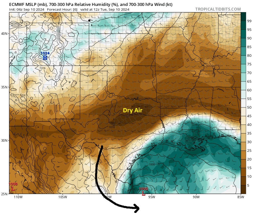
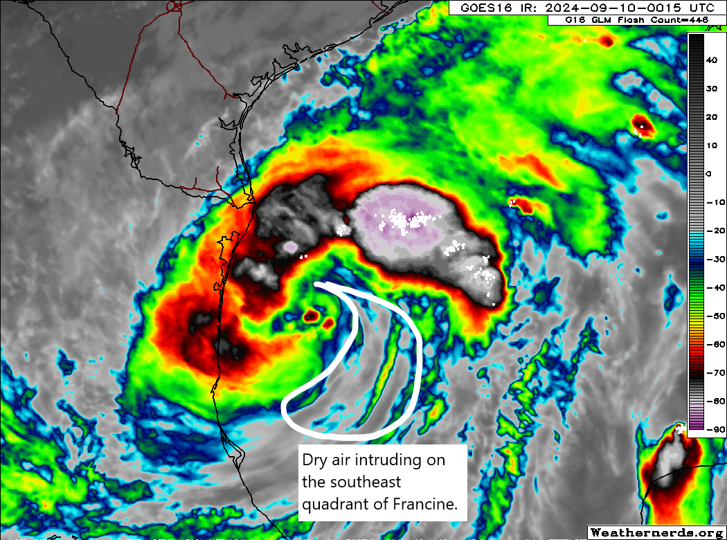
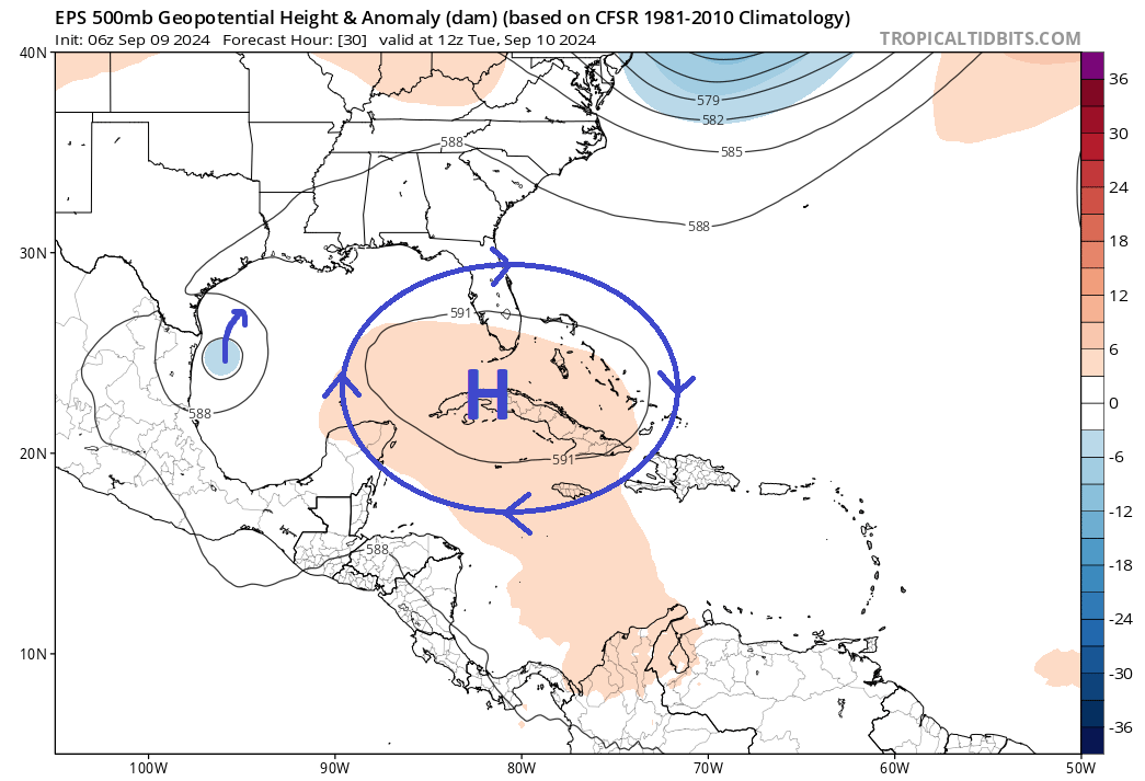
Thus far, wind gust reports have been relatively pedestrian with only 30 to 40 mph reports on the immediate coast. Oil platforms offshore are elevated and poor barometers of surface winds, but some of those have seen 80 to 100 mph gusts at times, so Francine remains capable of producing some pretty nasty wind. Still, it’s tough to not notice that it’s struggling somewhat due to dry air and shear. So hopefully the outcomes will be manageable, given the situation.
Conditions will continue to deteriorate across southern and southeast Louisiana this afternoon, so it’s probably a good idea to get where you want to be during the storm very soon and stay there til it passes tonight.
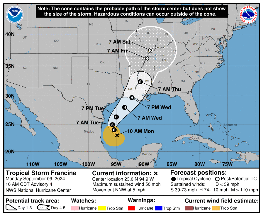
10 AM CT Update
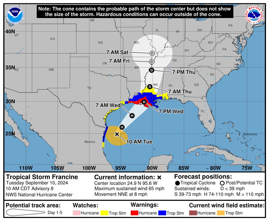
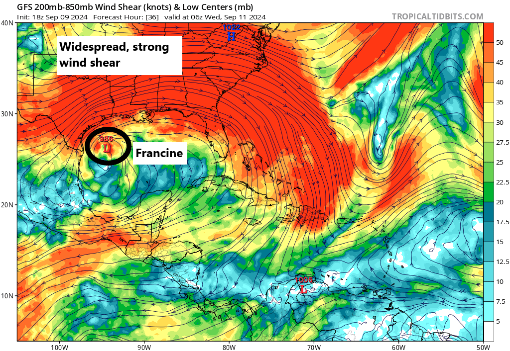
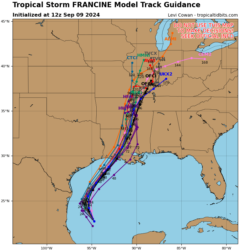
No major changes in track or intensity with the 10 AM update from NHC. Francine is stated to have an open eyewall, as it’s beginning to feel some of the significant wind shear on the Gulf Coast. While Francine will remain a significant, dangerous storm, its intensity may have peaked now.
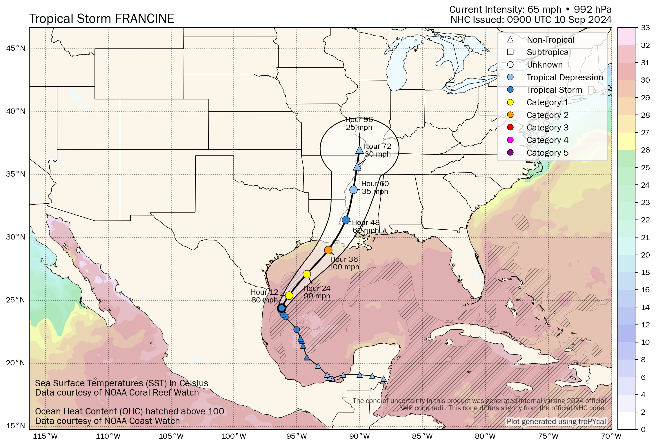
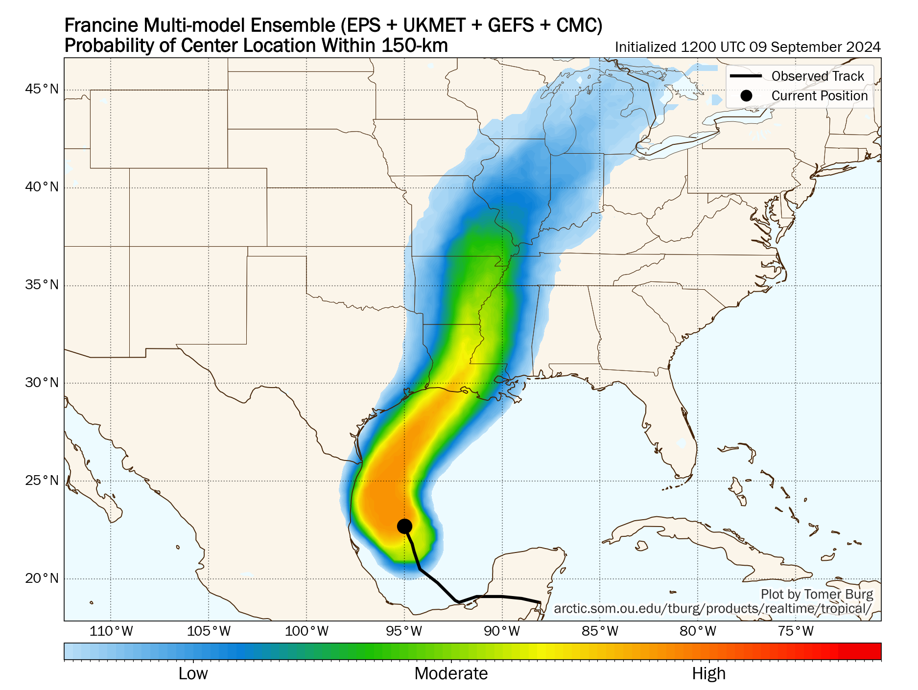
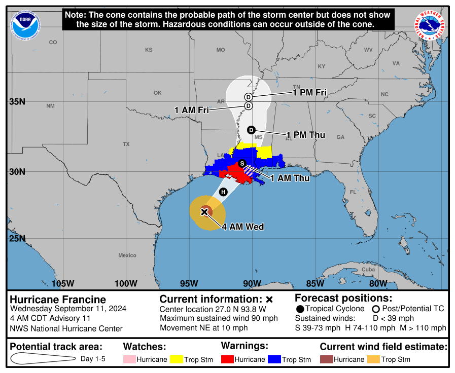
Francine is still on track for a landfall near the Atchafalaya Delta or just east late this afternoon or early this evening.
Our previous post from 7 AM follows below:
Headlines
- Francine make its initial approach to the Louisiana coast as a high-end category 1 hurricane.
- Francine will make landfall late this afternoon or evening, likely between the Atchafalaya Delta and Port Fourchon.
- Significant wind and surge issues are likely at the coast with lesser impacts inland but tropical storm force winds and power outages a good bet between Lafayette and coastal Mississippi.
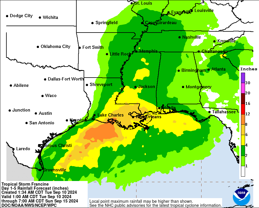
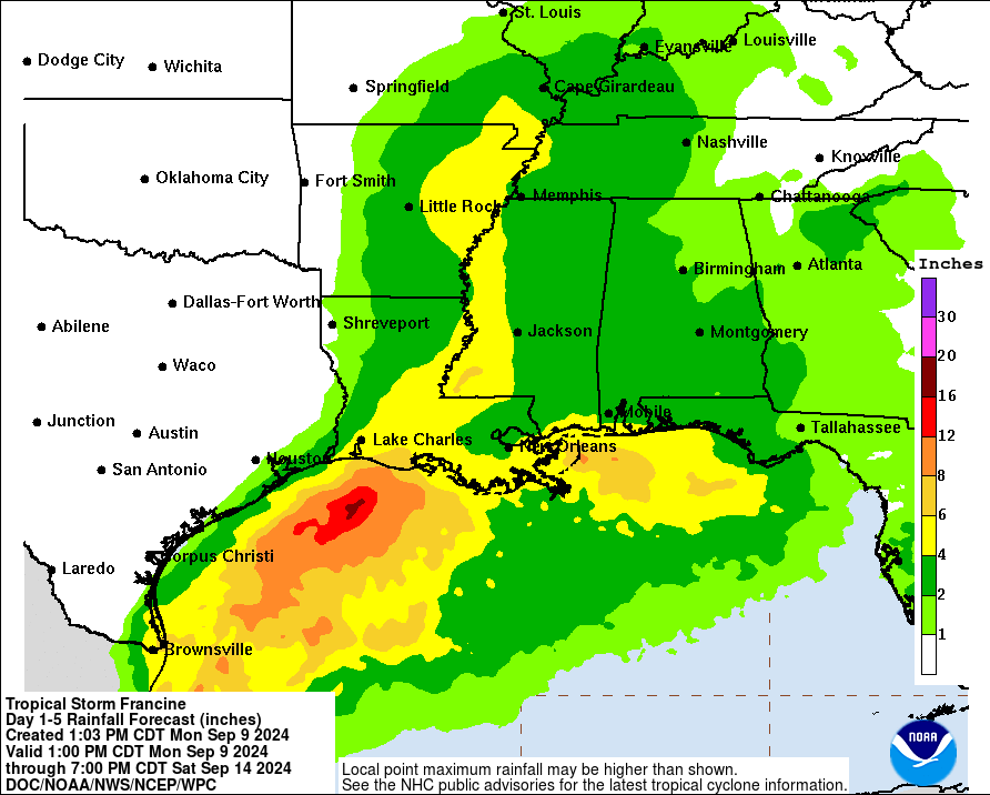
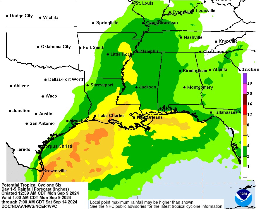
- 4 to 8 inches of rain expected in Louisiana and southern Mississippi with flash flooding likely in spots.
- Francine will slam on the brakes near Memphis but should basically just die off in place with scattered rains the rest of this week across the Southeast.
Francine now
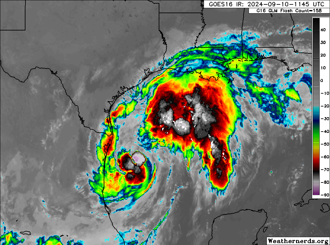
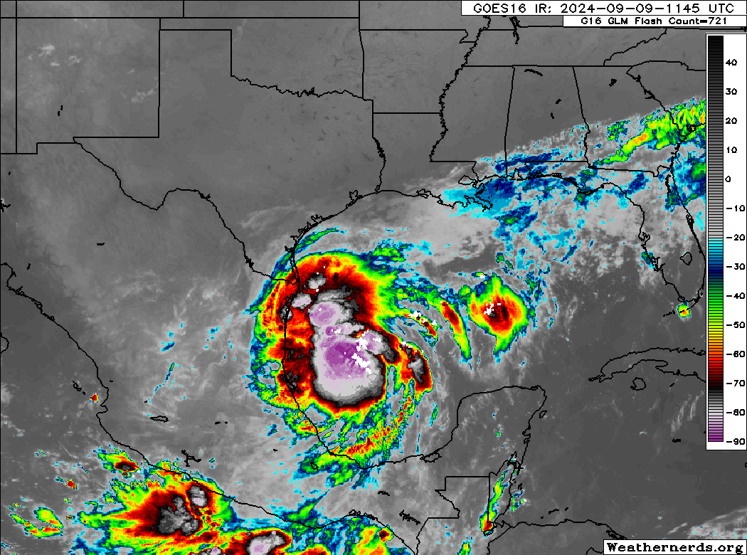
Hurricane Francine has 90 mph maximum sustained winds this morning, as it did some work overnight to get more organized. It has a few hours left to gain some more intensity before it runs into dry air and wind shear that will likely take its toll on the storm.
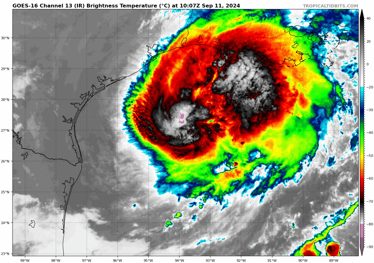
Francine’s outer rain shield has pushed ashore, mainly south of I-10 in Louisiana so far. Rain will continue to spread inland today.
Francine’s forecast and impacts
As of the 4 AM CT advisory, Francine was moving northeast at 10 mph. This speed should pick up some through the day. On its current track, a landfall between the Atchafalaya Delta and Port Fourchon seems most likely. That should occur late this afternoon or evening. As noted, rain has begun to overspread Louisiana, mainly east of Cameron and Lake Charles, and that will continue today. Rain totals of 4 to 8 inches in the Atchafalaya Basin and into parts of Mississippi. Rainfall will be 4 to 6 inches in New Orleans east to the Florida Panhandle.
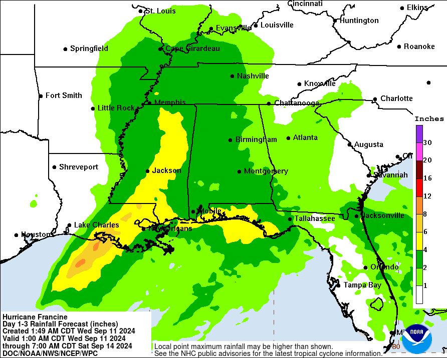
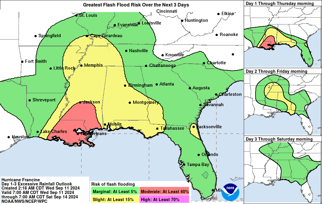
Flash flooding is likely in spots, and the Weather Prediction Center has a moderate risk (level 3 of 4) for flash flooding risk in much of southeastern Louisiana and portions of southern Mississippi.
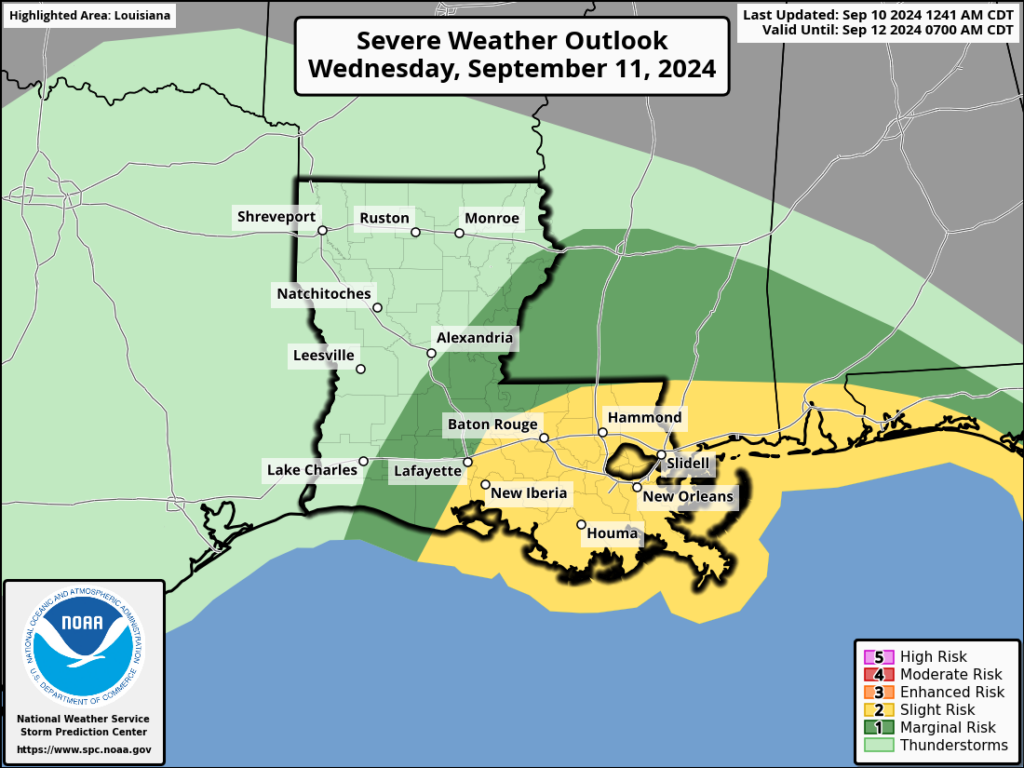
In addition to excessive rainfall, we expect to see isolated tornadoes today, and a slight risk (level 2/5) for severe storms exists in eastern Louisiana, extending east to the Florida Panhandle.
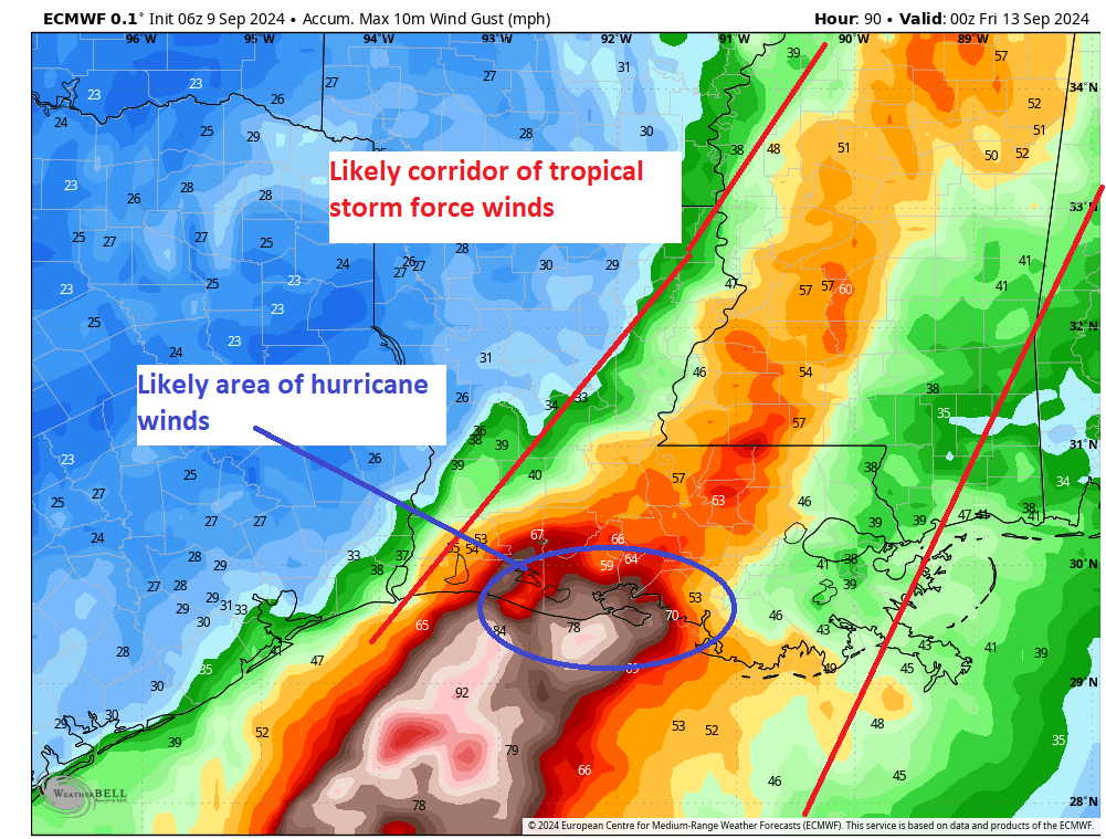
In terms of wind, the highest risk will be right at the coast, obviously. As you push inland, we’ll see hurricane-force wind risk extend into Morgan City, Houma, and perhaps extreme southwest portions of the New Orleans metro. New Orleans proper should see moderate to high-end tropical storm force winds, as will Baton Rouge, perhaps Lafayette, and up into portions of southern Mississippi.
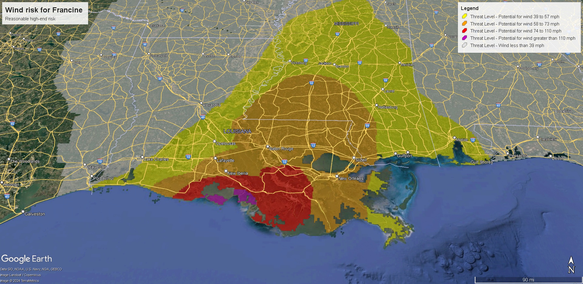
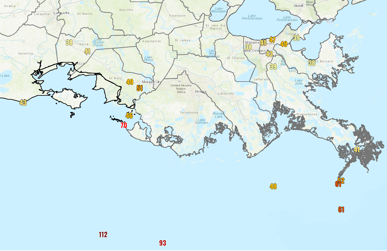
As we did yesterday, here are the current forecast maximum wind gusts as of 6:45 CT based on official National Weather Service forecasts.
Lake Charles: 36 mph
Lafayette: 49 mph
Baton Rouge: 51 mph
Port Fourchon: 67 mph
New Orleans: 57 mph
Morgan City: 87 mph
Houma: 67 mph
Gulfport: 62 mph
Natchez: 38 mph
Vicksburg: 38 mph
Jackson, MS: 40 mph
Mobile, AL: 37 mph
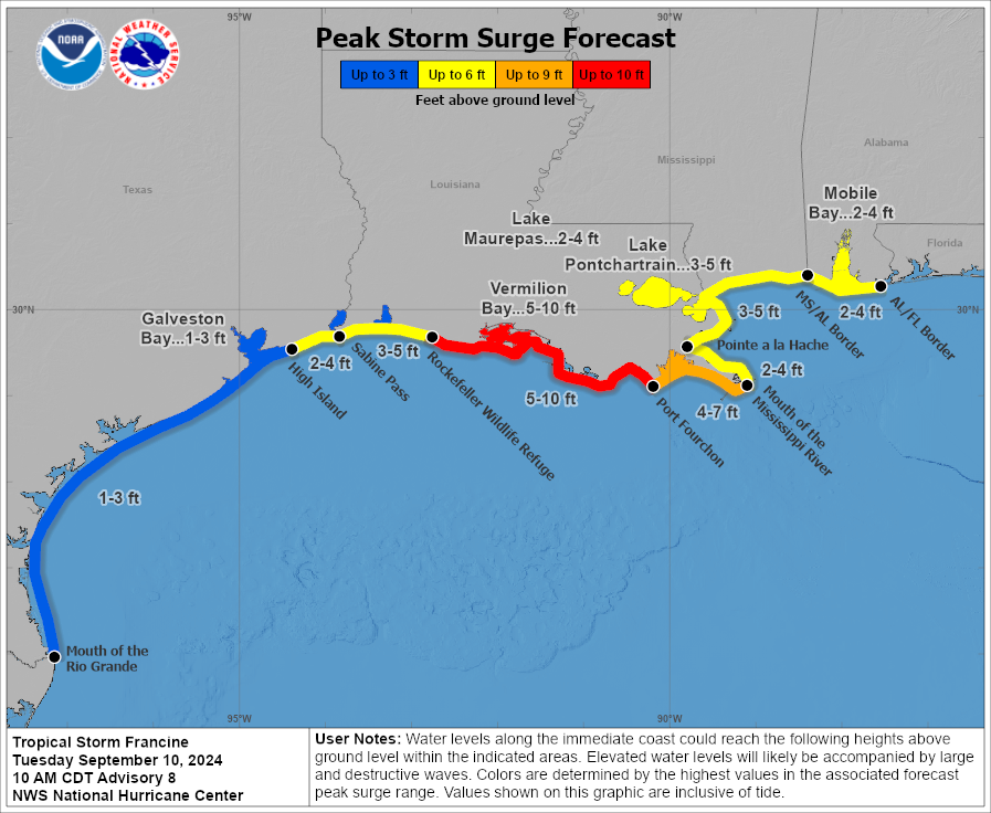
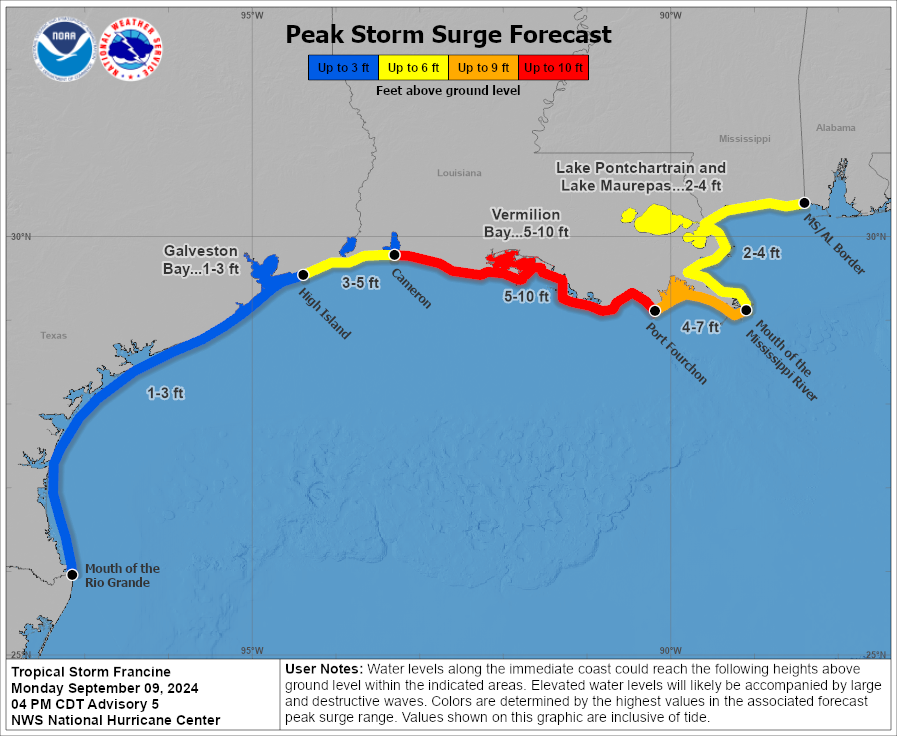
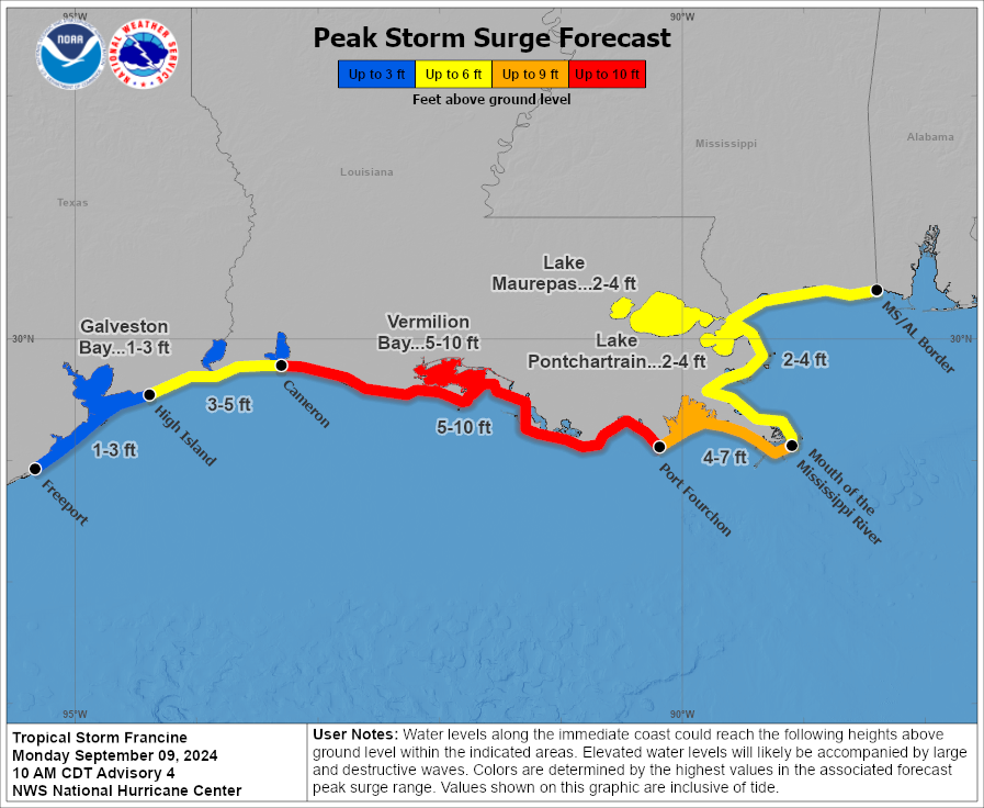
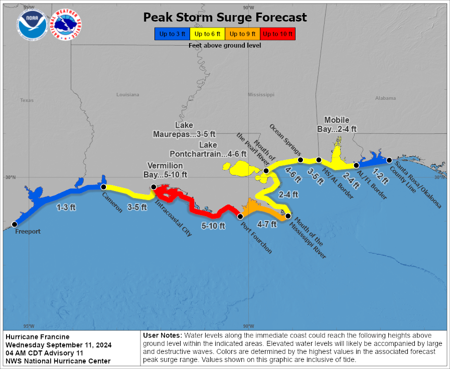
Storm surge will continue to be an issue as well with 5 to 10 foot surge expected on the Louisiana coast between Vermilion Bay and Port Fourchon. While the surge drops off east of there, it remains fairly substantial all the way to the Florida border, including a 2 to 4 foot surge in Mobile and 4 to 6 foot surge in Mississippi and in Lake Pontchartrain.
Beyond the coast, Francine will accelerate north into Mississippi, but it will slam on the brakes (as a non-tropical storm) just south or west of Memphis. As it just sort of sits, spins, and dies off, periods of scattered showers and storms will impact parts of the Southeast through the rest of the week off and on. No serious flooding is expected at this time, but it’ll be a good idea to keep tabs on things in Georgia, Tennessee, and Alabama perhaps heading into the weekend.
No other land concerns in the tropics right now. We’ll have another update before evening today.