Headlines
- Florida rains will slowly subside the next couple days.
- System likely in the Bay of Campeche next week, probably lower-end and heading quickly into Mexico.
- Heavy rain around a broader easterly flow in the Gulf will become increasingly likely on the Louisiana, Texas, and Mexico coasts later this weekend and next week.
- Additional rain and additional lower-end tropical development is possible the week of June 24th in Texas and/or Mexico.
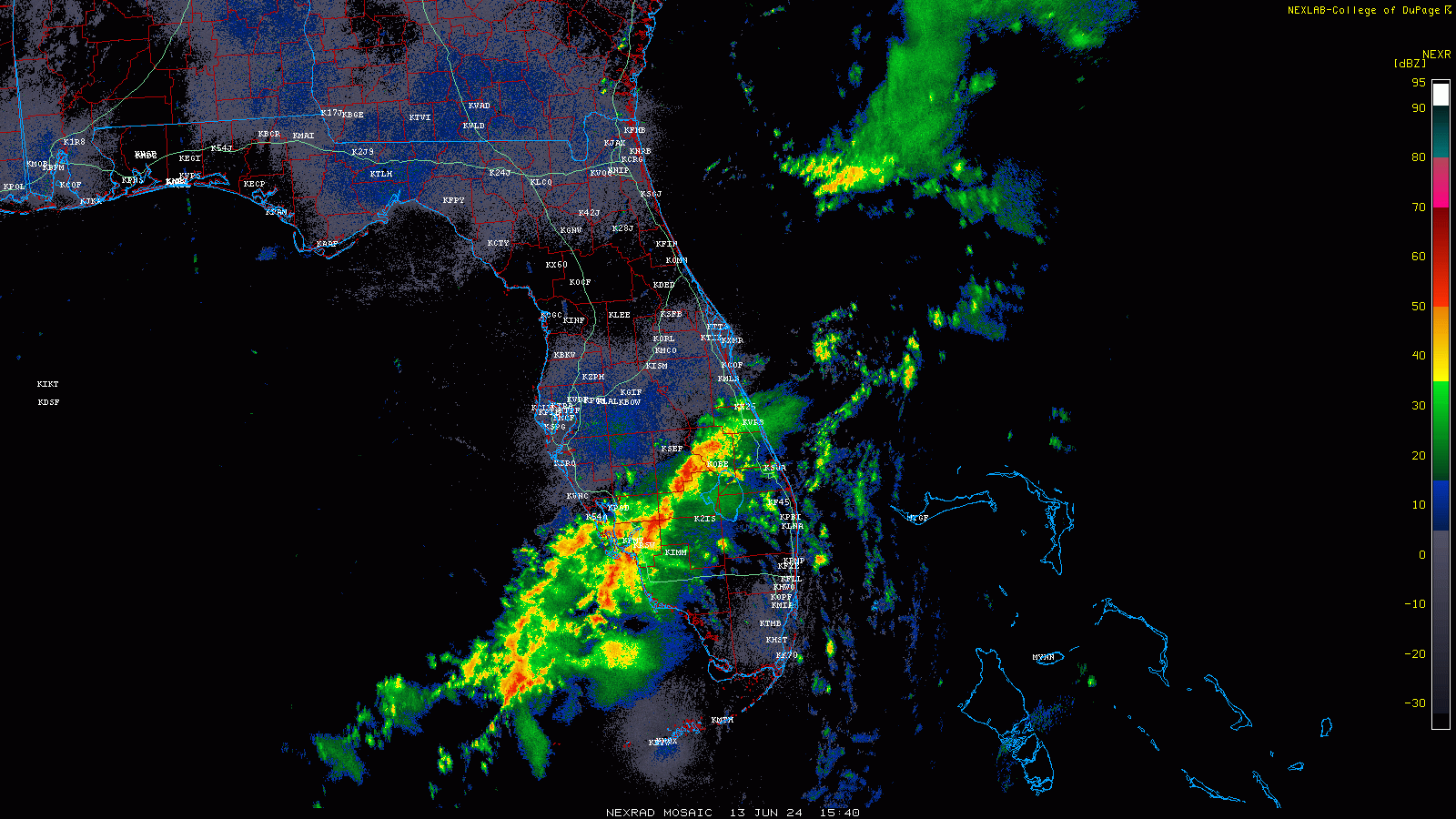
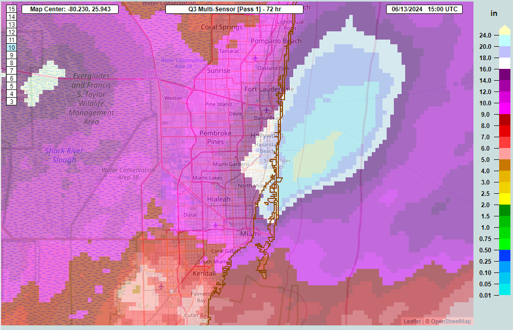
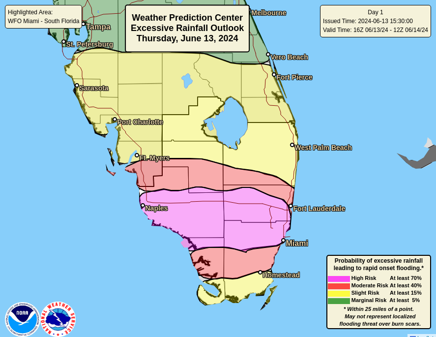
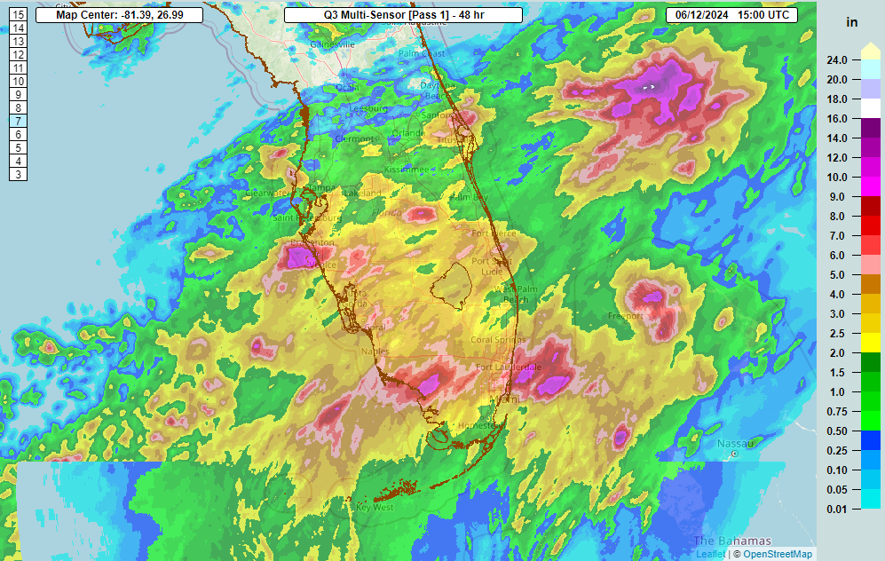
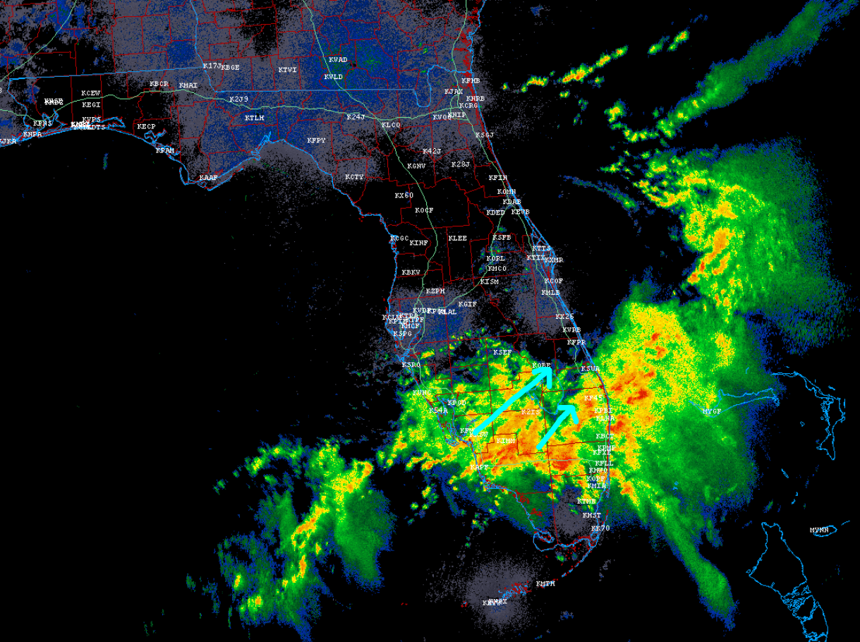
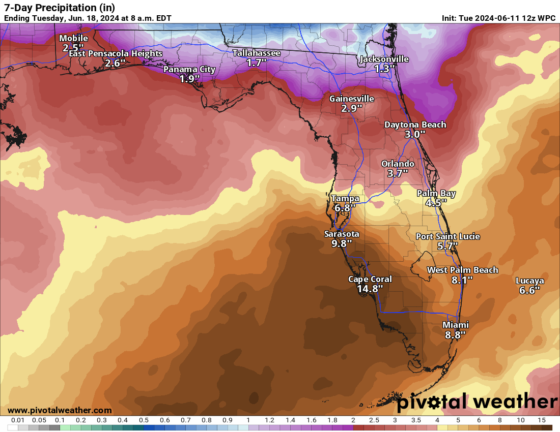
Florida still soggy
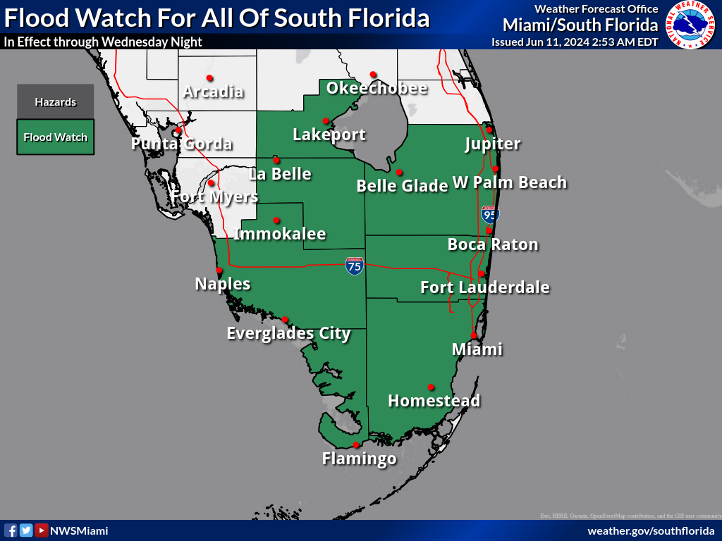
Yesterday’s rains weren’t quite as bad as what we saw on Wednesday, but at this point, it’s just a lot of water and time for a break in Florida. More storms have fired up this afternoon and locally heavy downpours are likely between the southwest coast the urban corridor on I-95.
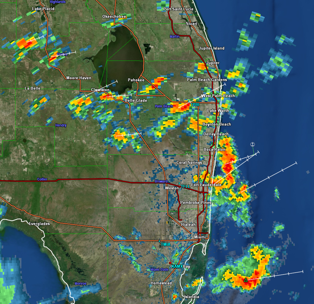
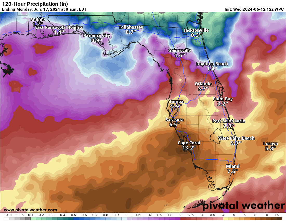
The entire southern half of the Peninsula has seen north of 3 or 4 inches of rain this week, with 10 inches or more over a wide swath across Alligator Alley and spotty 15 to 20 inch totals in a few locations. We’ll see another half-inch to inch with locally higher amounts possible through tomorrow. The clean up can hopefully get underway in earnest after today or tomorrow.
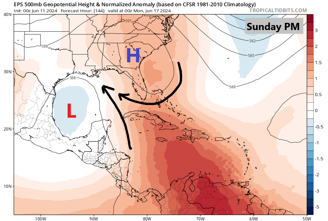
CAGgy consternation in the Gulf
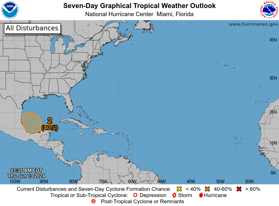
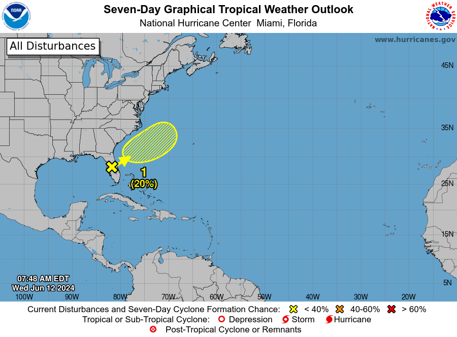
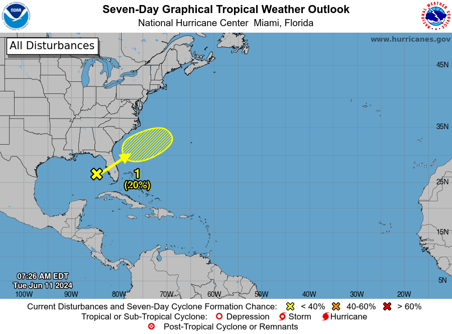
We continue to see plentiful signs that a weak system will develop in the Bay of Campeche next week.

The National Hurricane Center continues to assign about 50 percent odds of development next week from this disturbance, which is currently just developing on the Pacific side of Central America. It will become embedded in this Central American Gyre (CAG) setup over the Yucatan which is a common pathway to development in June. You can learn more about CAGs here, which is a pretty well-put together article.
Anyway, the path for this feels pretty straightforward again today, with the expectation that it will produce a middling system that tracks around the Yucatan and west or west-northwest into Mexico next week.
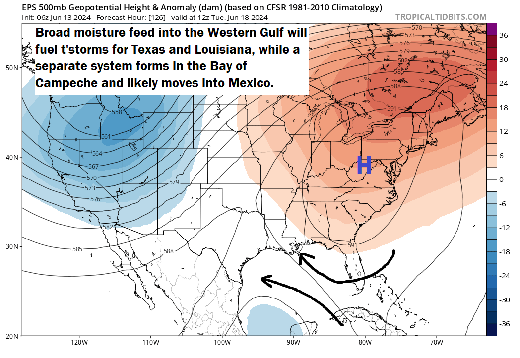
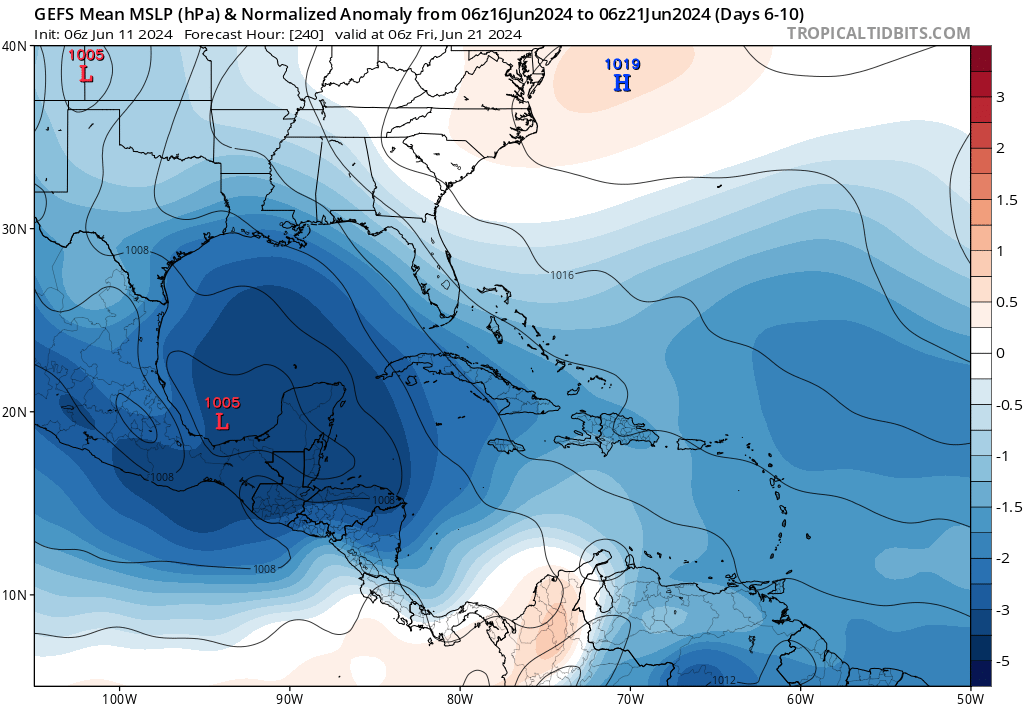
Western Gulf’s turn to get soaked
Any direct impacts from a tropical system will likely be confined to the coast of Mexico near where it comes ashore. But broadly, this pattern is going to continue to produce a long “fetch” of moisture across the Gulf of Mexico.
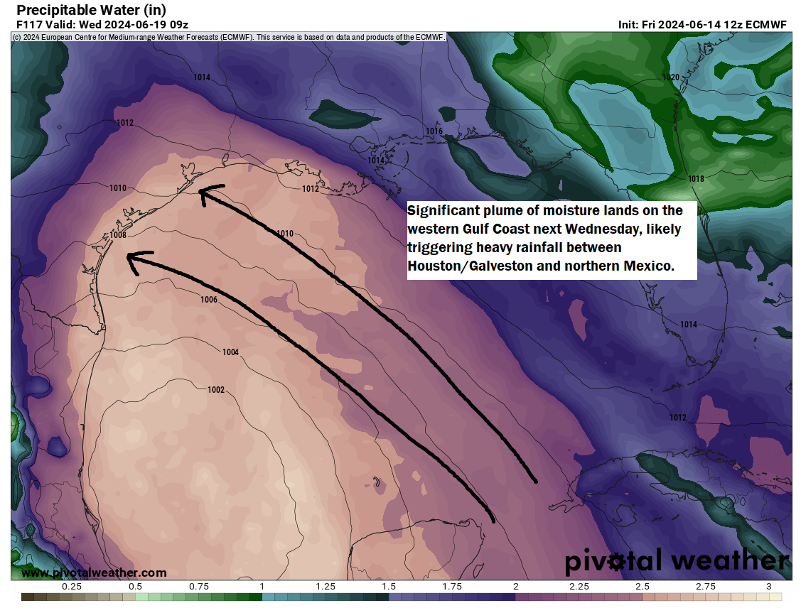
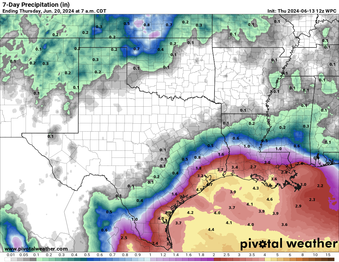
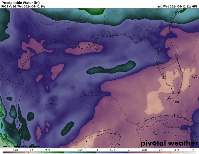
The map above shows precipitable water for next Wednesday, which is a measure of how much moisture is in the atmosphere. Values north of 2 inches like we see plentifully in Texas and Mexico usually produce locally heavy rainfall. And indeed, the rainfall forecast for the Texas, Louisiana, and Mexico coasts is pretty significant.
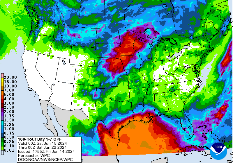
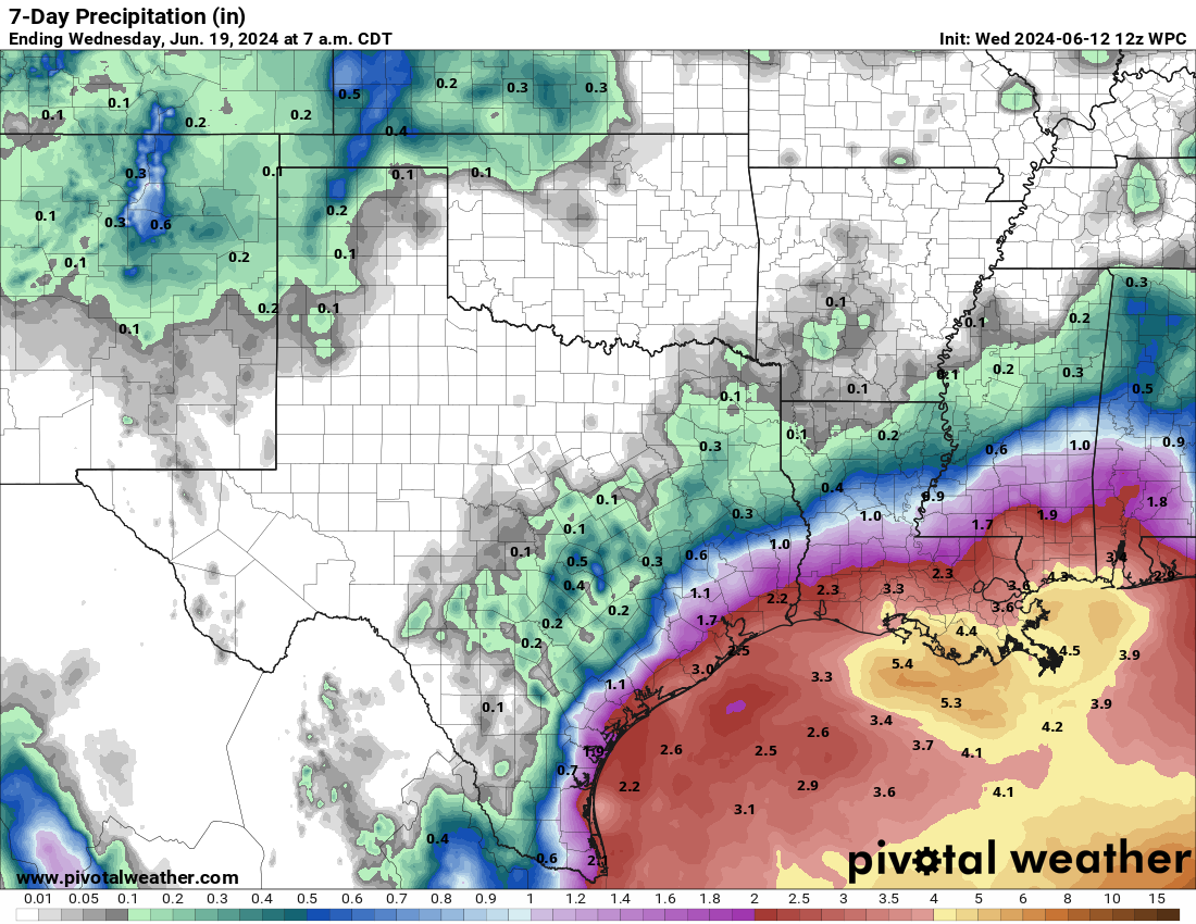
I will emphasize for our Louisiana and Texas readers that this will potentially be a very sharp rainfall gradient. In other words, you could see 6 to 10 inches of rain on the immediate coast in, say, Galveston versus a more manageable 2 to 5 inches or so in Houston. So the highest impacts will very likely be on the literal coast. Same goes for Corpus Christi, Brownsville, and the Louisiana coast. Mexico is likely to see more widespread rainfall due to terrain considerations and their proximity to the tropical system, whatever it becomes.
Beyond next week?
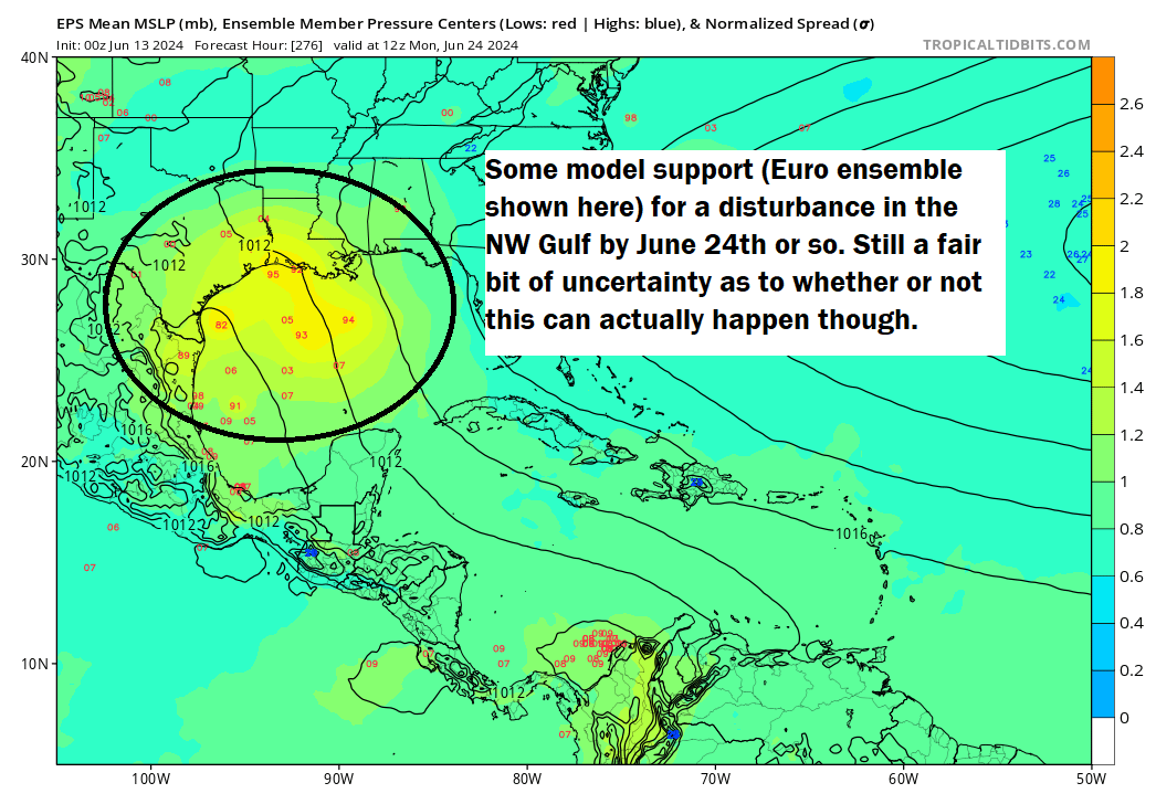
A second system may follow as the CAG begins to break down the week of June 24th. You can safely ignore some of the silly GFS operational model solutions for now. But it appears that something is there. That system may or may not develop, which is to say that we don’t currently think this is going to be a huge deal. That said, the wet pattern into Mexico and southern Texas is likely to continue into that week.
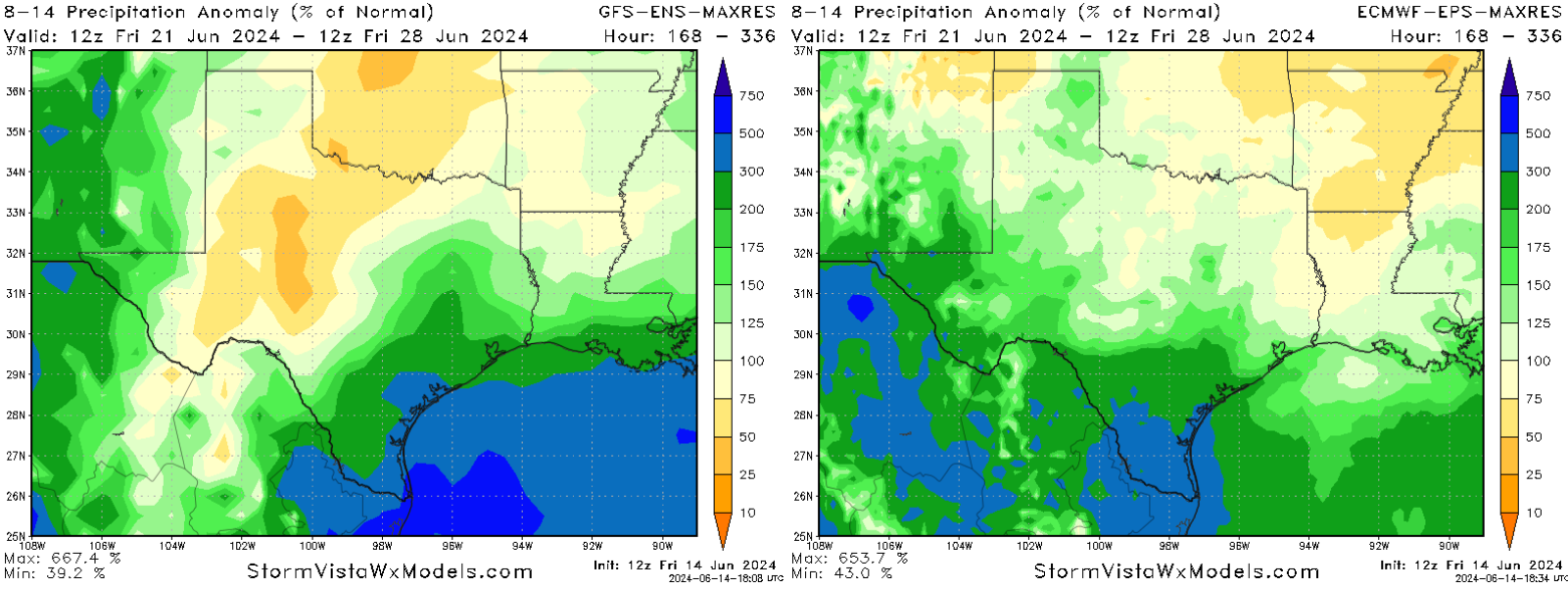
With about 200 to 400 percent of normal rainfall expected on the Texas and Mexico coasts, we may begin talking more about flooding for some areas. Heavy rains may also linger to the north. More on this next week.
We’ll take a breather tomorrow and come back on Sunday with the latest!