First off, sorry for being away all last week with some severe weather and a big thumping snowstorm in the Rockies. It was spring break week in Texas, and my family headed to the Northwest, or Southwest if you’re reading from Canada. Spent some time in Seattle and Vancouver, and the weather went from wet to sublime. A beautiful part of North America. But it’s good to be back in the saddle. Fortunately, we have a relatively basic week ahead.
Headlines
- Cool temperatures dominate the Eastern 2/3 of the country this week, with frost and freeze conditions in parts of the South.
- Two more delightful spring days in the Pac NW.
- Severe weather looks isolated and confined to the Gulf Coast or Florida this week for the most part.
- Potential for a more significant storm and subsequent severe weather next week in the Central U.S. or Southeast, but details are sketchy right now.
Eastern chill, Western warmth
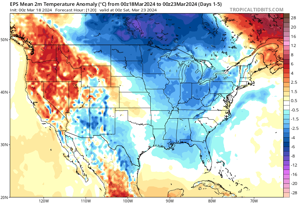
For the eastern two-thirds of the country, the theme this week will be cool weather. We’ve got some solid cool weather expected up in the Great Lakes and Midwest, with what I’d deem “lesser cold” in the South.

That said, the only place I can find that’s expected to close in on a record low is Lakeland, Florida on Wednesday morning, with a low of 45°, just off the record of 43° from 1956. Meanwhile, Miami is forecast to get close to 90 degrees today, which is the previous record set in 2003.
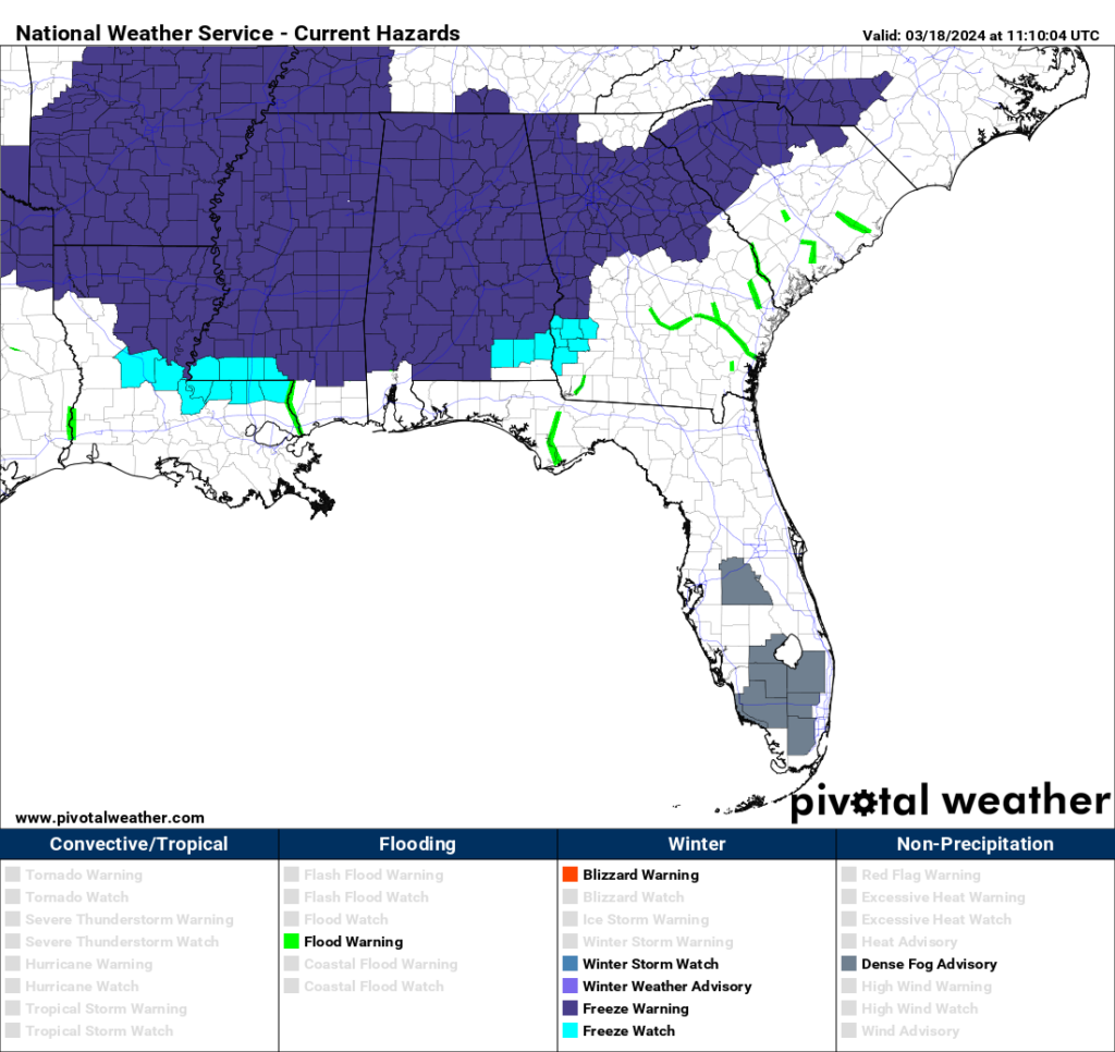
Still, this setup will be enough to produce freeze conditions in a lot of places where the growing season is underway, mainly in the Deep South, which is blanketed by freeze warnings tonight.

Meanwhile, the West is enjoying a stellar early spring stretch. Seattle hit 74 on Saturday, a new record, followed by a record tying 71 degrees yesterday. Back to the 60s there today. Portland hit 76 on Saturday, 75 yesterday, and is forecast to hit 76 today, which would actually be the first record high in this stretch.

The Pac Northwest will get one more day of stellar weather tomorrow before clouds, rain, and cooler temps return for midweek.
Severe weather next week?
On the severe weather front, it looks relatively benign this week, with perhaps one day tomorrow with an isolated severe risk in Florida and then another chance at it Thursday or Friday from the Gulf Coast into Florida. With cool air dominating things this week, a relatively suppressed storm track will follow, keeping most of the country quiet-ish.
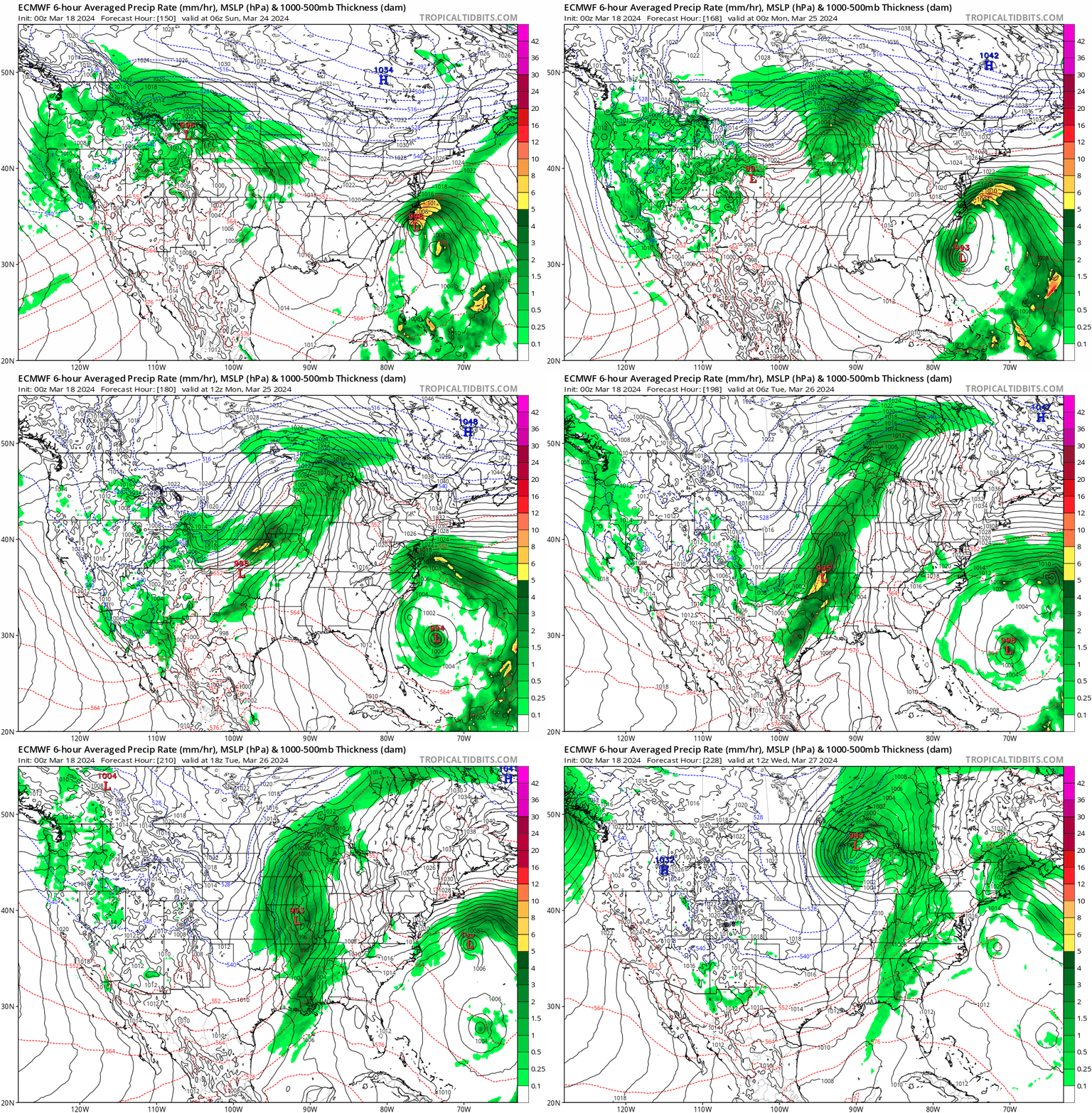
The same cannot necessarily be said for next week, however. It appears that we’re going to get a significant storm developing off the lee of the Rockies. From there, it will track east or northeast, which should prime the Central US or Southeast for a chance at strong to severe storms.

Exactly how this unfolds is TBD, but I think we could see the severe threat begin as early as Saturday or Sunday and become more notable by Monday, hopefully winding down Tuesday. As of now, the Storm Prediction Center has not highlighted anywhere in their day 4 to 8 outlooks, citing low predictability. And indeed if you look at that map above, notice how there is also a storm system off the Southeast coast while this is happening. Situations like this can complicate how much Gulf moisture (a really necessary ingredient for widespread severe weather) ends up flowing north. I think we will see this change somewhat between now and then, with a lean toward severe weather risk, but confidence in details is far too low to pin down at this point. We’ll check back in on this Wednesday.
Hurricane season check-in tomorrow
Since it’s a quiet week, we’ll dive into hurricane season again tomorrow. We’ll take a look at where ocean temps stand this month and see if anything has changed with regard to the emerging possibility of La Niña. It remains far too early to say anything conclusive about the upcoming season, but we’ll check in on where we stand compared to last month.
It’s great to have you back, Matt 😊
🌬 ⚘