In brief: Hurricane Lowell will impact Hawaii over the next 24 to 36 hours, perhaps significantly so west of Oahu. The Atlantic remains quiet. And we take a deep-ish dive into a squirrely, significant Atlantic Canada flooding event.
Hurricane Lowell
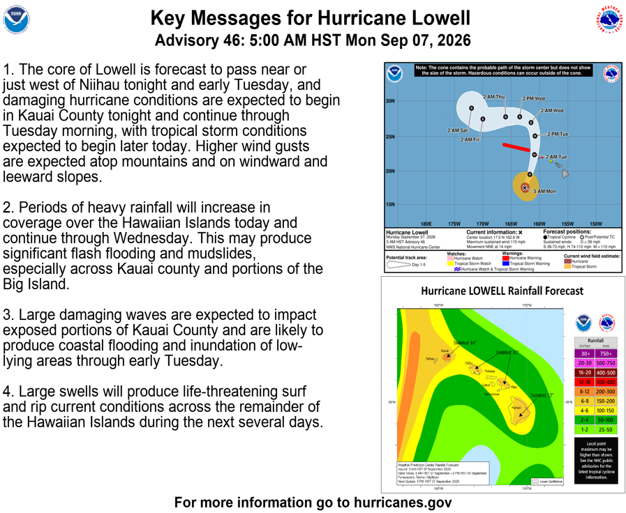
Hurricane Lowell is heading toward the western Hawaiian Islands, with its center likely to track a bit closer to Ni’ihau than we discussed on Saturday, only about 40 miles or so west of the island and with a wider eastern flank, capable of producing strong winds on Kauai and even perhaps Oahu. Thankfully, Alan Gerard at Balanced Weather has an excellent summary of the impacts and details on Lowell to check out. I’ve done this long enough to know that sometimes, you don’t need to reinvent the wheel!
Atlantic Basin
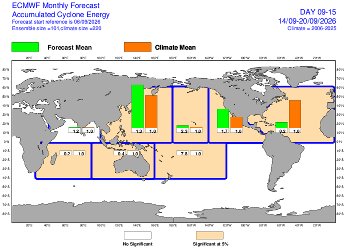
We continue to see no sign of any meaningful tropical activity in the Atlantic for the next 7 to 10 days. Yesterday’s Euro subseasonal outlook gave us 20 percent of normal activity or less over the next 2 weeks.
If there is any risk over the next week or so, it would be on the lower end of the scale in the northwest Gulf of Mexico. A weak but slow moving mid-level disturbance is likely to generate showers and thunderstorms near the Texas and Louisiana coasts this week. In about 95 percent of cases like this, nothing happens. but in the off-chance that a complex of storms happens to form near the coast and drift offshore, it wouldn’t be out of the realm of the possible to see it try to develop a surface low.
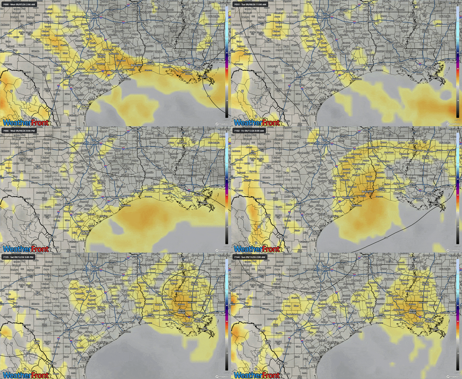
Again, this is highly unlikely to do anything except bring unsettled weather back to Texas and Louisiana, but it’s the time of year where you just tap back in a few days from now to make sure nothing’s changed.
Otherwise, I can’t really sniff anything else of note out.
Cape Breton flooding
Thank you to reader Alison for flagging this one. A pretty intense storm hit parts of the Canadian Maritimes this weekend, specifically Cape Breton Island and parts of the northeast mainland of Nova Scotia. How much rain has fallen in the last 72 hours? A lot.
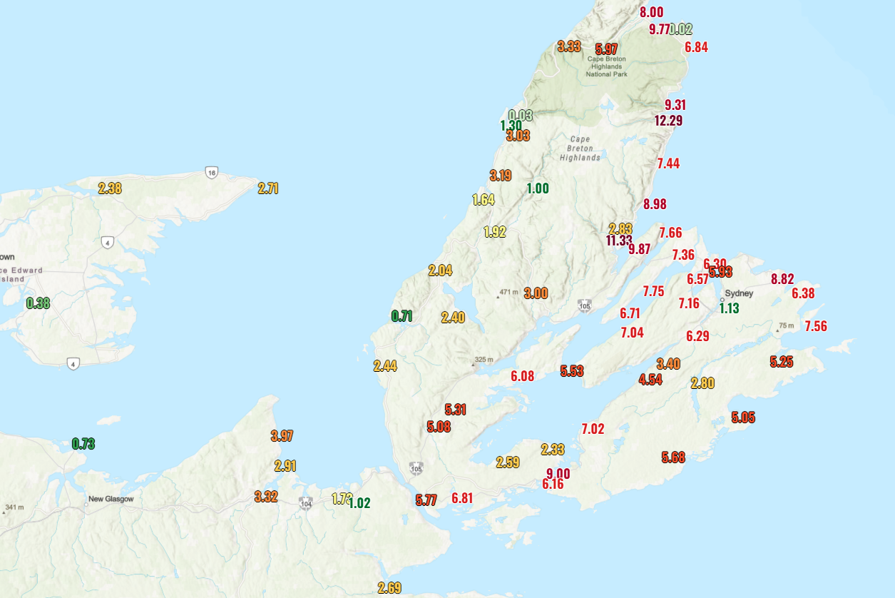
A gauge at Ingonish Harbour on the south coast of the Cape Breton Highlands picked up over 12 inches of rain (300 mm), while another gauge measured over 11 inches (280 mm) at North River Bridge. Many locations saw 6 to 9 inches (150-230 mm) of rain across Cape Breton.
The rain fell in two bursts, one on Friday, followed by a heavier one on Saturday. Some places saw additional rain on Sunday as well. The culprit was a slow moving upper low that basically cut off from the jet stream and sat over Nova Scotia this weekend. Interestingly, the GFS model had forecast upwards of 150-200 mm of rain on Thursday night into Friday morning, so a signal for torrential rain was there. Whether or not you wanted to trust it was another matter. The usually more trustworthy European model had significantly underforecast rain, especially on Cape Breton Island.
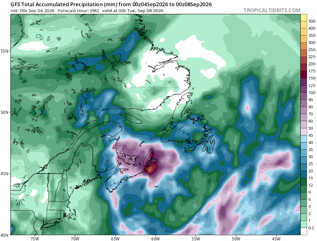
The European AIFS model did better than its physics-based counterpart. That is also interesting because the line on AI modeling is typically that it cannot capture the tail (extreme) events. While it still underdid the rainfall this weekend, the AIFS did a much better job than the European operational model. It’s tough to get a good handle on how Google’s new AI model did with minimal available data still, but their WeatherNext 2 performed better than the AIFS, though not as good as the GFS.
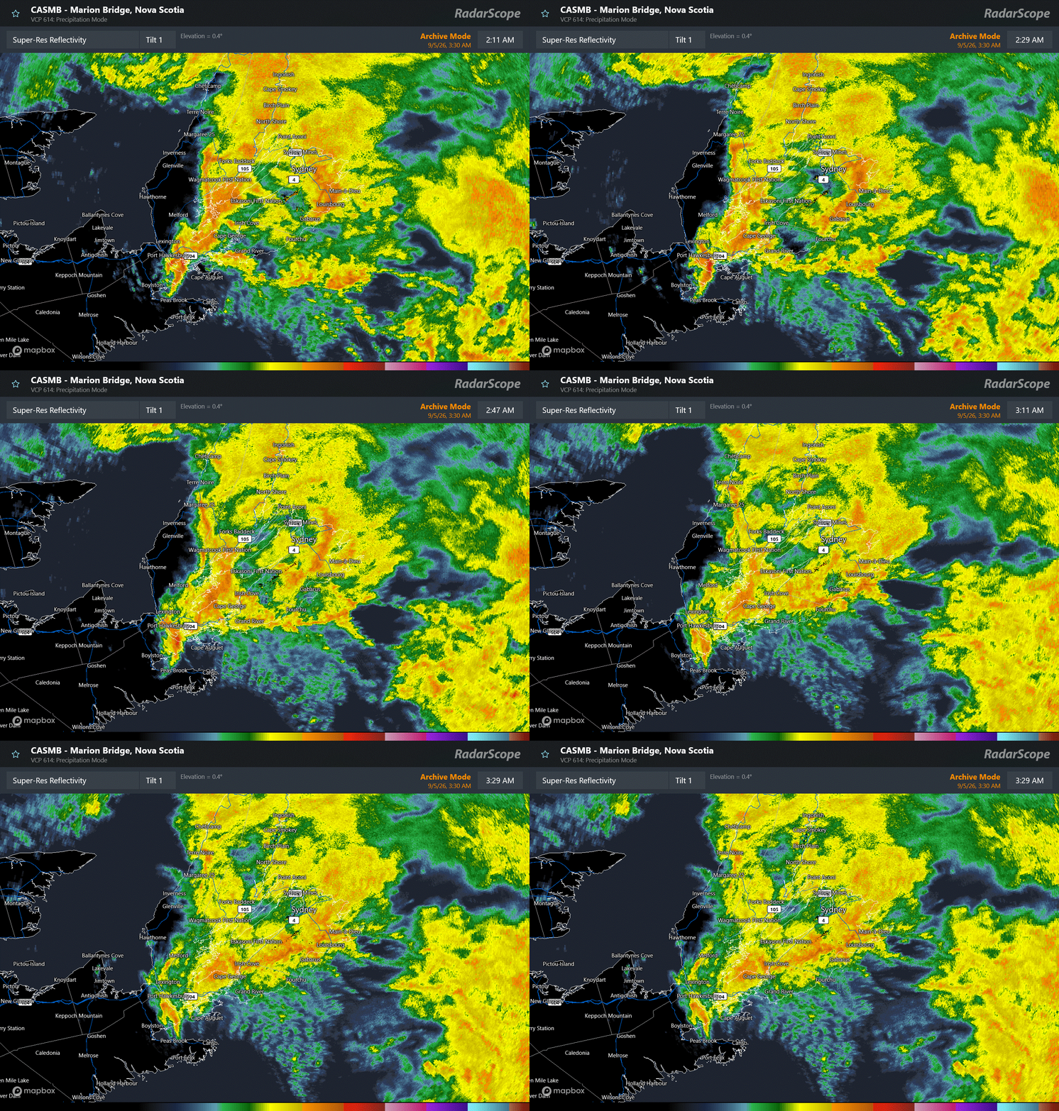
Bottom line: This was a marginally predictable event. Upper lows can notoriously cause locally heavy rainfall under the wrong circumstances. And looking at a sample of radar data from Nova Scotia, you can see how this event was playing out at 4:30 AM local time.
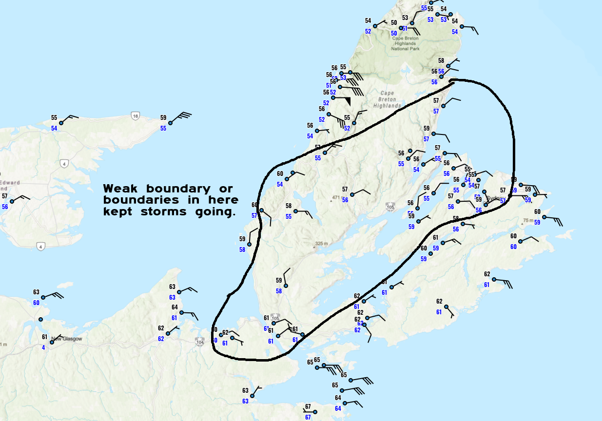
A surface analysis from the same time shows a somewhat convoluted pattern over Cape Breton Island, with winds broadly out of the northeast or east, but varying levels of some convergence boundaries showing up on the map. It’s not exactly a grab your attention sort of map in real-time, but in hindsight, I can see how this may have aided this particular rain event.
But nothing appeared necessarily extreme about this event. Precipitable water levels were somewhere in the 85th-ish percentile, which while high is not exactly extreme. The only other thing I can point to is that water temperatures in this part of the Atlantic are running quite warm. So perhaps that also played a role. The Environment Canada rainfall warnings called for 80 to 120 mm of total rain on Thursday and 100 to 150 mm of rain by Friday evening. Again, it was predictable to a point, but it does appear that some subtle influences took this from a heavy rain event to a pretty bad flooding event. Thoughts with all those impacted.