In brief: Hurricane Lowell may not be a direct hit on Hawaii, but it will still deliver some noteworthy impacts to the western Hawaiian Islands after Monday. Hurricane Marie is going to fling some moisture for a rare September rain in LA and SoCal this weekend as well.
Hurricane Lowell
Lowell is a powerful, high-end major hurricane with 150 mph maximum sustained winds near the center. It is modestly imperfect, however, as some dry air or modest wind shear has eroded parts of the center’s thunderstorm activity a little bit.
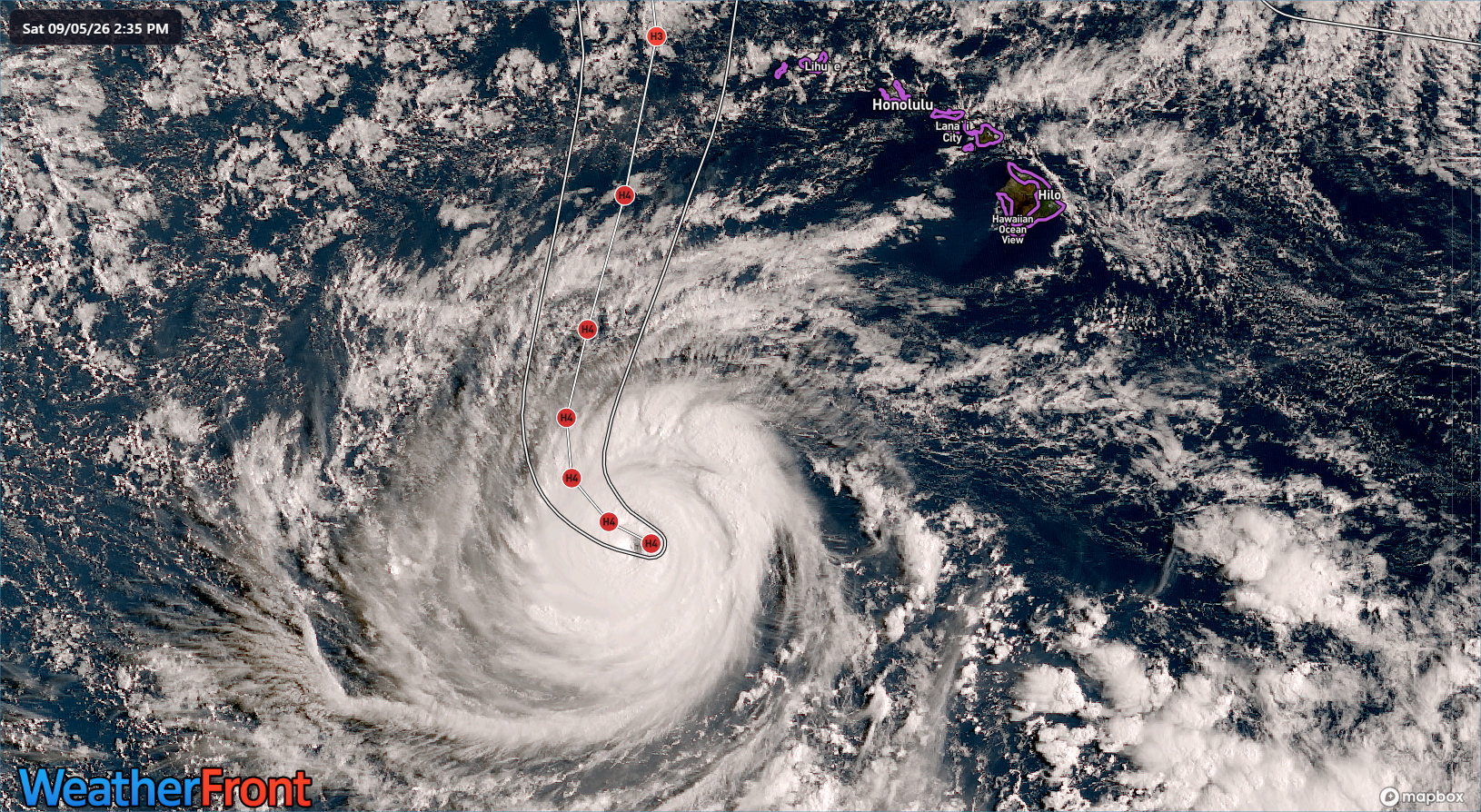
Still, Lowell is about as formidable as they get in this part of the world. Lowell’s forward speed, as expected is beginning to slow a bit, and it’s moving just north of due west. As ridging gets eroded by an approaching mid-level area of low pressure, Lowell will turn more to the north or even north northeast for a time. That trajectory will determine how close it passes to the western Hawaiian Islands.
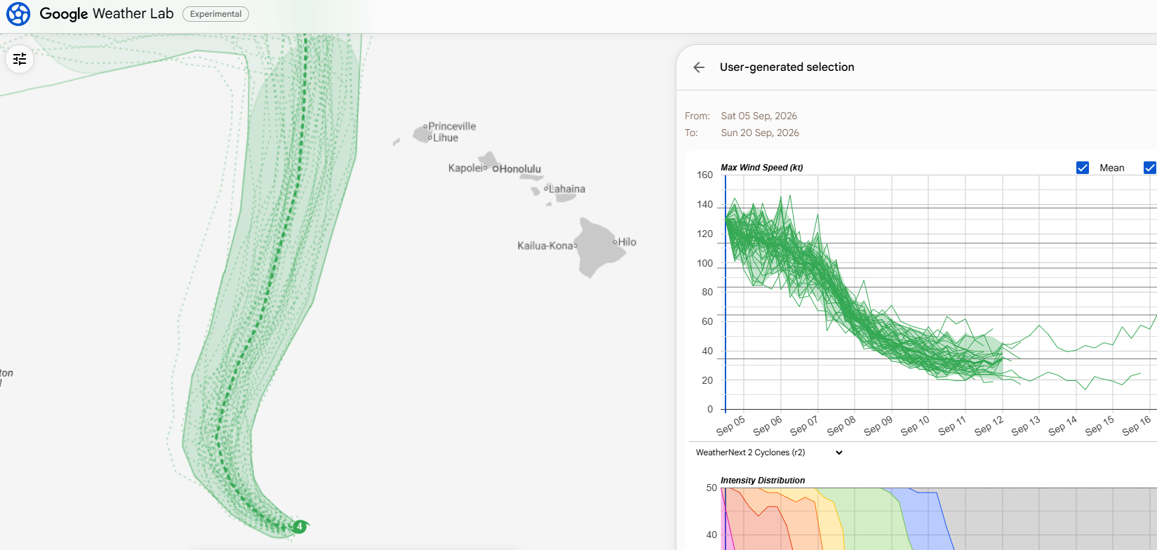
Per the most recent operational run of Google’s WeatherNext cyclone model, the track is slightly to the east of some other guidance, with a few outlier ensemble members taking Lowell within about 75 miles of Kauai and not far west of Ni’ihau. This would place those islands on the east flank of the storm, the stronger side, though perhaps far enough east of the center to avoid severe problems. Still, heavy rain is a possibility, and the current forecast calls for up to 10 inches of rain on Kauai.
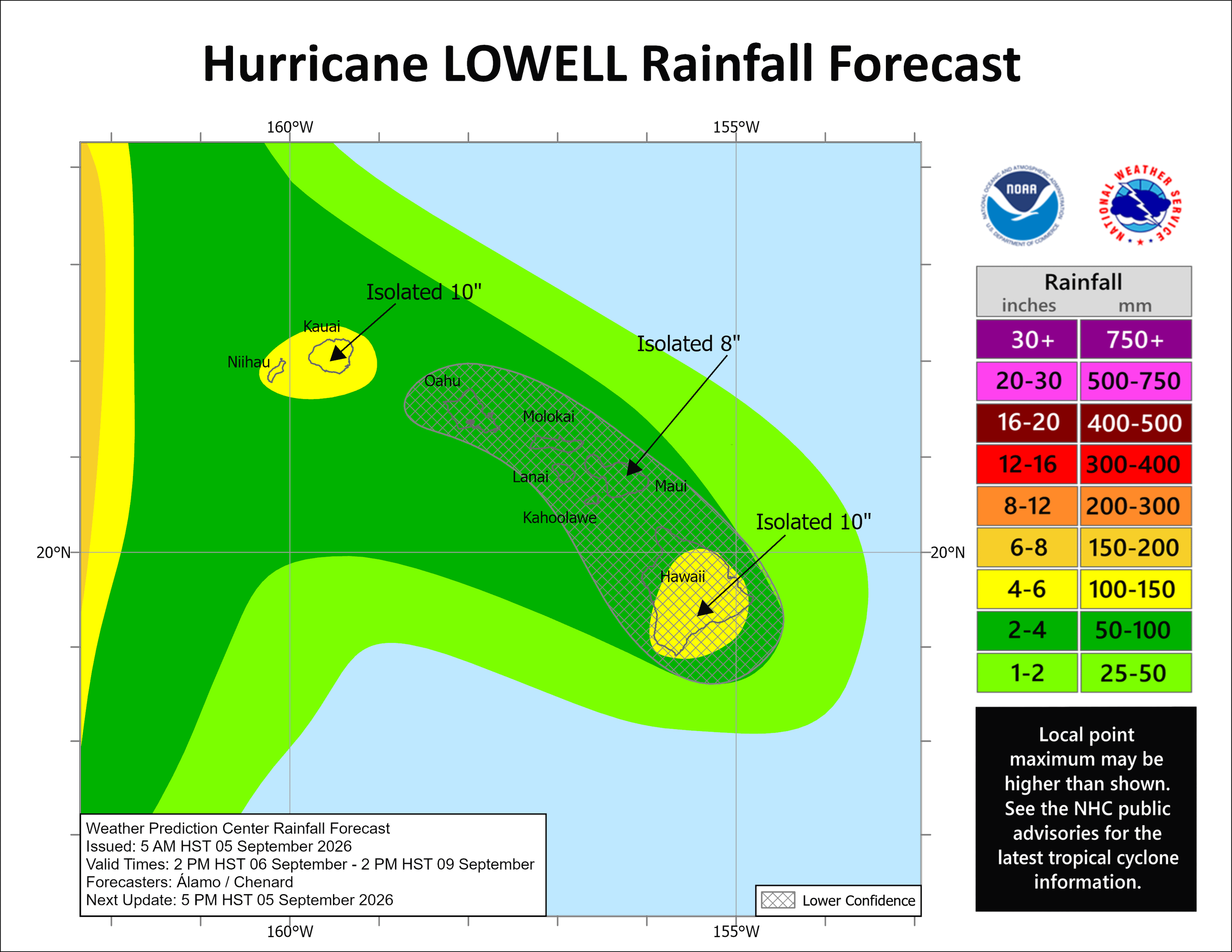
Confidence drops off some to the east of there, with the other islands more likely to see perhaps 1-4 inches of rain, with higher amounts in the southern facing slopes of the Big Island and Maui. The current forecast says perhaps up to 10 inches, but that may be a bit high depending on how close or far Lowell ultimately tracks.
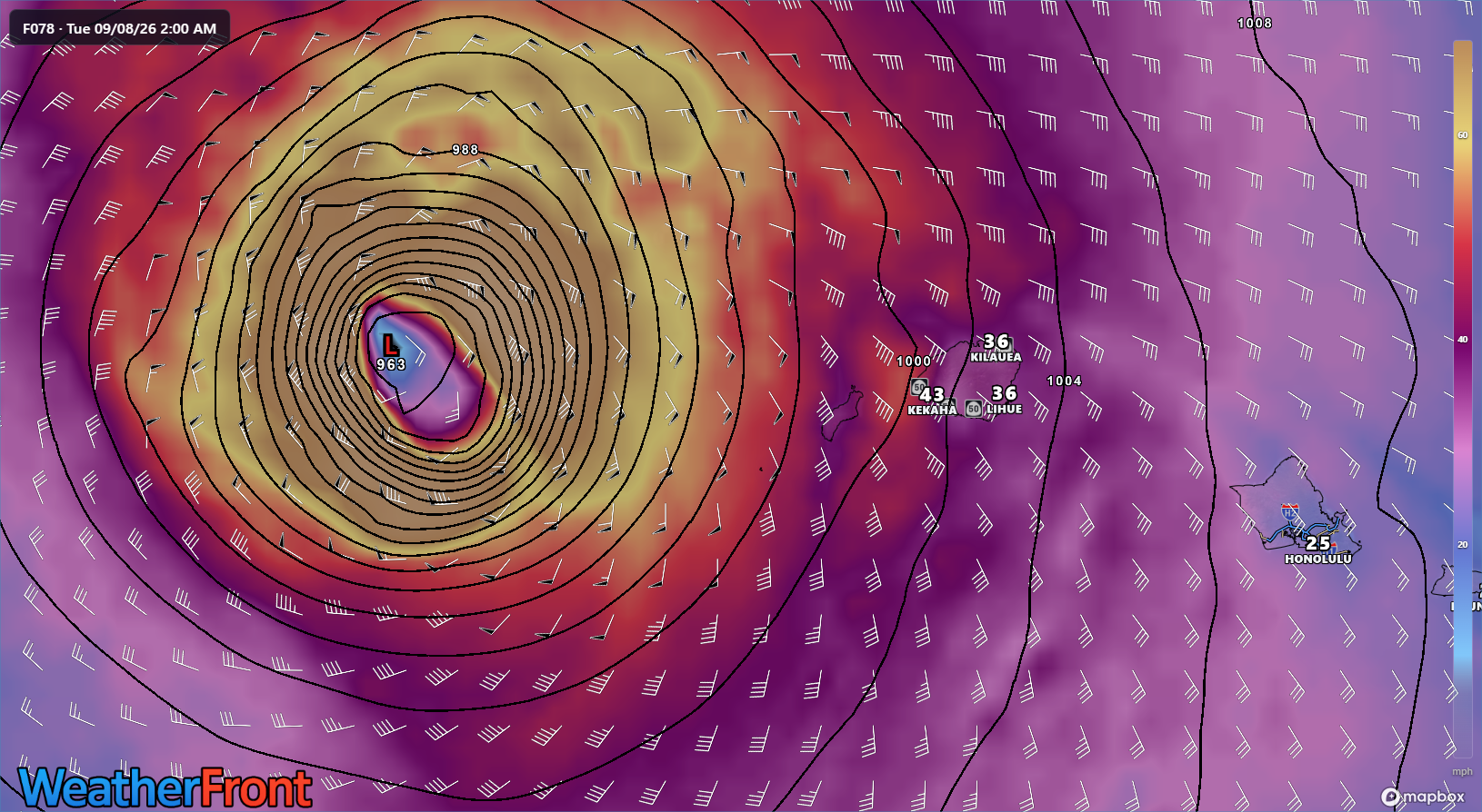
Lowell is expected to be a borderline major hurricane when making its closest pass to the western islands. So, obviously strong winds are a concern. However, with Lowell passing just far enough west, it may mean the difference from some isolated damaging winds in the westernmost islands or something more serious. Obviously, the exact final track of Lowell is critical here in determining how strong those winds are. The HAFS-A forecast below takes the center about 40 to 50 miles farther west than perhaps it will go, so some of those stronger winds (yellow shading) will come very, very close to Ni’ihau and Kauai.
Folks in Hawaii, especially on the populated Kauai should be following the advice of local officials and emergency managers. Presumably most hotels and resorts have plans for these scenarios as well, so heed their guidance too.
The rest of the tropics
Elsewhere, Hurricane Marie is not a threat to land directly, but some moisture is going to fling off it and toward southern California, especially in the Los Angeles area. This outward band of rain could produce around a tenth to a quarter-inch of precip across SoCal, even into the desert. Slightly higher totals are possible in the San Gabriel or San Bernardino Mountains. While that may not sound like much, consider that this is about 750 percent of normal. In other words, it does not usually rain in SoCal in September!
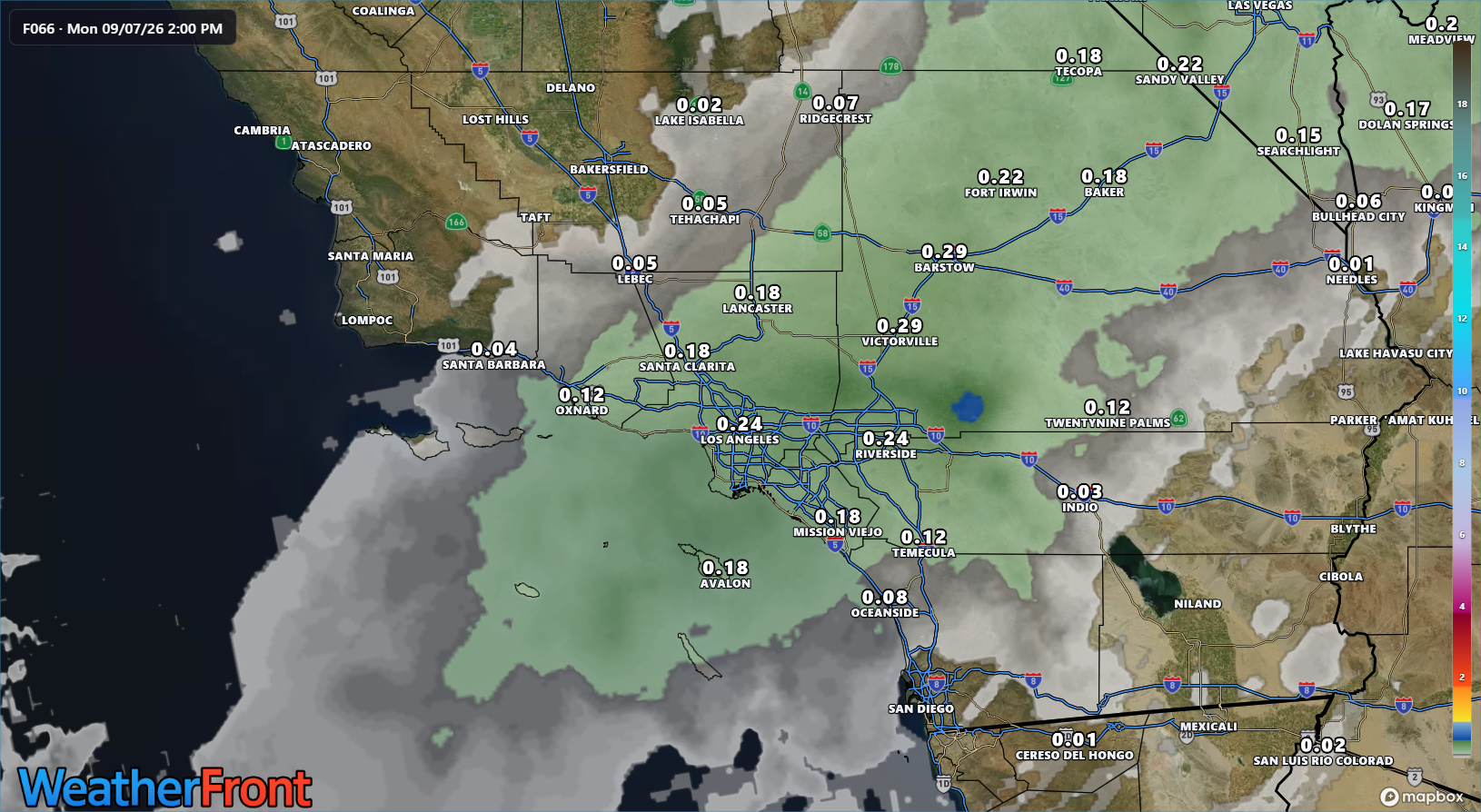
In addition to the rain, surf conditions are going to be a little nasty for the average person. Watch for coastal flooding, rip currents, and the high surf. Hopefully the surfers find ways to enjoy this.
Elsewhere, the Atlantic looks to remain quiet through all of next week.